World Snow Roundup #73
Issued: 06th February 2019
By Patrick “Snowhunter” Thorne
Our latest roundup of snow conditions around the world. Each section that follows below goes into detail country by country. Clicking the map thumbnail will take you to our dynamic snow forecast map for the latest detail (where you can also overlay live weather & reported conditions). Weather outlooks for Europe and North America can be found at the end of this roundup.

INTRODUCTION:
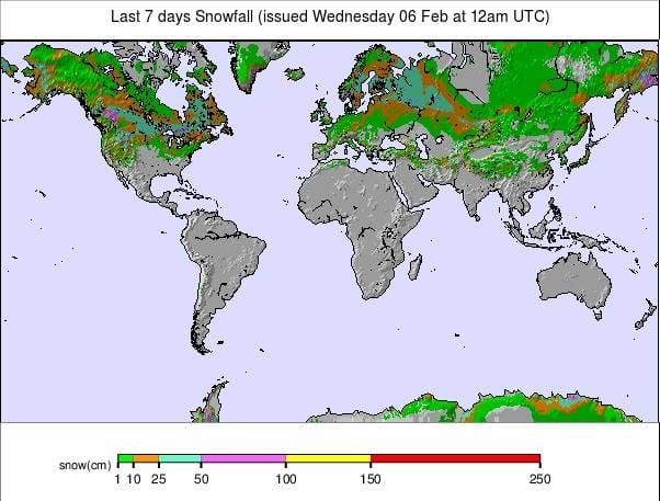
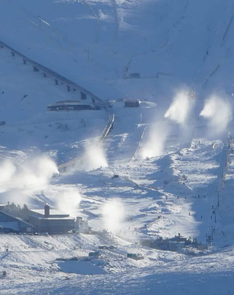
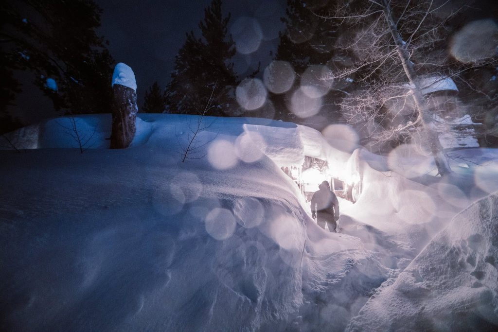
It has been a very snowy week in many of the world-leading ski regions with 7-day totals at some areas in the Alps; the Dolomites, the Pyrenees and Western USA passing the 2-metre mark. It’s unusual for so many ski regions to get so much snowfall in the same week.
For the Alps, the snowfall has continued to build bases and freshen up cover for what is turning in to a great season almost everywhere. But with all the heavy snow there has also been cold temperatures and, at times, high avalanche risk with Western Italy this week being the region to, sadly, see multiple off-piste avalanche deaths.
For The Dolomites the snowfall this week has been really transformative after several months of relying on snow-making to open runs. There’s suddenly deep powder here. In the Pyrenees, it was more of the same after a very snowy previous week which had already transformed conditions. A little like the Dolomites experience.
Across Europe, the past few days have been much calmer with little or no fresh snow and the week ahead looks similar. With the likelihood of more significant snowfall arriving at the weekend.
INDEX:
Austria / France / Switzerland / Italy / Andorra / Norway/Sweden / Germany / Bulgaria / Scotland / Japan / USA / Canada / Europe / North America
Austria
After a comparatively quiet few weeks for snowfall following the three-week-long ‘mega-dump’ in northern and western Austria which ended
FRANCE

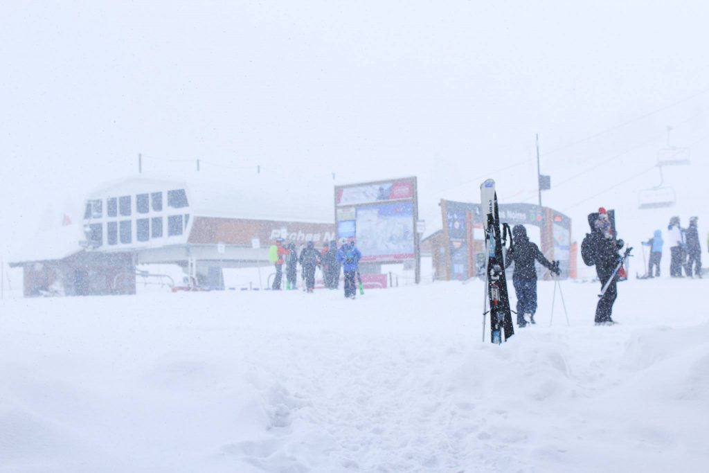
A very snowy week in France. At one point at the weekend ski areas in the French Alps and the French Pyrenees were both posting the most snowfall accumulation over the previous week, with both resorts concerned posting 2m+ accumulations for the last 7 days. As a result of the heavy snow, visibility was poor, the avalanche danger touched maximum level 5 and for a period many runs were closed. That’s now all changed. The heavy snowfall has eased and skiers in the French Alps report superb conditions. The avalanche danger has dropped to level 2 or 3 in most areas from the very high 4 and 5. The largest snowfalls since the weekend have been in the southern French Alps with Isola 2000 (130/160cm) reporting a
SWITZERLAND

Another snowy week in Switzerland too but with less of the east/west divide of the previous five weeks, with snow falling across the country this time. Andermatt continues to have the deepest upper-slope base-depth in the world but Engelberg (80/545cm) is creeping closer and reported 40cm of fresh snow over the past few days to Andermatt’s 10cm. As with much of the rest of Europe, the snowfall has largely ended over the past few days giving
ITALY

Italy has seen some of the heaviest snow in the world over the past week, making up for the fairly dry few months it got through from the start of the season until late January. Unfortunately, the huge snowfalls in the northwest of the country resulted in at least eight off-piste avalanche deaths around Courmayeur (45/200cm) and the Aosta Valley with the avalanche danger level at maximum. The resort of La Thuile (50/200cm) reported particularly heavy snowfall last week, at one point posting more than 2
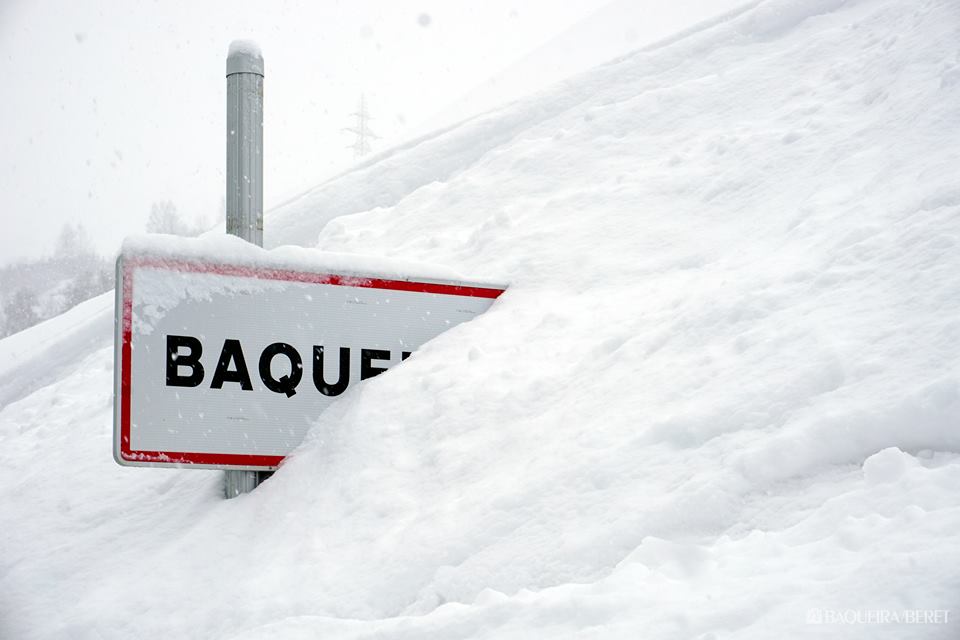
ANDORRA
Andorra has had a second snowy week with bases building and conditions much improved from the first few months of the season, when there was little fresh snowfall. All of the ski areas are fully open. Grandvalira (70/165cm), which will host the World Cup Finals next month, reports superb conditions.
NORWAY/SWEDEN

In ski racing terms the eyes of the world this week and next are on Scandinavia’s largest resort: Ãre (69/69cm), in Sweden, where the Alpine Skiing World Championships take place. Lindsey Vonn and Axel Lund Svindal’s final races are to take place there. The good news is that these should go ahead as planned with none of the severe weather problems, that have plagued the Alps this year, on the horizon. Indeed, there’s no snow forecast for the rest of this week. That’s not quite the case for the wider region. Several resorts in Eastern Norway, including Geilo (53/85cm), have reported 20-25cm of fresh snow in the past few days giving powder conditions in the area. Elsewhere, most resorts have had 5-15cm of fresh snow since the weekend.
GERMANY

It has been a week of heavy snow in Germany, particularly over the weekend when the classic Kandahar World Cup races at Garmisch Partenkirchen (80/250cm) eventually had to be canceled as
BULGARIA
The snow depths continue to build in Bulgaria where Pamporovo (305/325cm) now has one of the deepest bases in Eastern Europe. There has been great powder snow conditions there for the past few weeks now. Bansko (60/180cm) currently has the most lifts operating whilst Borovets (160/190) has, marginally, the most trails open to choose from: 17 (one more than Bansko).
SCOTLAND

A definitely improving picture in Scotland thanks to consistent cold weather and some decent snowfalls; conditions which look set to continue for at least the coming week. All five Highland ski areas plus the Lowther Hills (0/10cm) club field in the country’s southern uplands have some terrain accessable and the amount open is growing by the day, at present. Glencoe (35/40cm) and Glenshee (30/35cm) both reported 15cm of fresh snowfall in the past few days and each has the most runs open at present: 10 a piece.
JAPAN
Conditions in Japan have taken a bit of a downturn. Unfortunately, in the past week issues including strong winds in the north and unusually warm temperatures in the south have caused problems for resort operations and snow consistency. Fortunately, things do seem to be
USA

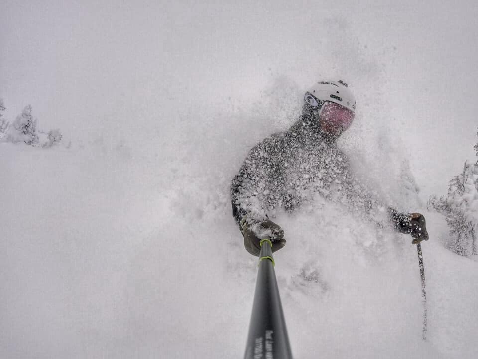
After ski areas on the eastern side of the country received more snow than those on the west side in the last weeks of January, the storm of the season has been battering the US West Coast since Saturday. Massive snow accumulations and very strong winds, at time topping 100mph, have led to very severe blizzard conditions causing several ski areas to close down until it eases (expected to be later today). Ski areas have reported up to 2
CANADA

Light snowfall but nothing too significant in Canada over the past few days, following heavier snow in BC in the latter half of last week. Tremblant (262/3262cm) in Quebec continues to post the country’s deepest base and had 6cm of fresh snow at the weekend; typical volume for other resorts in the area too. On the opposite side of the country, Whistler (264/264cm) had 12cm of fresh in the same period.
EUROPEAN WEATHER OUTLOOK

Following the heavy snowfall of the past
NORTH AMERICAN WEATHER OUTLOOK

The huge snowstorm that has been dumping vast amounts of snow on the Californian Sierras, accompanied by very strong winds at times, should finally ease later today (after lasting four days). The rest of the week is looking clear so closed resorts should re-open and everyone should be able to get in to all that powder. The snow will keep falling, at times, for a few more days with significant accumulations further east in Colorado and Utah. Over in the east, there’s not much snow forecast at present but there may be 5-15cm in New Hampshire and Vermont later in the week and into the weekend. Over the Canadian border, there’s not much snow forecast on either east or west sides of the country. The most


