WORLD SNOW ROUNDUP #72
Issued: 29th January 2019
By Patrick “Snowhunter” Thorne
Our latest roundup of snow conditions around the world. Each section that follows below goes into detail country by country. Clicking the map thumbnail will take you to our dynamic snow forecast map for the latest detail (where you can also overlay live weather & reported conditions). Weather outlooks for Europe and North America can be found at the end of this roundup.

INTRODUCTION:
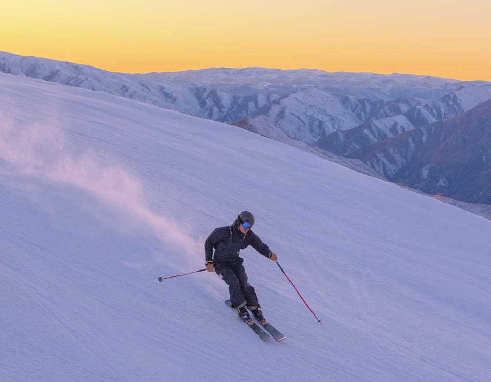
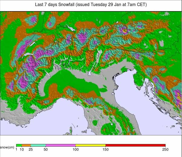
The snowfall never really went away in the Alps after the massive accumulation on the eastern side of the range up to a fortnight ago. But the past week and the past few days, in particular, has seen the rate of accumulation gather strength. This time the Western Alps is seeing the heaviest falls; some areas reporting more than a
However, the biggest snowfalls of the past week on the continent have been in the Pyrenees, which have seen some massive dumps. The biggest of all, so far, have been on the French side where several areas claim more than two metres of snow has fallen since this time last week.
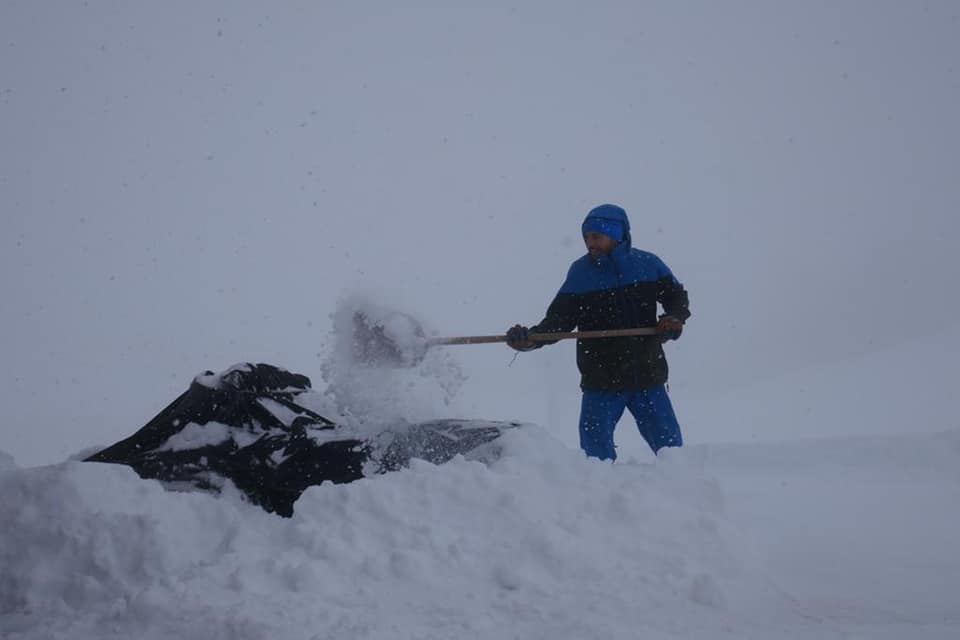
Elsewhere, Eastern Europe remains fairly snowy. The Dolomites look set to get a big dump and there’s been more snowfall in Scandinavia, particularly in eastern Norway. Whilst Germany has posted the biggest accumulations of the past 24 hours. Scotland edged closer to opening properly for the season at the end of last week but then had a damaging 26-hour warm spell. But the snow and low temperatures are back now so not all hope is lost.
Across the Atlantic, it’s a quieter week with, unusually, some ski areas on the eastern side of North America seeing more fresh snowfall than resorts on the west.
INDEX:
Austria / France / Switzerland / Italy / Andorra / Norway/Sweden / Germany / Bulgaria / Scotland / Japan / USA / Canada / Europe / North America
Austria
The rate of snowfall may have slowed in Austria since the three-week snowy deluge between Christmas and mid-January but it hasn’t stopped snowing with ski areas in Carinthia and Salzburgerland reporting up to 70cm of fresh snow in the past week. Although, for many areas around the country the totals were lower: more like 20-40cm.
At Kitzbuhel, Austria’s biggest sporting event of the year: the Hahnenkamm festival had to be re-arranged with the Blue Ribband downhill (traditionally on a Saturday) moved to Friday to avoid the worst of the snowfall and low visibility that moved in on Saturday. A dozen or so Austrian areas now have more than 4
FRANCE

France has had its snowiest week of the year, topping the snowfall totals for Europe over the past seven days in both the Alps and the Pyrenees. The latter has actually posted the most dramatic totals with a dozen French areas there posting 1.2
SWITZERLAND

It has been an often snowy week in Switzerland too with the heavier snowfall now in the west rather than the east as it was from Christmas to mid-January. So whilst Andermatt (80/600cm) in the east continues to post the deepest base in the world, it has not had much fresh snow. Whilst areas in the Valais to the west have posted up to 80cm of snowfall in the last week with the heaviest snow falling over the past few days. The Central Switzerland canton has benefited from snow first coming from the east and more recently the west and it too has seen some big snowfalls in the past few days. Engelberg (50/520cm), for example, now has the country’s (and the world’s) second deepest base after 55cm (nearly two feet) of fresh snowfall in the past few days.
ITALY

It has been the snowiest week of the month, and indeed for much of the winter so far, in parts of Italy, and it looks set to get snowier. The biggest accumulations have been reported on the western side of the country with La Thuile (25/170cm) reporting 40cm of new snowfall since the weekend. There’s been snow further east too, just not so much this week with Madesimo (60/265cm), which has one of the deepest upper-slope base depths in the country, getting 15cm since Saturday. Temperatures are currently low with many resorts at double-digits below freezing, even down at village level, which should mean the snow is great for skiing and boarding as it continues to accumulate.
ANDORRA
It has been a remarkable week for snowfall in the Pyrenees. Definitely the big one’ for the season so far with several resorts in the French Pyrenees posting more than 2.1m (7 feet) of snow in the last seven days. At times this heavy snowfall has been accompanied by strong winds and low clouds giving blizzard conditions on the mountains, blocking access roads and ramping up the avalanche danger. But once these issues have eased there’s deep powder waiting after two months with little fresh snowfall in the region. Grandvalira (40/140cm), in Andorra, reported 50cm of snowfall on Sunday/Monday alone.
NORWAY/SWEDEN

A fairly quiet week in Scandinavia which is the region set to become the focus of world attention next week as the bi-annual Alpine Skiing World Championships kick off in Are (70/70cm), Sweden, the biggest resort in the area. There’s been snowfall across Sweden bringing 5-10cm of fresh snow over the past 72 hours. But the biggest snowfalls of 15-20cm since the weekend have been reported in Eastern Norway, with one of the country’s biggest resorts, Hemsedal (85/85cm) posting a 19cm accumulation, with 14cm at nearby Geilo (53/85cm).
GERMANY

It is snowy once again in Germany where conditions have completely transformed through January after the warm, dry December. The past month has been one of the snowiest in years in Bavaria and the wider area though and there’s no real sign of it easing off much. The past 24 hours have, in fact, seen the biggest snowfalls in Europe reported in Germany with Baiersbronn (110/150cm) posting the biggest: 50cm/20 inches. The Zugspitze glacier (0/390cm), Germany’s highest, continues to post the deepest base in the country with 40cm more fresh snow in the past few days. But bases are good across the country and the problem continues to be the clearing of snow to open roads and make the slopes safe, rather than any lack of snow. Most of the country’s larger areas have at least
BULGARIA
It’s continuing to look good in Bulgaria with a healthy base and most lifts operating and runs open across the country – temperatures are hovering at around zero in resorts and colder in the mountains. There was a big dump at the largest resort: Bansko (80/160cm) at the end of last week which brought the main gondola lifts to a standstill on Friday, but conditions were then great for the weekend. Pamporovo (215/235cm) continues to report the deepest base in the country.
SCOTLAND

A typical weather roller coaster week in Scotland. Over a week of cold weather allowed Glencoe (15/25cm) and Nevis Range (0/0cm) to finally open a few runs last Thursday, just before temperatures
JAPAN
It remains a snowy picture across Japan and the vigilance of the authorities there to
USA

After some decent dumps last week it has been fairly dry in the US since the weekend with little fresh snow reported on East or West coasts. The biggest accumulations since Sunday have been reported in Colorado with one of North America’s highest altitude areas: Loveland (142/142cm), in Colorado, saying its had 21cm/7 inches of fresh. Nearby, Breckenridge (147/147cm) has had 11cm in the last few days but recently announced it was extending its ski season from its usual late April end to the end of May this spring and, conditions permitting, every spring moving forward. Conditions are good across most of the country with Californian areas posting the deepest based thanks to the huge snowfalls there in recent weeks. Soda Springs (462/462cm) currently claims the deepest in the country and indeed in all of North America.
CANADA

The eastern side of Canada has seen more snow than the west since the weekend and, compared to a week ago, more resorts in the east have moved to the top of the snow depths table ahead of western areas. Mont Tremblant (318/318cm) has taken the country’s deepest base for 2018-19 through the three metre/10 feet mark. Conditions are good across the country. However, with nearly every lift running and every trail open at every Canadian ski area, Whistler Blackcomb (245/245cm) has one of the deepest bases in the west after its big December snowfalls.
EUROPEAN WEATHER OUTLOOK

It is going to stay snowy this week in the Western Alps with ski areas in France and Western Switzerland likely to see another 50cm to as much as a
NORTH AMERICAN WEATHER OUTLOOK

There’s due to be a resumption in snow deliveries to Western North America from the middle of this week with California and Oregon likely to see some of the biggest falls in the US (up to 70cm) with the heaviest accumulations expected Friday/Saturday. The snowfall should continue East and arrive in Utah around then too. Other parts of the US will see small 10-20cm accumulations over the coming week with most of the snow in the East looking likely to arrive over the next day or two, before skies clear ahead of the weekend. Over the Canadian border, it’s looking cold and clear for much of the country with most of the significant snow forecast likely to hit coastal ski areas on the east and west sides of the country. That could mean 10-20cm in Quebec but it’s coastal V/BC resorts like Whistler and Mount Washington (220/220cm) on Vancouver Island that could see significant snowfalls of 50-70cm respectively.