WORLD SNOW ROUNDUP #282
Issued: 15th March 2023
By Patrick “Snowhunter” Thorne
World Overview
It has been a week of very heavy snowfall on both sides of the Atlantic. It’s a bit hard to believe that it’s the first time this season, when some areas have already ended their 22-23 seasons, that we’re able to say that.
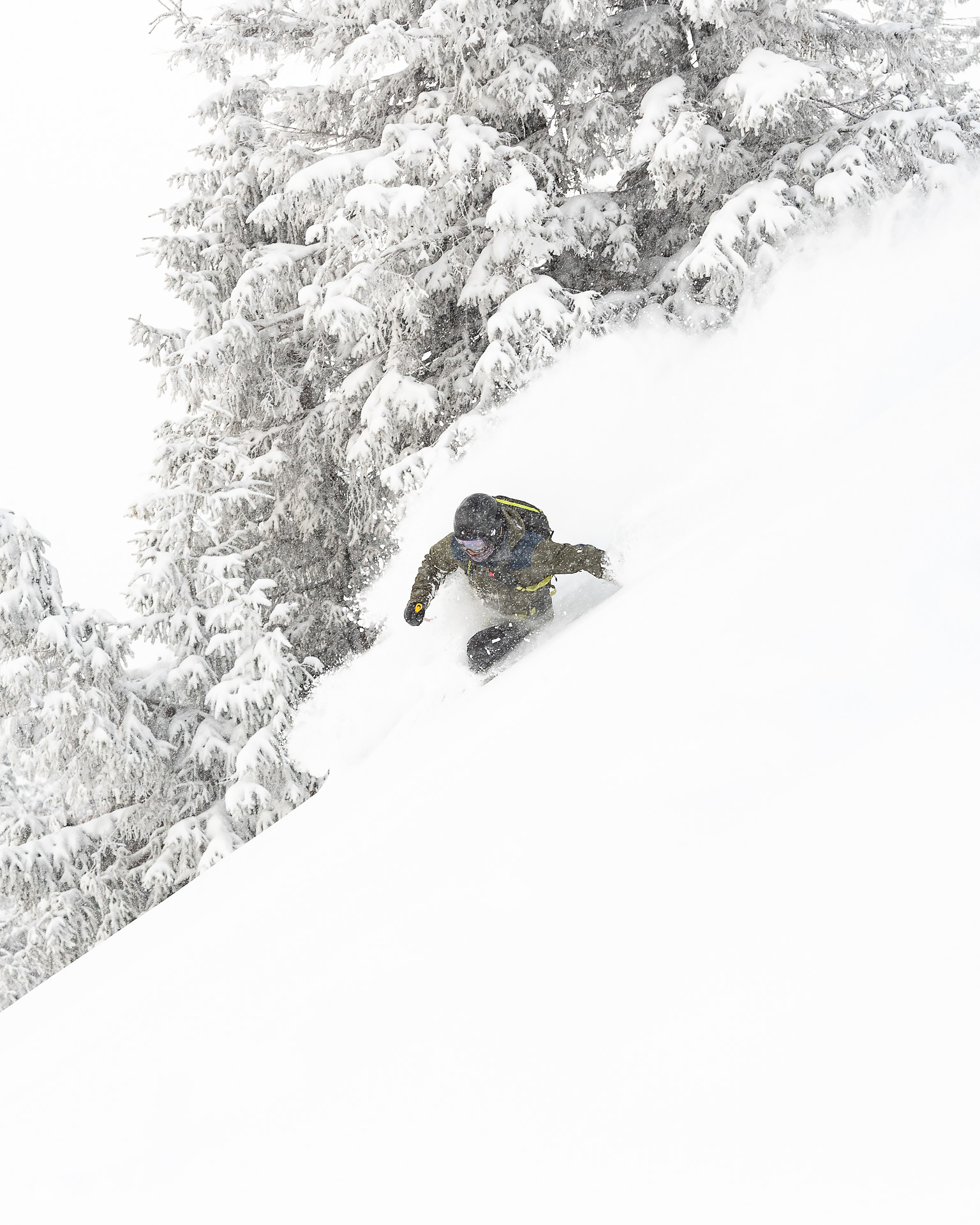
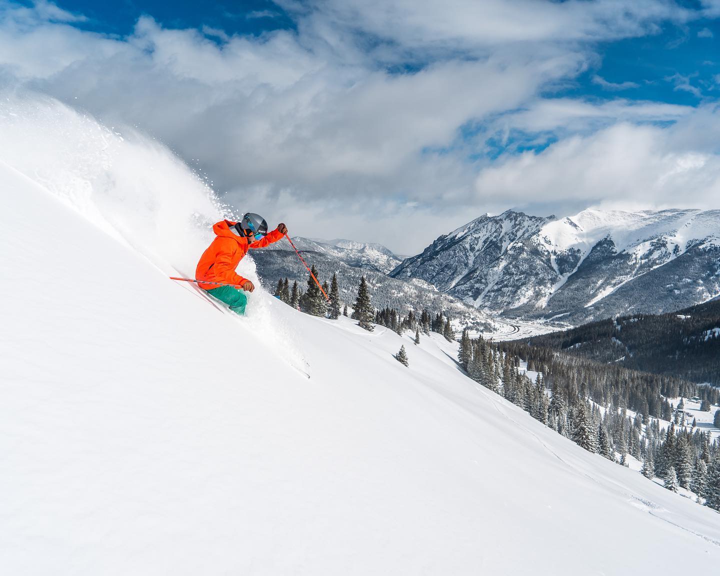
Heavy snowfall hasn’t been unusual this winter in western North America, which continues to post the world’s deepest bases this season and has resorts going through the 500 and 600 inches of snowfall to date mark (12.5-15 metres). It has been very rare in the Alps and up to 1.5 metres of snowfall has been reported on high slopes there over the past few days has been the most for many areas this winter, in fact almost as much as they’ve received all winter in some cases.
Common factors of the latest giant snowstorms were rain and wet snow at lower elevations (we are approaching mid-March), strong winds causing closures of higher lifts and runs and sometimes whole ski areas, and the avalanche danger level rising to high.
Outside the North American west and the western Alps, it has been quieter. There have been more dumps in the Rockies, north-eastern North America and Scandinavia but all more moderate and manageable quantities, as well as more powdery snow. Drier and getting warm at low elevations in particular as spring conditions take hold.
There have also been reports of more fresh snowfall up high this week in the Southern Hemisphere with New Zealand’s Mt Hutt posting snowy images.
Europe
EUROPE INTRO
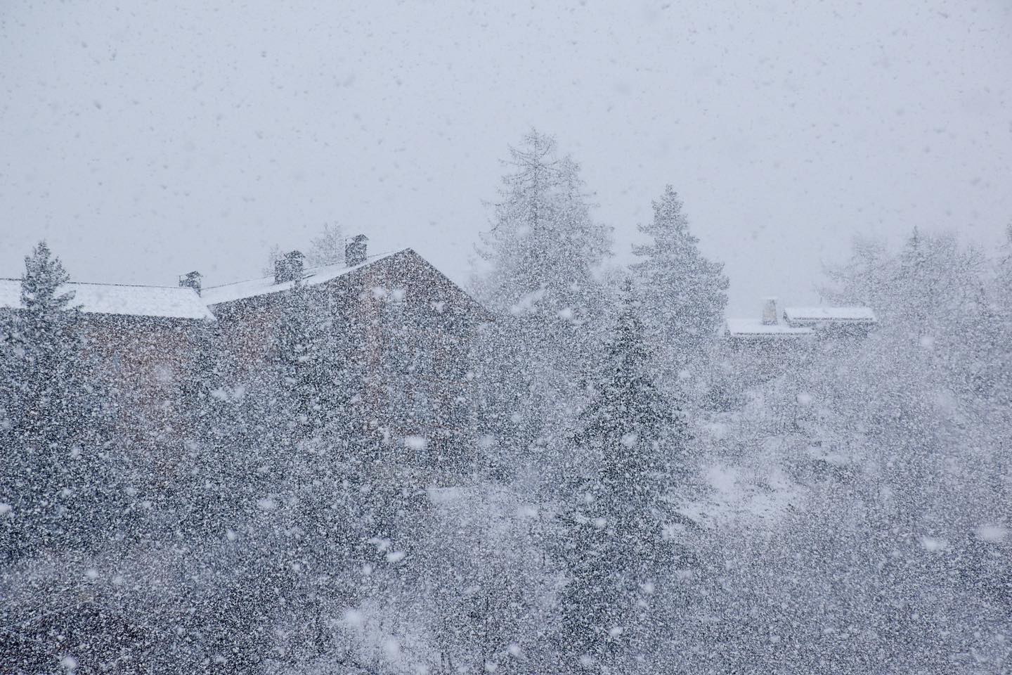
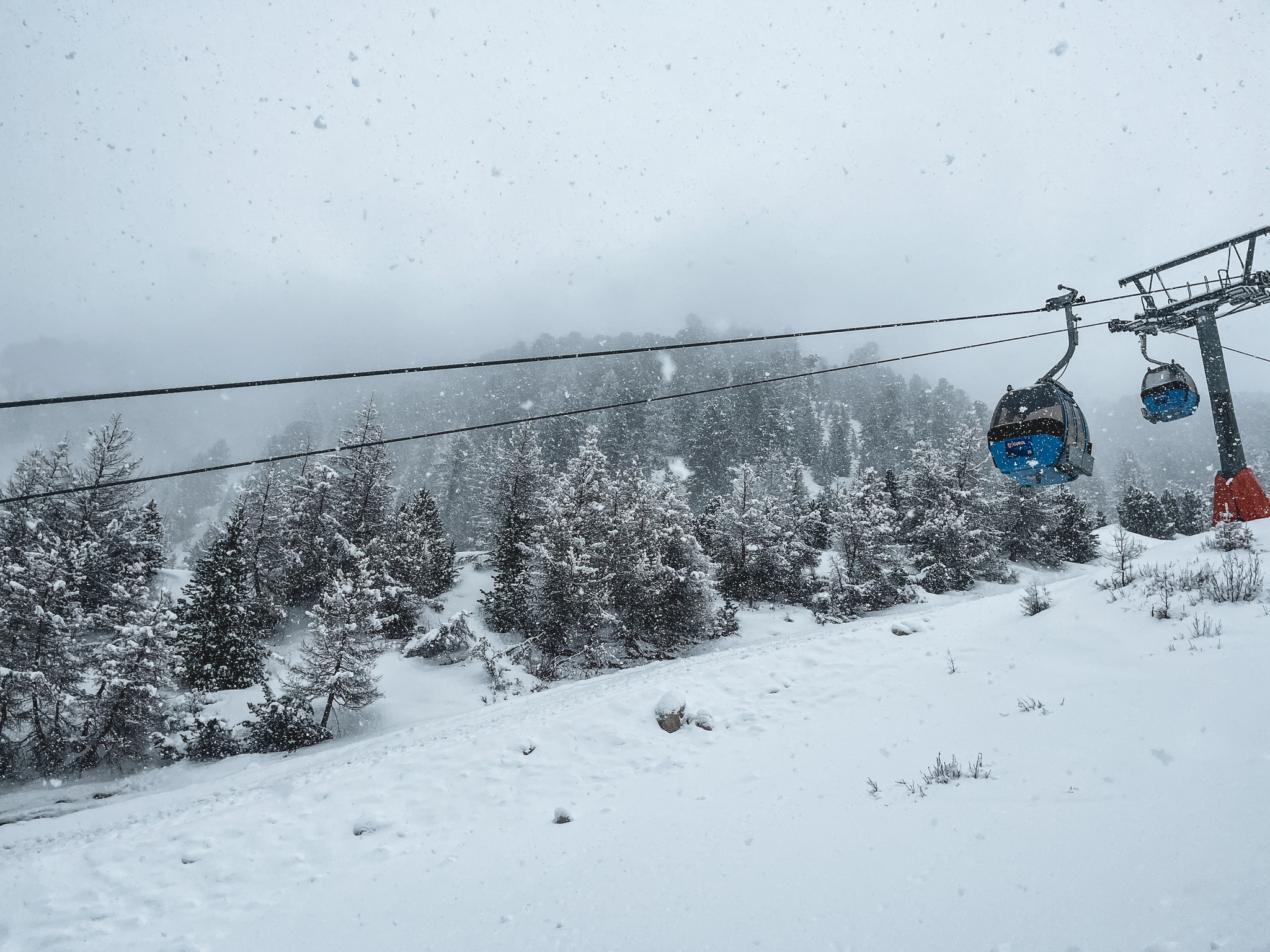
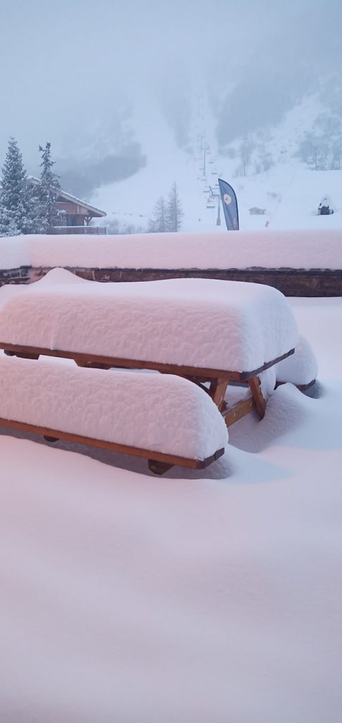
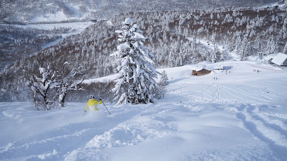
It has been the snowiest week of the 22-23 season so far in many areas of the Alps with some resorts posting over a metre of snowfall, much of it in a 48-hour period from Friday to Sunday. The snowfall has greatly bolstered snow depths for the final weeks and months of the season and even given a big boost to glaciers that had previously had below-average cover ahead of the 2023 summer ski season. It’s been heaviest in the north and west of the Alps (France and parts of Austria, Italy and Switzerland). Strong winds of up to 100kph were a factor at the end of last week and through the weekend, leading to entire ski area closures in the Pyrenees and large-scale high lift and run closures at altitude in the Alps. The avalanche danger has also risen to level 3 (“considerable”) or 4 (“high”) across a wide area.
AUSTRIA REPORT
Austria was quite divided in terms of snowfall received over the weekend in particular with areas like the Arlberg receiving over 60cm (two feet) high up, while large swathes of the country hardly saw a flake. On the one hand, those areas were the ones that did see snow in the latter half of February when much of the Alps didn’t. On the other hand, their bases weren’t great in most cases and they did see temperatures peak at +15C on Monday. Things have started to improve a little in the last 24 hours though St Anton (40/290cm / 16/116”) is posting the country’s deepest base if you’re allowed on the lift to go up to Valluga.
AUSTRIA FORECAST
The snowfall will continue across much of the country through Wednesday before things start to quieten down with sunshine forecast to return in the latter half of the week.
SWITZERLAND REPORT
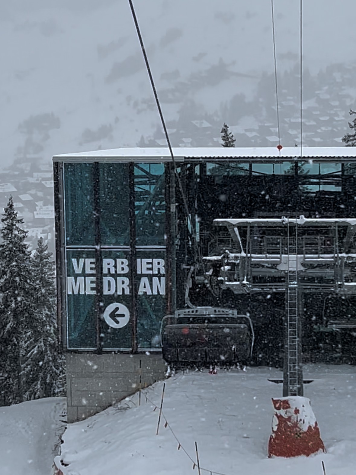
Swiss centres have seen some huge snowfalls over the past week, by far the most of the winter so far. It is, though, a divided picture with some resorts on the western side of the country seeing big jumps in their base depths, others in the east virtually nothing. Saas Fee (65/290cm / 26/116”) posted the largest base depth increase from Thursday in the entire Alps, 35cm (14”) more at resort level, 1.2m (4 feet) more up on the glacier. St Moritz (30/50cm / 12/20”), in the east, received almost none of the weekend snowfall. Although it is reported to be currently getting a decent dump as we complete this week’s report.
SWITZERLAND FORECAST
A sunny few days ahead with freeze-thaw conditions and daytime highs getting up to double figures in valleys, staying sub-zero up high. Cloud and light snowfall arriving to end the week and continue through the weekend.
FRANCE REPORT
It has been quite a week in the French Alps with some spectacular snowfalls at the weekend. Tignes (140/370cm / 54/148″) was one of the centres reporting over a metre of snowfall and continues to post the deepest base in Europe but is now up by over a metre (40″) on seven days ago. The snowline was at about 1400m on average and some lower resorts did see rain, with slopes below 1800m also reporting wet snow. But, overall, it was a big boost to snow depths for the final month or two of the season, and for ski areas like Tignes for the summer ski season. The snowfall was driven in by gale-force winds at times though and the avalanche danger warning has risen to 3 (considerable) or 4 (high) in many areas. However, most groomed slopes at larger areas are open, the 3 Valleys reporting almost 95% of its slopes skiable. There was more snowfall in many areas on Tuesday.
FRANCE FORECAST
After the recent snowfall, drier, sunnier weather will continue midweek with freeze-thaw conditions dominating through the week ahead below about 2,500m, staying below freezing higher up. Clouds and light snowfall are expected to end the week.
ITALY REPORT
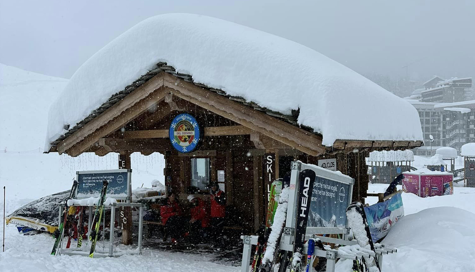
Some huge snowfalls in north-western Italy as Cervinia (30/140cm / 12/56”) posted 1.5m (5 feet) of snowfall over the weekend and more than a metre for La Thuile (72/280cm / 29/112”) too. The falls were limited in their geographic extent though with much less further south of the Aosta Valley in the west and over in central and eastern Italy. They were also followed by warm weather on Monday. The Dolomites missed out on the weekend snowfall but many areas did see 5-15cm (2-6”) of snowfall on Tuesday when there were snowfalls across Italy.
ITALY FORECAST
Looking drier across the country for the remainder of the week, with the freezing point around 2,000m and freeze-thaw conditions at lower elevations. Quite sunny but with periods of cloud.
GERMANY REPORT
Most German ski areas have seen a mixture of rain and snowfall over the last week. Only about 20% of the country’s centres are open still after a bad winter here for snowfall with temperatures too warm at the lower elevations of many German areas for consistent operations. The recent rain below 1500m, which is the higher slope height in many German areas, has exacerbated the problems. It is the more established, larger resorts that are still open with Reit im Winkl (0/100cm / 0/40″) still reporting 95% of its terrains skiable, the most in the country for a single area.
GERMANY FORECAST
There are more unsettled conditions forecast which may deliver snowfall or rain depending on the time and day and altitude of slopes when and where it falls. Overnight lows on highs slopes down to -15C but daytime highs are up to a thawing +15C.
SCANDINAVIA FORECAST
There’s quite a lot of sunshine in the forecast but with many areas seeing snow showers too, the heaviest likely at the end of the week and into the weekend. Temperatures typically in the -5 to -15C range but daytime highs could creep a degree or two above freezing.
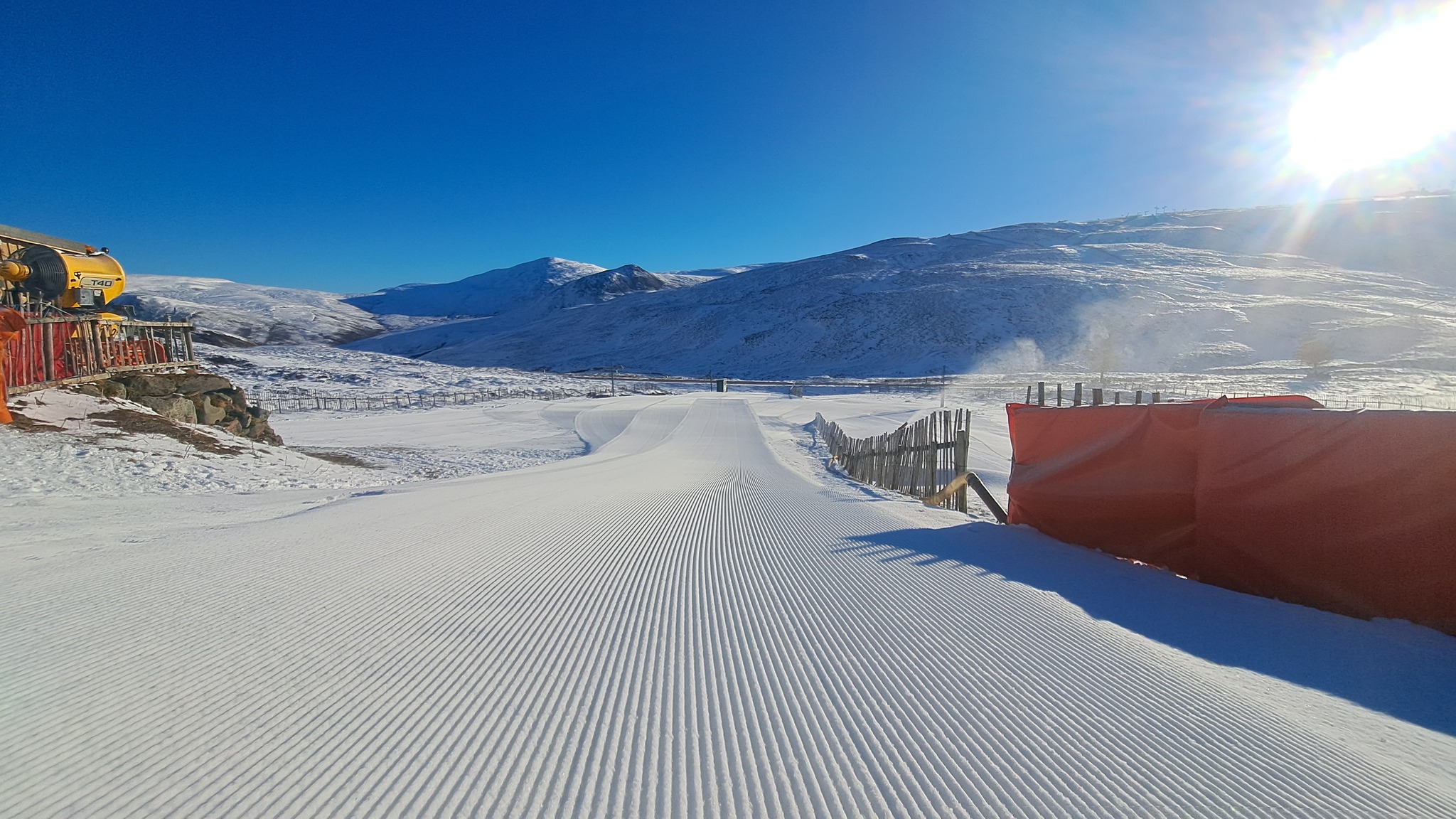
SCOTLAND REPORT
Conditions at the open Scottish ski areas have got better and better through the past week. There were very low temperatures in the latter half of last week, as low as -16C was reported overnight. Cairngorm (20/50cm / 8/20″) has the most terrain open after reporting 35cm (14″) of snowfall initially and more snow showers since. The Lecht (10/40cm / 4/16”) and Glenshee (10/40cm / 4/16”) also have the best conditions they’ve had for months, using conventional snow-making as well as their all-weather machines to make more snow and open more runs, albeit, recovering from little or no snow left a week ago, with still only a proportion of their potential terrain able to open until there’s more snow.
SCOTLAND FORECAST
The forecast is currently fairly promising with cold nights, more snowfall and not getting too warm in the daytime. So, hopefully, centres will be able to reopen more and more terrain.
SPAIN / ANDORRA REPORT
The Pyrenees have not seen the snowfall that’s arrived further north and east in the Alps, but there have been some flurries on higher slopes over the weekend. A problem though is that the snow line has been up above the highest peaks in the range at times. So there’s been some rain at lower elevations, not ideal with Soldeu, in Andorra, hosting the Alpine Skiing World Cup finals. Afternoon temperatures have been getting above +10C in valleys. The region’s largest ski area, Grandvalira (50/105cm / 20/42”), of which Soldeu is a part, still has 95% of its terrain reported open though. Spain’s Baqueira Beret (115/165cm / 46/66”) also has most of its runs open.
SPAIN / ANDORRA FORECAST
Sunny and rather warm conditions, particularly on low-lying terrain, this week with highs of +15C. Still dropping below freezing most nights for freeze-thaw conditions.
BULGARIA / ROMANIA REPORT
It’s been mostly sunny in Bulgaria with temperatures getting up to double digits at resort level and a degree or two above freezing in the afternoons on higher slopes too, although overnight lows are continuing to drop below freezing. There was some light snowfall just before the weekend, however. Bansko (5/70cm / 2/28″), the largest area in the region, reports 80% of its slopes are still open.
BULGARIA / ROMANIA FORECAST
Cloud and light snow showers are expected over the next few days before sunshine returns in the latter half of the week and through the weekend.
CZECH REPUBLIC / SLOVAKIA REPORT
It has been a mixed week for Czech and Slovak ski centres with some decent snowfalls reported on the higher slopes at the larger centres of the two countries. But rain has fallen on lower slopes at times, mostly at the smaller centres of the region. Jasna (50/180cm / 20/72”), in Slovakia, the largest ski area in the region, remains fully open and posted 25cm (10”) of fresh snowfall at the weekend. It also has the region’s deepest base.
CZECH REPUBLIC / SLOVAKIA FORECAST
A mostly dry and increasingly sunny end to the week and weekend with temperatures in a freeze-thaw cycle between around -8 and +8C.
NORTH AMERICA INTRO
A mixed bag of weather across North America with more spectacular snowfalls off the Pacific Coast. Once more driven in on gale force winds and this time with increasingly warm, wet weather leading to heavy snow issues and the inevitable high avalanche danger. Further inland there have been big new falls in the Rockies too, with the snow a little better thanks to cooler temperatures. The east and midwest have also had fresh snowfall, albeit measured more in inches than in feet as it is further west. It has also finally been cooler in the southeast of North America, although most resorts in the region have unfortunately already closed until next winter after sustained record warm temperatures earlier in the year.
ROCKIES REPORT
Still more fresh snowfall in the Rockies with Colorado’s Crested Butte (58/58” / 145/145cm) one of the big winners posting an 18” (45cm) snowfall accumulation in 24 hours to Saturday, then it kept falling. Sunday was a(nother) fabulous powder day for many areas as the sunshine returned. Snow depths are good everywhere but remain deepest in Utah e.g at Alta (52/176”/ 130/439cm).
ROCKIES FORECAST
A mostly dry remainder of this week with a week front moving through on Thursday potentially bringing 3-6″ (7-15cm) of a fresh snowfall, otherwise it will be mostly sunny. Temperatures stay well below freezing most of the time and on high slopes but, at resort level, we could see numbers creeping up to the mid-40s in the afternoon as springtime continues to take hold.
USA WEST REPORT
There is a definite sense of weariness from US West Coast resorts as they report yet more heavy snowfall as the “atmospheric river” coming in from the Pacific continues. There was a brief respite at the end of the weekend/start of the week but the next storm is in full force as we complete this week’s report with more strong winds, buried roads and lifts, high avalanche danger and heavy wet snow or rain at lower elevations all resulting in both incredible snow depths and season-to-date snowfall totals (more and more areas with 600” (15m +), but also limitations on opening and business as staff seem to be eternally digging out. Six ski areas are currently posting 200” (5m+) upper slope base depths, with five of them in California. Mammoth Mountain (243/291” / 607/726cm) continues to top the table.
USA WEST FORECAST
The latest in the successive run of dozens of big storms is easing as we complete this week’s report and it looks like there will finally be a respite for the latter half of this week, with sunshine and temperatures in the low-20s to mid-30s. The end of the week will probably see more snowfall, however, but so far it’s forecast as fairly light.
MIDWEST REPORT
It’s been a cold and sometimes snowy week in the Midwest with several areas reporting over a foot of snowfall, in most cases the heaviest falls coming at the weekend. Wisconsin’s Little Switzerland (20/20″ / 50/50cm) reported one of the biggest 24-hour accumulations, reporting 8″ (20cm) of fresh on Saturday. It is 100% open. The same is true of Michigan’s Ski Brule (72/72″ / 180/180cm), which has had less fresh snowfall this week but is reporting the deepest base in the region. The ski season has started winding down in some areas though with Mt Crescent in Iowa closing at the weekend.
MIDWEST FORECAST
Drier over the next few days in most parts of the region with temperatures ranging from the mid-teens to low-30s Fahrenheit. The chance of snowfall to end the week when snow clouds are expected to return.
USA EAST REPORT
It has been a good week in the eastern US with weekend snowfall topping up the improved cover and giving some great fresh snow cover for spring skiers and boarders. Another nor’easter is currently impacting the east coast as we complete this week’s report and, interestingly, it’s bringing (wet) snowfall to more southerly latitudes. Many ski centres in the US southeast already ended their seasons in late February after record warm temperatures. So it’s unclear if any might re-open as a result, but it should boost those still open. Sunday River (36/49” / 91/127cm) is posting the region’s deepest snow and is 100% open, with only Killington (14/23” / 35/58cm), also fully open and offering more skiable terrain.
USA EAST FORECAST
The current storm system is expected to keep blowing in through the remainder of this week. Temperatures range from the mid-teens to the high-30s in the north of the region. So it should continue to be fairly wintery. Skies clearing at the weekend.
CANADA WEST REPORT
Continuing to look good across western Canada with many ski areas in Alberta and BC posting 10-20cm (4-8”) of fresh snowfall to start the new week. Then drier, sunnier weather to enjoy it with temperatures hovering around freezing in the daytime. Canada and North America’s largest ski area of Whistler Blackcomb (75/248cm / 30/99”) remains fully open. Another coastal BC resort, also fully open, Mount Seymour (289/430 cm / 116/252”), also has Canada’s deepest snowpack.
CANADA WEST FORECAST
The dry weather looks set to continue in most areas for the remainder of this week and through the weekend. Temperatures range between -15C and +2C.
CANADA EAST REPORT
Conditions in eastern Canada continue to be among the best they’ve been all season after months of stop-start winter weather conditions. Everything is open, base depths are pretty good and there’s been more light to moderate snowfalls over the past week. Temperatures are generally in the -10 to +3C range. The largest area, Tremblant (54/140cm / 22/46”), continues to post one of the deepest bases in the region as well as all slopes open and lifts turning.
CANADA EAST FORECAST
Similar conditions are expected through the remainder of the week with a front bringing fresh snowfall in the latter half of this week, probably heaviest on Thursday, with skies clearing on Friday for the weekend.
Asia
JAPAN REPORT
Snow depths across Japan are continuing to drop, gradually, as springlike conditions take hold and the spring thaw sets in. Niseko (110/345cm / 44/138″) has posted warm and wet weather at times this week. Although there have also been periods of colder, snowier conditions, it’s the usual springtime mix.
JAPAN FORECAST
The unsettled conditions are set to continue with the freezing point moving up above mountain peaks at times, but then dropping again allowing more snowfall to arrive with Thursday currently looking good for more of that. There’s plenty of sunshine in the forecast too.


