WORLD SNOW ROUNDUP #281
Issued: 8th March 2023
By Patrick “Snowhunter” Thorne
World Overview
Western North America continues to deliver the big snow news. Although we’ve had calmer weather for much of the past week and as our report was published last week, it was still dumping off the Pacific. At the height of the storm, some areas posted that the snow was arriving at 3 feet (90cm) per 24 hours and by the end, several Californian resorts posted they’d received over 10 feet (3 metres) of snow in the previous week. The world’s deepest base had also reached 25 feet, passing the 7.5 metres mark. The snowfall wasn’t just in the west either with ski areas across Canada and over in New England posting decent, if not quite so spectacular, dumps too.
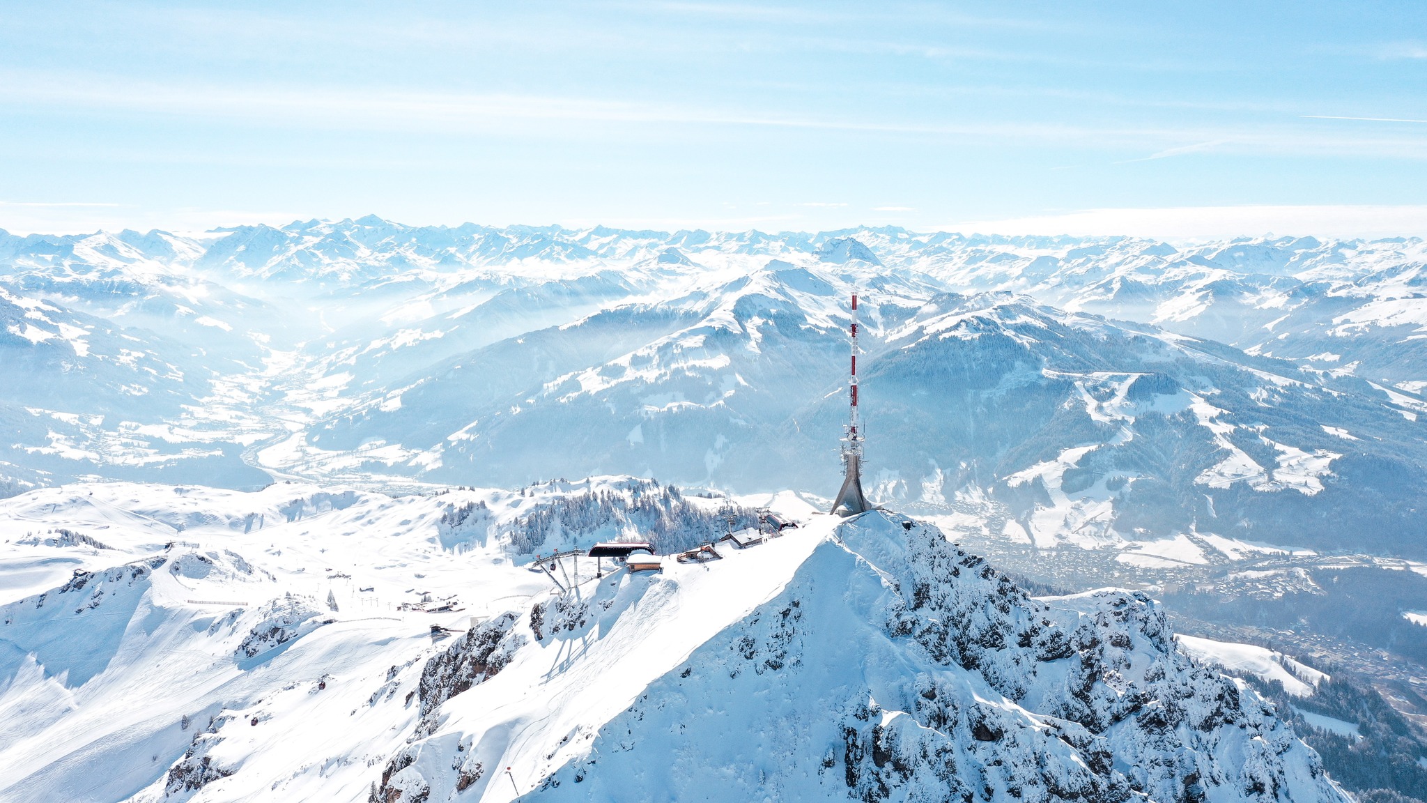
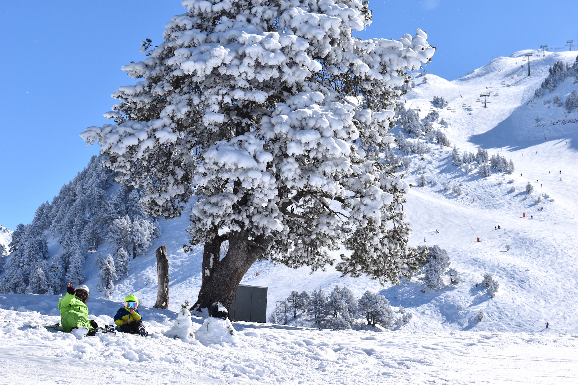
Europe saw snowfall as well, if not on the scale of the US West. But after an often dry and warm latter half of February, colder, snowier weather to start March was very welcome. Unusually the Pyrenees posted some of the biggest accumulations with Scandinavia continuing to deliver. In the Alps, the most snow, 10-40cm (4-16″) at a time and up to a metre (40″) in a few locations in total, fell in the southwest corner (France/Italy) and northeast (Austria/Switzerland), although almost everywhere saw at least 5-10cm (2-4″). Colder weather and some snowfall for the Balkans too.
In Japan the start of March has seen the arrival of ‘spring like’ conditions with temperatures rising and base depths, which had peaked at over 5 metres (200”), starting to drop.
Europe
EUROPE INTRO
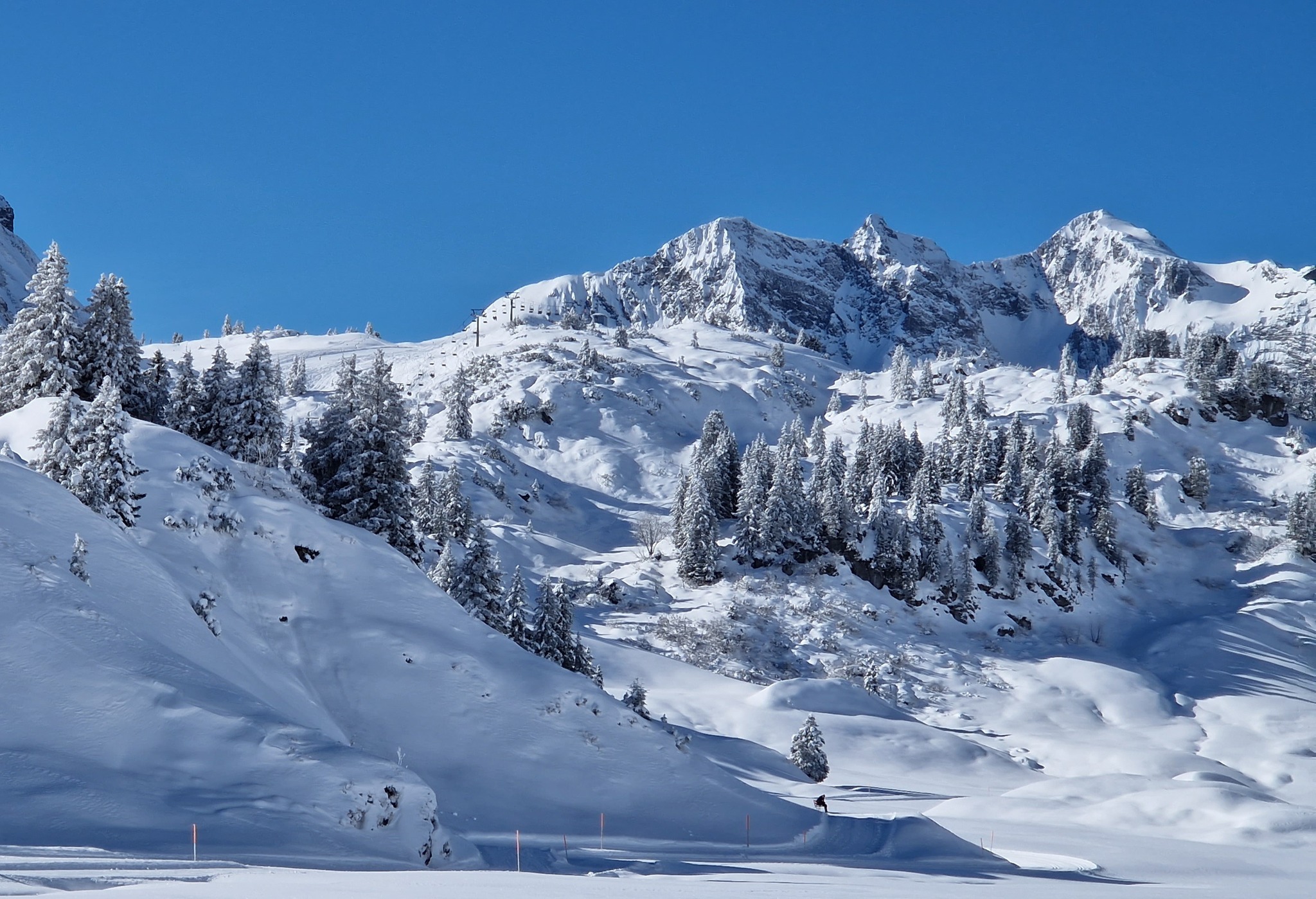
Temperatures dropped across Europe at the weekend and snow clouds rolled in during the middle of last week, bringing light to moderate snowfalls to end over a fortnight of warmer-than-average dry weather. The southwest of the continent just about fared best with ski areas in the Pyrenees and in the southwestern corner of the Alps among the French/Italian border, faring best with up to a metre of fresh snowfall reported, though for most it was about half that. There were also some good accumulations of 20-40cm (8-16″) on the other side of the Alps in the northeast corner, mostly in Austria. Most areas in between saw 5-10cm (2-4″) in the latter half of last week before drier conditions once again became dominant. Elsewhere in Europe, the Balkans saw 20cm (8″) of snowfall to start March and it has been snowy, still, in much of Scandinavia but Scottish centres continue to face challenges with little open now beyond nursery slopes, plus some touring terrain.
AUSTRIA REPORT
Austria has had a fairly good week with the start of March much cooler than the final few weeks of February were. It’s been a mixture of sunshine and some snowy spells with temperatures staying colder than they were, although creeping up to +5C or so in the afternoons in lower valleys. Up on the highest slopes, though, the numbers we saw dropping in the last week of last month have been put back. So although the stats still aren’t great for each March, the decline has halted. St Anton, for example, has put 25cm (10″) back onto its depth up at Valluga and the Arlberg region remains more than 90% open, similar to the country’s other big regions. Lower slopes are typically ribbons of white on green valley sides though, which is more like April conditions.
AUSTRIA FORECAST
Sunshine and light snow showers continue through the remainder of the week, the freezing point continuing around 2000m. The snow showers should get heavier towards the end of the week with potentially 30-60cm totals.
SWITZERLAND REPORT
Swiss resorts have had a mixed week with some light snowfall, particularly on higher slopes up to the weekend, along with lower temperatures than in the latter half of February. However, thin bases at lower elevations have started to melt away at the resort level, even though snow may be pushed down to maintain runs over the full vertical. Zermatt (0/90cm / 0/36″) is a good example, it has seen a (rare in 2023) increase in its rather lacklustre glacier base depth up high by 10cm, whereas resort-level snow has gone in the other direction down to zero. Despite the challenges, the weather, particularly the lack of a serious snowfall this year, continues to cause most of the main Swiss centres to continue to have their slopes pretty much fully open.
SWITZERLAND FORECAST
Largely cool and sunny across Switzerland with some clouds starting to bubble up. Temperatures in the range of -10C to +5C. Later this week we may see heavy snowfall, particularly on higher slopes and heaviest in the west. But there are many factors at play and a precise prediction is difficult.
FRANCE REPORT
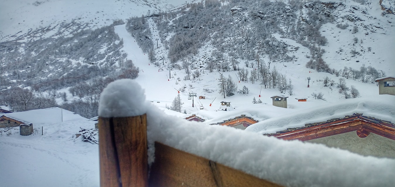
After snowfall in the early and middle part of last week, it has been another quiet one in the French Alps, meaning mostly clear skies and quite a lot of sunshine, although more cloud than there has been. The rate of thawing of the snowpack in the latter half of February has slowed however, partly with the freezing point dropping from around 3000m to 2000m and partly thanks to the small top-up last week, which was heaviest at resorts like Serre Chevalier (22/160cm / 9/64″), which saw its upper slope depth increase by 10cm and its lower slope base drop by about the same amount. There were heavier falls still further south for resorts like Auron and Isola 2000. For many resorts in the northern Alps, which have had little or no snow for 6 weeks now, it was more like 2-5cm (1-2″). Most resorts still have 85-95% of slopes open though, despite those thinner than usual springtime bases.
FRANCE FORECAST
Turning snowier again in the latter half of this week, with potentially very heavy snowfalls expected. If these arrive at their most optimistic levels, potentially 1.5m (5 feet up high) by Monday, they’ll be the heaviest of the winter so far, but models are very fluid at present. Temperatures continue at freeze-thaw levels between -10C and +7 to 8C in the afternoons down low.
ITALY REPORT
A fairly quiet week in Italy with occasional snow showers right across the country’s ski areas but mostly dry weather since the weekend. It was initially cooler here too but by the weekend we were seeing double digits at lower elevations once more, particularly at more southerly ski areas. That said, although bases remain thin, ski areas remain mostly fully open, as elsewhere in the Alps. The most snow was reported along Italy’s northeasterly border with up to a metre in total reported in some areas. Cervinia (10/75cm) was one of the big winners reporting 35cm (14”) of fresh in 48 hours and Bardonecchia got 30cm (12″) in 24 hours for Friday morning. For most of the rest of the country, it was more like 3-6cm (1-2 inches) although Arabba (40/100cm / 16/40″) in the Dolomites posted 10cm (4″).
ITALY FORECAST
A new front is expected to move in over the latter half of this week bringing a return of snowier conditions in the central and eastern part of northern Italy, especially Trentino and the Dolomites. Heavy snowfall also likely in the west. Temperatures staying cool and back to drier, sunnier weather in the northeast.
GERMANY REPORT
March has begun cooler than for much of February in Germany, slowing the rate of thaw of the thin cover. About a third of the country’s 500+, mostly small, ski centres are open, including most of the bigger resorts. It’s certainly been a challenging winter but the last week has seen temperatures close to freezing or below and snow showers for many. The Zugspitze glacier (144/144cm / 58/58”), with Germany’s highest slopes, now has the deepest base too with Reit im Winkl (17/130cm / 7/52”) managing to keep almost all of its 42km of slopes open; the most in the country, despite that very thin cover on lower runs.
GERMANY FORECAST
Quite a mixture of weather with not a great deal of snow in the forecast. Temperatures are generally low but some expected warm weather spikes could spoil things a little.
SCANDINAVIA FORECAST
Remaining cold (-5C to -25C) across the region and generally dry. Although in the far north and west of the region, snowfall is expected at times.
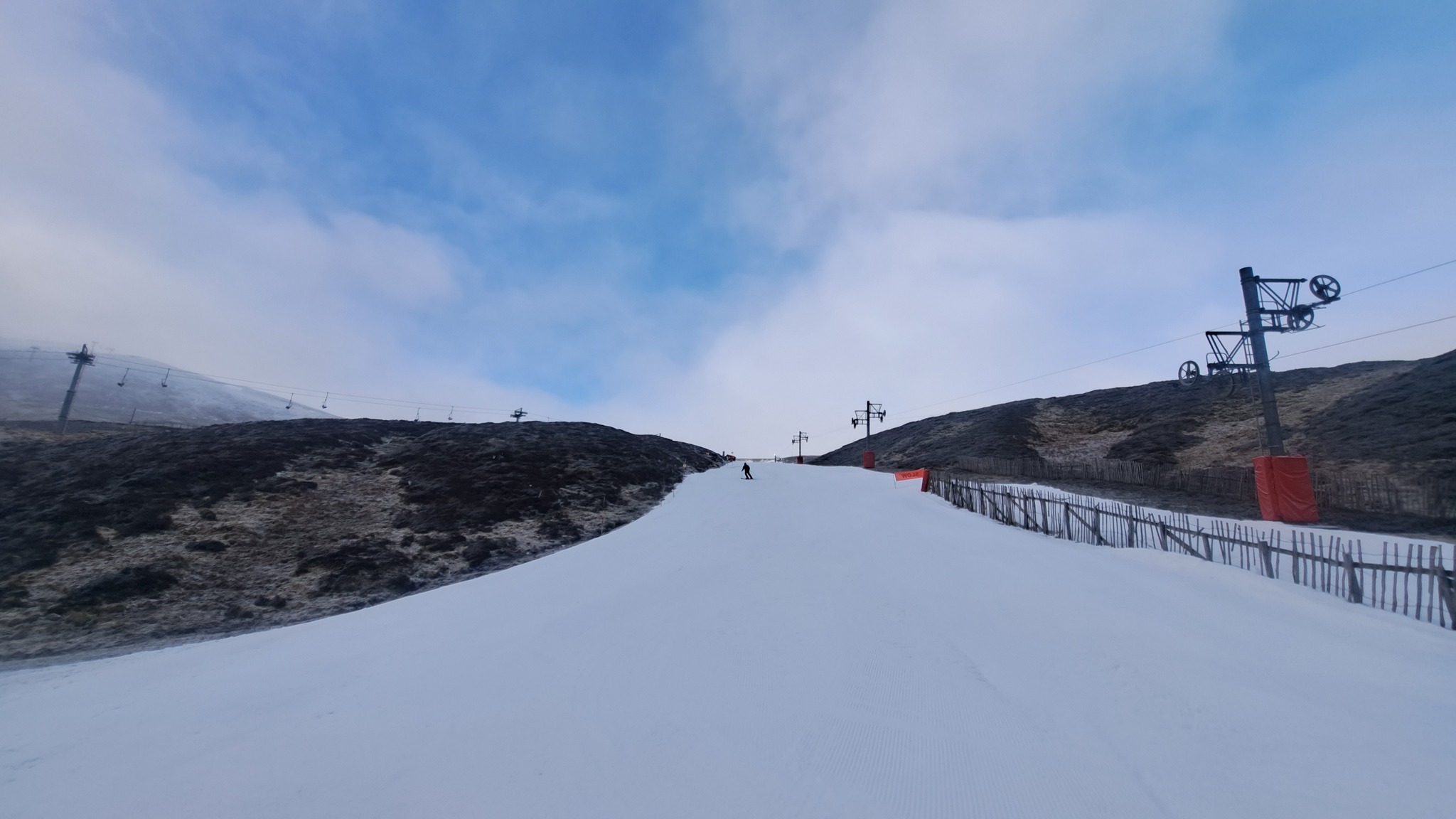
SCOTLAND REPORT
There’s been colder weather and some snowfall in Scotland. But, at the time of writing, not enough for resorts to reopen closed terrain. Instead, it’s small areas of nursery slope created and maintained using all-weather snow-making equipment at Glenshee, Cairngorm and The Lecht that’s open as we start springtime. Cairngorm does have a small amount of higher terrain just about open, or did at the time of writing, requiring some hiking in/out. Glencoe has, unfortunately, had to cancel its Mighty Coe festival.
SCOTLAND FORECAST
The most promising forecast for the long-awaited improvement in conditions for quite a while with very low temperatures (down to -10C) and frequent snow showers, sometimes heavy. Whether it will be enough remains to be seen.
SPAIN / ANDORRA REPORT
The Pyrenees have had a second good week for snowfall, among the best in Europe in fact. Temperatures have stayed low and snowfalls, particularly in the latter half of last week, were among the biggest reported anywhere on the continent. Grandvalira (50/110cm / 20/44”) saw its upper slope base depth jump by 35cm (14”), the most reported in Europe, after clocking up 50cm (20”) of fresh snowfall, taking it back over the metre mark. It means Andorra and the Pyrenees’ largest ski area is in good shape for hosting the FIS Alpine Skiing World Cup Finals later this month.
SPAIN / ANDORRA FORECAST
After a cool but mostly sunny weekend and start to the week things are starting to change with temperatures dipping further and a front moving in that should bring snowfall through the latter half of this week, with potentially some quite decent accumulations.
BULGARIA / ROMANIA REPORT
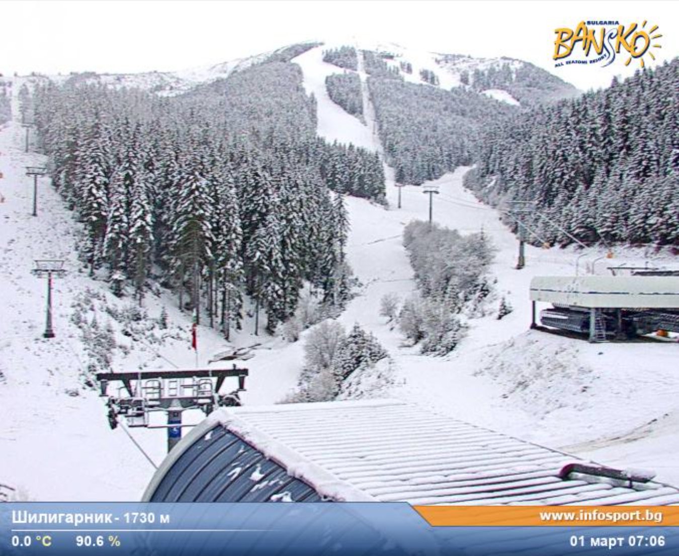
Bulgaria started March with colder temperatures than forecast and a decent snowfall on higher slopes. Bansko (5/70cm / 2/28″) posted a 20cm (8″) snowfall for the first day of springtime. It stayed cold and snowy through the latter half of last week and into the weekend. Although it’s now getting a little warmer at base levels it remains much cooler than it was in the latter half of February and below freezing above 2000m.
BULGARIA / ROMANIA FORECAST
It has been a sunny start to the week and that will continue although more clouds may build up later this week with a chance of snow showers. Temperatures range between +8 and -8C.
CZECH REPUBLIC / SLOVAKIA REPORT
After a sunny end to last week the past few days have seen more snowfall and cold temperatures (from freezing down to about -8C) in the Giant and Tatra mountains of northeastern Europe. Conditions have been mixed with some low-lying centres having tough times getting enough snow to open, but the bigger resorts like Špindlerův Mlýn (60/80cm / 24/32”), in the Czech Republic and Jasna (50/180cm / 20/72”), in Slovakia, have reached and remain 100% open.
CZECH REPUBLIC / SLOVAKIA FORECAST
Staying cold with temperatures rarely getting above freezing. Mostly dry and cloudy but with occasional sunny spells and even more occasional snow showers.
NORTH AMERICA INTRO
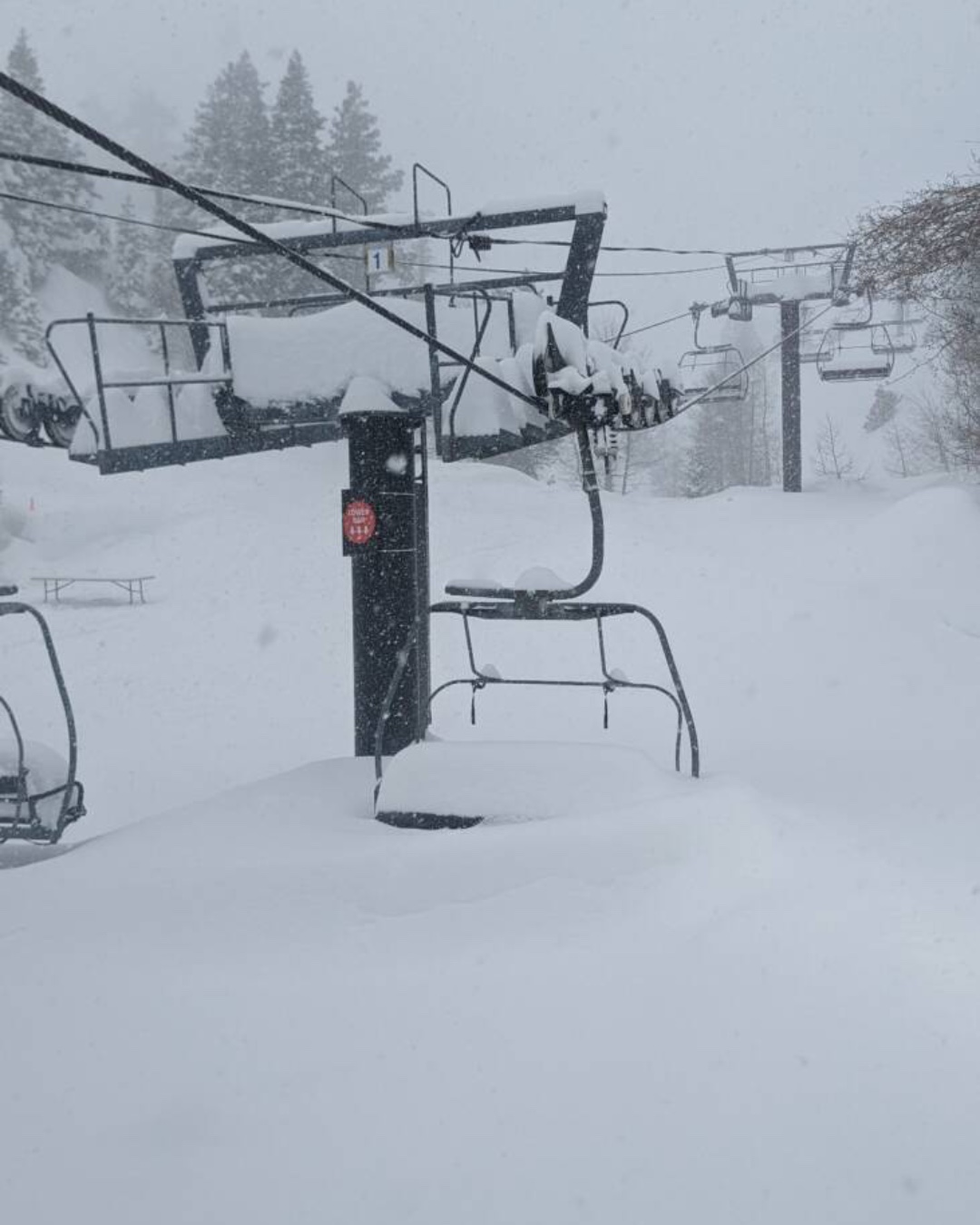
Another remarkable week for North American ski areas with several in Utah now approaching the 600 inches (15 metres) season snowfall to date total. While in California some centres posted over 120 inches in seven days alone, while the world’s deepest snowpack, also in California, reached 25 feet (7.5 metres). These stats, which also include at least one area now saying this is their snowiest winter in over 50 years, are thanks to an almost constant storm system moving in off the Pacific. Of course, all the snowfall did cause some practical issues with roads and lifts needing to be dug out, but it has also led to a growing number of areas extending their seasons later into April.
Away from the US West, it has been cold with snow showers, some heavy, across Canada and northerly East Coast resorts are in the best shape they’ve been all season after significant fresh snowfall and lower temperatures there. The exception remains the unseasonably warm southeastern corner of the continent where many ski areas have already given up and closed for the season.
ROCKIES REPORT
While West Coast ski areas have posted absolutely huge snowfall totals in the past week, the numbers in the Rockies would otherwise be drawing attention, particularly in the north. Jackson Hole posted 60” (1.5m) in 6 days. Alta (62/152” / 155/381cm), in Utah, continues to post the region’s deepest snowpack although Colorado’s Wolf Creek (129/144” / 323/361cm) is not far behind; both are fully open. Aspen, which hosted world cup racing, is one of several resorts to announce extended ski seasons to later in April at two of its four areas (Ajax and Highlands).
ROCKIES FORECAST
A dry few days with plenty of sunshine for most areas coming up, but fresh snowfall is expected to move in to end the week. Temperatures remain below freezing day and night, top to bottom at most resorts.
USA WEST REPORT
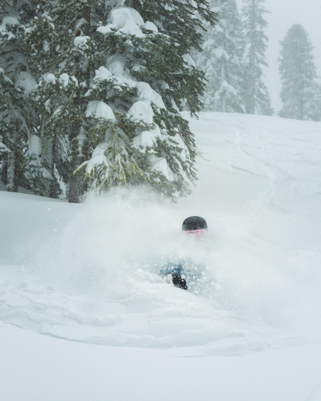
It has been a season of exceptional snowfall in the western US and the past week has perhaps topped all the huge storms that have already gone before with The Palisades Tahoe (82/170″ / 205/425cm) posting 12 feet (3/6 metres) of snowfall in the 7-days up to the weekend, and passing a 53-year-old record for the most snowfall up to start of March. That’s just one ski area of course, resorts across the region have passed 500″ (12.5m) season-to-date snowfall totals and Mammoth Mountain’s (228/305″ / 571/762cm) base, already the deepest in the world, has gone past the 7-metre mark to hit 25 feet (7.6 metres) up top. All the snowfall has of course caused a lot of issues for road teams clearing access and resorts digging out lifts and making terrain safe to open as fast as they could. Bigger areas tended to keep at least some runs open, sometimes with late starts to the day, and smaller areas were closed for several days. The snowfall actually eased away at the end of last week and most had blue skies and great conditions through the weekend before another front, bringing still more big snowfalls over the past few days, moved in.
USA WEST FORECAST
We are in a lull between fronts which should allow for a few sunny, dry days before the next snowfall arrives later this week. However, the snowfalls won’t really stop up in the Pacific Northwest. Temperatures are generally in the range of freezing to 10 or 15 degrees below.
MIDWEST REPORT
It’s been a pretty good week in the Midwest with predominantly low temperatures and some fresh snowfall reported. So slope conditions are fresh. Among the bigger falls was 6″ (15cm) to end last week at Whitecap (48/48″ / 145/145cm) in Wisconsin, which saw snowfall again at the start of this week. For most areas in the region, temperatures have been tracking a few degrees below freezing down to the mid-teens and there have been frequent cloudy skies and occasional snow showers. Michigan’s Ski Brule (69/69” / 172/172cm) has the deepest snowpack in the region.
MIDWEST FORECAST
After another snowy few days to start the week most regions will be dry for the rest of this week with a mixture of sunshine and cloud, temperatures ranging from the low single figures up to the high 20s Fahrenheit.
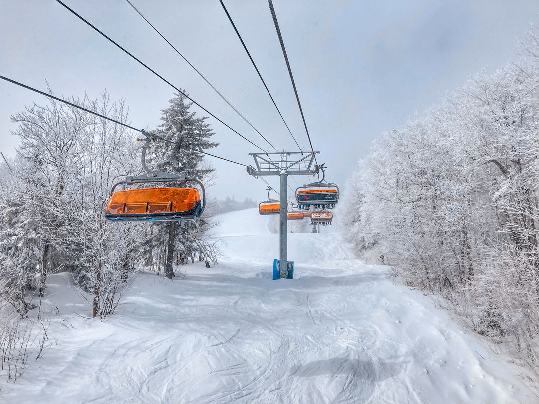
USA EAST REPORT
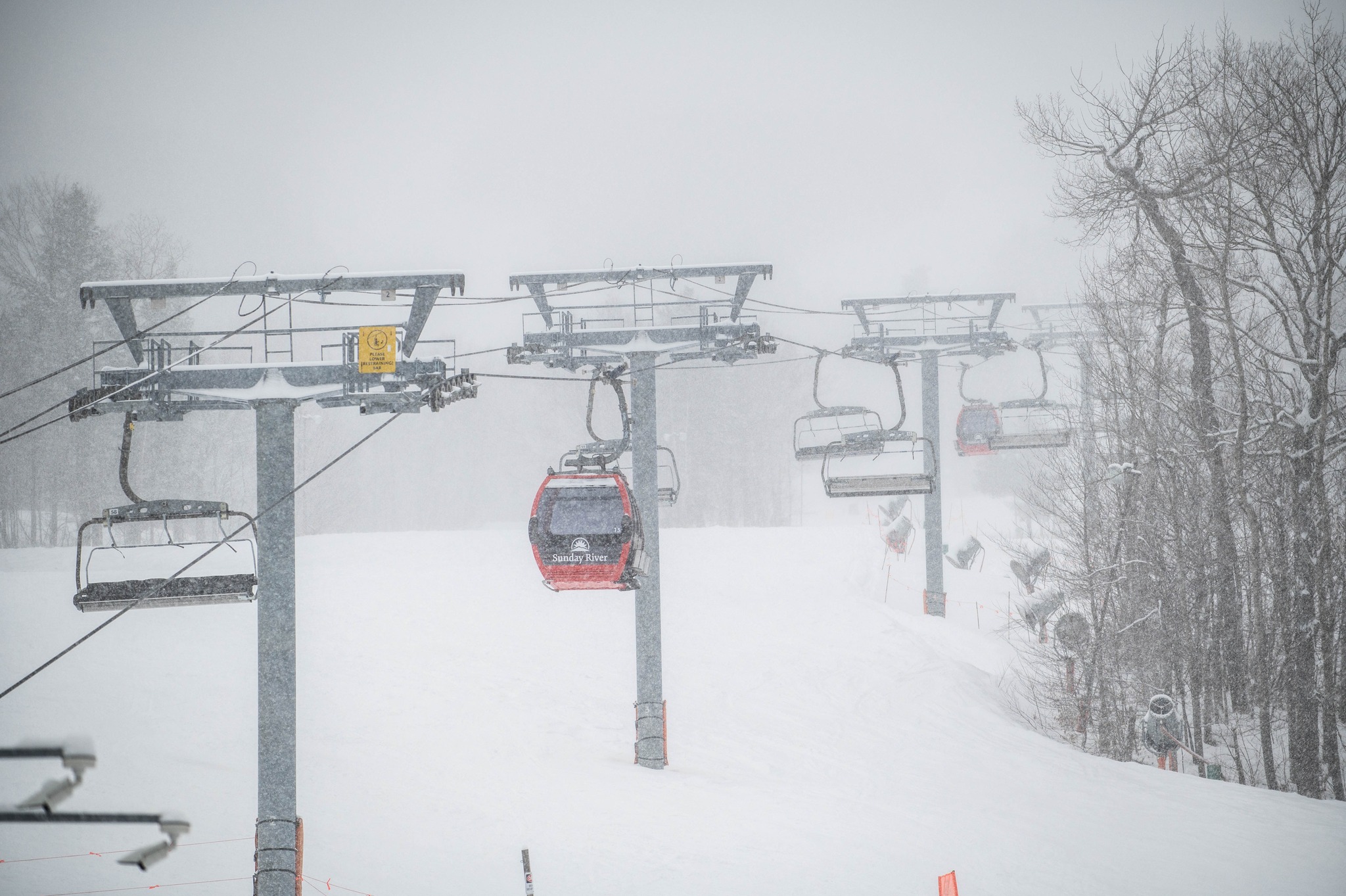
It has been a snowy week across the northeast, with temperatures staying below freezing, day and night, in most areas, and a lot of resorts posting over a foot (30cm) of snowfall, some now several feet (60cm). So skiers and boarders have been revelling in the powder and what has been one of the best weeks of the season so far in many areas. The caveat to that upbeat message is that in more southerly latitudes conditions remain very challenging, following a record warm winter and most centres have now given up on the 22-23 season. Sunday River (36/51” / 91/127cm), in Maine, has the deepest snow and is 100% open, Killington (14/24” / 35/60cm) is also fully open with the most terrain in the region.
USA EAST FORECAST
A return of the snow is forecast for the rest of this week, with daytime highs just a degree or so above freezing. Lows will be down towards single figures.
CANADA WEST REPORT
Although not quite the huge accumulations we’ve seen further south, it has kept snowing across western Canada this week with temperatures down in the freezing to minus 20 range. Whistler Blackcomb (20/235cm / 8/94″) has seen its base grow again and it remains 100% open with the most terrain in North America. However, Mount Seymour (259/400cm / 118/160”), also in BC by the Pacific Coast, is the first in the country to reach a 4m base.
CANADA WEST FORECAST
The current cold and snowy conditions appear set to continue through the coming week with temperatures remaining below freezing 24-7 at most resorts, the sun rarely breaking through and frequent snow showers continuing.
CANADA EAST REPORT
It’s been a week of low temperatures, sunny spells, and cloud and snow showers all mixed together across Canada’s eastern provinces. Temperatures have ranged between -20 and +2C. The past four or five days have been mostly dry in Quebec but there have been further snow showers in Ontario. The snow stats for the region’s largest and currently fully open ski area, Mont Tremblant (54/220cm / 22/88”), continue to improve and remain the deepest in the region.
CANADA EAST FORECAST
After a bit of a weekend lull, snow showers are starting to regain their strength and are expected to continue through the remainder of the week, with temperatures remaining in the freezing to -15 range.
Asia
JAPAN REPORT
Although there has been more snowfall in Japan over the past week, the heavy snow of the latter half of February has ended and we may have switched to ‘spring mode’ a little earlier than usual with above-freezing temperatures and a few rain showers reported. The change is reflected in a drop of snow depths, right across the country. Yudonosan (200/480cm / 80/192”), which had been posting a 5 metre (200”) plus base for the past month, is a case in point and Niseko (160/380cm / 62/152”), which topped 4 metres (160”) a week ago, is also down.
JAPAN FORECAST
The spring like conditions look set in for the week ahead with plenty of sunshine and temperatures ranging from -2C up to +10C. So expect bases to continue on their gradual decline. Most areas have enough snow lying to last until May assuming spring temperatures aren’t too far above freezing.


