WORLD SNOW ROUNDUP #277
Issued: 1st February 2023
By Patrick “Snowhunter” Thorne
World Overview
As we enter February the world’s ski areas are largely in their happy place, certainly a much better one for most of them than a month ago as we started January.
The past week has seen some good snowfalls across North America. What’s different to the past weeks of the season is that there’s been a foot or two of snowfall in the Rockies and the west but mostly without the violent storms we’ve seen for much of the past few months, while on the eastern side of the continent, its been consistently cold and the snow has built up to allow some areas to finally fully open, rather than being preceded or ending with rain and warm temperatures. So it’s now looking good pretty much everywhere.
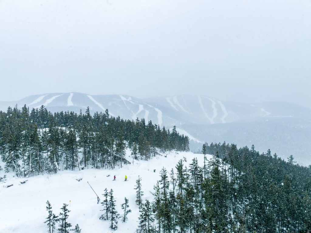
It’s a similar story across Europe where, as widely reported, the warm temperatures at Christmas and New Year caused snow-cover issues on lower slopes in the western Alps. As (less widely reported), it also did in the Balkans and Pyrenees among other areas, although not so much above 2000m in the Alps where conditions were about normal. Here there has not been a lot, but some, snowfall this last week but more importantly another seven days of consistently sub-zero temperatures have allowed for ongoing improvements and again almost everywhere is fully open in the Alps now and other areas are looking much better too. It seems to just keep dumping in Bulgaria.
In the wider world, there have been more reports of snowfall on ski slopes in North Africa and the Middle East and across Asia. Japan has had its snowiest weekend of the season so far with some areas posting over a metre (40″) of snowfall in the last seven days and the deepest reported base depth passing 5.4 metres (18 feet).
Europe
EUROPE INTRO
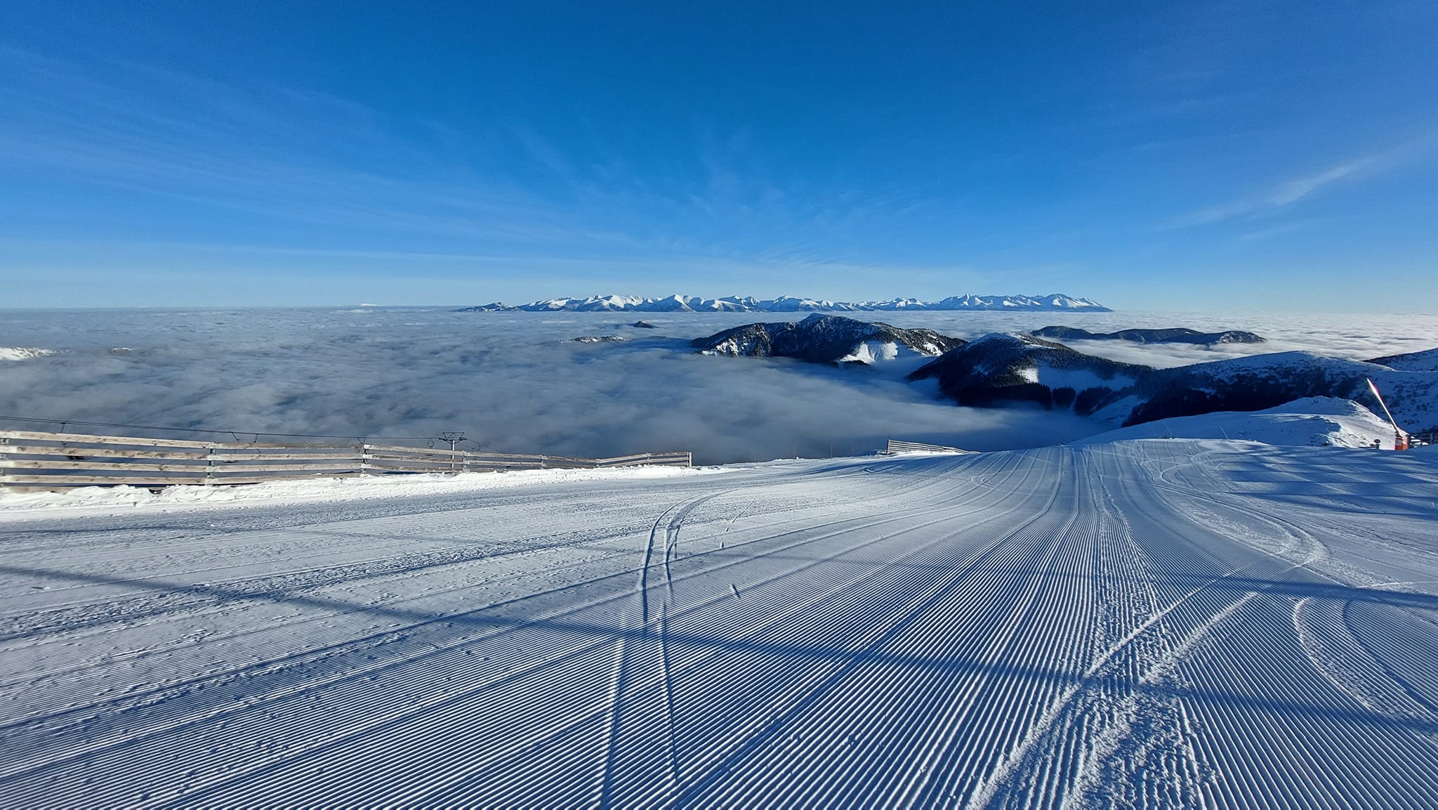
It has been a largely dry week in the Alps after the last of a snow-bearing front that was impacting the south and west of the region faded out. Now it has started snowing again in the northern and eastern Alps with a new front moving down from the Arctic. Snow depth numbers are little changed from a week ago except in those areas that benefitted from the heavy snowfall in the first half of last week in France and Italy. Elsewhere, the Pyrenees are in their best shape for over a month after the fresh snowfall and low temperatures there. It’s the same for the Balkans, the main thing across Europe has been temperatures staying low, generally below freezing. Further north in Scandinavia, the wintery weather continues and in Scotland, it is back after the warmer temperatures last week.
AUSTRIA REPORT
Austria has had a second successive “pretty good week” after the warm weather issues between mid-December and mid-January. It starts February with most slopes open and snow falling. It was actually sunny and cold for most areas of the country for much of last week, but since the end of the weekend snow has begun falling which is expected to continue through the week and intensify as we get further into the new month. Sölden (69/188cm / 28/75”) continues to post the deepest snow of a major resort and to have all its slopes open as it did through the warm spell, thanks to its high altitude terrain, although little Weinebene in Carinthia now claims a few more centimetres of snow up top after the big snowfalls in the region last week. The big ski regions also have the most terrain open they’ve had all season led by the Arlberg, incorporating Lech and St. Anton am Arlberg (65/140cm / 26/56”) with over 230km (80% of its maximum terrain) open, closely followed by the SkiWelt Wilder Kaiser-Brixental, incorporating Westendorf, Soll, Ellmau (40/85cm / 16/34”) just behind with 226km.
AUSTRIA FORECAST
Currently light snowfall is expected to intensify over the latter half of this week, with the potential for 30-60cm (1-2 feet) of fresh snowfall in total but the weekend, Friday/Saturday looking like the snowiest days ahead at present. Temperatures are a little warmer than they have been but still cold, just not so far below freezing and possibly getting a few degrees into positive numbers at lower levels in the afternoons.
SWITZERLAND REPORT
It has been a predominantly dry week, at least up to the past day or two, on Swiss ski slopes. Temperatures have remained below freezing at all levels and getting to 20 below up high with a lot of sunshine. Since Sunday though a front moving down from the north has brought increasingly wintery conditions and fresh snow showers. These have been light so far but look set to intensify over the coming week. Saas-Fee (43/196cm / 17/78”), which is now 75% open, continues to post the country’s deepest snow, with the 4 Valleys (50/115cm / 20/46”) around Verbier, the most terrain wholly in Switzerland open, around 90% of its 400km+ of slopes can be skied now.
SWITZERLAND FORECAST
The forecast for the latter half of this week is looking promising for some serious snowfall in Switzerland on Thursday/Friday, particularly over the eastern half of the country. Up to 60cm (2 feet) accumulations by the weekend are forecast.
FRANCE REPORT
France saw some unexpectedly heavy snowfall in the first half of last week just as our report 7 days ago was being completed. By the middle of the week resorts in the far southeast corner of the French Alps were posting up to 70cm (28”) accumulations. Since then though the cold, sunny weather that’s been dominating for nearly a fortnight now, has continued. More terrain has opened and the avalanche danger has dropped slightly. The world’s biggest ski area, Les 3 Vallées (110/160cm / 44/64”), home to Val Thorens, Les Menuires, Méribel and Courchevel resort, has the most terrain open of the season so far, over 560km of its 600 km of slopes.
FRANCE FORECAST
There’s no real change in the forecast at least for the rest of this week with temperatures remaining well below freezing and plenty of sunshine forecast. The snowfall that’s arriving in the northern and eastern Alps may make its way to French borders later in the week but so far it remains unclear whether it will make much progress into the country’s airspace.
ITALY REPORT
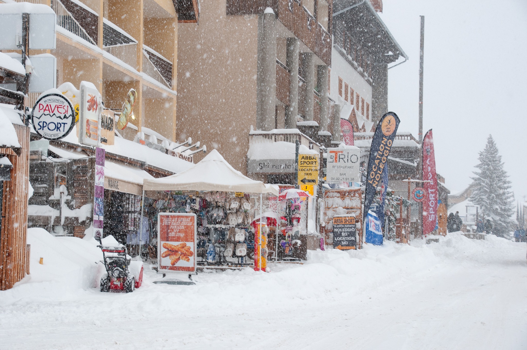
A predominantly cold and sometimes snowy week for Italy. The snow has started falling and that snowfall is set to intensify over the coming week, if perhaps not so much as further north and west. The Via Lattea (Milky Way) region incorporating Sestriere, Sauze d’Oulx and Montgenèvre (40/110cm / 16/44″) over the French border is up to 70% open, the most terrain so far, following the intense snowfall there last week. Val Gardena (60/75cm / 24/30″) is also in great shape following snowfall in the Dolomites too and is 98% open.
ITALY FORECAST
Snowfall is expected to intensify across much of Italy over the latter half of this week, although the Dolomites are expected to stay dry and sunny. Temperatures remain below freezing, in the -5 to -25C range in most Italian resorts.
GERMANY REPORT
It has felt like full-on winter at last across much of Germany with low temperatures and widespread snowfall over the past few days. The number of ski areas open across the country has kept climbing and is now up to about two-thirds of the total from only about 10% at the start of the month. Open resorts have been reporting more terrain open top including the first runs down to the valet floor for the first time thanks to the sub-zero temperatures. The deepest snow is, as usual, up on the Zugspitze glacier (117/117cm / 47/47″) with Reit im Winkl (17/80cm / 7/32”) continuing to post the most terrain open, but up to about 90% of its runs now – around 40km (25 miles) of slopes.
GERMANY FORECAST
Temperatures stay below freezing into February with more snowfall expected, along with cloudy and sunny periods. Lows around -15C, highs close to zero.
SCANDINAVIA REPORT
Scandinavian ski areas have been enjoying a mixture of sunny spells, snow showers and cloud through the week, with temperatures mostly in the -5 to -15 Cecius range. Norway’s Trysil (60/104cm / 24/42”) is currently posting the most terrain open, just, with about 95% of its 70km of slopes open. The region’s largest area, Sweden’s Åre (29/35cm / 12/14”), which is struggling for decent snow cover so far this season, is just behind but only about 70% open. The deepest snow continues to be in Western Norway although there’s no growth in the depth stats from a week ago despite fresh snow falling. Myrkdalen (80/170cm / 32/72”) near the coast tops the table with Hemsedal (80/150cm / 32/60”) just behind.
SCANDINAVIA FORECAST
More of the same for Scandinavia as daylight hours get longer with more snowfall, more sunny spells in between showers and more sub-zero temperatures forecast.
SCOTLAND REPORT
Scottish ski centres continue to do battle with fluctuating temperatures, recently creeping quite a way above freezing and touching double figures with rain on Sunday, before dropping away with some snowfall since. So it’s an all too familiar scenario of terrain open best up high or on the slower slopes where the snow has been piled up with snowmaking machines to sustain through the periods of thaw.
SCOTLAND FORECAST
Still a mixed back of weather – snow, rain and above/below freezing temps changing by the hour. On higher slopes, though it’s definitely close to freezing and up to 10 degrees below with snowfall more likely than rain.
SPAIN / ANDORRA REPORT
The Pyrenees has seen a lot of storm activity of late, and consistent polar air has driven snowfall to lower altitudes. Generally, there have been light winds and a mix of sun and clouds through the past week, with temperatures well below freezing on higher slopes, just getting a degree or two above freezing, at the most, at lower elevations. The region’s biggest ski area, Grandvalira (25/70cm / 10/28”) in Andorra, is now about 90% open, the highest percentage of slopes of the season so far. Over on the French side of the range, several areas report they’re now 100% open for the first time this season and while that’s not the case at Sierra Nevada (20/80cm / 8/32″) to the south there has been fresh snowfall over the past week here too. Portugal’s Serra da Estrela area is also fully open.
SPAIN / ANDORRA FORECAST
There’s more sunshine with temperatures staying low in the forecast for the Pyrenees for the rest of this week.
BULGARIA / ROMANIA REPORT
Another positive week for snowfall and snow cover in Bulgaria and Romania and the wider region with temperatures well below freezing and snowfall down to low levels, heaviest at the end of last week and into the weekend. The result is growing snow depths and ever more terrain open. Bansko (0/60cm / 0/24”) continues to post the deepest snow and the most terrain open in the region, now more than half of its 75km of slopes.
BULGARIA / ROMANIA FORECAST
It should stay cold, mostly below freezing, over the coming week, although with little snow forecast. But with temperatures down to -10C more snowmaking should be possible.
CZECH REPUBLIC / SLOVAKIA REPORT
It was cold and dry for much of last week in the Czech and Slovak Republics but the snow has been falling since the weekend continually improving conditions here. Temperatures have remained below freezing, with most resorts spending much of their time in the -5 to -15C bracket. Slovakia’s biggest ski area Jasna (30/100cm / 12/40”) reports both the deepest snow in the region and the most terrain open – about 95% of its domain now.
CZECH REPUBLIC / SLOVAKIA FORECAST
The snowy weather is expected to continue for the week ahead with the potential for quite heavy falls over the next few days as Arctic air moves south. Temperatures remaining below freezing and dropping as low as -15C on higher slopes overnight.
NORTH AMERICA INTRO
Perhaps the most balanced week of the season after the stormy weather in the west of the last two months switched to the East a week ago. This time there have been storms – but as not as big as they have been – bringing fresh snow to both sides of the continent. For the West – which has been largely cold and sunny with a moderate front moving through to dump a foot or two – it means not too much fresh disruption to operations, in the East, it means bases are finally building and larger resorts there are now, almost, fully open.
ROCKIES REPORT
A mixture of sunshine and snow showers in the Rockies over the past week, with much of the latter coming at the end of last week and through the weekend when quite a few areas picked up several feet more snow. Temperatures have been in the teens to high 20s Fahrenheit so mostly below freezing and keeping the powder dry. Utah resorts continue to post the deepest snowpack in the region with Alta (60/146″) most of all. All ski areas in the region remain fully open.
ROCKIES FORECAST
It appears to be a sunny end to the week for most areas in thE Rockies, with temperatures ranging from the low 20s up high to potentially getting to the low-mid 40s in the afternoons at mountain bases.
USA WEST REPORT
It has been a second much-calmer week for weather in the west than we have seen for much of December and January. Another front did move in at the start of the week bringing up to a foot of snow, but otherwise, it has been mostly sunny, particularly in California, cloudier further north in Oregon and Washington State, with temperatures in the freezing down to mid-teens Fahrenheit range. Pretty well everywhere is fully open with Mammoth Mountain (164/246” / 411/614cm) still posting the world’s deepest snowpack, although the numbers have dropped a foot or so as it continued to settle.
USA WEST FORECAST
A fairly dry forecast for the week ahead with snow mostly sunny skies in more southerly states like California, and more cloudy with snow showers up in the Pacific Northwest. Temperatures may climb quite a way above freezing at mountain bases, potentially low-mid 40s Fahrenheit, remaining below freezing higher up.
MIDWEST REPORT
Base depths have kept increasing in the Midwest with fresh powder reported in several areas as the front moves over from the east and hit the very cold air hanging over the region. Michigan’s Ski Brule (64/64″ / 160/160cm) has added another 4 inches/10cm to its base over the past week, similar to other areas in the region. Boyne Mountain (40/40” / 100/100cm), also in Michigan, reports 59 of its 60 trails open, the most in the region. Temperatures are in the 10 to 30F range across the Midwest.
MIDWEST FORECAST
Conditions will stay cold, cloudy and snowy over the coming week with temperatures continuing well below freezing.
USA EAST REPORT
Ski resorts in the eastern US have declared the last weekend the best of the season so far after a fairly disastrous first few months of winter for many with too much warm weather for snowmaking and periods of rain damaging the snowpack. Many smaller areas had only been able to open 20-40% of their slopes but, thanks to recent colder weather and natural snowfall, are up to 60-80%. Bases still aren’t great but Killington (16/21” / 40/54cm) does have about 90% of its terrain open, the most in the region. Fellow Vermont ski area Smuggler’s Notch (10/40” / 25/100cm) reports the deepest snowpack in New England. Jay Peak reported one of the biggest accumulations at the weekend – up to 24 inches (60cm) so deep powder there.
USA EAST FORECAST
Staying cold with temperatures in the 10s to 20s Fahrenheit. Currently, it’s looking drier and sunnier for the coming week, compared to the previous one.
CANADA WEST REPORT
The most consistent feature of the past week in western Canada has been cold weather with temperatures mostly well below freezing and getting down as low as -25C. Other than that there have been snow showers, sunny spells and a lot of low clouds. Whistler Blackcomb (0/190cm / 0/76″) remains fully open, the largest skiable area in North America once again. It’s a similar picture – in terms of 100% operations – at most other ski areas in the region too now though. Mount Seymour (158/263cm / 63/105″) south on the Pacific coast from Whistler is posting the region’s deepest snowpack.
CANADA WEST FORECAST
Staying cold and mostly cloudy for the rest of the week, currently with not much snow forecast. Temperatures in the freezing down to -20C range.
CANADA EAST REPORT
After the slow start to the season in Eastern Canada the picture is much improved as we start February. Massif du Sud (50/100 / 20/40”) reported 45cm (18”) of fresh snowfall going into the weekend for some great powder days and it was a similar story across Quebec. Very cold though with temperatures typically in the -10 to -30 Celcius range. Tremblant (40/130cm / 16/52”) continues to post the most terrain open and the region’s deepest snowpack.
CANADA EAST FORECAST
Staying cold and cloudy with some midweek snow showers. A few sunny spells are likely although more commonly overcast. Temperatures for the start of February are typically in the -5 to -30C range.
Asia
JAPAN REPORT
The fear in Japan last week was of a superstorm bringing dangerous levels of snowfall and cold. That didn’t seem to impact quite as hard as the worst-case scenario, but many areas did get a boost to their snow depths, and as in our global yoyoing weather patterns there’d previously been record warm temperatures in some parts of the country for January, the colder temperatures were widely welcomed. Experts SnowJapan.com report the deepest snowpack in the country has reached 5 metres (17 feet) at Yudonosan in Yamagata. Niseko (155/355cm / 62/142″) reported heavy snowfall through the weekend, up to 38cm (15″) in any one 24-hour period, so it’s powder heaven there this week.
JAPAN FORECAST
The cold weather is set to continue with temperatures typically in the freezing down to -15C range. Mostly cloudy skies with frequent snow showers through the remainder of the week.
You might also like...

A Guide to the Perfect Skiing Stance in All Conditions with Maison Sport

Huge Snowstorm Hitting Western North America

World Snow Roundup #231
