WORLD SNOW ROUNDUP #271
Issued: 21st December 2022
By Patrick “Snowhunter” Thorne
World Overview
As we begin winter, by both the astronomical and meteorological measures of the seasons in the northern hemisphere, and the run-up to the Christmas weekend, things are looking fairly good, to very good for this early in the season, across much of the skiing world. With hundreds more ski areas opening last weekend and a few hundred more planning to open over the next few days before Christmas Eve the season is largely on track in most areas.
In North America, its the west of the continent that’s leading the world in terms of snow depth and open terrain down to low levels but the past four or five days has seen a switch of focus, for fresh snowfall at least, to the east, which had been lagging behind after a warm first-half of December. Ski areas have seen temperatures plummet and up to three feet of snow here, transforming conditions. Although there’s a lot to catch up on and some areas have not done so well, but overall, much improved.
In Europe, the southern and western Alps are leading the way with French ski areas posting the deepest snow, including the first to reach two metres (80″) on upper slopes this season. It is now warmer than ideal for this point of December so improvement for lower slopes doesn’t seem likely until post-Christmas. The most challenging early season conditions have been reported in the southeast of the continent where ski areas in Bulgaria and the wider region are struggling to open at all.
Elsewhere, it’s an improving position for Japan, where snow deliveries are getting more regular, and daily, especially in the north. And it is still snowing in Australia, even though summer is now underway by both measures of the seasons here.
Europe
EUROPE INTRO
Conditions at most of Europe’s larger ski areas remain pretty good for Christmas weekend. The best snow is, as you would expect, up above 1500m and especially above 1800m. There’s been more snowfall this week, particularly in the southern and western Alps, with ski areas in the southern French Alps now posting the deepest snow lying on the continent. The downside to this good news is that some lower altitude ski areas in the northern Alps in countries like Austria and Germany are struggling to open much at all so far. Current warmer than average temperatures aren’t helping either. That’s also the case in southeastern countries like Bulgaria and Serbia where temperatures have been too warm to open any runs in most areas as of yet.
AUSTRIA REPORT
Austria had only about a third of its ski areas open up to last weekend, partly as it’s the norm here for many ski areas not to open until a week before Christmas, partly as many smaller ski areas are at a lower elevation and it is lower elevation slopes that have not seen a lot of early season snowfall this autumn. However, as of now about 5% of Austrian areas are open after a mass turning on of lifts at the weekend and many of the rest will open on or before this coming Saturday. Conditions have been old with some snowfall although not so much as further west and south in the Alps, Three areas are doing battle to have the most terrain open, despite not yet giving much snow lying and are on a round 160km (100 miles) of slopes each. They are Ischgl/Samnaun (10/40cm / 4/16”), the SkiWelt Wilder Kaiser-Brixental (25/60cm / 10/24”) and KitzSki’s Kitzbühel/Kirchberg (50/55cm / 20/22”).
AUSTRIA FORECAST
Overcast skies through this week after the sunny weekend with snow showers expected almost any time, but generally light to moderate 5-010cm (2-4 inch) accumulations daily rather than anything particularly huge forecast at present. Continuing through the Christmas weekend.
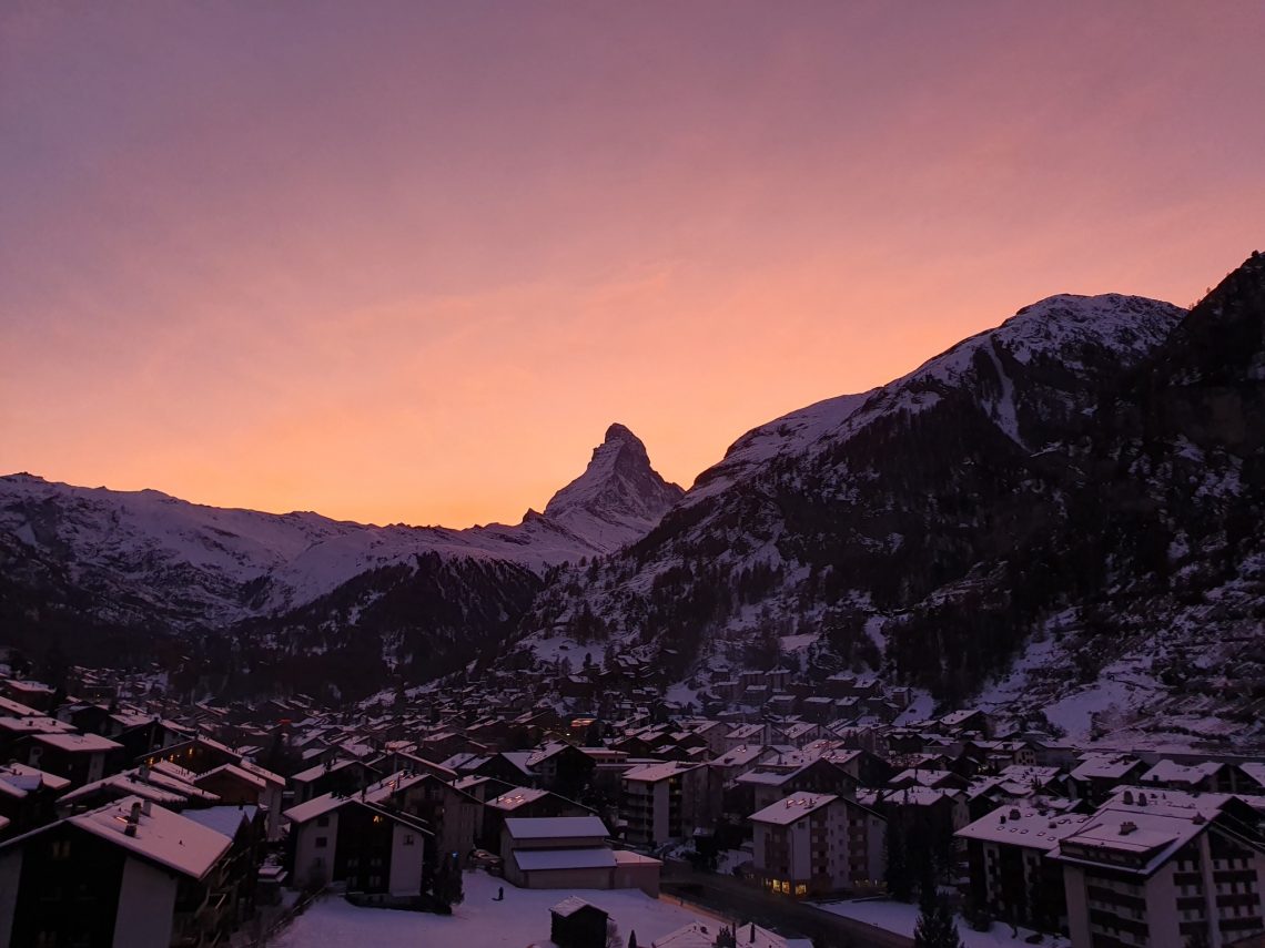
SWITZERLAND REPORT
About 80% of Swiss resorts have opened for the run-up to Christmas and there’s been fresh snowfall across most of the country. The World Cup tour was in St Moritz at the weekend which, after low cloud caused runs to be shortened at the end of last week, was bathed in its usual sunshine, as was much of the rest of the Swiss Alps over the weekend. Glacier 3000 – Les Diablerets (20/180cm / 8/36) has overtaken Saas Fee (20/160cm / 8/64”) to post the country’s deepest snowpack after Saas Fee had dominated for most of the autumn. The 4 Vallées around Verbier (25/55cm / 8/22″) have the most runs open in the country, about two-thirds of its full area now with 265km of its 412 km open.
SWITZERLAND FORECAST
It’s a changeable and varied picture across Swiss ski slopes for the coming week but temperatures are expected to be in the low single figures in valleys in the afternoons down to double digits below on high slopes overnight. Snow is forecast midweek and again over the Christmas weekend but mostly light to moderate falls rather than anything major.
FRANCE REPORT
French resorts are currently reporting the best conditions in the Alps after seeing the most snowfall in the past few weeks. Almost all of the country’s ski areas are open and while snow cover remains problematic, as for much of the Alps below about 1500m, overall things are pretty good. The southern Alps have seen the most snow and Puy-Saint-Vincent (85/205cm / 34/82″) and Alpe d’Huez (65/200cm / 26/80″), in the southern French Alps, are reporting the deepest snow in the country and indeed all of Europe at present, the only resorts to have hit the two-metre upper slope base depth mark. Meanwhile, the 3 Valleys is the only area to be posting more than 300km of slopes open. The Chamonix Valley also has every sector open since the weekend with more than 80 runs skiable. The snowy weather eased at the weekend and it has been mostly dry in most areas since Sunday. The avalanche danger has been quite high, however, up to 3 on the scale of 5.
FRANCE FORECAST
A fresh band of snowfall should cross the country in the latter half of this week. Temperatures are a little mild for the time of the year after that, the daytime freezing point rising to around 2000m for a time before cooler, snowier weather returns for Christmas weekend.
ITALY REPORT
It’s an ever-improving picture in Italy, which has seen some of the best accumulations in Europe over the last seven days, with most of the snow-bearing clouds moving up from the south and off-loading here first. As a result, it’s actually Sella Nevea (20/135cm / 8/54”), in the far east on the Slovenian border, that is posting the country’s deepest upper-slopes depth, and is in the top 10 in Europe. The snow is not so deep but on the other side of the country on the French border, the Via Lattea (Milky Way) (20/90cm / 8/36”) region has the most terrain open in the country, over 200km (125 miles of slopes now), and the second largest reported in Europe in the week before Christmas. About 90% of Italian ski areas have now opened for the 22-23 season.
ITALY FORECAST
Quite a mixed bag for the coming week with plenty of sunshine and freeze-thaw conditions at resort level with temperatures ranging 5 degrees on either side of freezing. Snowier weather midweek, with Wednesday/Thursday likely to bring 10-20cm (4-8 inches) of snowfall to many Italian ski slopes. Snowfall will ease into the Christmas weekend.
GERMANY REPORT
More German ski areas have opened for the season last weekend but the warm autumn and low elevation of ski centres means there’s still less than a quarter of resorts operational, with many hoping to be able to open for the Christmas holidays still. It has been colder with some light snowfalls but not really transformative. Despite having a thin base, Reit im Winkl (20/50cm / 8/20”) has managed to open three-quarters of its terrain to post the most open in Germany so far with 33km (20 miles) of runs available.
GERMANY FORECAST
Not an ideal forecast, unfortunately, with rain to quite high levels and above-freezing temperatures going into the Christmas week except above about 2,000m. This is bad news regarding the hope of the season starting for most German ski centres.
SCANDINAVIA REPORT
Scandinavian ski areas are getting ready for the busy Christmas period with Geilo (60/120cm / 24/48”), in Norway, posting the region’s deepest snow so far. While Åre (31/34cm / 12/14”) has the most terrain open. Although not a lot yet, about 20km, less than a quarter of its full area. But with midwinter here there’s little daylight and nearly all open slopes are floodlit. It has been mixed conditions with some light to moderate snow showers.
SCANDINAVIA FORECAST
A largely sunny Christmas weekend, when the sun is up, with temperatures into the minus 20s Celsius in the north and west. Some snow showers through the coming week as well though.
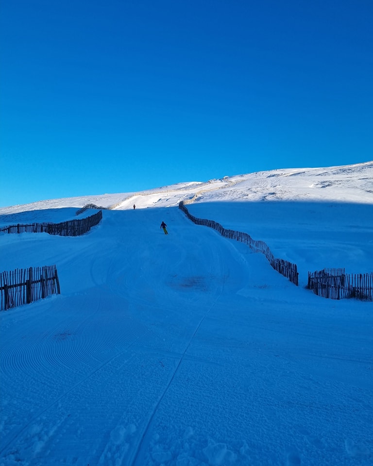
SCOTLAND REPORT
Scotland’s 22-23 ski season has continued to gather pace, despite a blip at the end of the weekend when a brief warm-weather front moved through. Ski areas in the east saw very low temperatures last week, getting to double-digits below freezing, but little natural snowfall. Glenshee expanded what it had on offer thanks to snow-making though and The Lecht and Cairngorm joined them at the weekend, the latter a few days earlier than planned in response to the conditions, both opening limited terrain. On the west, heavy snow showers arrived on Friday. Nevis Range opened for sledging and Glencoe, which had already been offering that, expanded its offer.
SCOTLAND FORECAST
After the warm spell at the start of this week temperatures have been dropping and it’s now a promising forecast for the week ahead with a good deal of snowfall forecast.
SPAIN / ANDORRA REPORT
Virtually all ski areas in the Pyrenees have been open for several weeks now with Andorra’s Grandvalira (Pas de la Casa, Soldeu El Tarter and others) (20/45 cm / 8/18”) and Spain’s Baqueira/ Beret (40/55cm / 16/22”) both posting the most terrain open, about 130km/80 miles of runs a piece. Formigal (35/85cm / 14/34″) has the deepest snowpack. The past week has been mostly sunny with freeze-thaw conditions, temperatures 5 degrees on either side of freezing through the 24-hour cycle.
SPAIN / ANDORRA FORECAST
There’s not a great deal of change in the forecast, plenty of sunshine and continuing freeze-thaw conditions meaning icy slopes are likely first thing each morning.
BULGARIA / ROMANIA REPORT
Conditions have been improving in Bulgaria and there was snowfall overnight on higher slopes at the end of last week. But, unfortunately, it’s looking a lot like green grass for Christmas at some lower resorts, with just limited terrain openings on higher runs. Temperatures at the weekend were still reaching double figures although it has been cooler over the past few days and some resorts have reported snowfall. Ski areas that have opened are largely offering just a kilometre or two of mostly machine-made snow and thin bases. Romania’s Madarasi Hargita (10/20cm / 4/8″), for example, was the only one open for all of the last seven days. But can’t offer a lot of skiing, just half a mile of slopes so far.
BULGARIA / ROMANIA FORECAST
The weather isn’t really helping ski areas in the region with a sunny week in the run-up to Christmas and temperatures reaching double figures above freezing at bases in afternoons.
CZECH REPUBLIC / SLOVAKIA REPORT
About half of the ski areas in the Czech and Slovak republics have now opened for the season with many of the rest planning to open for Christmas weekend. The weather the past few days have been cold and overcast with some fog issues on slopes. Jasna (30/70cm / 12/28”) is posting the most terrain open in the region, 26km of slopes, just over half its potential maximum.
CZECH REPUBLIC / SLOVAKIA FORECAST
Snowfall is expected to return over the next few days and continue through the Christmas weekend, with 5-15cm falls daily and 30-50cm accumulations possible by the start of next week.
NORTH AMERICA INTRO
A bit of a switch of focus this week after the spectacular series of early season snowfalls in the west, it has finally got much colder and there’s been snow in the east. There is some debate about the quality of the snow itself, with resort marketing focused on the volume, whereas some skiers are complaining a lot of it is heavy wet stuff, but it has transformed the landscape from one of the ribbons of white on brown produced whenever snow-making was feasible, to something much more wintery. Back in the west, there has finally been a break in the storm cycle and some sunny weather to start to enjoy it all.
ROCKIES REPORT
Ski areas in the Rockies are reporting great conditions after a week that saw still more 12-24″ accumulations of snow. The last major falls were reported going into the weekend when Steamboat was among the areas reporting (another) foot of powder in 24 hours. Since Saturday though it has been dry and mostly sunny for much of the region, with daytime highs at resort bases around freezing, and night-time lows up top in the single figures Fahrenheit. Alta (45/94″ / 113/236cm), in Utah, has been posting pictures of incredibly deep powder (describing it as “literally chest deep”) and now has the deepest snowpack in the Rockies, passing the 7 feet mark. Fellow Utah resort Park City (47/98″ / 116/245cm) and Big Sky Resort (30/47″ 76/123cm), in Montana to the north, are both around the same amount of terrain open, each with more than 100 miles of prepped slopes skiable, the most in the US at present.
ROCKIES FORECAST
It’s looking cold but dry through the holiday weekend in the Rockies. Very cold at times, down to 20 or 30 degrees below freezing on higher slopes overnight, with a mixture of sunshine and cloud.
USA WEST REPORT
The series of storms through the latter half of November and the first half of December that have brought over 10 feet of snow to some areas have stopped for a while at least and we’ve had dry, sunny weather in recent days in the south of the area, although snow showers have continued further north. Temperatures have stayed below freezing on high slopes and again further north but got a few degrees above at resort level in Californian areas in the afternoons. Mammoth Mountain (79/137″ / 196/343cm) continues to post the deepest snow in the region and the entire world.
USA WEST FORECAST
The dividing line between north and south should continue with more snow forecast in the north, and dry in the south. Very cold midweek but temperatures rise towards the weekend.
MIDWEST REPORT
A much-improved picture in the Midwest over the last seven days with some natural snowfall at last at the end of last week and then very low temperatures allowing snow-making systems to return to full operations. The upshot is much of the land is now white and much more terrain open. The ski areas that had still not opened last week pretty much now all have since the weekend. Several areas have reported more than a foot (30cm) of snowfall with Minnesota’s Sprit Mountain (6/12” / 15/30cm) reporting the most, with 19” (47cm) of snowfall. Andes Tower Hills Ski Area (12/40” / 30/100cm), also in Minnesota, is reporting the deepest snow depth in the region at present.
MIDWEST FORECAST
Currently back to largely dry conditions and expected to remain so through Christmas but back to much lower temperatures. Well below freezing day and night and potentially below zero Fahrenheit in some places overnight.
USA EAST REPORT
The weather has finally favoured America’s East Coast with low temperatures arriving at last at the end of last week. Snow began falling on Friday with blizzard conditions for some as strong winds blew in at the same time, and snow was reported to be accumulating at a rate of up to two inches (5cm) per hour. By Monday accumulations were up to three feet (90cm) completely transforming conditions for the better. Belleayre Mountain (12/41” / 30/102cm) and Whiteface – Lake Placid (12/40” / 30/101cm) were among the big winners, the former opening all of its runs as a result.
USA EAST FORECAST
The snowfall has now eased off but it is bitterly cold for many areas and so snow guns are hard at work trying to make up lost ground cover in the run-up to the peak Christmas and New Year weeks.
CANADA WEST REPORT
Perhaps the main factor at play in western Canada, particularly inland this week, has been cold. Temperatures have regularly been in the minus 20s and at times got to the minus 30s. Fernie was among the areas that have closed lifts due to extreme cold risk preventative issues. It has been mostly dry but there was fresh snowfall in many areas on Tuesday. Sun Peaks (65/92cm / 26/54”) has one of the largest areas open in Canada with 123km of slopes, about 90% of the total possible, open.
CANADA WEST FORECAST
It will stay mostly dry and remain cold in western Canada over the coming week although temperatures should rise a little from their current extreme lows.
CANADA EAST REPORT
As with the northeast US to the south, things started to turn increasingly wintery in Quebec, Ontario and the surrounding area, after a mostly mild autumn, from last Friday, with a big drop in temperatures and widespread snowfall reported. There’s still not a huge amount open but Tremblant (10/68cm / 4/29”) reported about 25cm (10”) of fresh snowfall and temperatures in the freezing down to minus 15 range. It has about a third of its slopes open. It’s a similar story across the region.
CANADA EAST FORECAST
The low temperatures are forecast to continue through Christmas week with more snowfall, although mostly light, keeping the snow constantly refreshed. The low temps should allow snow-making systems to keep firing out and catch up on cover where possible.
Asia
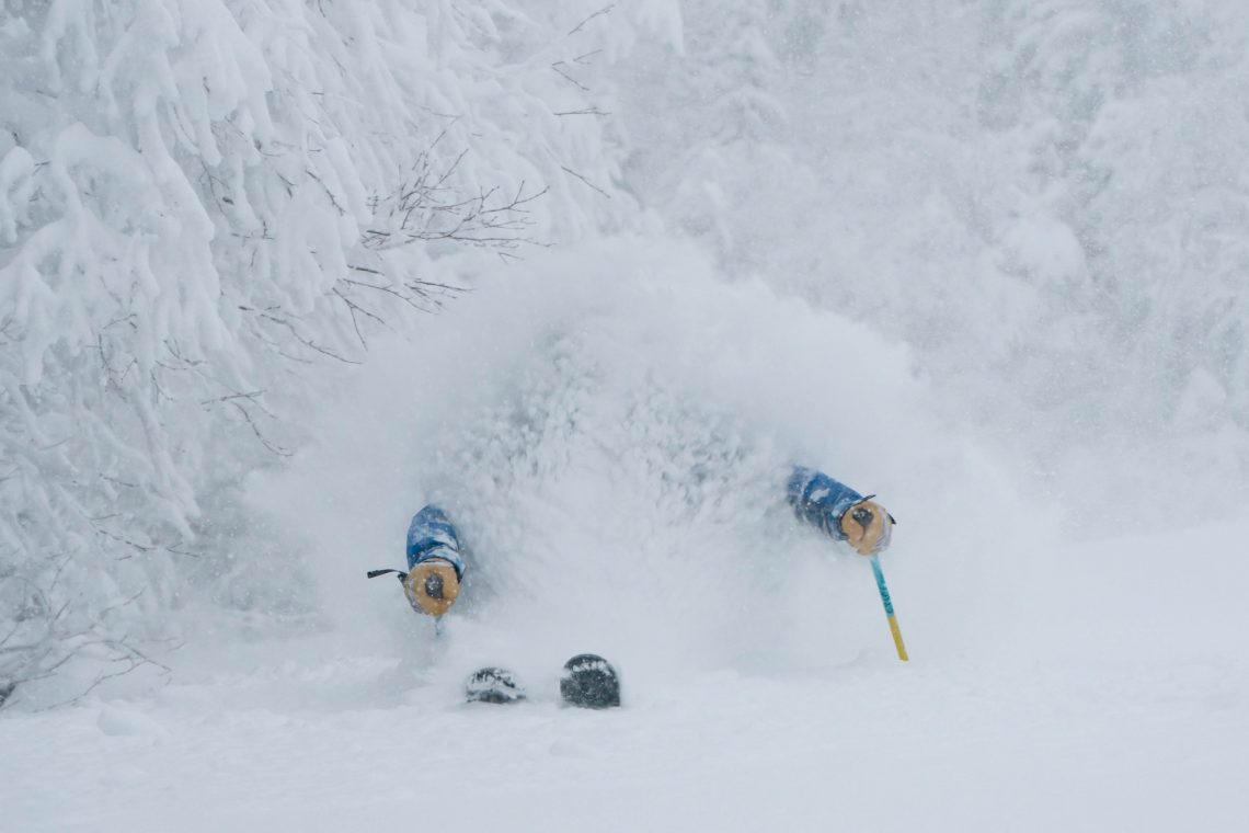
JAPAN REPORT
Conditions continue to improve across Japan with more ski areas opening more terrain and reports of the first backcountry access gates opening at those areas that are doing the best for snowfall so far. Niseko (80/175cm / 32/70″) has seen a big jump in its base depth stats on a week ago, having received 10-20cm (4-8 inches) of fresh snowfall most days. Temperatures have also dropped to the ‘bitterly cold’ mark at times and strong winds have led to lift closures at other times too. The strong winds have also led to blizzard conditions and the creation of drifts up to two metres deep, with an increased avalanche danger resulting. A similar picture at other Hokkaido resorts while across the sea to the south it’s not quite so snowy but most big-name resorts have now started their seasons and are adding more terrain as they can.
JAPAN FORECAST
The “white season” is now officially underway and that should mean ongoing regular daily snow deliveries. The snowy, windy conditions are forecast to continue through the coming week.
You might also like...

A Guide to the Perfect Skiing Stance in All Conditions with Maison Sport

Huge Snowstorm Hitting Western North America

World Snow Roundup #231
