WORLD SNOW ROUNDUP #249
Issued: 20th July 2022
By Patrick “Snowhunter” Thorne
World Overview
Chile and New Zealand have been the big stories of the past seven days for snowfall, although Argentina and Australia have seen plenty of fresh snow falling too. Chile was the most dramatically affected with heavy snow becoming more of a logistical issue at the end of last week as numerous mountain passes and access roads to most of the country’s leading resorts were closed. Obviously, great news for snow cover for the rest of the season but a problem caused in the short term. In New Zealand, ski areas on the South Island were closed for several days in the middle of last week as a major storm blew through there. More recently some centres have seen torrential rain affecting access roads although, fortunately, the rain has fallen as snow high up.
In the northern hemisphere, we remain at all-time-low for the number of ski areas still open. One new centre did open in the Alps but only to race teams, not the general public. At the same time two of the three Norwegian centres have closed, one for the season, the other temporarily for July. It means we’re down to four areas open in Europe, six across three continents in the north. There have never been fewer areas open since before the summer ski era.
SOUTHERN HEMISPHERE INTRO
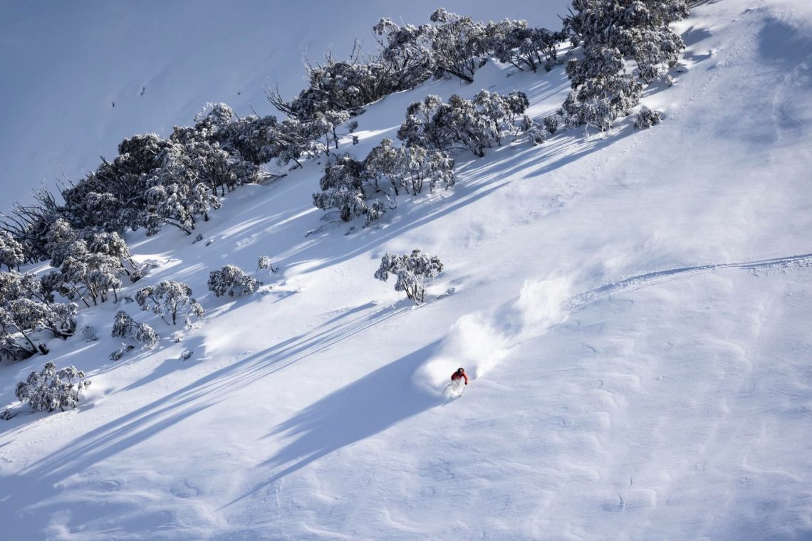
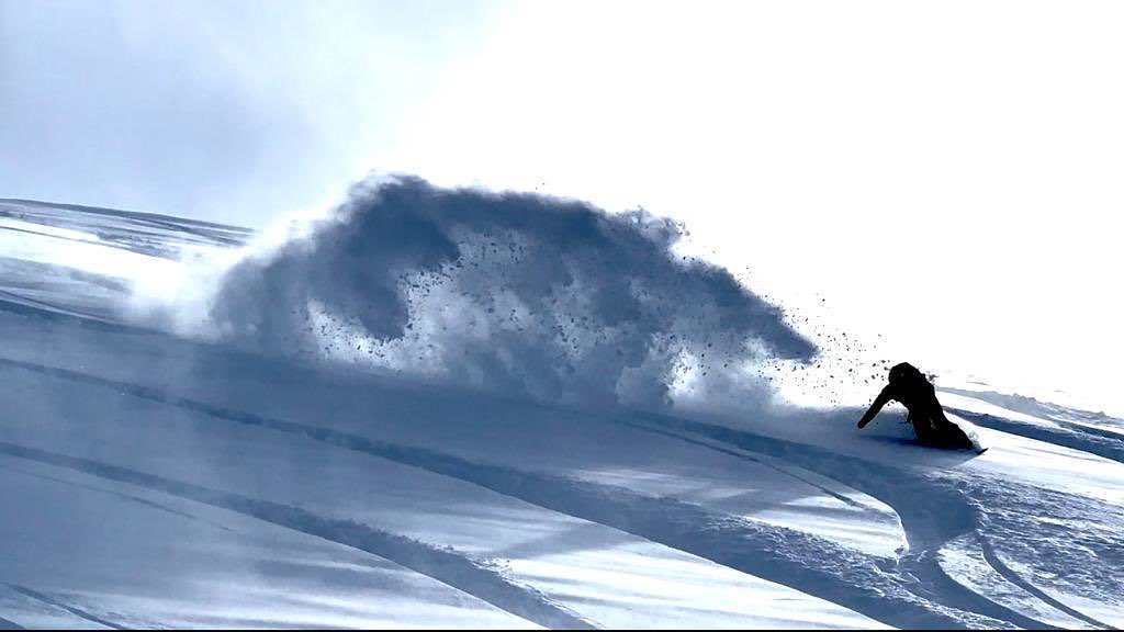
Quite a dramatic seven days for snowy excesses in the Andes, New Zealand and to a lesser extent Argentina. The end of last week saw mountain passes and access roads to ski centres in central Chile blocked by huge snowfalls. Obviously good news in the longer term for the rest of this season and while snow is falling again most centres are now accessible once more with powder aplenty. In Australia, there was about 30cm (a foot) of snowfall at the weekend and some issues with strong winds but overall the picture remains very positive with everything open and snow depths good. New Zealand ski areas have once again had one of the most challenging weeks with lots of heavy snowfall. But this came with blizzard conditions, closing resorts up to the weekend, then with torrential rain at lower elevations, causing flooding and wash-out on access roads at a number of centres in the past 24 hours.
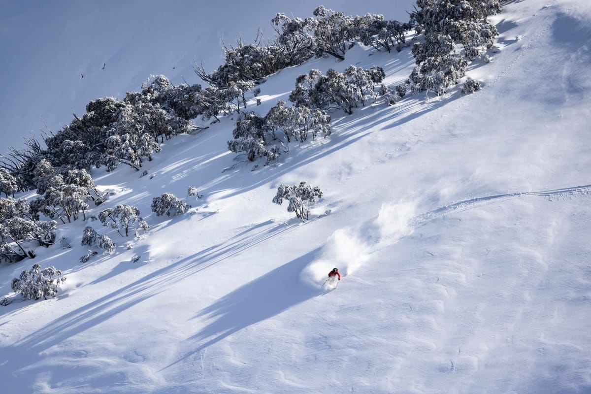
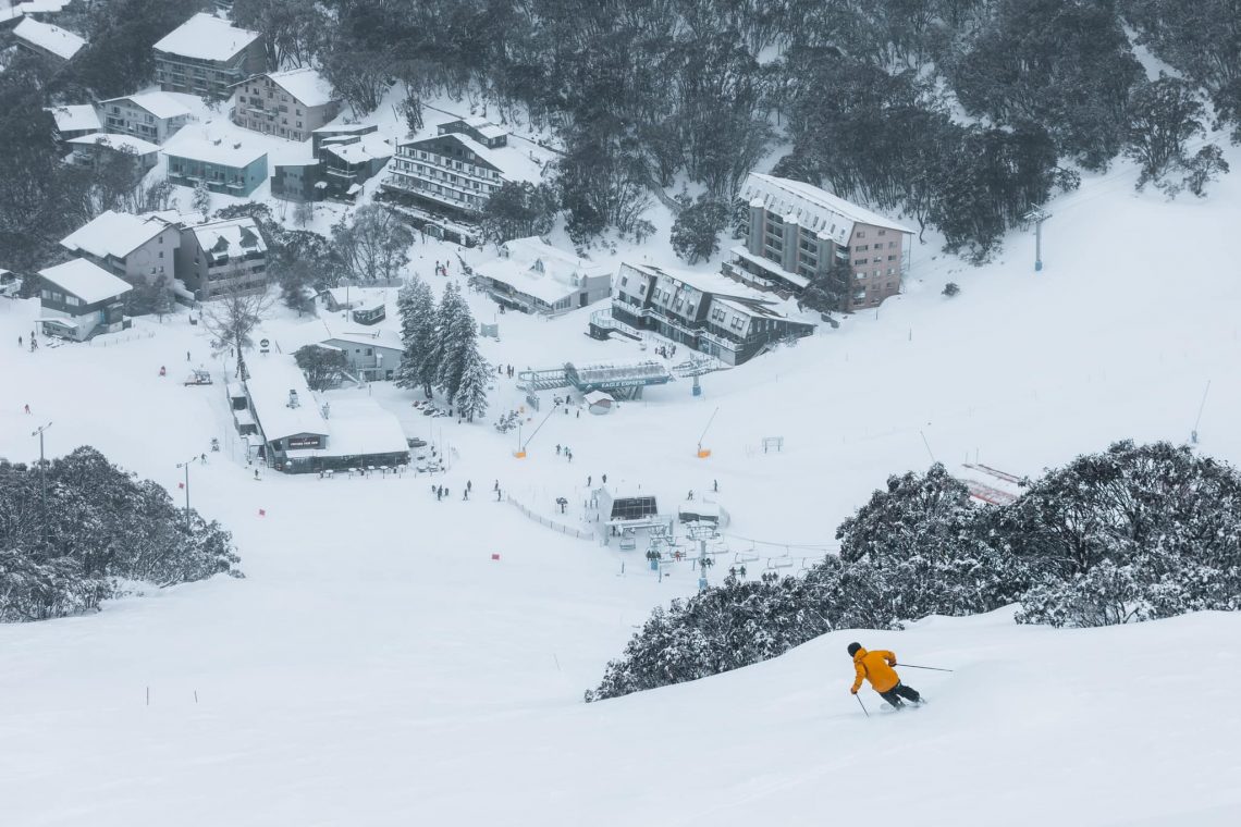
AUSTRALIA REPORT
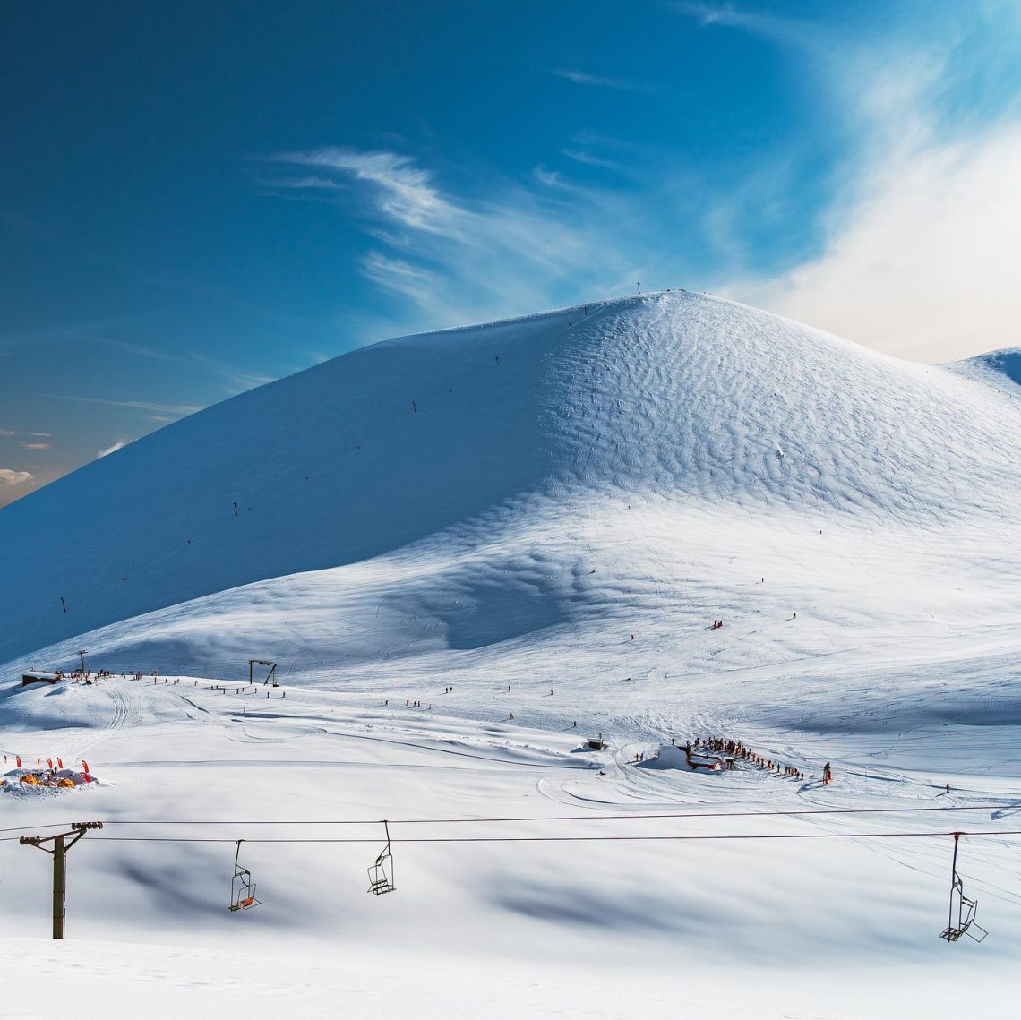
Australian ski areas have had one of their snowiest weeks of the season so far with several storms over the past week and cold enough weather for snowmaking in between dumps. The country’s ski centres are also reporting one of their busiest ever winter school holiday periods as people get back on the slopes after two winters of closures and lockdowns. The heaviest snowfall of the past week came at the weekend with a number of resorts posting 20-30cm (8-12″) of fresh snowfall, at times driven in on gale force winds to bring blizzard conditions. Mt Buller (65/90cm / 26/36”) said it received 14cm (6”) of fresh snowfall at the end of last week and went into the weekend with that fresh snow and what it described as “immaculate grooming = a snowtacular day on the slopes”. Perisher (75/110cm / 30/44”) currently reports conditions best up high with dry powder. It has the most terrain open in the country with 60km (nearly 40 miles and about 95% of its maximum terrain) open.
AUSTRALIA FORECAST
It’s a largely dry forecast with only light snow forecast for some Australian areas over the next seven days. Temperatures should stay fairly cold with overnight lows down towards -8C allowing for snowmaking as required, daytime highs mostly below 5C although perhaps as high as +10C later in the week. Cloud will build up to the weekend but, currently, clearer weather is then expected without much precipitation in the meantime.
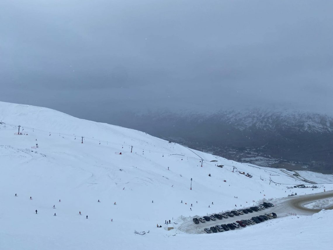
NEW ZEALAND REPORT
There have been some fantastic ski days this past week in New Zealand after significant snowfalls for many of the country’s centres. But there have been problems too over the past few days with gales and heavy snowfall/rain (depending on altitude) causing operational issues including access road closures. Starting with the positives, Thursday last week was a particularly good blue sky powder day for many with resorts having been stormbound and then digging out last Tuesday/Wednesday. Up to 50cm (20 inches) of fresh cover was reported. Mt Hutt (50/130cm / 20/52”) and Temple Basin (60/130cm / 24/52”) reported particularly snowy weather, but most South Island centres reported at least 30cm (a foot) of fresh. Treble Cone continues to post the deepest base (100/200cm / 40/80”). There was another major storm system moving through as we complete this week’s report. It has left many areas closed for the start of this week with more strong winds (up to 135kph/82mph reported) an issue, blizzard conditions up high but also torrential rain at lower elevations washing away sections of access roads and damaging lower-level snowpack. So some recovery is required over the next day or two. The snowy picture hasn’t been universal, however. The country’s largest resort by some measures, Mt Ruapehu, has repeatedly delayed the full opening of its ski slopes while it awaits more snow. The mountain has not yet seen the big snowfalls seen elsewhere in the country and it has been warm too but it reports temperatures did dip at the start of this week allowing snowmaking to resume. It says 30-40cm more snow is needed to open its Whakapapa base.
NEW ZEALAND FORECAST
After the tumultuous conditions of the past week the next seven days are looking colder and drier with plenty of sunshine so hopefully, assuming the snowpack has survived on lower slopes and access roads can be quickly patched up, there should be great conditions into the weekend, especially on higher slopes which haves seen 30-40cm more snowfall. Temperatures range from -10C up to +5C but mostly stay on the right side of the freezing point.
ARGENTINA REPORT
Although the main focus has been on Chile for the past week’s big snowstorms, of course, the snowfall didn’t stop on the long border between the two countries and many Argentinian ski areas saw some big accumulations too. The continent’s largest ski area by uplift, Catedral (50/120cm . 20/48”) near Bariloche, has been opening more terrain reporting 80 km (50 miles) of runs open now, the most in the world at present. The continent’s biggest by available terrain, Las Lenas (40/100cm / 16/40”) to the south, open for the first time in three winters, has posted images of deep powder snow. Many other Argentinian areas have been reporting similar superb snow conditions. Caviahue (160/220cm / 64/88”) is reporting the deepest snowpack in the southern hemisphere at present.
ARGENTINA FORECAST
Mixed forecasts depending on where you’re looking in Argentina. More northerly centres should see the snow keep falling through the week ahead, but further south in the country, more sunshine is expected for areas like Las Lenas. Further south still at Cerro castor (35-100cm / 14/40″) it’s a midway picture between these two with snowfall to Thursday/Friday but then a sunny weekend expected. Temperatures are in the range of -15C (overnight lows) to +5C (afternoon highs) across the country’s ski slopes so the snow should stay in good shape regardless.
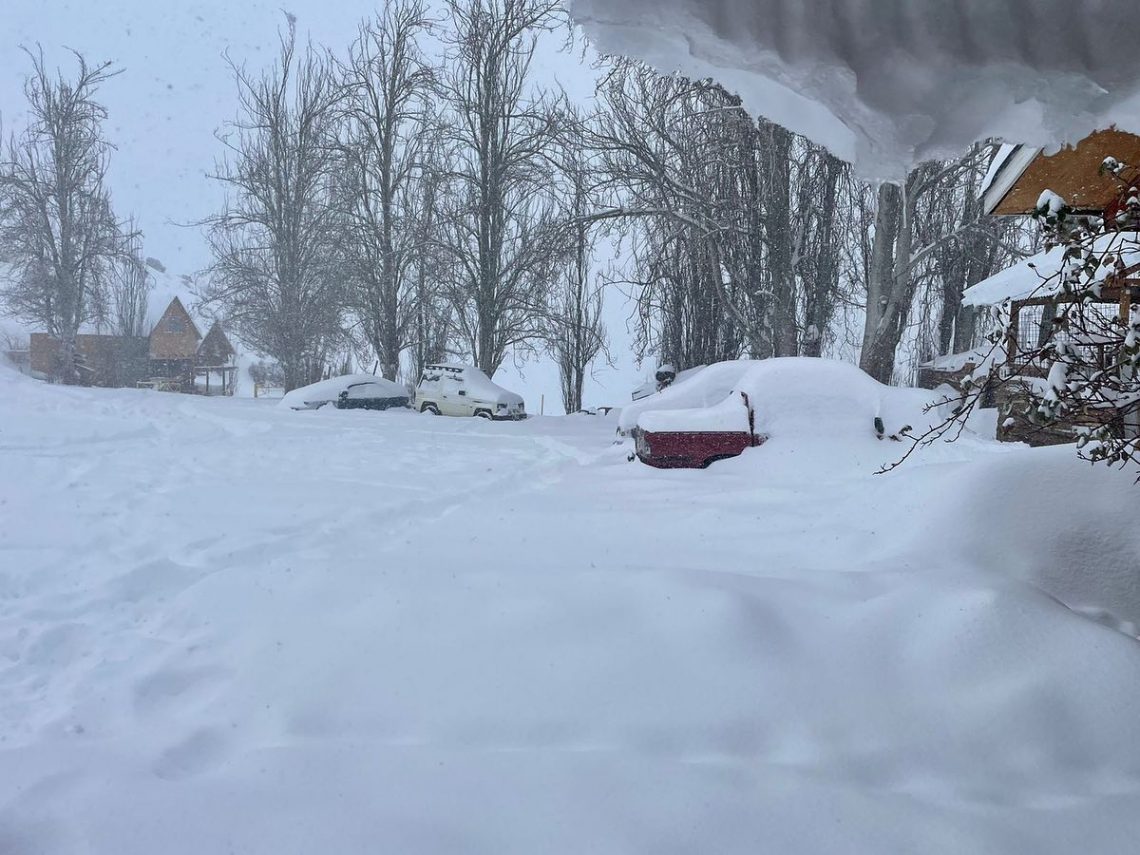
CHILE REPORT
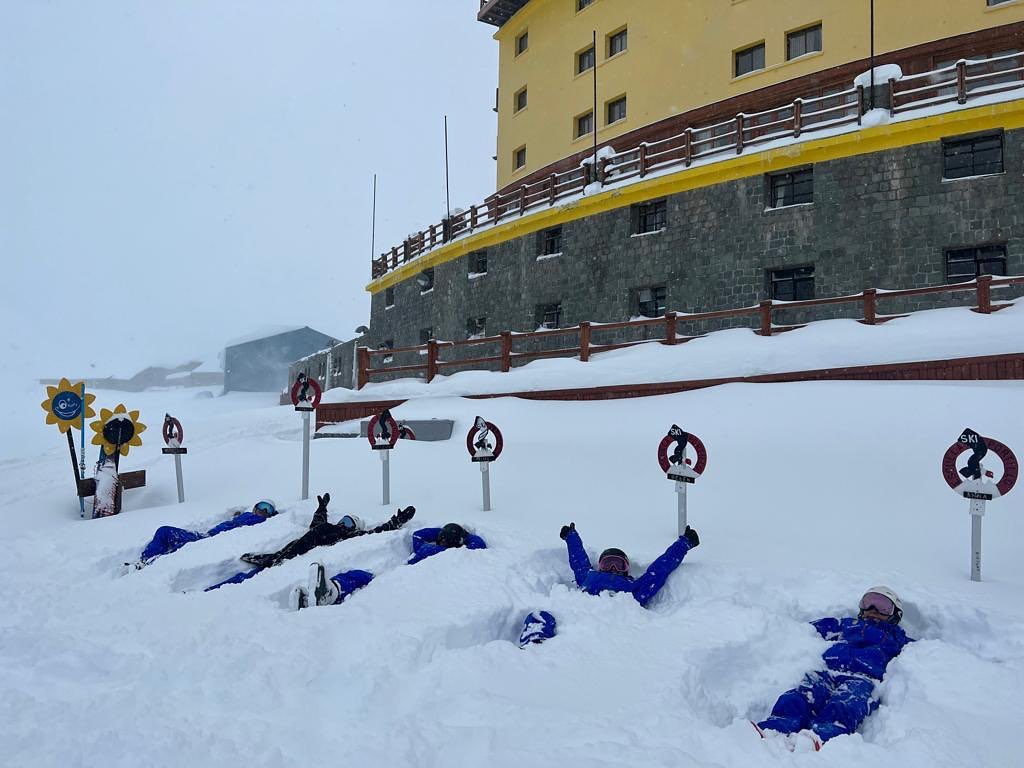
Chile has seen the most dramatic winter weather in the skiing world over the past seven days with heavy snowfall and very low temperatures in areas that rarely see any winter weather of this kind, most mountain passes were closed and access roads to ski areas blocked for some time too. The ski areas impacted were mostly in the central part of the country and, at the end of last week, ranging from Portillo (120/180cm / 48/72”) in the north to Nevados de Chillan in the south. The road from capital Santiago up to Farellones, El Colorado, La Parva and Valle Nevado was also closed overnight. The weather, for many areas, did begin to calm down from Friday and there’s been plenty of sunshine since to enjoy the spectacular powder, once access has been declared safe. Portillo reported 1.3 metres (over four feet) of snowfall in the run-up to last weekend and overnight temperatures getting down to nearly -20C on the slopes.
CHILE FORECAST
Mostly sunny weather is expected in the northern half of the country with temperatures in the -10C to +5C range and the snow staying fresh. Further south of Santiago a more mixed picture with more snow forecast and sunny spells over the next few days. These will most likely be light showers with more significant falls expected again over a wide area from the weekend.
AFRICA REPORT
Ski slopes at Afriski (20/50cm / 8/20”) in Lesotho remain fully open, largely thanks to ongoing overnight snowmaking efforts rather than any fresh natural snowfall. Indeed, there’s been more of the usual wall-to-wall sunshine in the kingdom although without temperatures climbing too high and dropping back below freezing overnight to allow for more snowmaking as required.
AFRICA FORECAST
Temperatures are climbing up in Lesotho and daytime highs will be in double digits Celsius during the next seven days. However, overnight lows will continue to be in the -3 to -6 Celcius range allowing snowmaking top-ups as required. As usual, the forecast is predominantly sun, sun, sun.
EUROPE INTRO
There’s been more hot and sunny weather in Europe. Saas Fee has opened for the season, although initially only to team training, but two of the three glacier ski centres that had been open in Norway have closed, one for the season and one temporarily. It means that only five glacier areas are open in Europe at present and only four of them to the public, another all-time low.
ALPS REPORT
It is looking increasingly challenging for the Hintertux Glacier (0/65cm / 0/26″) with its base down another 30cm (a foot) on a week ago, with two months of summer heat ahead it is hard to see how it will maintain its daily year-round opening plan. Temperatures have been reaching +5 to +10- Celsius once more on the glacier in the afternoons. However, for now, it continues to post 20km (13 miles) of slopes open, the most in the northern hemisphere this week as has been the case for months now. The other year-round ski area on the Klein Matterhorn above Zermatt also remains open, facing similar challenges. However, it reports that 12km (7 miles) of slopes, Europe’s highest, remain open. It’s currently possible to access these from Italy too. As mentioned in the introduction, Saas Fee also opened for its 22-23 season at the weekend but with only about half (12km / 7 miles) of its summer slopes open and only permitting race teams booked for training on them for now. That’s to be reviewed next month. Finally, Italy’s Passo Stelvio (0/180cm / 0/72”) remains open and posting the deepest surviving snowpack of open ski areas. It’s mostly used by teams training too but it is possible for anyone to head there for a snow fix.
ALPS FORECAST
There’s no respite from the summer heat with temperatures hitting 30C at around 1500m and getting well above freezing at 3,000m (glacier height). It’s mostly sunny weather forecast but some clouds may bubble up up high and bring light rain showers in the afternoons.
SCANDINAVIA REPORT
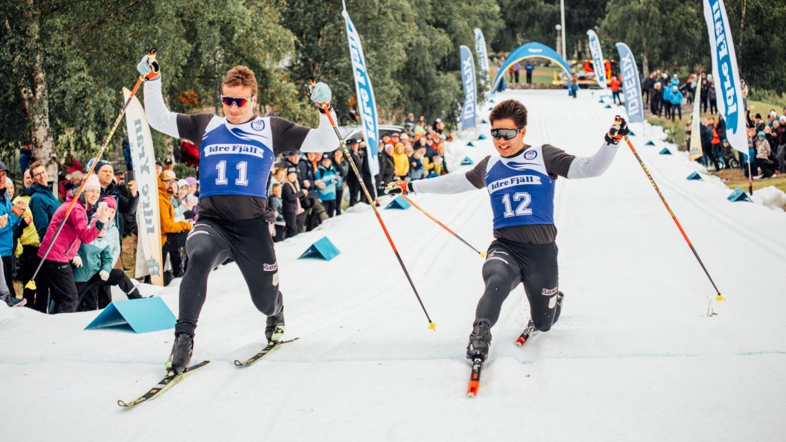
Norway’s Stryn glacier ended its 2022 season at the weekend. It has the shortest summer run of Scandinavia’s three glacier centres, but 2022 has actually been a better year than some recent ones, clocking up around two months of operations when some years Stryn summer ski glacier area has closed after just a few weeks. This reflects the fact that the northern glacier areas had a snowier winter and cooler spring than down in the Alps. The Galdhøpiggen (0/100cm / 0/40″) is also currently closed but in its case, the plan is to re-open at the end of the month and remain so through to its planned season end in early November. Finally, Fonna (380/740cm / 152/296”), still with the world’s deepest snowpack is still open most days, although it did have a closure day due to strong winds last week. Worth noting that Sweden’s Idre Fjall had a little snowsport at the weekend when some snow that had been stockpiled from last winter was spread back out on the ground for some summer cross-country skiing competition.
SCANDINAVIA FORECAST
It’s looking warm for the week ahead at Fionna, with temperatures in the range of +4 to +18C. Mostly dry but with a chance of rain (sadly much more likely than snow) from the weekend.
NORTH AMERICA INTRO
Timberline (0/88” / 0/220cm) on Mt Hood in Oregon remains the only ski area open to the public in North America. Well, outdoors at least. You can ski or board indoors at Big Snow in New Jersey. But there’s much more terrain open and bigger views out west. The weather in Oregon has, once again, been hot and sunny and the surviving snowpack has dropped to less than half what it was two months ago. The resort does hope to continue snowsports on the Palmer snowfield still to the latter half of next month though. Private snow slopes with terrain park features are also open at Copper Mountain for those attending Woodward freestyle camps there. A similar facility on the Blackcomb Glacier above Whistler has ended its 2022 summer season however, it’s first opening since 2019.
NORTH AMERICA FORECAST
There’s another week of non-stop sunshine forecast with overnight lows in the high 30s and 40s Fahrenheit up on the snowfield, and daytime highs in the 50s and 60s.
JAPAN REPORT
Japan’s Gassan (0/150cm / 0/60”) remains partially open although the base depth has dropped another 50cm/20”/25% compared to a week ago. However, it should hopefully make another week or so to the planned end of the season on the final weekends of the month. The past week has not been too hot, mostly in the teens Celsius, with periods of cloud keeping things cooler than they might otherwise have been. The main course and the Sawa run are both closed but you can hike up to the remaining snow or use the Hino T-bar or Ubagatake T-bar lifts, which are still operating.
JAPAN FORECAST
There’s more mixed weather in the forecast, with mostly sunny weather but with some rain showers and periods of mountain mist and fog. Temperatures are mostly in the +10 to +20C range.
You might also like...

A Guide to the Perfect Skiing Stance in All Conditions with Maison Sport

Huge Snowstorm Hitting Western North America

World Snow Roundup #231
