WORLD SNOW ROUNDUP #231
Issued: 23rd February 2022
By Patrick “Snowhunter” Thorne
European Roundup
North American Roundup
Asia Roundup
WORLD OVERVIEW
It has been a week of quite unsettled weather in many parts of the world. Storms impacted much of North America and much of Europe bringing disruptive, strong winds to many areas along with more snowfall. As a result of the latter, in most areas, the unusual trend of a declining snowpack in the first 4-6 weeks of the year has now been reversed. There was fresh snowfall in the Alps, Carpathians and Pyrenees as well as for Scandinavia and Scotland, the latter enabling centres there to open by far the most terrain of the season so far at the weekend.
In North America the main news is some snowfalls for the west of the continent bringing over a foot (30cm) of fresh snow to most ski areas in the Rockies or further west, the biggest accumulations there since the end of December in many cases. The snow is still falling and expected to intensify as we publish this week’s report. The east, by contrast, has had quite the week with a brief spell of warm weather at the end of last week bringing gales and torrential rain, resulting in flooding for some and temporary closures for many as the snow surface was repaired. Fortunately, a rapid return to cold temperatures to allow snowmaking, along with natural snowfall, allowed many to reopen within 24 hours.
In Europe and North America, a growing number of regions, states, provinces and countries have been announcing the easing of pandemic travel and resort operating restrictions.
EUROPE INTRODUCTION
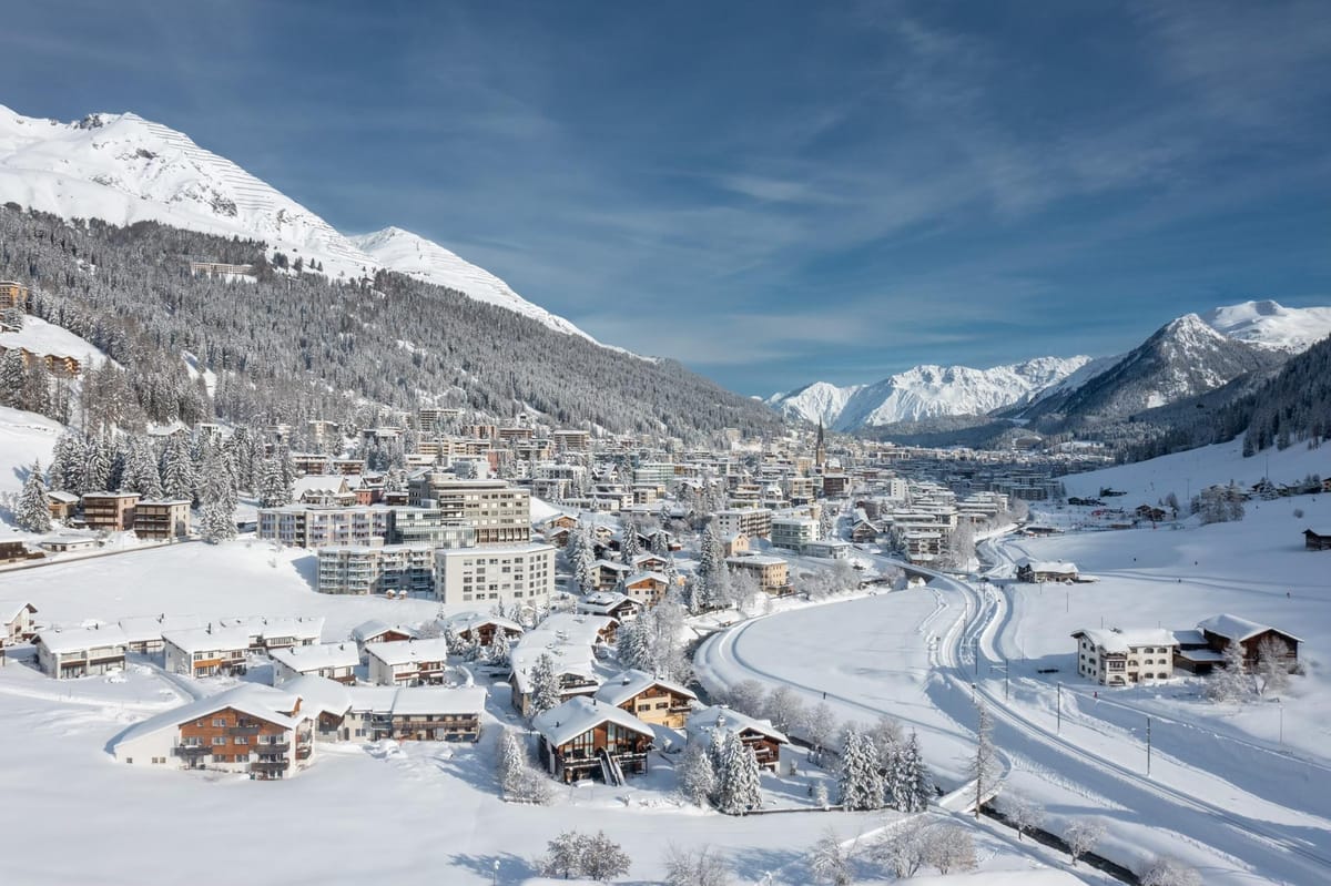
The Alps have seen several snowfalls over the past seven days, further improving conditions and building bases ahead of the start of spring next week. Elsewhere, the Pyrenees have seen more snowfalls for the second successive week after a previously long dry, period and there’s been more snowfall for Scandinavia too. Conditions are the best they’ve been in Scotland as well after colder temperatures and snowfall allowed centres there to finally open more terrain. Strong winds have been a factor, particularly in the north and west of the continent, as a series of storms move up through the Atlantic. This led to closures of upper slopes and in some cases full ski areas, for periods
AUSTRIA
AUSTRIA REPORT It has been the third snowy week in a row in Austria, continuing a pattern of wintry weather through February. Indeed, Austria has probably seen more snowfall this month than any other country in Europe, although individual resorts in Switzerland and Italy are up there too. There’s been snowfall most days, some windy weather too at times, and temperatures generally in the freezing to minus ten range. There’s been some snow most days for most resorts but it has been light in recent days, although a bigger fall is currently underway. The Arlberg region (125cm/245cm / 50/96”) has the largest amount of terrain open in the country with more than 260km (160 miles+), or about 85% of its slopes open.
AUSTRIA FORECAST There’s not much change in the forecast with more snowfall expected daily through the rest of the week and temperatures remaining low. Thursday looks likely to be the best for those hoping for clear skies.
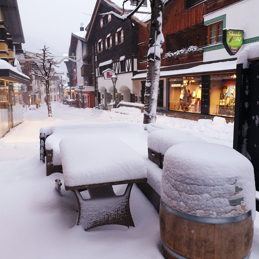
SWITZERLAND REPORT More snowfall was welcomed in Switzerland this past week, but so was the lifting of most pandemic operating restrictions with the need for vaccine proof, most mask-wearing and other restrictions lifted, as well as the ending of restrictions on arrivals to the country. It has been a consistently snowy period across much of the country with cumulative totals of 30-60cm (1-2 feet) of new snowfall reported. Many areas have seen snowfall almost daily, only the weekend, Sunday in particular, was dry and in places sunny. The latest snowfall has led Mürren (80/330cm / 32/132″) to move to the top of the country’s table for the deepest snowpack, also the first to pass the 3 metres (10 feet) mark this winter.
SWITZERLAND FORECAST A lull in the snowfall is expected through midweek with sunshine and rather warm temperatures for many on Wednesday and Thursday before temperatures drop again with more snow forecast from Friday.
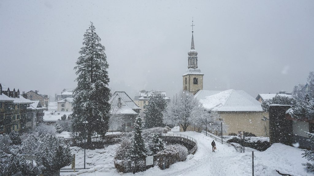
FRANCE REPORT French ski areas are in their best shape of the season so far after successive snowfalls in the past week brought a cumulative 30cm or so more snow cover to the pistes. The past few days have been sunny and for many, it was a sunny weekend too with snowfall at the end of last week and the start of this. Three ski areas, Paradiski (75/250cm / 30/100”); the Grand Massif (20/250cm / 8/100”) and Aravis (60/250cm / 24/100”) are all posting the deepest base in the country.
FRANCE FORECAST Mostly sunny for the remainder of the week with temperatures dipping as low as 15 degrees below freezing on higher slopes, climbing up to +5 in the valleys in the afternoons. Some snowfall is possible at the end of the week but currently looking light to moderate.
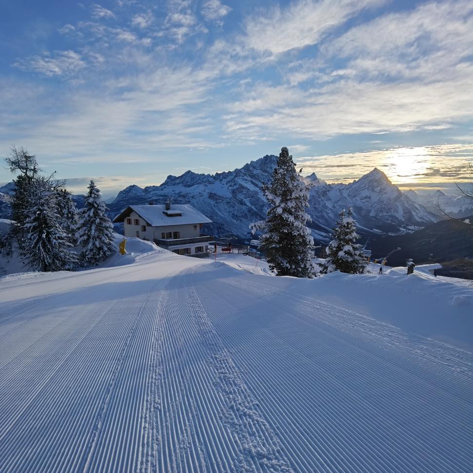
ITALY REPORT Italian ski areas have seen more snowfall too with most centres across the country reporting falls at the end of last week and the start of this, although in most cases it was light to moderate falls rather than big dumps. The Dolomites got a welcome snow cover refresh on Monday. Daytime temperatures have been getting quite warm in valleys (up to +10) but are remaining below freezing up on the slopes. The country’s deepest base is being reported on the French border at Espace San Bernardo where the ski areas of La Rosière/La Thuile (129/215cm / 50/86”) meet.
ITALY FORECAST Dry and increasingly sunny with temperatures fluctuating ten degrees on either side of freezing for most of the country although the Dolomites may see more snowfall 0n Friday.
GERMANY REPORT A frequently snowy and sometimes stormy week in Germany, where it has been cold and cloudy for the last seven days. Up high on the Zugspitze (230/275cm / 92/110”), which is posting Germany’s deepest snowpack (and one of the deepest in Europe) large wind-blown drifts developed. The snow has kept falling into the new week too with many areas posting 5-10cm (2-4 inches) of fresh daily. Reit im Winkl (38/170cm / 15/68”) continues to post the largest ski area open in the country, with around 40km (25 miles) of its slopes open, about 95% of the total.
GERMANY FORECAST Midweek sunny spells and snow showers are forecast with more snowfall expected by the weekend. Temperatures range from 10 degrees below on higher slopes to 10 above in low valleys.
SCANDINAVIA REPORT After a snowy end to last week, many Scandinavian ski areas have seen fairly dry weather with temperatures in the freezing to minus 20 Celcius range. A mixture of sunny days and some overcast skies with strong winds a common feature. Base depths have built further with Myrkdalen (160/210cm / 64/84”) near Voss in Western Norway posting the deepest at present. With pandemic restrictions easing across the region it’s looking promising for the next two months of the season in Finland, Norway and Sweden. The famous spring skiing centre of Riksgränsen up in the Swedish Arctic Circle is due to open for its 2022 season this weekend and reports lots of snow lying.
SCANDINAVIA FORECAST More snowfall is expected for the latter half of this week with the potential for some big accumulations on the slopes of western Norway with 60-90cm (2-3 feet)) of fresh snow possible in the most optimistic interpretation of the forecast. Drier and sunnier in most areas by the weekend.
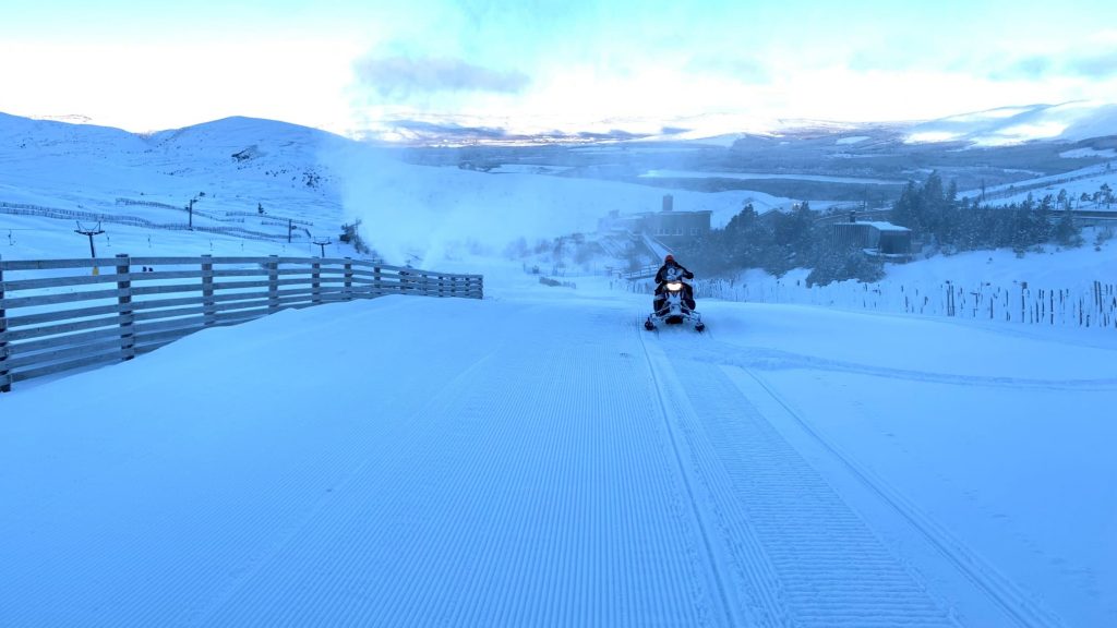
SCOTLAND REPORT Scottish ski areas saw by far their best day of the season so far on Saturday when, after several days of snowfall, skies cleared, the wind dropped and it was a perfect blue sky day. All five Highland centres were able to open terrain additional to their base area nursery slopes for the first time in two months, with Glencoe and Nevis Range in the west faring best and opening about half of their terrain or more in Glencoe’s case. Further east, centres opened closer to a quarter to a third of their runs. The days since have seen more typical changeable conditions with warmer temperatures, some windy weather and plenty more precipitation on the cusp of rain and snow. But overall the current picture is looking the best it has since mid-December.
SCOTLAND FORECAST The current weather roller coaster is set to continue into next week with plenty of precipitation, sometimes stormy, and temperatures fluctuating between about 5 degrees below freezing and five or six degrees above, which will make the difference between rain and snow at different altitudes. As usual, it’s going to be a close call.
SPAIN / ANDORRA REPORT The latest snowfall to pass through the Pyrenees brought a light accumulation on Saturday-Sunday when ski areas there reported 5-10cm of snowfall. Otherwise, there have been warm conditions at times with Baqueira Beret (145/245cm / 58/98”) reporting its cover as “wet” at one point as a result although another 15cm (6”) of snowfall the next day. Sunny skies have been the norm once more. But we remain in a position where most ski areas in the Pyrenees continue to post the best bases in Europe thanks to big early-December falls and 30-40cm (12-16”) of fresh snow in the past week following a largely dry January. Gransdvalira (75/120cm / 30/48”) in Andorra now has the most terrain open in the region by some distance with 95% of its 240km (150 miles) of runs accessible, the most so far this season.
SPAIN / ANDORRA FORECAST Sunshine is the forecast for the remainder of this week, with temperatures hovering a few degrees on either side of freezing up on the slopes but getting as high as 10 degrees above freezing down in resort.
BULGARIA / ROMANIA REPORT A predominantly dry and frequently sunny week in the mountains of south-eastern Europe, but there is a more substantial snow bearing front currently moving through the region which could bring 10-20cm (4-8”) more snowfall over the next day or so. Bansko (30/140cm / 12/56”) has its best cover of the season so far all the way back to the resort thanks to the snowfalls earlier this month, topped up with a few snow flurries in the last week. Romania has seen more unsettled weather with snowfalls most days since the weekend, but no big accumulations. Poiana Brasov (40/60cm / 16/24”) has the region’s deepest base.
BULGARIA / ROMANIA FORECAST After the current snowfall passes through the remainder of the week should be dry with a mixture of sunny and overcast conditions. Temperatures range from just above freezing to 15 degrees below up high.
CZECH REPUBLIC / SLOVAKIA REPORT A snowy week in the Czech and Slovak Republics with Špindlerův Mlýn (40/65cm / 16/26”) among areas reporting 25cm (10″) of fresh snowfall from the previous 24 hours awaiting skiers on Sunday morning. The region was one of those also hit by strong winds as successive storms, systems moved through. However, with Slovakia’s leading resort of Jasna (40/80cm / 16/32”) forced to close some high lifts at the weekend as a result. The snow has kept falling since the weekend too.
CZECH REPUBLIC / SLOVAKIA FORECAST The current snowy conditions are forecast to continue for much of the week in the Carpathians with more snowfall expected most days and just occasionally sunny spells during breaks in the weather. Falls will be mostly light to moderate (5-10cm / 2-4″ per day) with temperatures just a little below freezing.
NORTH AMERICA
NORTH AMERICA INTRO After the mostly dry and often warm first month and a half of 2022 in the west the past seven days have seen much more promising conditions with two decent snowfalls on the west coast mountains and in the Rockies. So some areas have totalled 12-18″ (30-45cm) of fresh snow so far with the snow coming down as we post this report. Over in the east, it has been a bit more of a rocky road over the past week with warm temperatures and strong winds passing through at the end of last week, leading to several areas closing temporarily. However, we’ve got back to below-freezing conditions and fresh snowfall here to since the weekend.
ROCKIES REPORT The Rockies reported some significant snowfall in the latter half of last week. Wolf Creek (84/92” / 210/230cm), which already has the deepest base in the region, reported 6” (15cm) of fresh snow lying for skiers and boarders arriving on Thursday morning, the best for several weeks. Temperatures stayed cold through the weekend as sunshine returned to the southern Rockies, although it stayed snowier longer further north. Breckenridge (20/55” / 50/137cm) posted one of the biggest accumulation in Colorado with 9” (22cm). The snow returned for all in the past 24 hours so it seems we are heading towards a snowier start to spring than we saw for much of mid-winter in the region.
ROCKIES FORECAST It was still snowing as we completed this report and we’re currently estimating up to about a foot (30cm) of snowfall in the region before the current system passes through, perhaps double that for some luckier resorts.
USA WEST REPORT There was big excitement in California late last week when 6″ (15cm) of snow fell on the mountains of Tahoe and other parts of the state, for many the first significant snowfall for nearly two months and arriving just as the state further eases pandemic restrictions. The snowfall was the first of two in the past seven days with some areas seeing more snowfall to start this week too, after a return to the usual sunny conditions over the weekend. There were similar sunshine and snowfall patterns over the past seven days further north along the Pacific Coast but more snowfall moved into Alaska, which continues to post the continent’s (and western world’s) deepest cover at over 13 feet (4 metres) and got another few feet (60cm+) in the past seven days. Oddly, drier in the Pacific northwest which continues to track below average after a good December.
USA WEST FORECAST After the recent snowy and at times stormy weather in the Pacific northwest it has turned bitingly cold once again, ironically it is looking a warmer end to the week up in Alaska than in Oregon and Washington state. Mostly dry but with things looking more changeable in the long-range forecast with the chance of snowfall returning at the end of the weekend.
MIDWEST REPORT It has been a snowy week in the Midwest with successive storms hitting the region and bringing some of the biggest snow accumulations of the season so far. 6-8 inch (15-20cm) accumulations were reported going into the weekend with more snow falling after a sunny weekend for some and very low temperatures into the new week. Most areas are fully open with Crystal Mountain (48/60″ / 120/150cm), in Michigan, posting the deepest base in the region and all trails open.
MIDWEST FORECAST Conditions remain changeable with clear, sometimes sunny days, but more often overcast, followed by moderate snowfall. Temperatures get extremely low (more than 30 degrees below freezing) at times.
USA EAST REPORT The forecast warm weather that hit the east coast in the latter half of last week, accompanied by gales and some rain at some ski areas, was thankfully short-lived, as expected, and by the end of last week, temperatures were dipping back down below freezing ahead of widespread weekend snowfall. Mad River Glen, in Vermont, was one of those badly hit by flooding on Friday but miraculously (or more accurately thanks to heroic staff efforts) had reopened on Saturday with fresh snow falling. Smugglers Notch (24/48” / 60/120c,), in Vermont, is marginally posting the deepest base in the east but many others are within a few inches of it.
USA EAST FORECAST It is looking mostly snowy for the latter half of this week with the possibility of clear skies for some on Thursday, maybe even some sunshine, but otherwise snow. Wednesday is looking slightly off with rather warm, temperatures meaning some may see rain at low elevations again but for most, it will be snow with temperatures heading back to 10 or even 320 degrees below freezing by the end of the week.
CANADA
CANADA WEST REPORT There was wild weather reported at the weekend for parts of western Canada with gale force winds impacting higher slopes and with heavy snowfall too, near blizzard conditions at times. The snowfall cleared the eastern side of the region by the end of the weekend however, and the past few days have been dry almost everywhere with some areas seeing a return of the sunshine but many remaining overcast. Kimberley (93/300cm / 37/120”) is posting the deepest base in western Canada but otherwise, the centres posting deep bases are over on the Pacific coast with Mount Seymour (202/285cm / 81/114″) one of the few worldwide to have hit the 2 metre / 80-inch mark at the base of its slopes.
CANADA WEST FORECAST The rest of the week looks dry in the west with quite a lot of sunshine in the forecast., A big range of temperatures as we approach the start of March from 5 to 25 degrees below freezing, but cold enough to maintain the snow’s integrity.
CANADA EAST REPORT It’s been a largely good week in eastern Canada, which did not seem to be as severely impacted by the warm end to the week last Friday as ski areas further south. Several ski areas reported10-20cm of fresh snowfall at the weekend and for many, it has been snowing for the last three days too. So it’s building bases once more and plenty of powder to power through. Tremblant (30/305cm / 12/122″) has put another few centimetres onto its base, which remains the deepest not only in the east but all of Canada. It also has the most terrain open in Quebec.
CANADA EAST FORECAST Temperatures will remain at 10 to 20 degrees below freezing on ski slopes as skies clear on Thursday/Friday. A dry and sunny weekend when some areas could see overnight lows 30 below freezing as we end February.
ASIA
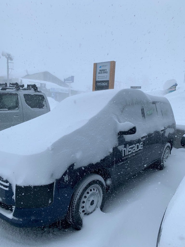
JAPAN REPORT A middling kind of a week with some dry spells and some small to moderate snowfalls compared to previous weeks this year. Accumulations over the past seven days would still be considered good on most areas, averaging 30-60cm (1-2 feet). But with Japan leading the world for snowfall totals this winter they’re down a bit on recent averages, However, we are nearing the end of February when the regular snow deliveries to Japanese slopes do tend to ease off in an average year. Temperatures have remained good, however, 5 to 10 degrees below freezing for most areas. Niseko (200/385cm / 80/154″) has had about 50cm (20″) more snowfall this past week taking it past the 9 metres (30 feet) snowfall season to date mark. Hopes of the border reopening to international guests this season appear to be declining.
JAPAN FORECAST Temperatures are forecast to remain largely below freezing as we head towards March but climb a degree or two into positive numbers down at resort level by the weekend. The next few days should see more light-moderate snow showers but dryer from Friday.


