WORLD SNOW ROUNDUP #229
Issued: 9th February 2022
By Patrick “Snowhunter” Thorne
European Roundup
North American Roundup
Asia Roundup
WORLD OVERVIEW
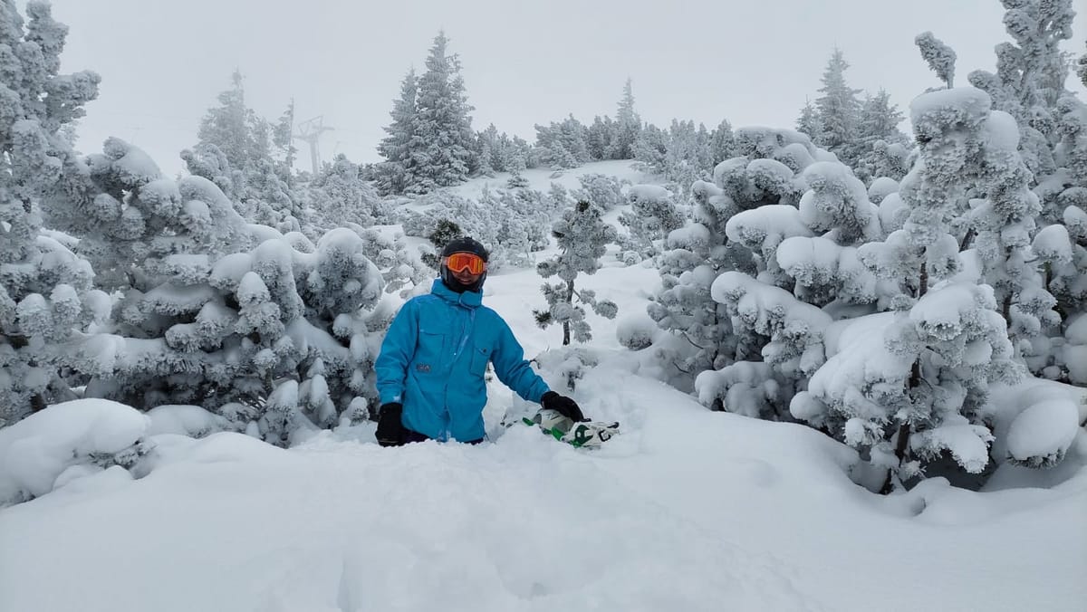
A rather snowy week for many areas with the central and eastern Alps, large swathes of Scandinavia, southeastern European countries like Bulgaria, the US northeast (again), Alaska and Japan (again) all posting decent dumps in the last seven days. In many cases, seven-day totals have been as much as 50cm (20”) or more at the luckiest resorts in countries like Austria, Italy, Switzerland, Norway, Canada, Japan and the US. Many of these accumulations have come quickly too in 24-48 hour storms, often accompanied by gale force winds which have closed ski slopes while they blew through and set avalanche danger levels up to high levels.
The most dramatic evidence of this was in Austria with, sadly, seven skiers killed in two separate avalanches at the end of last week, which were among a record more than 100 recorded in Tirol region in just a few days. At Villars, in Switzerland, a train ascending a mountain railway to the slopes was swept off the tracks by an avalanche, fortunately with just a lone driver on board at the time and even more luckily he was unhurt.
For most though, the new snowfall has just been very welcome, once skies cleared, and it was powder heaven in many parts of Europe and North America in the latter half of the weekend and the start of this week. The deepest snow in North America is now back above 13 feet (4 metres) although now in Alaska, not Washington state which hit that level a month ago before falling back. The deepest reported base, touching 5 metres (17 feet) is in Japan.
The 2022 Winter Olympics are underway in China with the world’s media obsessed with the fact that most of the snow in this very cold but very dry region is machine-made. The main weather factor concerning athletes, however, has been very strong winds, a similar issue to Pyeongchang in relatively nearby South Korea four years ago. China’s borders remain closed to international travellers.
EUROPE INTRODUCTION
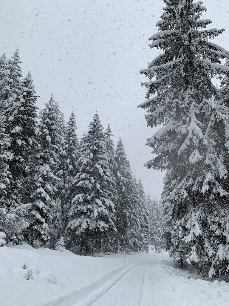
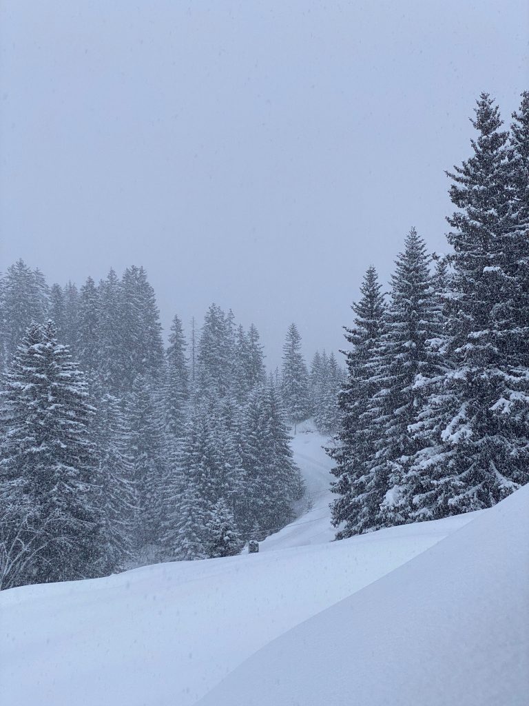
Much of Europe has been transformed over the past week by heavy snowfall, particularly in the middle and latter part of last week, which added 50cm (20”) of snow cover to many areas in the central and eastern Alps, with some seeing as much as a metre (40″) of new snow. A second storm, this time extending over a wider area encompassing more of France, followed on Sunday/Monday. There was snowfall over a wider area too with decent dumps in Eastern Europe, Scandinavia and the Dolomites and some lighter snowfall in the western Alps. Only the Pyrenees and the southern Alps really seemed to miss out and they still have plenty of snow lying from the big early-season storms a few months ago now.
AUSTRIA
AUSTRIA REPORT The snowstorm that was getting underway a week ago when we last published our report gathered momentum through the middle of last week with several areas seeing storm totals moving towards the metre (40″) mark by the latter half of the week and several closed due to the issues this caused. The Stubai Glacier closed midweek due to avalanche danger on its access roads, as did the Zillertal Arena due to worries on the slopes at the height of the storm, many others were similarly impacted. The avalanche danger level reached 3 to 4 on the scale of 5 in Tirol and sadly multiple avalanches included one that killed four ski tourers and their guide. Another avalanche crossed a piste at Solden, burying five although fortunately all survived there. However, by Friday the storm had largely cleared, blue skies returned and Austrian ski areas were reporting fabulous conditions for the weekend. Then more snowfall has been falling over the past few days since the start of the new week. Austria is now reporting Europe’s deepest snowpack at Loser (60/300cm / 24/120”).
AUSTRIA FORECAST Another sunny few days over the latter half of this week in Austria but yet another front is due to move in, in time for the weekend with more snow forecast for many areas from Friday. Temperatures down to freezing down to about 1000m altitude.
SWITZERLAND REPORT Swiss ski areas saw big snowfalls too last week. Arosa reported its snow depth as shown on its measure. It grew from 41cm (16”) at the start of the storm to 110cm (44”) 48 hours later, so nearly 70cm/32” accumulated. Here too the snowfall caused practical and safety issues opening, none more so than at Villars where an avalanche took out the main funicular lift at it went up to the slopes, derailing two of the three carriages. Fortunately, only the driver was on board at the time and he was described as “fine” after the impact. The country’s largest area the 4 Valleys around Verbier (35/70cm / 14/28”) has about 90% of its terrain open. Laax (65/275cm / 26/110cm) has the deepest snowbase in the country.
SWITZERLAND FORECAST Sunny for much of the country over the next few days with temperatures quite warm in the valleys. The next snowfall, widespread across most of the country, is expected from Friday.
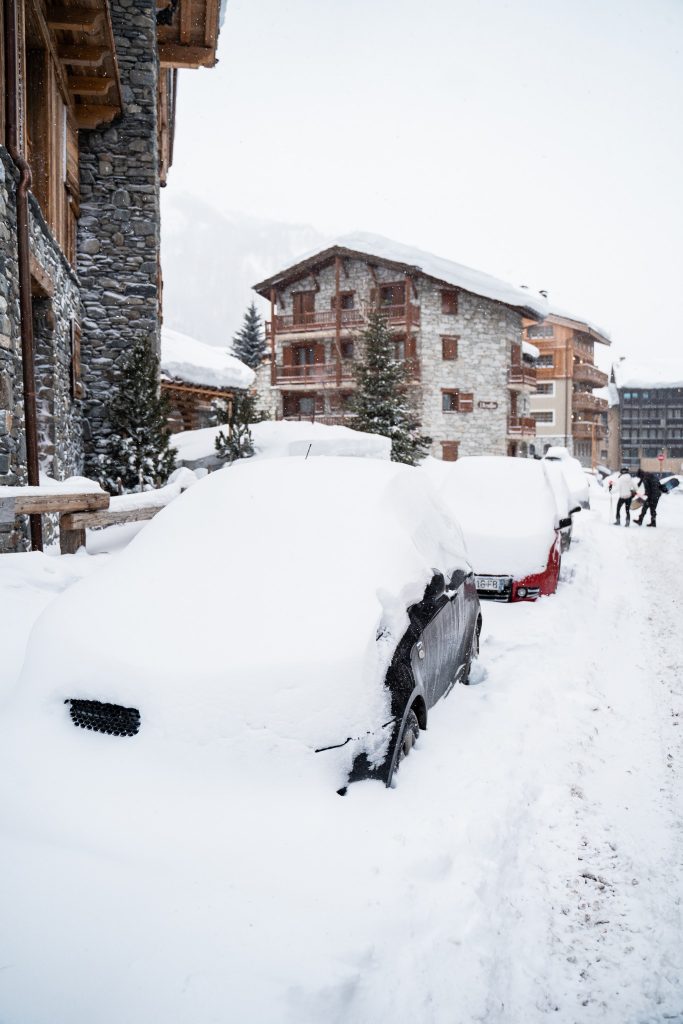
FRANCE REPORT Unfortunately, most French areas missed out on the bulk of the big snowstorm that hit the central and eastern Alps at the end of last week. However, the second storm at the start of this week did see 20-30cm (8-12”) falls across most of the French Alps, the best for some weeks for most areas there. There were reports of 5-10cm (2-4 inch) accumulations but nothing on the scale of Austria, Switzerland or indeed northern Italy. But that’s still not a huge problem as most French areas remain fully open thanks to the big snowfalls at the start of the season. In any case, French areas did benefit from another front that moved through at the start of this week bringing 15-30cm (6-12″) accumulations to the northern Alps, slightly less in the south, the best snowfall for several weeks for some. The 3 Valleys (116/166cm / 46/66”) continue to have the most terrain open in Europe with a reported 550km of their 600km of slopes currently skiable.
FRANCE FORECAST Staying mostly sunny, fairly cold and with another front expected to bring light to moderate snowfall towards the end of this week.
ITALY REPORT Italy saw some of its biggest snowfalls of the year so far over the last week. Heavy snowfall was reported along the country’s northern border with Cervinia (45/125cm / 18/50”) one of those posting over 50cm (20″) of snowfall. However, perhaps more significant was snowfall in the Dolomites which have been largely dry all year to date, although still able to fully open groomed runs due to early-season falls building a pre-Christmas base and subsequent snowmaking. Much of the country had a sunny weekend after the snow but there was more, lighter, snowfall for many on Monday. The deepest bases in the country, at 1.5 to 2.1 metres (5-7 feet) are being reported over on the other side of the country to Cervinia, in the ortheast of Italy, particularly in the South Tyrol.
ITALY FORECAST The next few days should be cold and sunny before another front moves in bringing snow clouds for at least 48 hours into the weekend for many Italian ski centres.
GERMANY REPORT German ski areas got lots of snow in the storm in the latter half of last week too with the Zugspitze Glacier (250/290cm / 100/116”) closed for several days as the deluge continued. It opened last Friday reporting amazing conditions. In fact, thanks to the snowfall the most German ski areas yet this season are now open and those that are open have the most terrain skiable too. Reit im Winkl (60/180cm / 24/72”) has the most terrain open in the country (40km/25 miles/95% of its slopes) and the Zugspitze the deepest snowpack.
GERMANY FORECAST It should stay cold in Germany over the coming week with a mixture of sunshine and light to moderate snow showers.
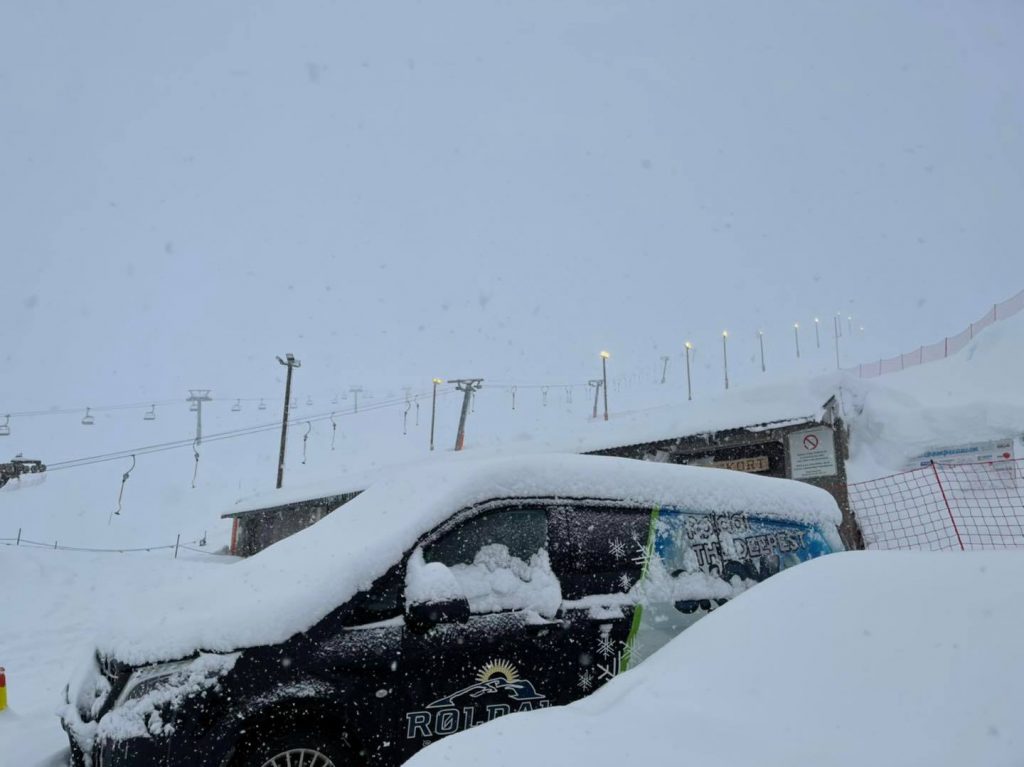
SCANDINAVIA REPORT Snow depths in many parts of Scandinavia have been climbing fast after a snowy few weeks in some areas., One of the usual suspects, Myrkdalen (110/160cm / 44/64”) near Voss on Norway’s west coast, has moved to the top of the region’s snow depth table and reports powdery conditions at present, as do many others. Roldal (100/150cm / 40/64″) has a similar base and is one of several in Norway posting 20cm (8″) of fresh in the past few days. It’s been a snowy start to this week up in Lapland and northern Sweden too.
SCANDINAVIA FORECAST Temperatures are rising a little too, typically running between freezing down to 15 below in most of the main Scandinavian ski regions. It’s looking fairly dry and sometimes sunny in most areas although more snow is forecast for northern Sweden.
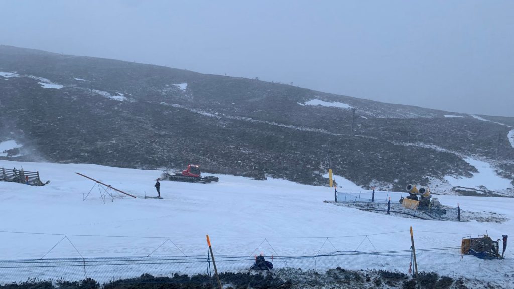
-SCOTLAND REPORT Scottish ski hills have seen some wild and windy weather over the past few weeks but the overall direction of travel appears to be good after the largely snowless January. Although we are still seeing warm weather spikes, there have been plenty of snowfalls too, albeit sometimes short-lived and with the thin cover wiped out again as temperatures yo-yo back up. That said, it’s looking increasing popular in the west with Glencoe’s slopes the most promising for being able to open more than the base area. In fact, they have opened a low run now near the base. The Lecht was unable to open even that at the end of last week as a power failure knocked out their Snowfactory all-weather snowmaking machine, preventing them from topping up cover. But that’s now been fixed. For now, though Scottish centres continue to operate limited areas at their bases for beginners and snow fun as the wild weather of recent weeks allows.
SCOTLAND FORECAST Unfortunately, rather warm, wet and windy midweek in Scotland once more meaning snow may thaw/wash away from some areas, although higher slopes may get more snow in a best-case scenario. Looking colder and calmer towards the end of the week at present.
SPAIN / ANDORRA REPORT After almost two months with very little snowfall and almost constantly sunny skies, the past week has seen the beginning of a change in the Pyrenees with light snow showers bringing 5-10cm (2-4 inches) of snowfall since the weekend to many areas. Not yet a lot but the first snow for weeks for many. In terms of piste skiing, the lack of snowfall hasn’t been an issue. After the big December snowfalls, the Pyrenees were posting the deepest snow totals in the world for a while and in Europe until very recently, when finally accumulations in the previously almost as dry Alps overtook a slowly diminishing Pyrenean snowpack. But almost all the region’s centres remain fully open, led by Andorra’s Grandvalira (80/140cm / 32/56”) with more than 95% of its 240km (150 miles) of runs open and Spain’s Baqueira Beret (150/375cm / 60/110”) which has all 160km (100 miles) of its runs open and the deepest base in the region.
SPAIN / ANDORRA FORECAST We’re back to sunny skies for the next few days, with temperatures below freezing on the slopes but getting as high as +10C at bases by the afternoon. The weekend looks like it should see more unsettled weather with snowfall forecast for many on Saturday.
BULGARIA / ROMANIA REPORT Ski areas in Romania and Bulgaria posted some of their best fresh snowfall totals of the year in the latter half of last week with Bansko reporting nearly half-a-metre (20”) of fresh snow by Thursday. There was another, lighter snowfall to start this week. Borovets (160/190cm / 64/76”) is posting the deepest base in the region.
BULGARIA / ROMANIA FORECAST It looks like we’re back to sunshine for the remainder of this week and through the weekend in the region. Temperatures are still cold though, double digits below freezing on the slopes, not getting much into positive numbers at resort level either.

CZECH REPUBLIC / SLOVAKIA REPORT Great conditions in the Czech and Slovak republics this week after a big dump of snow left fresh cover everywhere. The Czech Republic’s leading area of Špindlerův Mlýn (40/65cm / 16/26”) reported 30cm (a foot) of fresh snowfall by last Thursday and as a result all of its terrain was finally open for the first time this season. It’s a similar sort of fresh snow at Slovakia’s leading resort, Jasna. It kept snowing through the weekend and into this week with more light to moderate falls.
CZECH REPUBLIC / SLOVAKIA FORECAST The next few days are looking the brightest and sunniest for a week or so, with sunny spells forecast. Temperatures should stay below freezing, however.
NORTH AMERICA
NORTH AMERICA INTRO Ski areas across eastern North America again saw the biggest snowfalls of the past week with the latest storm that grounded thousands of flights in the region bringing up to 20 inches (50cm) of snowfall to ski areas across the region. In many cases, this was on top of similar falls the week before and has improved conditions still further. The west of the continent is seeing some snowier weather too though with some decent dumps in the Rockies, particularly southern Colorado and up in the northwest. Actually, Alaska, in the very far northwest, has been posting the biggest accumulations of all and ski area there are the first to post bases in North America back above the 160 inches (4 metres) mark since early January in Washington state, after which bases dipped as the snow settled and temperatures, unusually for January, rose.
ROCKIES REPORT Some of the best conditions of 2022 so far in the Rockies in the past week after some of the best snowfalls since December for some areas. The southern Rockies seem to have done the best with Wolf Creek (92/102” / 231/255cm), already posting the deepest base in the US Rockies, reporting another 27 inches (67cm). Utah’s Park City (42/59” / 104/147cm) has all of its terrain, the largest in the US, open.
ROCKIES FORECAST It’s another largely sunny week ahead but there’s a front forecast to move through the Rockies midweek that could bring a few inches of snowfall then some clouds and possibly another few inches of snow for some at the weekend. Temperatures could get as high as 10 above freezing in resort, 20 below up on the highest slopes.
USA WEST REPORT There’s a lot of snow falling way up in Alaska where Alyeska has added several feet more to their base in the past week and is now posting the continent’s deepest base. Further south, there have been some snowfalls up in Oregon and Washington but it has remained largely dry down towards California. Despite this, Mammoth Mountain (75/154” / 188/381cm) remains in second place for snow depth thanks to the big December falls. Timberline (110/136” / 275/340cm), up in Oregon, is also looking good for spring and hopefully, summer skiing with the base it has built.
USA WEST FORECAST The dry sunny weather that has been the feature of 2022 to date looks set to continue for at least another week along the west coast. Temperatures will range from 10 below up on the slopes to five above freezing at bases.
MIDWEST REPORT Cold and frequently snowy in the Midwest in the past seven days, although much of the snowfall was at the end of last week with most states in the region seeing dry weather since. Hidden Valley (20/20″ / 50/50cm) was one of the big winners reporting 20″ (50cm) of snowfall in 72 hours into the weekend. Most other ski areas in the region reported around half that. Crystal Mountain (48/60″ / 120/150cm), in Michigan, is posting the region’s deepest base. Like most other centres in the Midwest now it has every run open.
MIDWEST FORECAST Light snow showers over the next few days for most ski areas in states including Michigan, Minnesota and Wisconsin. Others like South Dakota look like they’ll stay dry. Dry or snowy temperatures look like they’ll be in the range of freezing down to 10 below, so a little warmer than they’ve been in recent weeks.
USA EAST REPORT There were some big winners from the latest storm to hit the east, with plenty of ski areas in the region reporting over a foot (30cm) of fresh snowfall on Friday-Saturday. They include New Hampshire’s Bretton Woods (22/36″ / 55/90cm) with a 17” (42cm) 24-hour accumulation and Vermont’s Killington Resort (28/32″ / 70/80cm), which also reported 17” (42cm) and now has all 155 runs open, the most terrain in the East. Up in Maine, it was powder days too for Sugarloaf 19-29″ and Sunday River (20/40” / 50/100cm). The heavy snow was driven in on strong winds at times, closing slopes and in some cases whole resorts for a day or two. But it was powder heaven when the skies cleared to start this week.
USA EAST FORECAST The clearer, drier weather of recent days, since the storm at the end of last week, is set for the rest of this week, giving great conditions to continue to enjoy the freshly fallen snow. Sunshine or cloudy skies, temperatures below freezing still. But not so far below as they have been.
CANADA
CANADA WEST REPORT There were some decent snowy days in the latter half of last week, topping up snow cover across western Canada, with many areas posting 10-20cm (4-8 inch) fresh accumulations. Since the weekend it has turned drier with sunny spells, although temperatures have remained below freezing at most locations. The deepest snow depths in the region have moved from ski areas on the Pacific coast, as they were a fortnight ago, to increasingly the eastern side of BC. Kimberley (99/293cm / 40/117″) continues to post the deepest base, now approaching the 3 metre/10 feet mark, with neighbouring Fernie (189/270cm / 70/108”) close behind. But all ski areas in the region now have decent bases and most terrain open. Whistler Blackcomb (20/241cm / 8/96”) has more than 95% of North America’s largest ski areas slopes open.
CANADA WEST FORECAST It’s currently looking increasingly bright and sunny for the latter half of this week for much of Alberta and BC. Temperatures should remain well below freezing on the slopes but could get into positive numbers at mountain bases by the afternoon.
CANADA EAST REPORT Although there were some sunny spells at the weekend, eastern Canada has seen predominantly overcast skies over the past week, with snow showers every few days. This continues the trend since the start of the year with bases building. Temperatures remain very cold much of the time in most areas, in some cases down to 20-30 degrees below freezing at times. Mont Tremblant (30/29cm / 12/117”) continues to post the deepest lying snow in the region and the largest amount of terrain available, now being 100% open. It also reports that all of its glade ski runs are open for the first time this winter.
CANADA EAST FORECAST Skies continue to be overcast through this week and more snow showers are likely. But it is set to get warmer, currently looking like being close to freezing by the weekend.
ASIA
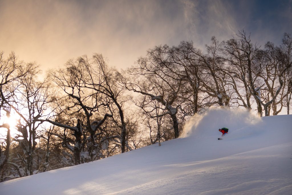
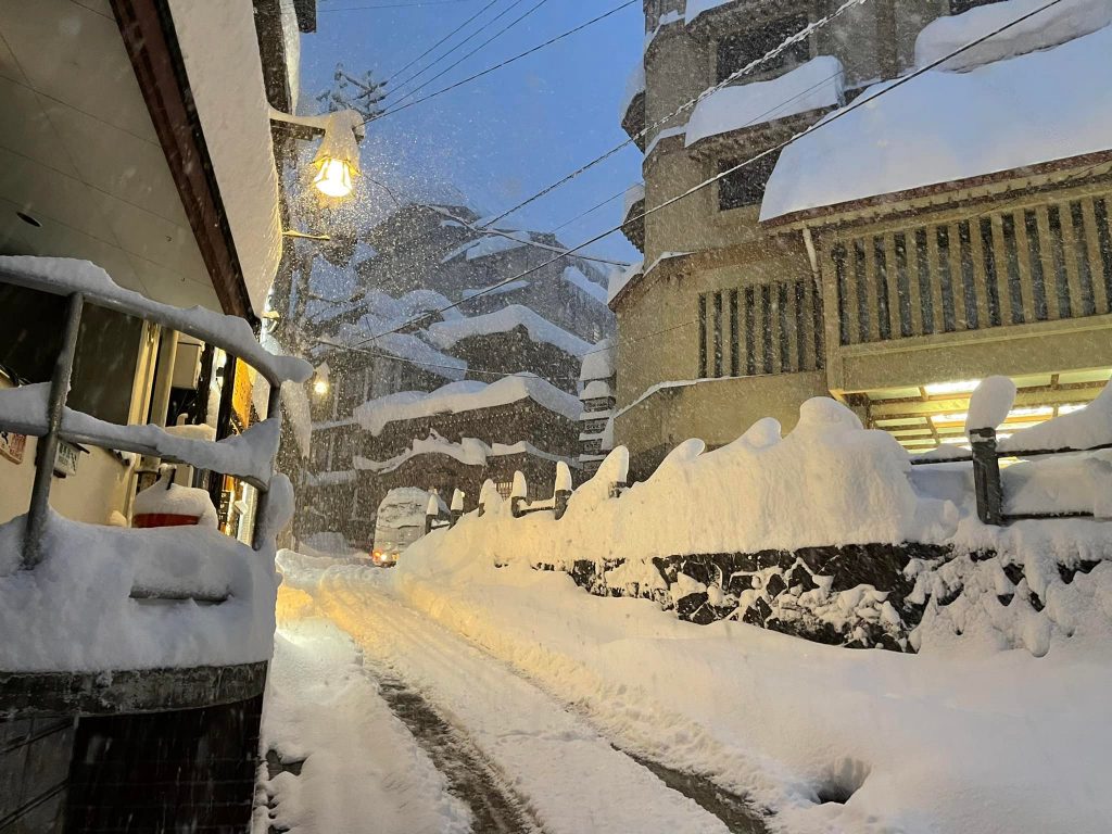
JAPAN REPORT Japan continues to post some of the best snow data in the world this winter, at least in terms of snowfall volumes and total depths. Kiroro (370/490cm / 148/196”) is posting the world’s deepest base including another 90cm (three feet) of snow in the past seven days. It’s been a week that once more has been cold (5 to 15 degrees below freezing) with snowfalls daily. Niseko (230/400cm / 92/160”) has hit a four-metre base and nearly nine metres (30 feet) of season snowfall to date. It has been even snowier than Kiroro with 1.2 metres (four feet) of snowfall in the past week.
JAPAN FORECAST The forecast is for more cold temperatures and more snowfall for the coming week for most Japanese ski areas. Temperatures will generally be below freezing and getting as low as 15 degrees below in places.


