WORLD SNOW ROUNDUP #225
Issued: 12 January 2022
By Patrick “Snowhunter” Thorne
European Roundup
North American Roundup
Asia Roundup
WORLD OVERVIEW
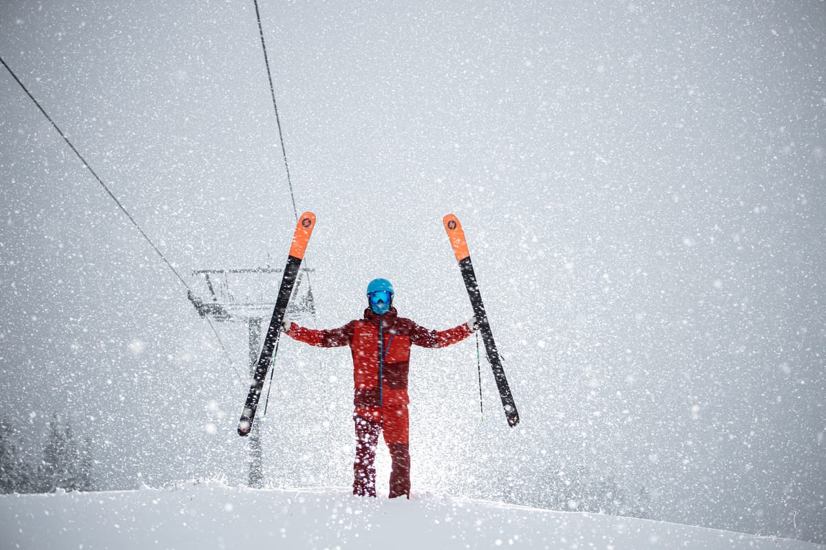
Approaching mid-January should be cold and snowy in most of the northern hemisphere’s ski regions and the past week hasn’t disappointed. The heaviest snowfall has been reported in North America’s Pacific Northwest, the Rockies and Japan, as is often the case. But it has also been snowing almost everywhere else, including a heavy snowfall for more southerly states in the eastern US, which was one of the regions which had been suffering a prolonged warm and dry start to the season until now. Most areas have stayed below freezing too, with Scottish centres re-opening slopes beyond their beginner runs for the first time since mid-December. Some of the lowest temperatures (20-30 degrees below freezing) have been reported in Eastern Canada, Scandinavia and the US Midwest. The deepest snow depths have reached or passed the 3 metre/10 feet mark at resorts in North America (US), Europe (French Pyrenees) and Asia (Japan). The other good news is that despite the omicron surge in most countries, all have so far allowed ski areas to open meaning you can ski in more than 50 countries at present.
EUROPE INTRODUCTION
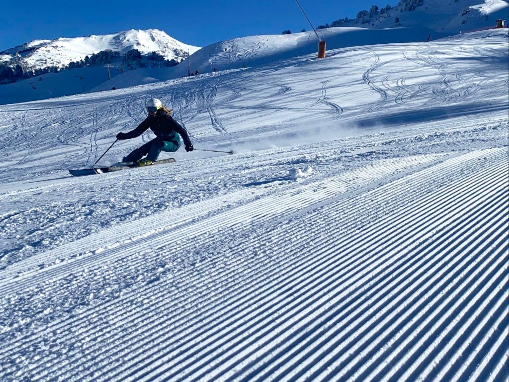
A mostly good week on European ski slopes with most areas seeing some fresh snowfall and predominantly low temperatures. With the omicron variant still surging it might also be noted that so far all ski areas across the continent remain open, albeit with ever tighter restrictions and the increasing requirement that skiers and boarders be fully vaccinated or recovered from an infection. The option to arrive unvaccinated but with a recent negative test is available in fewer and fewer countries. The sun is now out across much of the continent and is expected to remain so for most of the week in most areas. It should stay fairly cold though, although again temperatures look to be climbing in the valleys towards the weekend.
AUSTRIA
AUSTRIA REPORT| There has been a dramatic improvement in snow conditions in much of Austria after the warm and wet start to the new year. After temperatures plummeted a week ago back below freezing, the snow started falling at the end of last week and now the sun is back out in many areas. Friday to Sunday saw ski resorts report up to 60cm (two feet) of fresh snowfall although this was driven in on gale force winds at times, which closed some centres and limited operations at others as visibility diminished and avalanche danger increased. The deepest snow depths in the country have gone back above the two-metre (7 foot) mark for the first time since before Christmas with Flachauwinkl and the Kaunertal Glacier both reporting 2.2m (7/3 feet) on upper slopes. The Skiwelt (62/92cm / 25/37”) continues to post the most terrain open in the country (about 240km/150 miles of runs).

AUSTRIA FORECAST| The snow showers should clear and we will have a sunny latter half of the week and weekend across much of Austria, which should mean glorious conditions. Temperatures rising and may reach positive numbers in the valleys by Friday but hopefully not getting much above freezing and staying below in the mountains.
SWITZERLAND REPORT| Switzerland also saw a snowy start to the week with Sunday and Monday seeing the greatest accumulations of 20-50cm (8-20″) in most areas. Most centres have seen sunshine return from late Monday or early Tuesday but temperatures remain low. Engelberg’s Titlis (20/260cm / 8/104”) is posting the country’s and the Alps’ deepest base but is showing an issue of lower altitude snow cover which is starting to impact more resorts meaning more snowfall would be welcome, although there’s nothing in the immediate forecast at present. In any case, most Swiss areas have enough snow to open most of their slopes. The 4 Valleys has about 90% of its 410km of runs open now.
SWITZERLAND FORECAST| sunny week is forecast across Switzerland too with temperatures climbing at the end of the week and getting into positive numbers in the valleys, but staying below freezing up high.
FRANCE REPORT| Fresh snowfall over the past week has bolstered and freshened up the French snowpack after a lean few weeks, cold temperatures have been good news too. French resorts posted 20-40cm of snowfall in the latter half of last week and then the same again on Sunday/Monday. Most remain fully open although there’s continuing nervousness about the huge number of omicron infections and ever-tightening restrictions on daily life. Although the country’s deepest snowpack is still reported down in the Pyrenees, famously snowy Bonneval sur Arc (120/240cm / 48/96”), over the back of Val d’Isere, now has the deepest snow reported in the French Alps.
FRANCE FORECAST| It has been sunny again after the latest snowfall for most French resorts. Temperatures remain double-digits below freezing at present but are set to climb towards the weekend and may get into positive numbers again by Saturday down in the valleys, although the forecast may change a little by then.
ITALY REPORT| New pandemic rules came in to force in Italy from Monday requiring all skiers aged 12 and over need a Covid Certificate that confirms they are vaccinated or recovered (Super Green Pass), to access all lifts, ski lifts and gondolas meaning only people who have been vaccinated or recovered from Covid-19 are now allowed to access lifts, bringing the country into line with Austria, Germany and several other leading ski nations. The Super Green Pass is also needed to enter huts, bars and restaurants. There’s been some snow in Italy this past week, but not so much as further north and west. That said ski areas in the country’s northeast have some of the deepest snow, with La Thuile (110/180cm / 44/72”) posting the deepest at present. It has been sunny pretty much everywhere since the weekend.
ITALY FORECAST| The sunny weather is set to continue for the remainder of the week, with temperatures staying below freezing. Warmer towards the weekend but unlikely to get much above freezing even in the valleys on the current forecast.
GERMANY REPORT| Germany’s poor start to 21-22 is gradually easing with nearly half of the country’s ski areas now open. That half includes virtually all the major destinations, it’s all the smaller, lower ski hills that have been unable to open for lack of snow cover. But the past week has seen cold and snowy weather to lower elevations, transforming things for the better. Oberstdorf (40/140 cm / 16/56”) now has the country’s deepest base, Reit im Winkl (17/70cm / 7/28”) the largest ski area in the country at present with 38km (24 miles) of runs. The snowfall continued to Sunday or Monday in most areas, but skies have now cleared, although it has remained cold.
GERMANY FORECAST| The dry weather will continue for the remainder of the week and after some midweek clouds, most areas should see sunny skies for the weekend. Temperatures will rise but remain subzero at altitude and should not get far into plus temperatures in the valleys.
SCANDINAVIA REPORT| Conditions continue to improve in Scandinavia with some of the heaviest snowfalls of the season so far reported in the past seven days. Among them, Norway’s Bjorli received about 25 cm (10”) of snow in 24 hours at the end of last week. It’s been very cold though with Sweden’s Idre Fjall reporting temperatures below -20C at the base (warmer on upper slopes) and suggesting skiers limit slope time and keep an eye on each other. Sweden’s Are (40/77cm / 16/31”) continues to post the largest amount of terrain open, more than 70km (45 miles), approaching double its nearest competitor at present.
SCANDINAVIA FORECAST| A mixed forecast withs some parts of the region including western Norway forecast to receive snowfall daily for the next week, potentially receiving more than a metre of snowfall, while further inland many areas look set to stay largely dry and hardly see a flake! What is common to all is cold temperatures, typically in the range of 5 to 20 degrees below freezing.
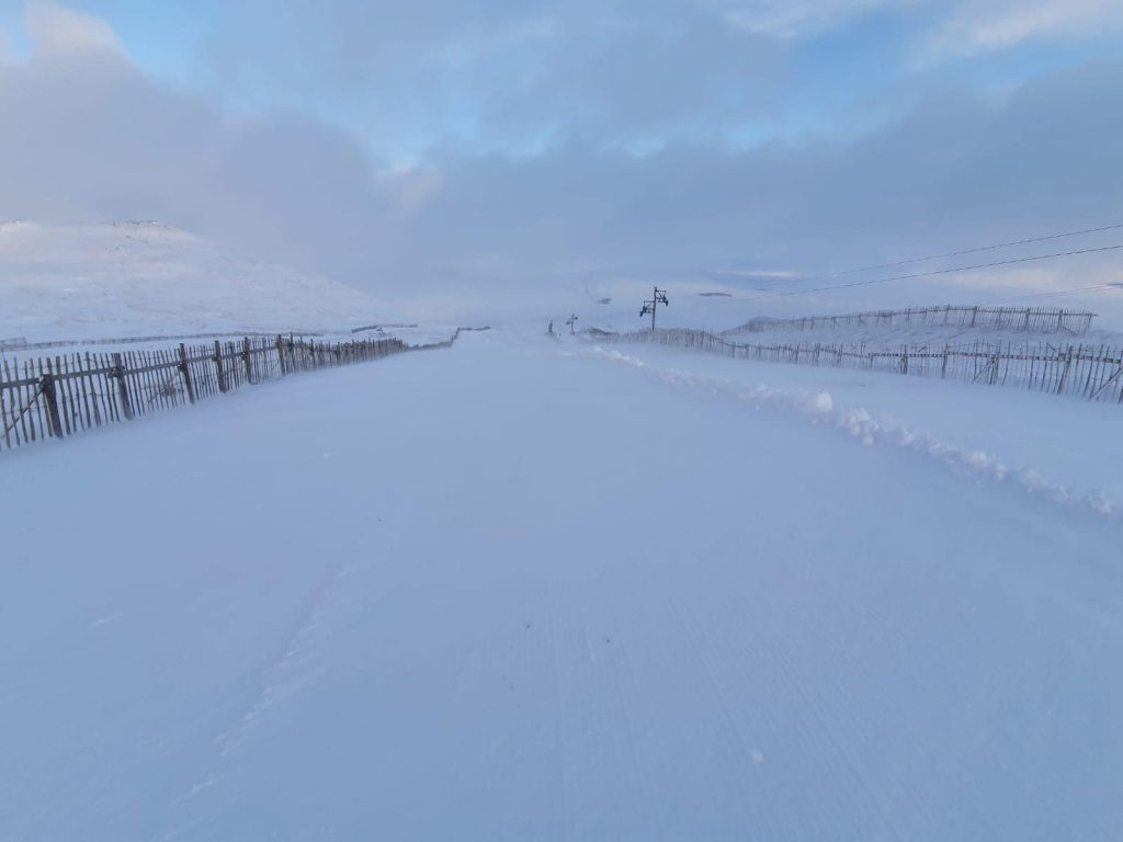
SCOTLAND REPORT| The cold weather continued last week on the Scottish mountains allowing four of the five commercial centres to open a few runs beyond the nursery slopes they’ve been maintaining thanks to their all-weather snowmaking systems. At Glenshee they have had the Plastic, DinkDink and Rope Tow operational, at The Lecht their two Magic Carpets, Eagle, Osprey and Grouse lifts, but at both centres, they’re stressing its very “early season conditions” and limited ticket availability. Glencoe and Nevis Range are also open, the latter for the first time since March 2020. Cairngorm is too but so far just a large nursery slope area still. Unfortunately, temperatures are warming a little this week which may impact operations.
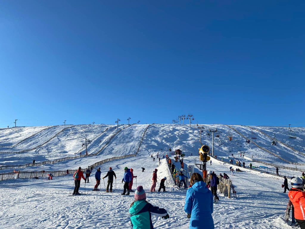
SCOTLAND FORECAST| Unfortunately, those temperatures could reach 10 degrees above freezing over the next few days down in Scottish glens which isn’t great news for the thin cover at lower elevations, but hopefully cooler, higher slopes will ride out the current upswing in temperatures until the next dip expected after the weekend.
SPAIN / ANDORRA REPORT| A good week in the Pyrenees after the thaw around the new year with snowfall returning over the weekend and into the start of this week and temperatures double digits below freezing. The region continues to post some of the deepest bases in Europe despite the recent snowfall in the Alps with Porté Puymorens (110 /300cm / 44/120”) still posting the continent’s deepest base and the only ski area to have hit three metres/ten feet. The region’s largest areas like Andorra’s Grandvalira (70/130cm / 28/52”) and Spain’s Baqueira Beret (140/205 cm (56/82”) have almost all their terrain open, about 160km/100 miles of runs each.
SPAIN / ANDORRA FORECAST| The sunny week that has followed the snowfall at the weekend is set to continue for at least the remainder of this week. Temperatures are set to climb towards the weekend but it should remain sub-zero in the mountains, perhaps reaching +5 in lower valleys by Saturday.
BULGARIA / ROMANIA REPORT| After warm temperatures in the middle of last week it has been much colder and frequently snowing through the weekend and the start of this week. Pamporovo (70/130 cm/ 28/52”) has the deepest base at present but Bansko (10/100cm / 4/40″) has the most terrain open in the region with 95% of its 48km of runs skiable including the long home run back to the resort.
BULGARIA / ROMANIA FORECAST| A drier few days ahead and into the weekend but staying cold – double-digits below – in the mountains which should be good news for snow conditions for the coming week. It’s looking warmer by the weekend but still staying close to freezing.
CZECH REPUBLIC / SLOVAKIA REPORT| An improving picture over the past seven days after a week or two battling warm weather and rain for many areas in the region. Špindlerův Mlýn (25/50cm / 10/20”) which had only had a third of its terrain open a week ago expanded that to 13km (8 miles) of runs after 15cm (6”) of fresh snowfall at the weekend. Since the snowfall, it has been largely dry but more crucially the temperatures have stayed 5-10 degrees below freezing day and night from the valley to the top of the slopes soi no more thawing and cold enough for snowmaking.
CZECH REPUBLIC / SLOVAKIA FORECAST| It looks like fairly glorious sunny weather for the next few days with temperatures remaining cold.
NORTH AMERICA
NORTH AMERICA INTRO| Plenty of snow falling across North America this week, but also, unfortunately, associated access road closures, power outages, high avalanche danger and iced lift cables. On the one hand, this means plenty of reports of fabulous powder days, but equally of ski areas closed for multiple days because staff can’t get to them. There’s also an added complication being reported of ski areas unable to open terrain that’s ready to open because too many staff are isolating or ill with the omicron variant of the virus. All that being the case, the big picture is of still more heavy snowfall in the northwest, the best conditions yet in the Rockies with some areas reporting another five feet (1.5m) of snowfall over the last seven days, and a much-improved picture in the east where ski areas that had been unable to open for lack of natural snowfall and temperatures too warm for snowmaking nearly all now have thanks to cold and some good natural snowfalls in recent days.
ROCKIES REPORT| Another week of very snowy weather in the Rockies with Jackson Hole among those reporting another five feet of snow. It’s not all been floating down gently though with driving winds causing blizzard conditions at the time closing access roads and slopes. Snowbird in Utah was one saying it had major issues de-icing lift cables at the weekend too. Colorado has also been hit by high numbers of omicron cases which have led some areas struggling to find staff to man lifts, causing fresh issues with opening terrain, according to the Denver Post. But against that most resorts in Colorado have indeed been opening more terrain and Wolf Creek (90/101” / 224/254 cm is posting the deepest snow in the US Rockies and says its runs are 100% open. It posted pictures on Tuesday of staff digging out a buried snowcat after 14 feet (4 metres) of snowfall at the start of the new year.
ROCKIES FORECAST| After all the snowfall the week ahead looks largely dry in the Rockies with plenty of sunshine, as it has been since the weekend. The exception is Friday when a weak front may bring some snowflakes. Temperatures well below freezing up high but rather warm conditions once more forecast for mountain bases, 5-10 degrees above freezing by the weekend.
USA WEST REPORT| TheWest continues to see the heaviest snowfall in North America after setting records for snow volumes in the final weeks of December. The only problem is that the amount of snow, as well as gale-force winds driving it in, is repeatedly causing full or partial closures. Resorts around Mount hood in Oregon were closed due to road closures after another three feet (90cm) of snow fell midweek, but partially reopened at the weekend. It’s good news for Timberline which will aim to stay open through to early September. Thanks to all the snowfall West coast US ski areas hold the top 10 places for deepest snowbases in North America with Mt Baker (135/172” / 337/429cm) and Mammoth (88/170” / 220/424cm) the only two worldwide reporting more than a 14 feet/4 metre base up high. Both are also 100% open other than when closed by bad weather conditions.
USA WEST FORECAST| It does look like it should be much drier for the week ahead, with largely sunny conditions. Temperatures as low as20 below freezing up high but climbing into positive numbers at bases later in the week. Some snow po0ssible from a fr9ont due to move through on Friday but otherwise looking much more settled.
MIDWEST REPORT| Quite a mixed picture is developing in the Midwest with very cold weather for some (ski areas in South Dakota closed for a time last week due to wind chill worries), whilst in Ohio, the battle continues to open much terrain against a background picture of warm weather. Overall though things continue to improve with temperatures staying low enough for most. In the north around Michigan and Minneapolis, it’s typically very cold, dry and still, so snowmaking systems can fire up. Mount La Crosse (12/50″ / 30/125cm) in Wisconsin is posting one of the deepest bases in the region.
MIDWEST FORECAST| More dry, often sunny weather is expected through the next seven days across most of the region, with very low temperatures – 20 to 30 below freezing, possible in the north which may limit operations at times. Good for snowmaking though.
USA EAST REPORT| The battle to open terrain against predominantly too warm conditions continues. Most of the major ski areas in the north seem on top of things now with mostly cold conditions and a mix of natural snow and machine-made. Further south though it remains marginal. Winterplace Ski Resort in West Virginia finally opened at the weekend and after a heroic snowmaking battle. The same is true for resorts in North Carolina which posted their third warmest December on record. Other states including Pennsylvania and Ohio are also affected.
USA EAST FORECAST| Changable weather over the next few days with periods of sunshine and cloud and some snow showers expected on Friday ahead of a sunny weekend. It should stay cold – typically 10 to 20 degrees below freezing, at most ski areas.
CANADA
CANADA WEST REPORT| Conditions remain top-notch in Western Canada with more decent dumps of powder building bases and everything open. Big White reported 20cm (8″) more snow in a pre-weekend storm. Mount Seymour (260/318 cm / 104/127″) now has the deepest base in the region overtaking Whistler Blackcomb (390/2350cm / 12/100”) although it remains fully open with the largest area in North America and is building its lower slope base which has been thin until now
CANADA WEST FORECAST| The weather is looking mostly cloudy and largely dry in Alberta and BC for the coming week. Much warmer than it was a few weeks ago, in fact getting into positive temperatures further west, although only just and only at the mountain base. There’s a band of snowfall forecast to move across the area at the start of the weekend but probably only bringing light snowfall.
CANADA EAST REPORT| It has stayed very cold in Eastern Canada over the past week, as it should be in mid-January, and ski areas there are continuing to catch up after the warm and wet Fall months there. Tremblant (10/88cm / 4/35”) is continuing to post both the deepest base in the region and the most terrain open of the larger resorts in the region with 66km (41 miles) of runs skiable. That’s up to about 85% of its total area and the largest amount yet this season.
ASIA
JAPAN REPORT| It has been another good week in Japan with many areas reporting 5-15cm (2-6″) snowfall top-ups daily and Niseko (155/305cm / 62/122″) now one of the few ski areas in the world posting a 3m (10 feet+) base. It has also gone through the 5m (200″) season-to-date snowfall total mark in the past few days. Perhaps more important is the consistency of snowfall and low temperatures (although a bit of a warm-weather brief blip occurred on Tuesday). Winds have also been relatively light over the past few days.
JAPAN FORECAST| The snowy weather is set to continue and indeed intensify over the next few days with heavier snow expected up to the weekend. Even then the snow should keep falling but with a return to lighter falls.


