WORLD SNOW ROUNDUP #224
Issued: 05 January 2022
By Patrick “Snowhunter” Thorne
European Roundup
North American Roundup
Asia Roundup
WORLD OVERVIEW
Europe saw a largely dry and alarmingly warm end to 2021 with temperatures getting to double-digits above freezing and setting new high-temperature records in some places for New Year’s Eve and New Year’s Day at the weekend. Thankfully, things have changed since the start of this week though with temperatures dropping back down towards freezing and below with a return to snowier weather as well.
In North America the stormy end to 2021, which saw record snowfall totals for some areas on the western side of the country, has continued to some extent into the new year with more dynamic weather for the east as well during the first week of 2022. Most of the continent has now got average to above-average snow cover for this point in the season but some more southerly ski areas in the east and some in the midwest have had to close due to warm, dry weather still, so it’s not quite yet a normal winter everywhere.
Across the northern Pacific in Japan, where travel remains closed to inbound tourists, the country has been seeing some of its famously intense snowfall with some areas reporting more than two metres (seven feet) of snowfall over the New Year weekend.
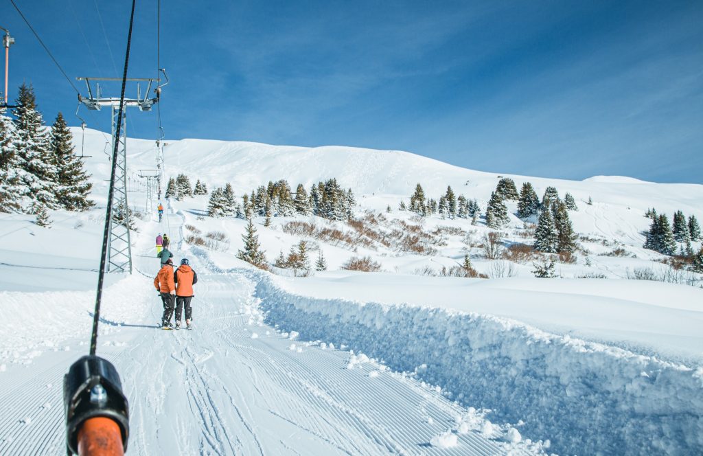
EUROPE INTRODUCTION
A bit of a roller-coaster weather week in the Alps and much of the rest of Europe with first up to 50cm (20”) of snowfall reported in the middle of last week in the western Alps then a rapid rise in temperatures to +10C and in some cases higher even at high elevations, meaning a thaw and temperatures falling again. Then a sunny weekend to start the new year saw temperatures begin to dip again and the new week has seen a return of snowfall to many areas with more snow and low temperatures in the forecast for the remainder of the week. So far, all areas remain open despite the growing number of Omicron cases across the continent and New year weekend once again saw the most terrain open since the beginning of the pandemic with most areas at least 80% open and some 100%.
AUSTRIA
AUSTRIA REPORT| Almost all Austrian ski areas were open for New Year week and most are now fully open. The deepest snow is, as usual, on the country’s glaciers with Sölden (84/197 cm / 33/79”) posting the country’s deepest. The SkiWelt Wilder Kaiser-Brixental (70cm/100cm / 28/40”), also in Tirol, has the most terrain open with 233 km of its 288 km of runs currently skiable. The country perhaps suffered more than others with the warm weather and rain at the end of last week, which actually left snow depths a little down at New Year compared to Christmas; an unusual pattern. But low temperatures over the past few days and fresh snow have now improved things again with little long-term damage done, seemingly, on the seasonal snowpack.
AUSTRIA FORECAST| After the warm spell, we’re now back to predominantly subzero temps with occasional snow showers for most of the country’s ski areas. Light to moderate most days with a sunny but still cold start to the weekend followed by heavier snowfall to start the new week. Overnight lows are good for snowmaking too, daytime highs staying below 5C in the valleys and mostly subzero.
SWITZERLAND REPORT| Engelberg (30/270cm / 12/108″) continues to post the deepest base in Switzerland and the Alps. It has been the third week in a row with not much fresh snow to report and like the rest of Europe, a very warm one around New Year. However, temperatures have been dropping and a midweek snowstorm is getting underway, which should give the best accumulation since mid-December. Snow depths are adequate to good across most of the country thanks to early December dumps and ski areas opened the most terrain yet over new year with the 400km+ of the 4 Valleys (509.150cm / 20/60”) about 80% open.
SWITZERLAND FORECAST| The remainder of the week is looking much snowier than the past few with snow showers forecast most days and temperatures staying well below freezing down to the valley floor, day and night.
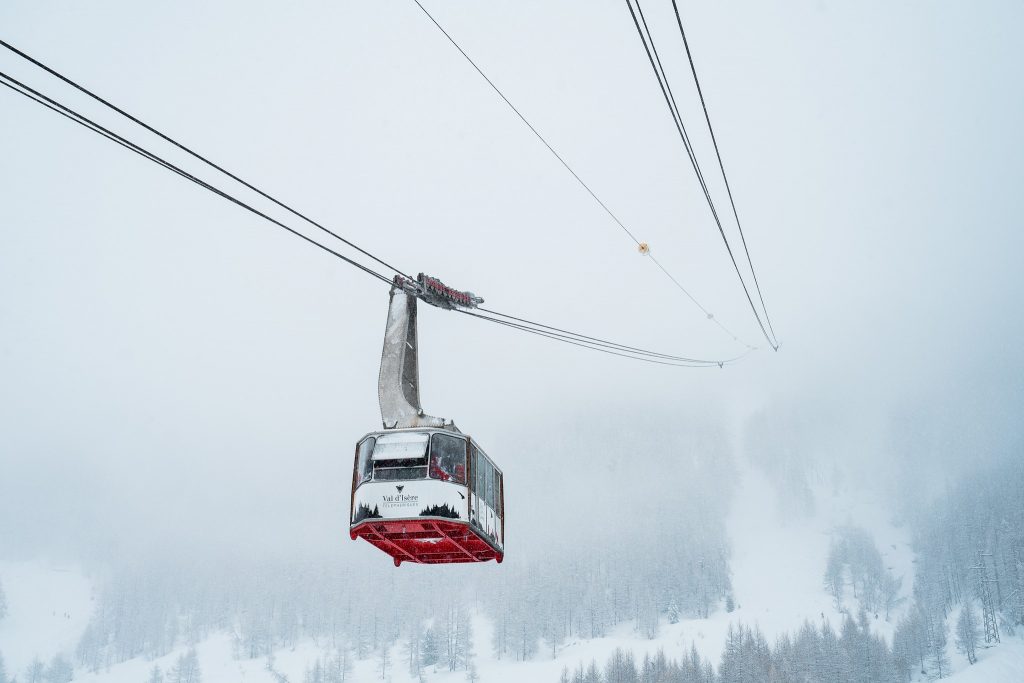
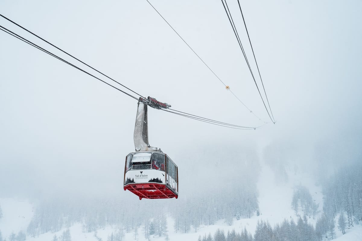
FRANCE REPORT| There was some good news in the French Alps towards the end of last week when snowfall ahead of a warm snap turned out to be heavier than forecast with several ski areas above 1800m reporting up to 50cm (20”) of fresh by Thursday last week. The downside of the new snow set against warming temperatures was the avalanche danger jumping back up to 4 out of 5 on the danger scale. It was a warm weekend here, as in most parts of Europe, but it is getting cooler again now. The deepest snow in the country and indeed all of Europe remains down in the French Pyrenees where the snowpack is down a little on previous weeks but still at 3m/10 feet. Most of France’s huge ski areas are 80-95% open. It has been a snowy start to the week in France after a dry fortnight, with ski areas reporting up to 30cm (a foot) of fresh snow since Christmas Day. The country’s large ski areas are close to fully open for the first time since early March 2020, with the world’s biggest area, The 3 Valleys, stating more than 90% of its slopes are currently open. The country is, however, reporting record coronavirus infections, topping 100,000 on Christmas Day for the first time, and it is not yet known if this will impact operations. The deepest snow in the country is actually being reported in the Pyrenees down at Porté Puymorens (140cm/330cm / 56/132”) with the deepest in the Alps at Avoriaz (50/220cm / 20/88”).
FRANCE FORECAST| Much colder than a week ago, with lows double digits below compared to highs double digits above freezing at the end of last week. Mostly cold and dry but Wednesday/Thursday should see a significant snowstorm bring 20-40cm (8-16”) of fresh snowfall to French slopes.
ITALY REPORT| The warm weather hit Italy on Wednesday night last week leading to the cancellation of the third world cup race planned for Bormio last Thursday, a GS that had already been postponed from Lake Louise the previous month. Rain, as well as warm temperatures, had made the snow surface too unstable for skiers descending at 120kph (75mph) although the slopes remained open to recreational skiers. Thankfully, things have improved dramatically since this low point of the season last week with colder temperatures and fresh snow. Cervinia’s (5/105cm / 2/42”) area shared with Zermatt has one of the larger areas open in the country, after Dolomiti Superski, with about 260km (160+ miles) of the 320km there open. The Milky Way/Via Lattea (20/40cm / 8/16”) is reporting one of the thinnest bases in Europe and less than half of its 400km (250 miles) of terrain open, however.
ITALY FORECAST| Most Italian ski areas should see a welcome 15-30cm, 6-12 inches of snowfall over the next few days before drier weather in the latter half of this week. Overall, it is looking to be a much-improved picture with temperatures back below freezing for the coming week.
GERMANY REPORT| Germany appears to be suffering from the warm weather with most of the country’s smaller ski areas currently closed as a result, although 50 or so of the larger ski areas have at least some terrain open. But temperatures in the teens above freezing and rain over the weekend made it an unhappy New Year for many ski area managers. Surging pandemic numbers are also a concern. Reit im Winkl (17/60 cm / 7/24”), down by the Austrian border, reports the most terrain kept open with 38km (24 miles), about 90% of its total ski area.
GERMANY FORECAST| It does look more promising for many areas for the week ahead with temperatures dipping below freezing and much of the precipitation forecast to be snow rather than rain so hopefully that will mean an improved picture this time next week.
SCANDINAVIA REPORT| Scandinavia has fared better than much of the rest of Europe with the recent warm weather, but here too it’s not been a particularly epic start to the year in terms of snowfall. Åre (30/64cm / 12/26”) in Northern Sweden has the most terrain open in the region with 72km (40 miles) from its 91km (47 miles) of runs open. Over in Norway, Trysil (26/29cm /11/112″) doesn’t have much snow lying but has managed to report the most terrain open there with 32km (20 miles). The deepest reports base is, like last week, at Kåbdalis (65/110cm / 32/44”).
SCANDINAVIA FORECAST| A mixed picture with drier weather in the south and west. But plenty of light to moderate snowfall forecast in the north and west, particularly Lapland. Temperatures double-digits subzero everywhere though.
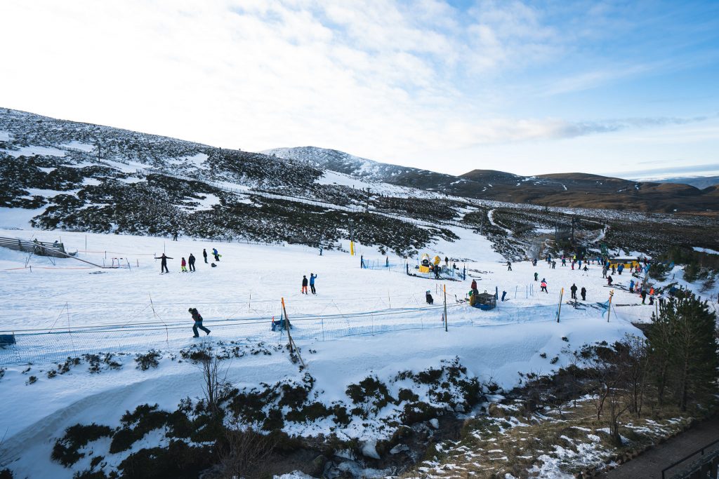
SCOTLAND REPORT| Scotland has been suffering the same warm weather problems that have impacted much of Europe. There had been very little terrain open as it was. But after the mid-December warm spell wiped out early season cover, there had been some recovery over Christmas with low enough temperatures allowing conventional snowmaking. But back up to double-digits above freezing over New Year left little or no cover at some centres despite all-weather snowmaking machine trying to keep up. Limited novice terrain was kept open though but slots available to access it are generally booked up days and sometimes weeks ahead as they are so few at present. The new week has seen a transformation, however, with blizzard conditions blowing in raising hopes that more can open soon.
SCOTLAND FORECAST| The improving picture on Scotland’s mountains should continue at least through to the weekend with temperatures at or below freezing and frequent snow showers. This should allow centres to use conventional snowmaking where they have it and to start to re-build bases.
SPAIN / ANDORRA REPORT| The warm temperatures that impacted the Alps over the weekend lasted longer and into the start of this week in the Pyrenees where valley temperatures were still close to +10C buy Tuesday, although it was cooling. Snow depths are looking good in the Pyrenees, however, where most resorts are open and close to fully open as elsewhere in Europe. Grandvalira (75/150cm / 30/60”), in Andorra, is reporting the most terrain open – 175km (109 miles), but the large Spanish centres are not far behind, while French areas are posting the deepest snow.
SPAIN / ANDORRA FORECAST| The three weeks of largely dry and recently warm conditions in the Pyrenees should break over the coming week with colder, cloudier weather forecast from Wednesday on and generally light to moderate snowfall most days for the rest of this week, getting heavier at the weekend.
BULGARIA / ROMANIA REPORT| It has remained close to freezing and mostly below in the mountains of southeastern Europe but down in the valleys temperatures have been well above. Despite this, ski centres like Bansko (10/130cm / 4/52”) have maintained slopes back to resort with grooming efforts. Higher elevations are in good shape thanks to recent snowfall.
BULGARIA / ROMANIA FORECAST| There’s not much snowfall forecast for the week ahead, just a mix of sunshine and cloudy days. Temperatures should stay cooler than last week, however.
CZECH REPUBLIC / SLOVAKIA REPORT| A warm end to 2021 and start to 2022 in the Czech and Slovak Republics too. Here things have also cooled in recent days though and although rather warm in the valleys still at the start of this week with more rain lower down, the upper mountain has seen snowfall. Špindlerův Mlýn (30/45 cm / 12/.18”) is reporting the largest ski area open in the Czech Republic.
CZECH REPUBLIC / SLOVAKIA FORECAST| It is looking more consistently colder through the remainder of this week and into the weekend, not climbing above freezing and reaching 10 below in the mountains overnight. Some light snowfall is expected with hopefully greater accumulations later in the weekend.
NORTH AMERICA
NORTH AMERICA INTRO| The ski season continues to get back on track across North America with ski resorts on the West Coast that couldn’t open in November and early December due to warm weather and no snow reporting increasingly huge accumulations which have then stopped them from opening again as they dig out and make slopes safe. At least one Californian ski area reported all-time December snowfall records, despite getting almost nothing in the first half of the month, passing 200 inches (5 metres) in total. The snowfall also continued further east where several ski areas in the Rockies reported their snowpacks now actually above the seasonal average at this point in the season for the first time in winter 21-22. One reported seven feet (over 2m) of snowfall in the final week of 2021. Still a little more problematic further east and in the Midwest. Up in Canada and the US Northeast is now pretty much consistently cold allowing for snowmaking and for precipitation to fall as snow rather than rain. But further south on the East Coast as well as inland in the Midwest there are ongoing problems with some ski areas still yet to open or forced to close again after opening over Christmas.
ROCKIES REPORT| It’s a constantly improving picture in the Rockies, although still something of a mixed one with a few areas seeming to get more than their fair share of the recent snowfall. Among them, Crested Butte (85/85” / 212/212cm), in Colorado, received more than five feet (1.5m) of snowfall in the days leading up to New Year. Another Colorado resort, Telluride, announced that after all the snow they’d had recently their base was now at 110% the average for this point in the season, an important claim as the region still has a reputation for below-average snow cover this winter, and that is still the case at low elevations. Vail Mountain was able to open their famed back bowls for New Year’s weekend. Breckenridge also reached the 100 inches (2.5m) snowfall this season so far mark. Wolf Creek (118/136” / 295/340cm) is reporting the deepest base in the Rockies. All the snow has led to high avalanche danger warnings in many areas.
ROCKIES FORECAST| A largely cold and frequently sunny week ahead in the Rockies. That said, light to moderate midweek snowfall is forecast and a brief (hopefully) spell with warmer temperatures (5-10 degrees above freezing at the mountain base) going into the weekend.
USA WEST REPORT| Western North America has had the most snowfall in the world over the past fortnight with several Californian ski areas posting December snowfall records with much of those totals recorded in the last 10 days of the month. Mammoth (108/180″ / 269/449 cm) also has the world’s thickest snowpack, good news already for its usual opening run to late spring or early summer. Recent days have seen lighter snowfall than Christmas week but still more has accumulated but with clearer spells allowing for the ongoing process of digging out and making more terrain avalanche safe. Strong winds were an issue again at the weekend though and the danger outside the officially open terrain remains high in many areas though.
USA WEST FORECAST| Changeable weather over the coming week with some clear, sunny days, others cloudy and occasional snow showers. Heavier snow forecast for the weekend when several feet falling at some centres is possible.
MIDWEST REPORT| It’s still mixed conditions in the Midwest as we enter the New Year. On the one hand, ski areas in Wisconsin were reporting the best snowfall so far in the area with 18 inches (45cm) of fresh snowfall in the final days of December, on the other ski areas in Ohio still hadn’t been able to open for the season due to still inadequate snow cover and a lack of consistently cold conditions for snowmaking. That said, about 70% of ski areas in the region are now open with Ski Brule (36/48″ / 90/120cm) in Michigan posting the areas deepest snow. The majority are closer to the one foot (30cm) nark although still have most of their terrain open.
MIDWEST FORECAST| The main feature of the week ahead will be low January temperatures keeping things bitterly cold. Good news for those parts suffering from a warm start to the season. There’s little snow forecast, just the odd light shower, with plenty of sunshine. So snowmaking systems will be needed to build or bolster bases.
USA EAST REPORT| The improving picture in the east is lagging some way behind the west of the US. Although the main ski areas in the Green and the White Mountains to the north are now close to normal for the volumes of snowfall by the start of January in a season, further south ski areas in states like West Virginia have just recorded their driest Decembers on record with just an inch of snowfall and the wider region is so far experiencing one of its ten warmest winters to date. Cataloochee Ski Area in North Carolina and Ski Sundown in Connecticut are reported to be among those forced to close over New Year due to the warm weather. It’s early days of course but there’s no immediate change on the horizon, hopefully later this month. Sunday River (18/32” / 46/81cm) is reporting the most terrain currently open in the east and the deepest base in the region.
USA EAST FORECAST| It will continue to be cold, staying below freezing, through to the weekend. Mostly dry with sunny periods, light fresh snowfall is expected for the end of the week.
CANADA
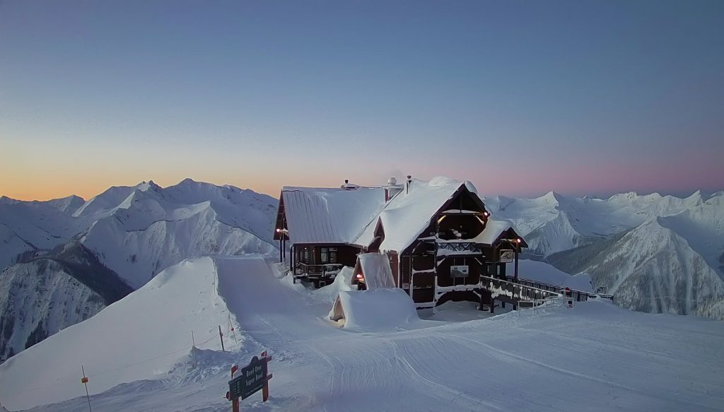
CANADA WEST REPORT| A drier, warmer week in Western Canada but coming after a very snowy and at times in places ”dangerously cold” week previously that’s actually good news. The snow has kept falling but in more manageable 5-10cm freshen-ups most days rather than feet at a time and temperatures are up from -30C to nearer -5 to -20C, so still plenty cold enough. The continent’s biggest area Whistler Blackcomb (10/195cm / 4/78”) has hit its 500cm (17 feet) season to date snowfall total after a slow start to the season. Its terrain is also 97% open now with 234 of 241 runs skiable. Most of the rest of Western Canada’s ski areas are also fully open. Grouse Mountain (175/230cm / 70/92”), near Vancouver, has the country’s deepest snow.
CANADA WEST FORECAST| The current largely cloudy, cool but dry weather will change in the latter half of this week bringing a new front and heavier snowfall across the country from Thursday that should carry on through the weekend.
CANADA EAST REPORT| A still improving picture in the east of Canada where temperatures have finally settled below freezing and all resorts are reported to be open and most now with 50-95% of their terrain open after the warm, wet start to the season slowed things down. Things have been on track for over a fortnight now though and it is beginning to look a lot more like a normal winter. Tremblant (10/164cm / 4/66”) continues to post the deepest base and the most terrain open in the East.
CANADA EAST FORECAST| After the snowy start to the year, it should be a largely dry week ahead with sunny spells. Crucially though, temperatures should remain below freezing the whole time so no more thawing for most areas and low enough much of the time for snowmaking as required where available. Fresh snowfall is expected to end the week.
ASIA
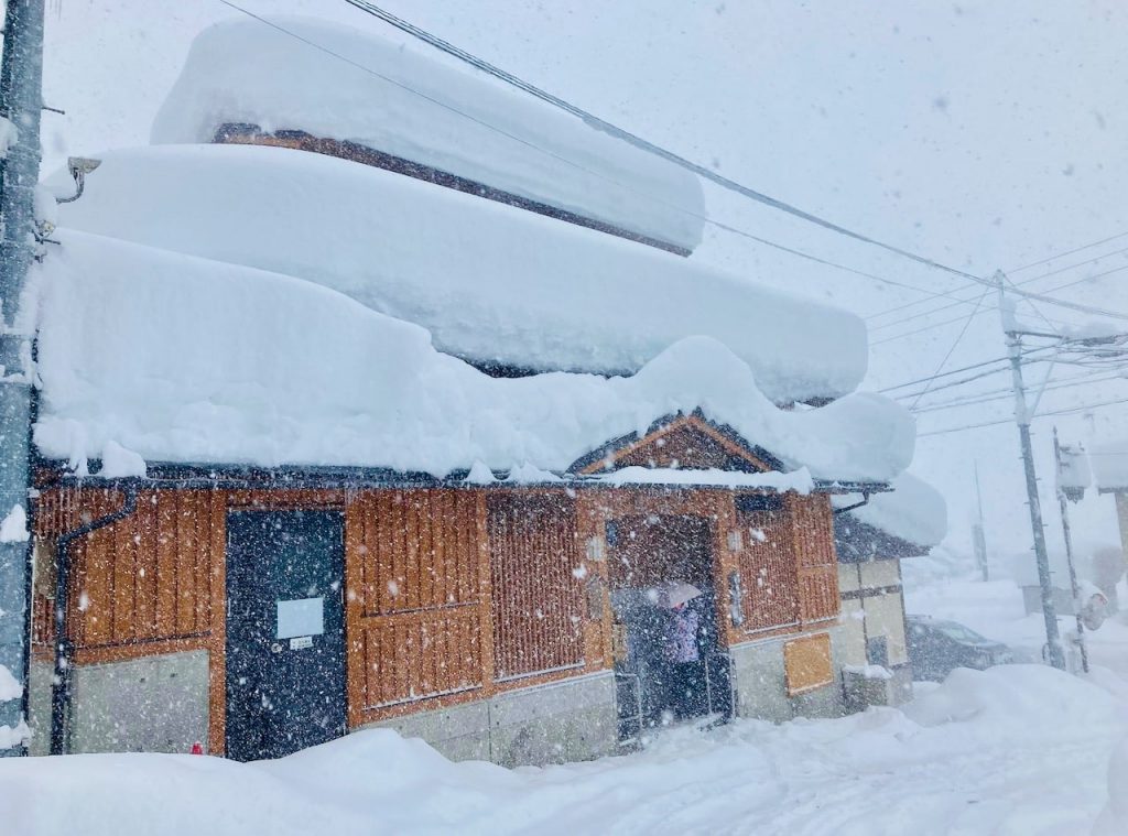
JAPAN REPORT| The snowfalls in Japan over the latter half of December have intensified with some huge accumulations to see in the New Year. Nozawa Onsen (145/225cm / 58/90”) received 135cm (4.5 feet) in 48 hours over Friday/Saturday and nearly 2.4m (eight feet) in the past seven days, about 3/5 of its season to date total. A little less snow this week on Hokkaido after the big Christmas falls but another metre over the past seven days for Niseko (140/275cm / 56/160”) is not to be sniffed at. Temperatures have been very cold at double digits below freezing and strong winds an issue at times.
JAPAN FORECAST| The forecast is for more snowfall and temperatures remaining low over the week ahead in Japan.


