WORLD SNOW ROUNDUP #221
Issued: 15 December 2021
By Patrick “Snowhunter” Thorne
European Roundup
North American Roundup
Asia Roundup
WORLD OVERVIEW
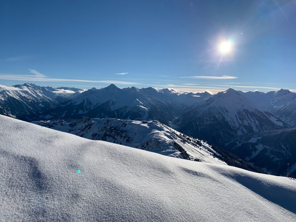
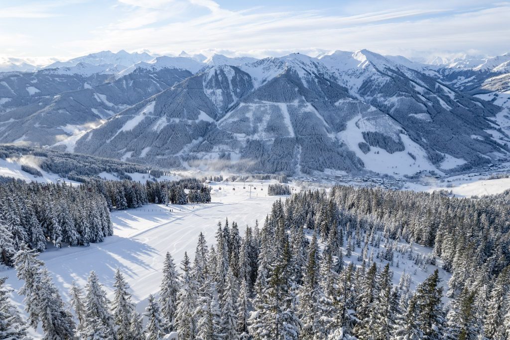
The mood has continued to improve in Europe over the past week after the setbacks of mini-lockdowns and omicron fears. The season remains on a knife-edge because of that latter issue. But, in positive signs for now at least, both Austria and Slovakia, the only two nations to announce short-term lockdowns, have ended them and resorts re-opened to tourism. There’s also ongoing euphoria as ski areas that had not been able to open for over 600 days continue to do so. For a final bonus, there have been huge amounts of snowfall across the Alps for one of the best starts to the season in years. Snow has also been falling in the Pyrenees, Dolomites, Eastern Europe and the ski slopes of much of the rest of the continent. In fact, so much snow has been falling there are claims already that this is the best season start this century. All the snow has also led to high avalanche danger in the Alps and Pyrenees, very unusual for the first half of December.
It’s a fast-improving picture in North America too as the six weeks of dry, warm weather has finally broken and snow fronts with cold temperatures have begun moving across the continent, and currently look set to continue through the rest of the month. As a result, ski areas in states like California, where few could open previously, are now starting to do so and everywhere it’s a much better picture. There have been several feet of snowfall in parts of Colorado and a huge dump is getting underway on the West Coast.
EUROPE INTRODUCTION
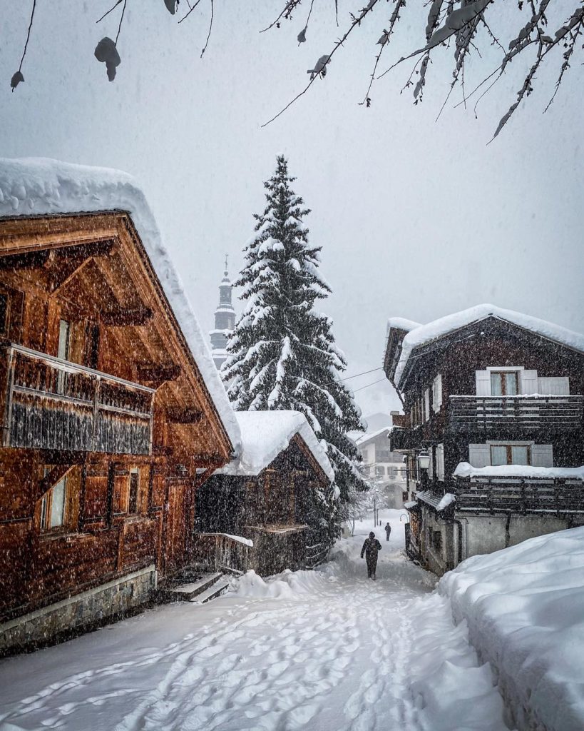
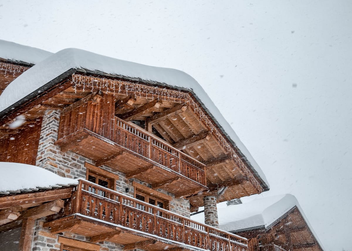
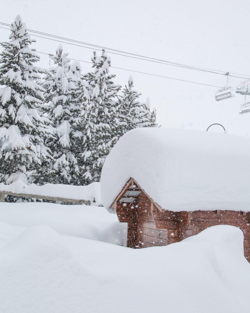
The snow has hardly stopped falling in many European ski areas with some reporting seven-day totals of more than 1.2m (four feet). The western Alps, covering France and parts of Italy and Switzerland, seem to have got marginally the heaviest. But there are unprecedented amounts of snowfall for this early in the winter pretty much everywhere. This is good news in most respects, particularly base building for the season ahead. But in the short term, it has led to high avalanche danger in some areas, hitting level 4 on the scale to 5, and closing much of the terrain at some centres. In fact, several smaller centres closed completely for a few days at the weekend. Beyond all the snowfall it’s worth noting that short term virus lockdowns for Austria and Slovakia ended, meaning every ski nation in Europe is allowing ski areas to open for the first time since March last year and in most cases ski centres have now opened in almost all European nations. That includes Scotland, where four of the five centres opened at short notice at the weekend.
AUSTRIA
AUSTRIA REPORT| There was excitement mixed with trepidation in Austria as the government announced ski areas could re-open from Sunday at the end of the 20-day lockdown, which has halved cases there. Individual provinces could make decisions on when to resume tourism with Tirol opting for day one and other ski states, like Carinthia and Salzburgerland, deciding on this coming Friday. It has also been snowing a good deal across Austria of course, if not quite so much as further west. There have been weather issues including gales closing high slopes at the weekend and bitterly cold temperatures at the end of last week too. About 200 Austrian ski areas are now open (some only to locals until tourism re-opens later this week), with the Ischgl/Samnaun (30.90cm / 12/36”) cross-border Austrian/Swiss area posting the most open at 130km (81 miles) although re-opened Solden (76/196cm / 230/78”) is not far behind with 122km (70 miles) open. It also has the country’s second deepest snow base being Brand (50/250cm / 20/100”)
AUSTRIA FORECAST| After all the snowfall the skies are clearing and it is a sunny and dry week ahead with temperatures climbing back up to seasonal norms. Staying below freezing day and night above around 2000m but daytime highs 5-10C above freezing in valleys and at lower elevations.
SWITZERLAND REPORT| A remarkably snowy week in Switzerland with ski areas there reporting up to 90cm (three feet) of snowfall at the end of last week and into the weekend. Engelberg (90/270cm / 32/128″) has gone from having quite a thin base by its standards to the deepest in the Alps. It has up to 50km of slopes open too. After Samnaun (see Austria) the 4 Valleys (50/150cm / 20/60”) has the most terrain open in the country, and probably the most, on the whole, in Switzerland, with 125km (78 miles) of slopes skiable already. The heaviest snowfall was in the west of the country. The snow ended at the weekend and it has been warmer and drier since Sunday in most areas.
SWITZERLAND FORECAST| The current more settled weather is set to continue through the week ahead with not much snow currently forecast. Warmer, although staying subzero in the mountains, but climbing into positive temperatures in the daytime in the valleys.

FRANCE REPORT| France saw some of the biggest snowfalls of the past week with ski areas like Val d’Isere (97/130cm / 39/52”) issuing avalanche warnings for both off-piste terrain and access roads on Thursday and Friday. It did manage to successfully stage World Cup racing, however. Many areas had to limit terrain open for a while due to safety issues whilst slopes were cleared, or practical issues such as digging them out. Val Thorens (140/190cm / 56/76”)was among many areas posting more than a metre of snowfall. If anything, the snowfall was even heavier in the French Pyrenees where several resorts were closed for several days until avalanche danger eased. About 150 French ski areas are now open. The skies cleared for most around Sunday and it has been dry and sunny since with the avalanche danger easing. About 150 French ski centres are now open and Alpe D’Huez (100/150cm / 4/61″) has the most terrain open so far with 150km (93 miles), about 3/5ths of its available terrain.
FRANCE FORECAST| The current weather looks set to stay through the coming week with clear skies and lots of sunshine. A little below freezing day and night above about 2,000m, getting warmer in the valleys. But not too far above freezing, especially at the mountain stations.
ITALY REPORT| Italy was the first major ski nation to close down its ski centres as the coronavirus pandemic broke in Europe in early March last year. It now has a higher percentage of its ski areas open than any other major ski nation, about 90%. Pandemic spread prevention measures at many include online-only ticket sales and most require the country’s health certificate to be shown. Regional requirements vary a little. Ski areas in the west of the country have enjoyed the huge snowfalls of the Western Alps. Further east and in the Dolomites, there’s been some fresh snowfall, but not so much. Sulden am Ortler (120/180cm / 348/72″), which was one of the country’s first non-glacier areas to open a month ago, is posting the deepest snow. Val Gardena (30/80cm / 12/32″) has the most terrain open, 160km (100 miles) of groomed runs.
ITALY FORECAST| After light cloud cover to start this week, when the snowfall petered out, at last, we are looking at full sunshine through the rest of this week and the weekend. Temperatures staying cold, just getting a little above freezing in the valleys in the afternoon but staying sub-zero at altitude day and night.
GERMANY REPORT| Despite rising pandemic cases and lockdown fears so far Germany continues to allow ski areas to open and has actually eased a requirement that asked vaccinated people to also take a COVID test before going skiing in some areas. Resorts have continued to open and many areas have seen some fresh snowfall. But, currently, it’s about 20% of the country’s centres open with many more likely to join them this coming weekend. Brauneck – Lenggries (40/95cm / 16/38”) has the most terrain open in the country, about 32km (20 miles) of runs while the highest and longest open slopes on Zugspitze (85/130cm / 34/52cm) have the deepest snow.
GERMANY FORECAST| Following the snow last week it has turned warmer, with a little rain at lower elevations and now drier too with the forecast increasingly sunny for the week ahead.
SCANDINAVIA REPORT| About two-thirds of Scandinavia’s ski areas are now open in Finland, Norway and Sweden. It is not super snowy yet though with fairly limited terrain open so far. Norway’s Voss Resort (20/75cm / 8/30″) is posting the biggest amount so far with 20 of its 45km of slopes open. The deepest snow is in the north, still on the Norwegian side, with Narvik (15/100cm / 6/40”) posting the deepest. The past few days have been the snowiest for a while with some areas seeing 20-30cm (8-12”) of fresh snow on Tuesday.
SCANDINAVIA FORECAST| After all the snow to start the week it’s looking drier for the remainder of this week with skies clearing towards the weekend and temperatures falling again.
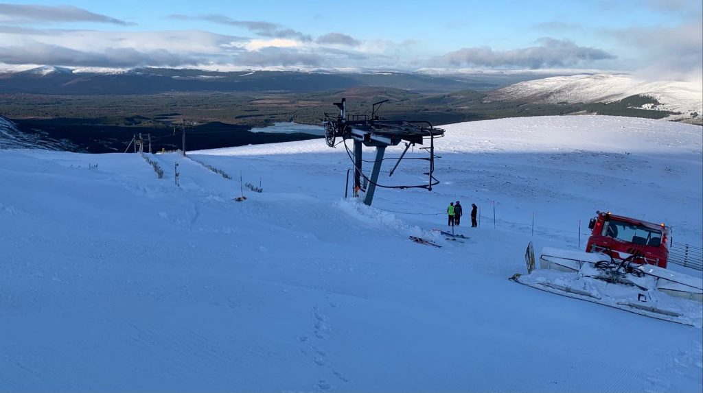
SCOTLAND REPORT| There was big news from Scotland at the end of last week when Glenshee (30/30cm / 12/12”) opened limited terrain for skiing and boarding, the first to be lift-accessed in Scotland since the start of the second lockdown in early January. It was quickly followed by Cairngorm (30/30cm / 12/12”), Glencoe (30/50cm / 12/20”) and The Lecht (25/25cm / 10/10”) also opening limited terrain. Glenshee reported enough natural snow cover to be able to open the Sunnyside and Dink Dink slopes. Other centres had initially said they did not quite yet have enough snow, but changed their minds, although the cover was marginal, not suited to beginners and very limited. Most are running their all-weather snowmaking and Glencoe continues to operate its tobogganing slope. The centres have now closed midweek and temperatures are unfortunately warm. Cairngorm says they will open as much as they can from this Friday, however.
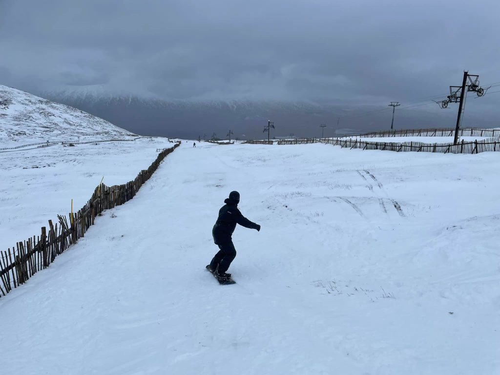
SCOTLAND FORECAST| Mostly dry weather for the coming week with a mixture of overcast and sunny days, some rain showers, some strong winds. Unfortunately, the temperatures may have a thawing impact on snow cover through the week and operational status this coming weekend is uncertain, but it seems likely all or most centres will open something thanks to their all-weather snowmaking systems and the Christmas holidays arriving.
SPAIN / ANDORRA REPORT| An incredible start to the season in the Pyrenees too, where ski areas on the French side of the border are posting the current world’s deepest snow bases at up to 3 metres (10 feet) after again nearly 1.5m (five feet) of snowfall here as well. The season had already started well and these volumes of snow caused problems over the weekend with high avalanche danger and blocked roads. This meant areas like Baqueira Beret (140/185cm / 56/74”), which had had 130km (80 miles) of runs open dropped as low as 7km on Sunday and some smaller resorts closed completely for several days until things could be made safe. We’re back to normal now and Grandvalira (120/200cm / 48/80”) has the most terrain open at nearly 160km (100 miles). The skies have cleared since the weekend and daytime highs are quite high, reaching +10C even at higher elevations at times.
SPAIN / ANDORRA FORECAST| The non-stop sunshine had returned along with plus temperatures day and night right across the mountains. We should see overnight lows dipping to zero or below and colder weather from the weekend but so far skies will remain clear.
BULGARIA / ROMANIA REPORT| The first slopes have opened in Bulgaria and Romania with about half of the centres in the two countries now open, the remainder due to join them this coming weekend. Vitosha (20/50cm / 87/20”) has the deepest snow and the most terrain open so far, although that’s only 5km (3 miles) of runs at this point. It has been a cold and snowy start to the week with fresh cover to low elevations.
BULGARIA / ROMANIA FORECAST| The cold weather is set to continue for the rest of this week with temperatures not expected to get above freezing even down in the valleys. Mostly dry but with some light to moderate snow showers to end the week.
CZECH REPUBLIC / SLOVAKIA REPORT| A much better picture than a week ago in the Czech and Slovak Republics with the region’s largest resorts like Jasna and Špindlerův Mlýn now open. In fact, nearly all the ski areas in the region are now open. There have been repeated snow showers through the past week and good conditions for snowmaking. The region got a big boost when Slovakia ended its short-term lockdown and allowed ski areas to open from last weekend.
CZECH REPUBLIC / SLOVAKIA FORECAST|Conditions look set to remain similar over the coming week although a few degrees warmer. But overcast skies, overnight sub-zero temperatures and occasional snow showers are expected.
NORTH AMERICA
NORTH AMERICA INTRO| After over a month of stalling winter 21-22 seems to be finally getting underway in most of North America (besides the small area around Eastern BC/Western Alberta where it was happening normally anyway). The biggest transformation currently underway is on the Pacific coast where many areas had delayed opening since mid-November due to the warm, dry conditions. That started to change at the end of last week when temperatures dropped and ski areas received 6-12 inches (15-30cm) of snow allowing more to open limited terrain. Now a huge snowstorm is underway which looks set to deliver five feet (1.5m) accumulations at resort level and up to seven feet (2 metres) up on the mountain. These kinds of volumes create season-long bases and allow resorts to go from zero to everything open. But they are arriving so fast they also cause short-term logistical issues and on-slope avalanche danger. So it is likely to before next weekend before things start to look more settled, just in time for Christmas week. The rest of the continent is seeing colder weather and decent snowfall too with an improving picture everywhere.
ROCKIES REPORT| Things are looking much better in the Rockies after a week of cold and often snowy weather. Ski areas in southern Colorado seem to have fared best with Crested Butte reporting 35 inches (88cm) of fresh snowfall, probably more than there’d been all Fall up to a week ago, in the last seven days. But most resorts have had at least a foot of snow and the all-important colder temperatures. Snowmass (16/39” / 40/97cm) has the most terrain open, about fifty miles (80km) of runs, Grand Targhee (21/52″ / 80/130cm) up in Wyoming the deepest base. The start of this week has seen a return to sunshine but it has stayed cold.hings remain far from normal in the US Rockies.The talk in Colorado is of this being the warmest, driest Fall since records began in the 19th century, at least down in Denver. It didn’t look a whole lot better off the sides of the World Cup downhill course in Colorado at the weekend. But despite these challenges, more ski areas have been opening in the Rockies and those that are already open have been adding small amounts of terrain to bolster their offering. It is not yet clear how much snow the series of storms set to continue moving across the region will bring, especially to more southerly latitudes. The most promising days look set to be at the end of this week. Bases remain thin though and terrain open only a small percentage of what’s there in normal times. Vail (4/21” / 10/53cm) for example has about10% of its area open.
ROCKIES FORECAST|A midweek snowfall is forecast for most before a return to cold, dry, sunny weather from Thursday and through the weekend.
USA WEST REPORT| It is a rapidly improving picture in the US West thanks to the increasingly powerful snowstorms hitting the area. Although the latest superstorm is dumping the most snow in California, there have been significant accumulations right up the coast with heavy snowfall reported in Oregon, Washington state and Alaska too. Mammoth (18/34” / 46/86cm) has now been overtaken for most-terrain-open in the region, for the time being at least, by Alyeska (30/107” / 76/267cm) up in Alaska with 31 miles of runs open and much deeper snow. But Mammoth still has 25 miles of slopes open and its base is increasing fast. About two-thirds of ski areas in the region are now open with the remainder expected to open this coming weekend.
USA WEST FORECAST| It’s looking mostly cold and mostly snowy for the coming week with temperatures staying below freezing and frequent snow-showers, some prolonged, more or less daily at least through the weekend.
MIDWEST REPORT| It has been cold and snowy at times in the Midwest over the past week. Ski areas reported up to a foot of new snowfall to start this week in some states. Giant’s Ridge (24/36” / 60/90cm) in Minnesota is posting one of the deepest bases although it only has about a third of its terrain open so far.
MIDWEST FORECAST| Unfortunately, there’s a brief warm spell forecast midweek before temperatures are expected to drop again in the latter half of this week with some areas expected to see snowfall at the weekend.
USA EAST REPORT| An improving picture in the Eastern US with some decent snowfalls over the past week and a much more wintry picture all around. Pretty well all ski areas in the East are now open. Killington (8/24” / 20/61cm) is posting the most terrain open with 18 miles (38 km) of runs open. Attitash (20/36” / 50/91cm) is the first area in the region to post a three-foot upper slope base depth this winter. It was cold and snowy into the weekend. But, unfortunately, has been warming up since with some areas seeing rain on Tuesday.
USA EAST FORECAST| A few warm days in the forecast for the latter half of this week unfortunately. But much colder towards the weekend with temperatures set to dip once more towards wintery norms by Friday.
CANADA
CANADA WEST REPORT| Pretty well all Canadian ski areas are open now and it’s an improving picture. Lake Louise (115/160cm / 46/64″) continues to have the most terrain open, about 95km/60 miles of runs, but others are opening up more too and snow cover is improving across Alberta and BC with 20-40cm (8-16”) accumulation reported in the past few days. Temperatures have stayed low and there have been regular snowfalls.
CANADA WEST FORECAST| The promising conditions should continue well into next week with temperatures staying well below freezing and some quite frequent snow showers, the heaviest most likely at the weekend. Not much sunshine to be seen.
CANADA EAST REPORT| It’s still some way from getting back to a normal season in Eastern Canada but the region’s largest resort, Tremblant (0/104cm / 0/42″), has reached the metre mark for snow depth and has got 25km (16 miles) of runs open now; the most in the east of the country, although still less than a third of its full area, reflecting the lack of early-season snowfall.
CANADA EAST FORECAST| Unfortunately, there are 24 hours of very warm temperatures (+10C) coming before things are due to dip back below freezing with hopefully a decent dump of snowfall at the weekend for Christmas week.
ASIA
JAPAN REPORT| An improving picture in Japan after a rise in temperatures set things back a bit in the latter half of last week. The start of this week has seen temperatures drop and many areas reporting 10-40cm (4-16”) of fresh snowfall over the past few days, allowing them to open more terrain. It remains early days but a definitely improving picture.
JAPAN FORECAST| The forecast looks to be an improving one for the coming week with pretty much a non-stop snowfall forecast from Thursday/Friday onwards in most areas, so more like the Japanese winter norm., there may be a bit of a blip this week as warm weather crosses the Sea of Japan and stops the snowfall for the time being. There looks to be colder, snowier conditions moving back in behind it though.


