WORLD SNOW ROUNDUP #219
Issued: 1 December 2021
By Patrick “Snowhunter” Thorne
European Roundup
North American Roundup
Asia Roundup
WORLD OVERVIEW
It is the start of December and that means the start of winter in the Northern Hemisphere by the meteorological measure of the seasons. The good news is that for most areas, in terms of the coronavirus, although infection rates are rising and the latest new variant identified, so far we seem to be in a much better position than a year ago. Only Austria is in a (hopefully) short-term lockdown and even here the slopes are open to locals. In countries like France, Germany, Italy, Andorra and Spain, which saw few or no areas open at all last winter, there’s been some euphoria as the first resorts have opened for the season, in some cases for the first time since March last year. It is just a case of seeing now if they can stay open.
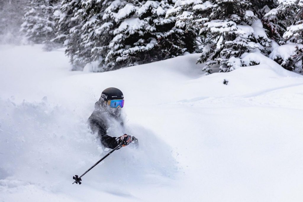
The second issue though is our usual main subject, snow, and here there are differences to last year. In most cases a rather less favourable position than 12 months ago, although for most not enough to impact opening. There has been some snowfall in parts of North America, but it’s here that there is the least terrain open after dry weather through much of November, which was also often too warm. In the east at least that has improved (the temperatures are now cold enough for snow-making, although there’s still not been much snow) and dozens of resorts did manage to open for all or part of the Thanksgiving weekend. In the west though it remains too warm in California and the season start stalled for most resorts. But things have been improving in some areas in recent days. Parts of New England have seen up to a foot (30cm) of snow and up in Alberta, which already had some of the best snow conditions on the continent, early season conditions are reported to be excellent.
It’s an increasingly positive picture for much of Europe too where most regions have seen some good snowfalls this past week (after an autumn that has seen less snowfall than the 2020s) along with cold snow-making weather. The season got started in the Pyrenees at the weekend (which didn’t happen at all last year) and more resorts opened in the Alps and Scandinavia.
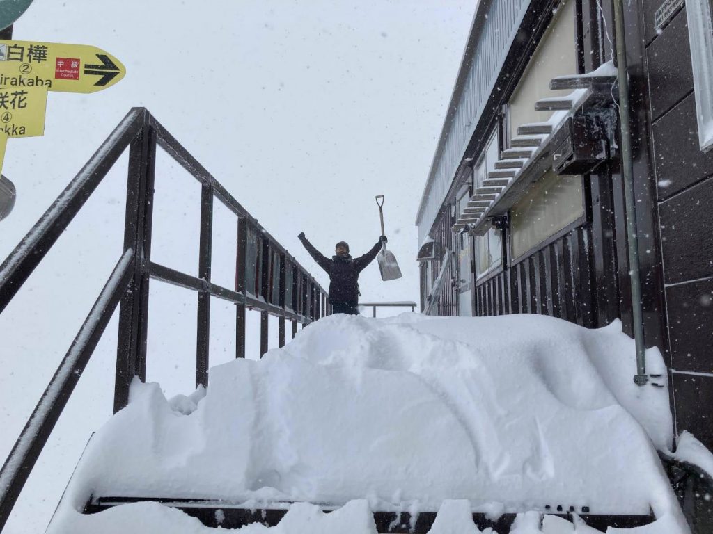
There was also lots of snowfall for Japan as the 21-22 season got underway there.
EUROPE INTRODUCTION
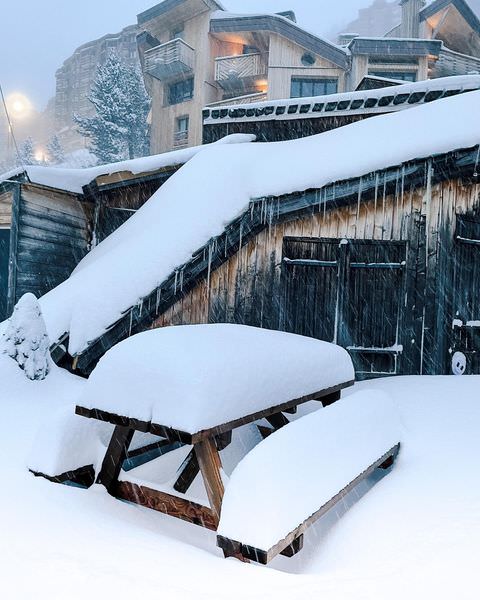
A mixed week for Europe’s ski areas with stormy and snowy weather for a large part of the north of the continent. The snowfall was very welcome and came too late for a few Italian resorts that announced they were delaying the opening for a week to this coming weekend whilst awaiting more snow. The stormy weather was less welcome and led to several high-altitude areas closing over the weekend.
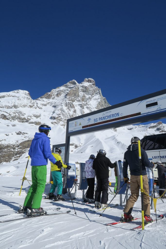
Despite these complications though there are now over 100 ski areas open and that number is set to at least double again this coming weekend. Perhaps the most promising start to the season has come in the Pyrenees where several leading resorts were open at the weekend, some of them have received over half a metre (20 inches) of fresh snowfall in the previous seven days. Europe’s most southerly major ski area, Sierra Nevada, has also opened, reporting 40cm (16”) of fresh cover.
AUSTRIA
AUSTRIA REPORT| We are into the second week of Austria’s three-week lockdown and a review of the current state of the pandemic there with a decision on whether the lockdown can end early or perhaps be extended (although that’s not being talked about) is due to be made around Thursday. In the meantime, ski areas there can open and a number are still running for locals only, with hotels and restaurants remaining closed. Resorts began posting images of heavy snowfall down to the valley floor at the weekend, greatly improving conditions. About half a dozen Austrian ski centres are open and several large areas, including Saalbach and the Skiwelt, have announced plans to open over the next few weekends even as the country remains closed to tourism.
AUSTRIA FORECAST| After the snowy weekend it has been a dry and sunny few days in the Austrian Alps, but more snow is due to arrive in the latter half of this week. Temperatures should remain at or below freezing, generally well below, day or night at most elevations.
SWITZERLAND REPORT| Swiss resorts continue to open for the season and many of the country’s main centres now have some terrain open. Here too there have been some good snowfalls since the weekend as well, although there were also strong winds at times closing higher slopes at resorts like Laax and Zermatt (0/150cm / 0/60″) for a period. As its higher slopes are exclusively open at most areas at this point in the season this meant a few areas were completely closed for periods at the weekend. Otherwise, though Zermatt opened its Gornergrat sector for the first time giving it the most terrain open in Europe at present at around 70km (44 miles). Switzerland has also moved strongly to try to stop the new virus variant from reaching them, re-instating mandatory testing and a 10-day quarantine for arrivals from the UK.
SWITZERLAND FORECAST| After a sunny few days midweek following the weekend snowfall the snow should return in the latter half of this week and continue right through the weekend with 20-40cm (8-16”) totals possible by Sunday.
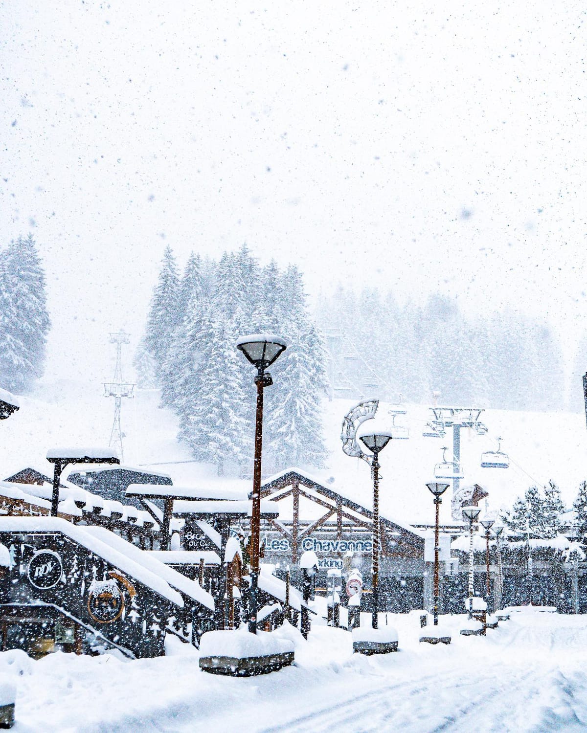
FRANCE REPORT|Chamonix, Les 2 Alpes and Val d’Isere were among the ski resorts to open for the season in France last weekend, along with more resorts in the Pyrenees. These made the country the latest to get into double figures for the number of areas open. Val d’Isère (10/80cm / 4.32”) initially opened their Pisaillas sector, accessed from the Fornet cable car and the Vallon gondola, along with the top of the Bellevarde, with four slopes, top of the OK, 3J, Verte, and Diebold, ready to be explored from the Marmottes chairlift. Fresh snow started falling in the French Alps on Saturday and created a snowy scene right down to resort level, refreshing cover on higher slopes too. A good number more French resorts will be opening for the season over the next few days, including Avoriaz, Les Gets, La Clusaz and Valloire, the latter reporting 80cm (32”) of snowfall over the past week. Some are opening earlier than planned.
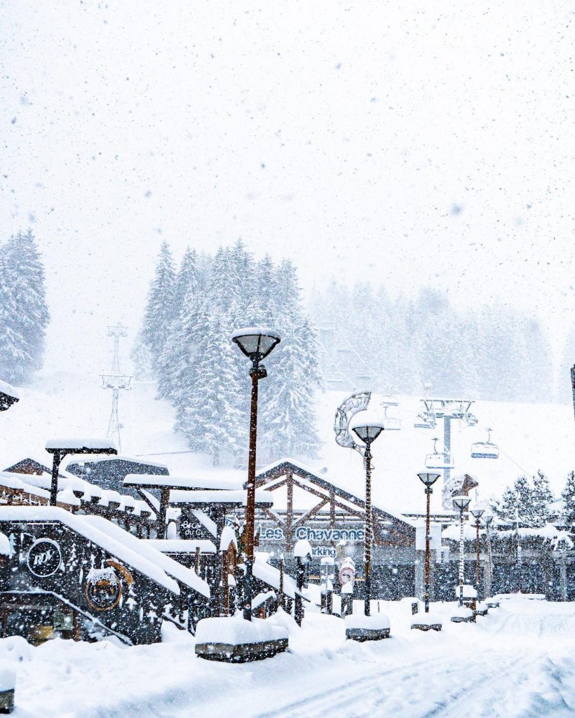
FRANCE FORECAST|The sunny midweek conditions should give way to another round of snowfall through the latter half of the week and the coming weekend, which should be more significant than last weekend, with up to 60cm (two feet) of snowfall totals forecast at higher elevations by the start of next week.
ITALY REPORT|More ski areas have been opening in Italy over the past week with the country’s largest region, Dolomiti Superski, officially opening for the first time since March last year. Other centres, including Livigno, have opened. But it isn’t totally good news as another, Bormio, which posted images of deep snow up top a month ago, has decided to stay closed today blaming a predominantly warm and dry November. The ski area that encompasses the Presena glacier and Passo Tonale also delayed plans to open the latter sector at the weekend due to inadequate snow cover here too. This area and other parts of Italy, particularly along its northern borders, did see some fresh snowfall at the weekend though before the return of sunshine to start this week.
ITALY FORECAST|The next snowy period is expected to move in in the latter half of this week with 10-20cm (4-8 inches) of snowfall expected by the weekend across much of the country’s ski regions.
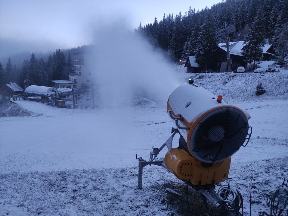
GERMANY REPORT| Germany continues to open up despite fears of a fresh lockdown. It has some of the tightest regulations for opening in Europe at present with only vaccinated or recovered-from-infection skiers allowed on the slopes. In addition, in some regions a negative test taken in the previous 24 hours is also required. Despite these feats and unfavourable autumn weather for many areas Winterberg (10/20cm / 4//8”) was able to open at the weekend, running just a couple of lifts, Poppenberg and Raucher Busch, thanks to its snow-making efforts (these allowed it to be one of only two centres in the country to manage to open last season when restrictions were eased in April). It joins the highest resort in the country, Zugspitze (15/20cm / 6/8”) which has had a cold and snowy start to the week.
GERMANY FORECAST| The cold snowy weather is expected to continue through the coming week with overcast skies and 5-10cm (2-4”) of snowfall expected daily.
SCANDINAVIA REPORT|It has been a week of weather extremes in Scandinavia with temperatures dropping as much as 20 degrees below freezing in some parts, gales hitting others and quite a few snowfalls. In short, it appears that winter is here after a rather warm autumn. Plenty of the region’s leading ski areas have now opened or will do this weekend. The largest, Sweden’s, Åre, is set to join them this Friday 3rd December with six runs open initially served by two lifts. They are to be: Gästrappet, Lundsrappet, Rödkulleden, Långsvängen, Redhakeliften and the Redhaken slopes. Leading ski areas in Norway, including Hemsedal, are also targeting this coming weekend.
SCANDINAVIA FORECAST|The current low temperatures are expected to continue for the week ahead with the weather typically 5-20 degrees below freezing. A mixture of sunny and cloudy days with periods of light to moderate snowfall is expected, although rarely more than 5cm (2″) in any 24 hour period.
SCOTLAND REPORT| It has been the most wintery week by some distance in the Scottish hills, with repeated hill snowfalls over the past seven days, at some points reaching down to the valley floor. There have also been strong gale force winds at times leading to drifting. At the same time, a number of resorts, including Glencoe, have fired up their all-weathers snow-making machine. It says it will offer sledging on a toboggan run it is creating with the snow from this weekend.
SCOTLAND FORECAST|Something of a weather roller coaster as is not unusual for the Scottish Highlands with more snowfall forecast but also more days of high temperatures and strong winds at times too.
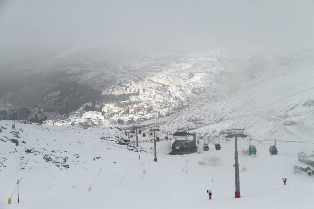
SPAIN / ANDORRA REPORT|Many of the leading ski areas in the Pyrenees opened for the season at the weekend, buoyed on by a good snowfall of up to 40cm (16”) of snow in the middle of last week. For most this was their first opening since March 2020 so there was plenty of celebration. Spain’s two biggest resorts, Baqueira Beret and Sierra Nevada both opened for the season. Baqueira Beret immediately offered one of the biggest areas open in the world so far, opening about 71km (43 miles) of runs, nearly a third of its terrain. Sierra Nevada went for a more modest 8km (five miles) of runs with 925 metres of vertical skiable and six lifts operating. The region’s largest ski areas, Grandvalira (30/90cm / 12/30”), opened Andorra’s season a few days earlier than expected on Tuesday, although initially there’s only 8km (5 miles) of runs open.
SPAIN / ANDORRA FORECAST|Following the snowfall last week that continued through the weekend at most areas the slopes have had sunny conditions over the past few days, although temperatures have remained largely at or below freezing. A fresh range of snowfall is expected to move in from the latter half of this week.
BULGARIA / ROMANIA REPORT|It has been looking much more wintery in southern Europe over the past week with temperatures in the mountains there now largely below freezing, sometimes down to the valley floor, day and night. There’s been natural snowfall over recent days and snow-making systems have been fired up. So it’s an improving position as we get closer to the start of the season, which for most areas is now 2-3 weeks away.
BULGARIA / ROMANIA FORECAST|The snow showers should clear and blue skies return for most areas in the region from midweek. Temperatures stay low, double digits below freezing, in the mountains but get above zero Celsius in the daytime in the valleys, sometimes 5-10 degrees above
CZECH REPUBLIC / SLOVAKIA REPORT| Temperatures finally dropped low enough for snow-making to get underway in the Czech and Slovak Republics in the middle of last week with Jasna posting pictures of its upper slopes turned white by machines. Natural snowfall has now moved in and continued through the past 3-4 days depositing 10-30cm (4-12”). Sadly though, Slovakia has become the second European nation to announce a lockdown, in its case a two week one, as cases there surge. The hope is that it will end before resorts are due to start opening for the season here in mid-December.
CZECH REPUBLIC / SLOVAKIA FORECAST|The current snowstorm is expected to continue through the middle of this week with skies clearing around Thursday/Friday before another front moves in bringing more light snowfall. Temperatures staying around freezing or below.
NORTH AMERICA
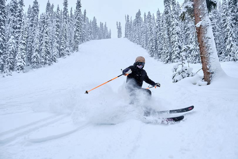
NORTH AMERICA INTRO|Despite the challenges of little natural snowfall across much of the continent and an unseasonably warm November around 50 ski areas had opened across North America by Thanksgiving and that number had nearly doubled at the weekend. Most centres were reliant on a fairly consistent period of cold weather which allowed enough snow-making to open a run or two. This was particularly the case in the East and Midwest. There was some more natural snowfall too, heaviest in the Rockies, with the best conditions continuing to be in the Alberta Rockies so far. Snowfall did arrive at the weekend, at last, in the East too with some ski areas in New York state and Vermont reporting storm totals of a foot (30cm,) or more. America’s Pacific coast continues to struggle with warm dry weather though leading more areas to push back planned opening dates in November to later into December, unfortunately. There was some reason to celebrate though with the return of World Cup racing to North America after a two-year pandemic caused pause with Killington and Lake Louise hosting races. Ironically though, the first races at both venues had to be cancelled due to heavy snowfall in Lake Louise then strong winds in Killington.
ROCKIES REPORT| There was some snow in the Rockies in the middle of last week to the great relief of Colorado ski areas who reported 4-6” (10-15cm) on Thursday morning. More resorts opened in the state, as did the first of the season in Arizona and Utah including Alta, America’s largest Park City and Solitude, all with limited terrain and thin cover. Jackson Hole (2/26” / 5/66cm) reported one of the biggest accumulations with 8” (20cm) of fresh cover by Thursday morning last week and has also opened for the season. Unfortunately, the weather conditions continue to be challenging with warm and sunny weather to start this week once more.
ROCKIES FORECAST|It’s not looking good for the week ahead, unfortunately, with temperatures staying too warm and the weather constant sunshine.
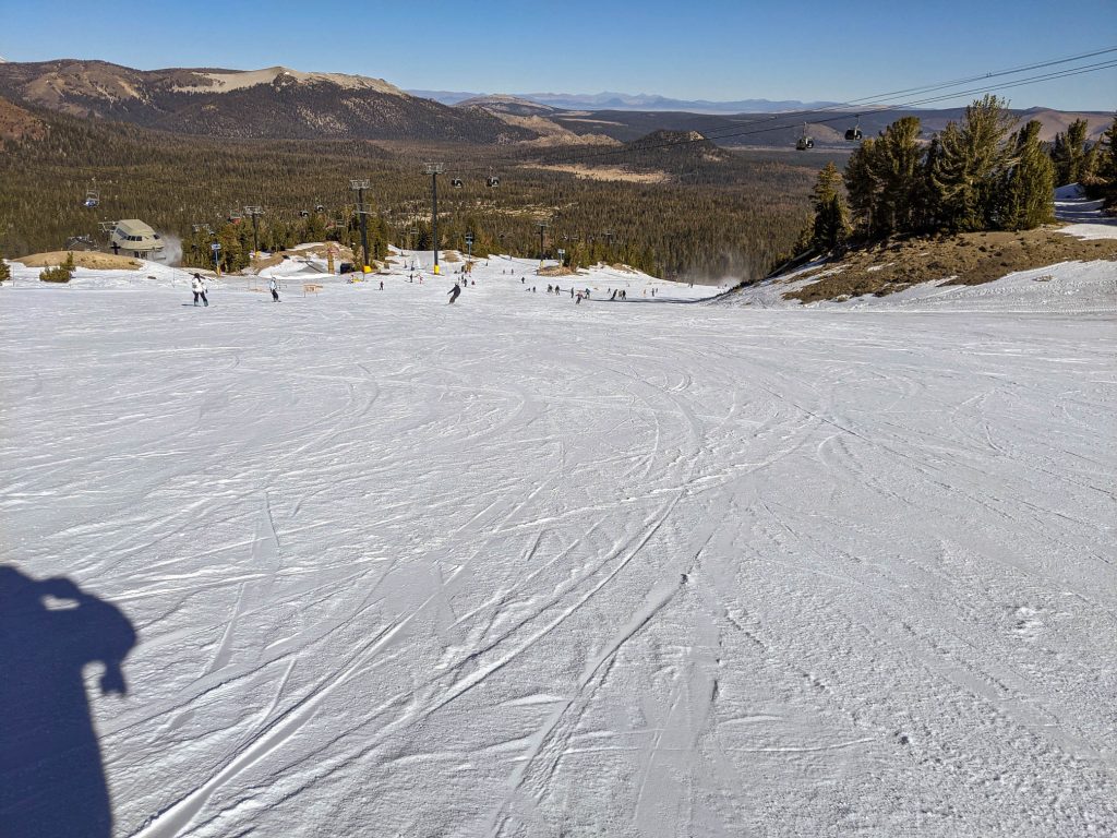
USA WEST REPORT| Warm and mostly dry weather has continued to dominate in California and it is still only really Mammoth that has managed to stay open with about a quarter of its 160 runs open. In fact, the 25 miles (40km) of runs it has open remains the most at this point of any ski area in the country. Other resorts have been forced to continue to delay. The Palisades and Boreal, which opened in late October then closed again, have managed to re-open but only very limited terrain so far, just a few nursery slopes in The Palisades’ case. Further north there’s nowhere open yet in Alaska or Washington state although the first centres do hope to open this coming weekend.
USA WEST FORECAST| If anything, conditions are going even further in the wrong direction with non-stop sunshine and temperatures not getting below freezing, even at night in the mountains.
MIDWEST REPORT|Although there has been largely dry weather, cold temperatures have allowed more Midwestern ski areas to open for the 21-22 season through the Thanksgiving weekend. Ski Brule in Michigan’s western Upper Peninsula was the first in the stater to open just in time for Thanksgiving. A resort spokesperson noted opening was late and blamed the warm weather. That has changed with a lot of snowfall in the region.
MIDWEST FORECAST| Staying cold and overcast with snow showers possible daily and temperatures rarely getting above freezing. Snow showers will be mostly light but will be heavier later in the weekend.
USA EAST REPORT|More ski areas in the East battled to open for Thanksgiving weekend relying heavily on snow-making once temperatures dipped again at the weekend, Some scraped a run or two, others gave up the battle and announced tentative plans to open this coming weekend. Things began to improve for some on Friday though and by Saturday resorts like Whiteface said they’d had a foot (30cm) of fresh snow, really transforming conditions for the start of December. Killington hosted World Cup racing at the weekend for the first time in two years, The first day was cancelled due to strong winds, but a slalom race was successfully staged on Sunday.
USA EAST FORECAST|A fairly promising forecast, with temperatures staying close to freezing, frequently below. Overcast but dry midweek then light to moderate snowfall beginning at the end of the week and expected to continue through the weekend.
CANADA
CANADA WEST REPORT| Western Canada, particularly inland in Eastern BC and Alberta has seen plenty of snow over the past week, vying with Japan and parts of the Pyrenees for the largest in the world, in fact. There was some wild, windy weather too which led to two of the three World Cup races planned for Lake Louise (66/106cm / 33/42”) having to be cancelled. Only Saturday’s downhill happened on a shortened course in a weather window. The resort is one of the first in the world to have all its lifts running though.
CANADA WEST FORECAST|A fairly dry week and a little warmer, at the base of the mountain at least, particularly further west, but staying below freezing in the alpine. Not much snow forecast, just the occasional light shower.
CANADA EAST REPORT|Temperatures are remaining below freezing in Eastern Canada but the issue of not much natural snowfall continues, so it remains a battle for snowmakers to make snow as fast as they can now that conditions have improved. More resorts have opened including the biggest Tremblant (10/20cm / 4/8″) and Mont Sainte Anne (0/20cm / 0/8″) but none have much snow cover yet and thus little terrain able to open. For Tremblant, it’s 4km (2.5 miles) of runs comprising three pistes on the upper half of the mountain, on versant Sud and versant Nord, with two lifts serving them. Only fully vaccinated people are allowed on the slopes there.
CANADA EAST FORECAST|Similar weather expected for the week ahead with cold temperatures and snow flurries at times but still no clear sign of the kind of major dump the area could do with.
ASIA
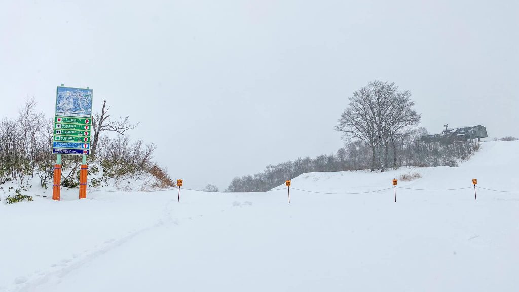
JAPAN REPORT| It has been a rapidly improving picture in Japan with the first of the snowstorms, for which the country is famous, moving in and seeing 40cm (16”) of snowfall in 24 hours on Wednesday/Thursday last week transforming Niseko and many other ski areas there ahead of the season start. There was a sunny spell at the weekend but the snowfall has returned to start the new week. Ski areas that have already opened include Happo One and Hakuba 47.
JAPAN FORECAST| Unfortunately, the final few days of November may see temperatures in valleys get back up to double figures, briefly, although still saying subzero on the slopes for most. The next wave of snowfall is due to start in December with temperatures dropping back below freezing at all levels.


