WORLD SNOW ROUNDUP #174
Issued: 13 January 2021
By Patrick “Snowhunter” Thorne
European Roundup
North American Roundup
Asia Roundup
EUROPE INTRODUCTION
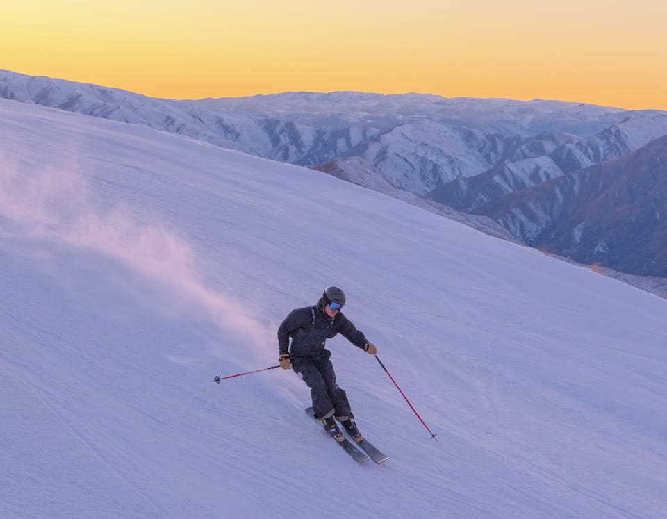
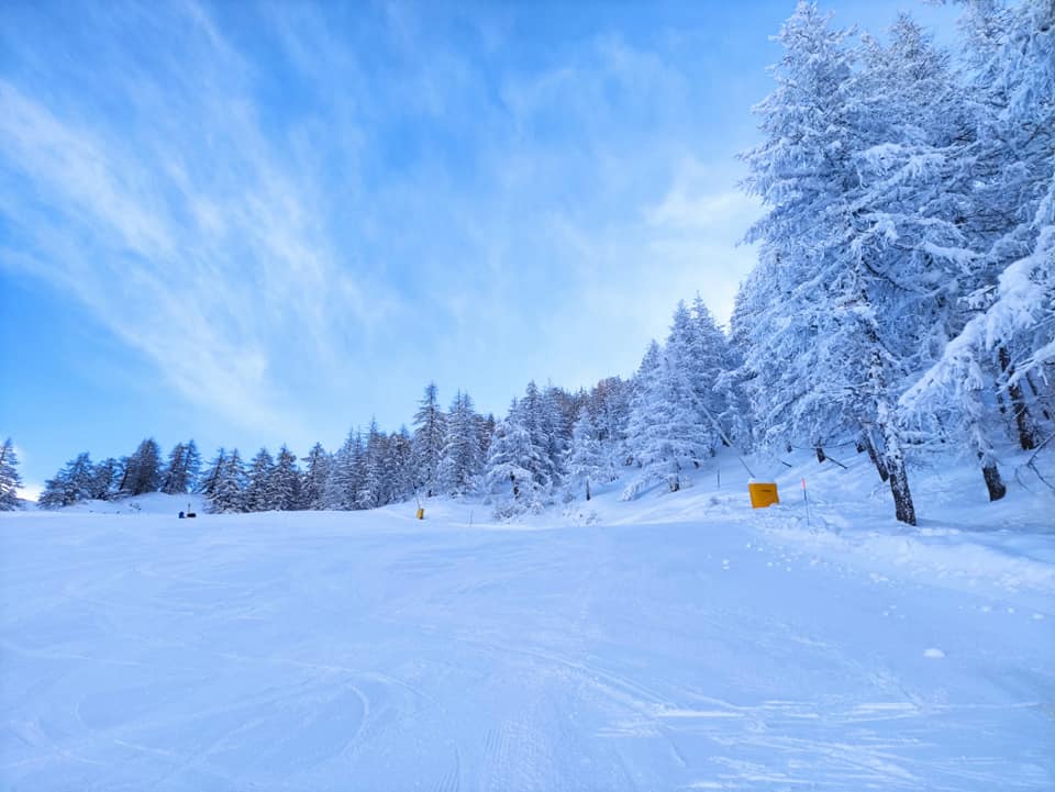
What will hopefully be the biggest snowfall of the year so far (ok, it is early days) is underway in the Alps, following a big storm down in the Pyrenees, of which more is mentioned below. Otherwise, a mixture of sunshine and light-to-moderate snowfall for much of Europe over the past week with some of the heaviest snowfalls in recent days reported in western Norway.
The main attention remains on the virus though with the start of the season set back in France, Germany and Italy to later this month or possibly February now, whilst resorts in Andorra, Austria and Spain remain open to locals only. The slopes of the Czech and Slovak republics, as well as those of Scotland and Slovenia, remain temporarily closed.
Down in the Iberian peninsular, storm Filomena impacted Andorra, Portugal and Spain making headlines for the biggest snowfalls in cities, including Madrid, for five decades. The impact was perhaps not so historic on the ski slopes but, nonetheless, most of the open areas in the region received at least 30cm (a foot) of snow, greatly bolstering cover.
AUSTRIA
AUSTRIA REPORT| Mostly sunny weather in Austria over the past week with some weekend fog at lower elevations. Temperatures in the mountains have stayed low (5-15 below freezing) at most Austrian areas. The (currently closed) Molltal Glacier (160/350cm / 64/140”) and Nassfeld (200/350cm / 80/140”), in Carinthia, are posting the country’s deepest bases. More than three quarters of Austrian ski areas are open but the plan to open to wider ski tourism beyond just locals has been delayed, first to the 18th and now to the 24th of January, and even then it will be reliant on infection rates dropping further. This is causing problems for some resorts opening as they say they’re losing too much money running lifts at a loss over a prolonged period. Many are limiting terrain open to try to keep costs lower and some have closed again. But most are still operating, including one of the biggest, Skiwelt (20/40cm / 8/16”). This week it reports 131 “perfectly prepared kilometres” of slopes open including the links between Ellmau – Scheffau – Brixen im Thale – Hopfgarten – Itter – Söll and Westendorf.
AUSTRIA FORECAST| Staying cold with more snowfall expected over the next few days and the likelihood of 30-60cm (1-2 feet) of snow for many ski areas by Friday. A sunny weekend ahead so superb conditions with the fresh snow and sunshine for those lucky enough to be able to get on the slopes. Temperatures as low as 25 degrees below freezing are possible at times.
SWITZERLAND
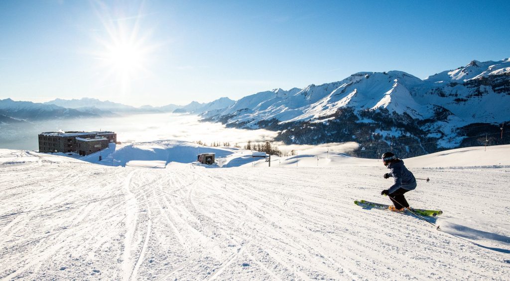
SWITZERLAND REPORT| Swiss resorts continue to operate and without quite the same restrictions on international skiers that other open areas in western Europe currently have. But travel there remains very difficult and resorts report few international guests and visitor numbers well down. The latest bad news was the need to cancel the famous Lauberhorn ski races this coming weekend due to an outbreak of the pandemic around Wengen (20/65cm / 8/26”) with more than 100 cases reported by Tuesday. As to the current weather, for most of the Alps it has been mostly cold, often sunny and just occasionally snowy over the past week. Andermatt (50/315cm / 20/126”) continues to post the deepest base in the country, whilst the 4 Valleys has the most terrain open (260km/170 miles of runs open).

SWITZERLAND FORECAST|The biggest snowfalls of 2021 to date are forecast for Switzerland from Wednesday through to Friday with some resorts likely to see as much as 60cm (two feet) of fresh new cover. This is good news for those that have not seen much fresh snowfall since before Christmas. Temperatures getting warmer (towards freezing and at times above at the mountain base) as the front moves in.
FRANCE

FRANCE REPORT| Many French ski resorts remain open but the past week has seen the date by which they will be permitted to restart the lifts go back by probably at least a month perhaps longer, from the increasingly-unlikely looking January 7th date given pre-Christmas. The French government now says a decision will be made, or at least an update on the ongoing delay, on 20th January. At the announcement last week though the government said it would be mid-February or later due to current pandemic rates. In the meantime, resorts can stay open and offer many activities including ski touring and nursery slope lessons for beginners, just not run the main lifts. It has been a mostly cold, dry and sometimes sunny week in the French Alps, although there has been some fresh snow too, particularly in the southern Alps. Isola 2000 (110/160cm / 44/64”) posted 10cm (4 inches) of fresh at the weekend. Alpe d’Huez (60/200cm / 24/80”) is posting the deepest base in the country, although, not all measurements are being made everywhere at this point.
FRANCE FORECAST| It is looking like a snowy few days in the French Alps after the recent predominantly dry weather with some quite significant (20-60cm / 8-24”) snowfalls expected over the next few days. Staying cold and a little more settled by the weekend.
ITALY
ITALY REPORT| It has been mostly dry over the past week on Italy’s closed slopes, with a few light to moderate snowfalls and temperatures staying cold, between freezing and 10 below for most. Uncertainty continues as to whether Italian ski areas will be able to re-open on 18th January (next Monday), as has been the provisional date for a few weeks now since the original 7th January date passed. The country’s regions are currently being divided into colour-coded levels according to pandemic levels with Veneto and Lombardy in orange (the middle rating) for now, and South Tyrol in the highest, red. Currently, it is being suggested maximum capacity at re-opened ski areas would be 30-40% of the norm. Ski areas are questioning whether people living in the lowest infection areas (yellow) will be allowed to travel to them and whether they will be able to cover their operating costs. Some are saying it would be better to delay and ‘open well’ for the last few months of the season than ‘open badly’ on the 18th.
ITALY FORECAST| Some snowfall is expected on Wednesday-Thursday, potentially quite significant accumulations in some areas in fact. Otherwise, it looks like there’ll be more predominantly dry, sunny and cold conditions across the Italian mountains up to the 18th if slopes do open then.
GERMANY
GERMANY REPORT| Germany has extended its ski resorts closure with no known end date yet. The Zugspitze Glacier said it hoped to open in February and is looking at extending its season into May if the snow stays good and the pandemic problems take a turn for the better. As to the snow this week, conditions are pretty good across most of the country’s ski areas. There was quite a lot of fresh snowfall down to low levels in Bavaria and although there were some warm temperatures at times, the overall picture is positive at present.
GERMANY FORECAST| The recent snowfall of the past few days will ease in most areas with the forecast generally dry but overcast. Temperatures should remain below freezing into the weekend for most areas but get a little warmer on Sunday when a fresh front could bring some light snowfall.
SCANDINAVIA
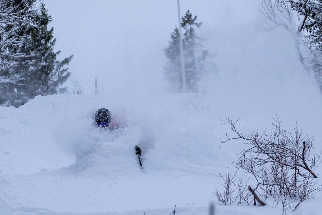
SCANDINAVIA REPORT| Scandinavian ski areas have been reporting some of the best conditions in Europe over the past week. Ski areas in Norway have been posting up to 40cm (126 inches) of snowfall in 24 hours at resorts like Voss on the west coast, whilst some of the bigger centres such as Hemsedal (112/112cm / 45/45”) are now pretty much fully open. Between the snowy periods there have been clear skies which have led to reports of temperatures so low that a few smaller ski areas had to temporarily close, but on the upside, good views of the aurora at night to start this week.
SCANDINAVIA FORECAST| After the recent snowfall, the next few days should be dry and sunny for much of Scandinavia with temperatures staying double digits below zero. Staying cold and dry into the weekend for most areas, but clouds will begin building again.
SCOTLAND
SCOTLAND REPORT| A first minor warm weather blip occurred at the weekend in the Scottish Highlands, during what has otherwise been a period of consistently cold temperatures from the north east since Christmas. It still only got a few degrees above freezing, however, and not much damage was done to the snowpack, especially up high. Temperatures went back to sub-zero from Monday afternoon and lower slope rain turned wintery once more. So conditions for ski tourers remain pretty good although, sadly, the ski lifts remain stationary as Scotland’s latest lockdown continues.
SCOTLAND FORECAST| Predominantly cold and frequently snowy in the Scottish Mountains over the coming week. Unfortunately – given that the ski areas look set to be kept closed at least into February now – it’s looking like one of the best Januarys for several years and certainly better than last January.
SPAIN / ANDORRA
SPAIN / ANDORRA REPORT| Storm Filomena made headlines across Europe, mostly as its snowy excesses brought snow the streets of the famously hot Spanish capital Madrid, with online video posted of people skiing there. For ski resorts across the Iberian peninsular, it also brought more fresh snow to enhance conditions at the open areas of Andorra, Portugal and Spain. Spain’s highest slopes and Europe’s most southerly major resort Sierra Nevada (60/100cm / 24/40”) posted a 39cm (16 inch) accumulation over 72 hours around the weekend and boasted powder conditions. It was a similar story in the Pyrenees with Baqueira Beret (70/110cm / 28/44”) reporting a foot (30cm) more snowfall on Saturday-Sunday alone, continuing its great winter to date for snow. Some ski areas were closed for periods due to the stormy weather.
SPAIN / ANDORRA FORECAST| Temperatures should stay low across the region through the coming week as much as 10-15 degrees below freezing at times at higher points in the Pyrenees. Drier now the storm has passed but another front should bring more snowfall (5-15cm (2-6 inches) at the end of the week before a largely sunny weekend.
BULGARIA / ROMANIA REPORT
BULGARIA / ROMANIA REPORT| Although it is perhaps a little warmer still than the ski areas would like and expect in early-January, conditions are generally pretty good on the slopes of Southeast Europe with almost all resorts open here. But whilst Bansko (0/95cm/0/38”) and Vitosha (10/40cm/4/16”) both reported around 30cm (a foot) of snowfall over the first three days of this week Pamporovo (40/60cm/16/24”) was reported to be temporarily closed on Tuesday with temperatures five degrees above freezing and rain falling.
BULGARIA / ROMANIA FORECAST| The week ahead should be colder again, ranging from a few degrees below freezing to as low as 20 below. There’s no snow forecast for the region at present.
CZECH REPUBLIC / SLOVAKIA
CZECH REPUBLIC / SLOVAKIA REPORT| The re-opening of Czech ski areas on 10th January after their Christmas and New Year lockdown did not happen as expected with the government announcing an extended closure period as virus rates soar in the country. In Slovakia ski areas closed at the start of the year for (at least) three weeks so, in other words, everywhere remains closed in the Czech and Slovak republics. But the weather continues to be favourable – cold and sometimes snowy, and resorts say they are prepping for reopening at short notice, whenever they are allowed to.
CZECH REPUBLIC / SLOVAKIA FORECAST| Lots of snowfall is forecast for the rest of this week and into the weekend in the region. Low temperatures (well below freezing) here too with the next dry day not expected until Sunday at the earliest.
NORTH AMERICA
Another week that has seen the northwest corner of the continent see the most snowfall, with one area at least reporting over 40 inches (a metre) of snow since this time last week. The deepest bases have also past the 14 feet/4.2 metre mark.
Many other ski areas across the continent have seen snow, but it’s been more on the scale of inches rather than feet in most cases. Temperatures have stayed low and more terrain has been opening in many areas, only on the West Coast and perhaps the Midwest has it been a little warmer than ski areas would like.
The main topic of conversation remains, of course, the state of the pandemic. So far resorts have stayed open but most are spending more time reminding skiers of the need to stick to pandemic operating procedures in terms particularly of social distancing and mask-wearing in order to ensure the centres stay open, as they are talking about snow conditions.
ROCKIES
ROCKIES REPORT| Although reports indicate it is typically a little warmer than usual and with less snowfall than the norm too, conditions do continue to improve is most rocky Mountain resorts. It’s noticeable that many here now have all lifts turning and all runs open – more so than most other parts of the world. The weather has been predominantly dry, cold and sunny again this past week but most areas have had a few inches of snowfall. Schweitzer (61/74”/152/185cm) in Idaho posted the most snowfall with six inches (15cm) since Sunday. Grand Targhee (68/77”/170/193cm) is posting the region’s deepest base at present.
ROCKIES FORECAST| Alas there’s still not a ‘big dump’ on the horizon at present with most areas set to see another predominantly dry weather week with a mixture of sunshine and clouds. Temperatures staying below freezing for most, day and night, hitting 15 below freezing at the coldest points.
USA WEST
USA WEST REPORT| The snow is really starting to stack up in the Pacific Northwest with Mt. Baker (152/168”/ 381/419cm) reporting more than 100 inches (2.5 metres) of snowfall now since New Year’s day, including over three feet (94cm) of snowfall since the weekend. It was however closed on Tuesday due to gale force winds and some daytime rain on lower slopes. But it is pone of the few resorts in the world and only one in North America to have passed the 4-metre base mark. Drier further south with Squaw Valley Alpine Meadows (40/63” /99/157cm) posting California’s deepest snow, but little fresh. Across the West, it is a little warm with daytime temps tracking above freezing.
USA WEST FORECAST| More snow in the north of the region, more dry, sunny weather to the south. It looks to be staying rather warmer than ski areas would like too, as often a few degrees above freezing as below.
USA MIDWEST REPORT
MIDWEST REPORT| Unusually the biggest snowfalls have passed to the south of the region this week with Texas reporting snow falling. Temperatures in the Midwest are still warmer than they would usually be in January. Although sometimes dropping to double digits below freezing overnight some areas are seeing positive daytime temperatures leading to sleet or rain instead of snow. But that cold weather is good for snowmaking during the hours of darkness at least. Paoli Peaks (30/62” / 76/155cm in Indiana is posting the deepest snow in the region at present.
MIDWEST FORECAST| More of the same really with a mixture of cloudy and sunny days, some precipitation but not always snowfall, unfortunately, and temperatures mostly well below gfre4ezing but sometimes rising into positive temperatures in the daytime.
USA EAST
USA EAST REPORT| A mostly dry but cold week in the East with Kissing Bridge (5/55” / 13/137cm) in New York State posting the deepest base in the region, Sugarbush (24/49” / 60/120cm) in Vermont the deepest of the internationally well-known resorts in the region. The temperatures have, on the whole, been very cold – typically 10 to 20 degrees below freezing for most areas, most of the past week.
USA EAST FORECAST| Remaining very cold and try for the next few days but it could creep up above freezing briefly at the end of the week, down at the base of most ski areas in the region anyway, with a front bringing fresh snowfall through the weekend.
CANADA
CANADA WEST
CANADA WEST REPORT| Most ski areas in Alberta and BC continue to report great conditions. Many are also continuing to sell out of lift tickets, especially at weekends, due to pandemic visitor number limitations. Cypress Mountain (127/328cm / 51/131”), just north of Vancouver, reported nearly 1.2 metres (four feet) of snowfall in the past week – among the biggest accumulations anywhere in the world this January (although similar to those across the Pacific in Japan), and has the region’s deepest base. Further north Whistler (233/233cm / 93/93”) reports all trails open and all lifts turning at North America’s largest ski area for the first time this season.
CANADA WEST FORECAST| Looking like snowfall daily for the week ahead with snow on snow into the weekend. Temperatures 5-10 below freezing in the mountains, although Whistler may see rain at times at its base with plus temps down there.
CANADA EAST
CANADA EAST REPORT| There’s been relief in Quebec that, so far at least, ski areas have been permitted to remain open despite ever more draconian measures to limit the spreads of the virus there. Ski areas in neighbouring Ontario remain closed by provincial government order. There’s little fresh snowfall to report but it has stayed cold at 10-20 degrees below freezing. Mont Tremblant (140/140cm / 56/56”) reports the deepest snow in the province by some distance and more than 60 trails open now – more than half the total.
CANADA EAST FORECAST| Staying cold and mostly dry until the end of this week when a band of snowfall is expected to bring 5-15cm (2-6 inches) of fresh snow to the region ahead of the weekend.
ASIA
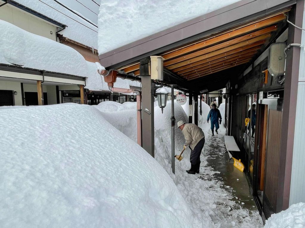
JAPAN REPORT| There have been more huge snowfalls in Japan as a third big storm has moved in off the Sea of Japan. In Myoko the resort reported over a metre (40”) of snowfall in 24 hours on Friday-Saturday, the biggest accumulation on so short a period since 1986. Up in Niseko (175/290cm / 70/116″), the seven-day total was nearly 1.2 metres (four feet) taking the season-to-date tally towards six metres (20 feet). SnowJapan.com’s eyewitness-reported and measured data shows that some ski areas have already gone past their snowfall totals for all of last season.
JAPAN FORECAST| Cold and snowy weather is set to continue for most Japanese ski areas with many seeing temperatures of 10-20 degrees below freezing and 10-20cm (4-8) inches of snowfall daily, on average, through the coming week.