World Snow Overview #77

Issued: 6th March 2019
By Patrick “Snowhunter” Thorne
Our latest roundup of snow conditions around the world. Each section that follows below goes into detail country by country. Clicking the map thumbnail will take you to our dynamic snow forecast map for the latest detail (where you can also overlay live weather & reported conditions). Weather outlooks for Europe and North America can be found at the end of this roundup.
INTRODUCTION:
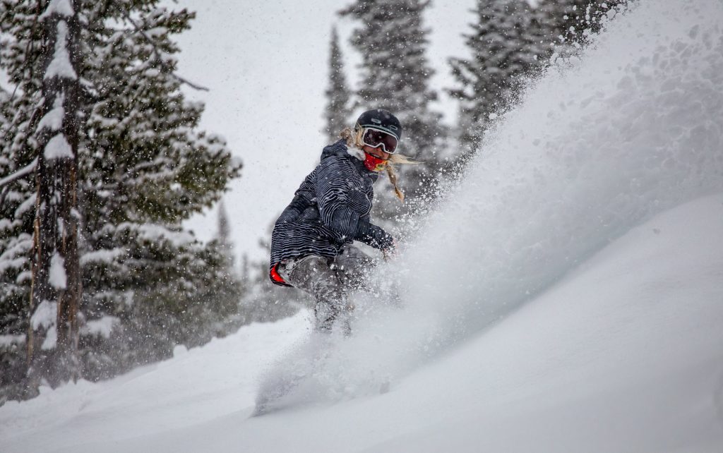
There has been a big change in weather conditions in much of Europe since the end of last week. The three-week spell of warm, dry weather came to an end and there has been a return to much colder conditions with fresh snow falling as we enter spring.
So far, it’s a patchy picture with most ski areas in the Alps and Dolomites reporting 5-15cm of snowfall. Although, some areas in Austria and Switzerland have passed the 30cm mark for fresh accumulations. But it’s expected to keep snowing through this week so those numbers should grow. However, probably not dramatically. The weather change has also brought much lower temperatures with most ski slopes now back below zero. It shouldn’t be much above freezing in the day time at resort level too.
Along with the fresh snowfall and lower temperatures, the wind has also been very strong at times. The avalanche danger level is creeping up from generally around 2 to 3 on the danger scale, up to a maximum of 5. That is something to be aware of.
Elsewhere in Europe, temperatures have been dipping too. The Pyrenees, which was still without fresh snow at the time of writing this overview, should be getting some later this week. after almost a full dry month. Scotland, which suffered a catastrophic thaw with Britain’s record temperatures last month, is already seeing its ski slopes turn white again with new snow since the weekend. Although, more is needed (and forecast) before main slopes can begin to reopen.
Scandinavia has got colder and snowier over the weekend with many areas receiving a few
Across the Atlantic, ski areas in California are publishing the total numbers for the record-breaking February snowfalls with some getting more than 7
INDEX:
Austria / France / Switzerland / Italy / Andorra / Norway/Sweden / Germany / Bulgaria / Scotland / Japan / USA / Canada / Europe / North America
Austria
Austria was the only country of the big four alpine nations to get some snowfall in late February; in some parts of the country at least (Salzburgerland, Upper Austria). The latest snowfalls in the Alps, for the start of March, are more widespread. However, it is parts of Austria that have again seen the best of it. Although, this time the whole country is expecting fresh snow through the coming week. The biggest falls on Friday/Saturday were again reported in the Steiermark, Salzburgerland and lower Austria provinces. Here, the Dachstein Glacier (0/460cm) posted the biggest fall of 30cm with Obertauern (270/310cm), one of a number of resorts, getting 10cm. Austria has turned much colder for the start of March and there are regular, mostly light to moderate, snowfalls at present across the country.
FRANCE

French ski areas saw their first significant snowfall for three weeks on Friday and Saturday. Resorts across the French Alps reported 5-15cm of fresh snow and there’s more in the forecast. However, for the start of this week, strong winds are also a major weather factor, closing higher runs in many areas. Avoriaz (140/245cm) was particularly hard hit with wind closures on Monday. Cauterets (230/340cm) down in the Pyrenees, where there hasn’t been any snow for nearly a month now, still has the country’s deepest base, with Bonneval sur Arc (70/260cm) still posting the deepest base in the French Alps. Most of the country’s big areas have very healthy bases still though; just a few centimetres less than Bonneval, which should certainly see them through the rest of the season. For example Les Arcs (137/250cm) or Flaine (115/245cm).
SWITZERLAND

Ski resorts in the Valais region of Western Switzerland reported the biggest snowfalls in the Alps during the Friday/Saturday snowstorms at the end of last week; led by Lötschental (35/285cm). There was snowfall across the nation though. Examples are: 20cm for Mürren (85/260cm) on the Schilthorn’s slopes in Bernese Oberland and 23cm at Braunwald (105/240cm) in Eastern Switzerland. Conditions are currently similar to the rest of the Alps with more snow falling and some strong winds. However, most areas remain fully open; other than the closure of a few high lifts at some centres.
ITALY

At long last it has been turning snowier once again in Italy after a mostly dry February. Indeed, the last big snowfalls in the country were four weeks ago, at the start of last month. So far, the fresh snowfall has only brought 5-15cm of fresh cover. But that new snow is very welcome on the established bases and it’s also widespread, covering most of the country’s ski areas. This includes resorts down in the Dolomites. The country’s deepest snow base continues to be on the Presena Glacier (70/400cm), near Ponte di Legno in Lombardy, where the ski season usually continues late into spring.
ANDORRA
We’re up to almost a month without fresh snowfall in Andorra and the Pyrenees now. However, the good news is that conditions are set to change in the latter half of this week with snow now firmly in the forecast and temperatures already dropping ahead of its arrival. In the meantime, it is very much business as usual with ski areas fully open and bases still very healthy from falls earlier in the winter. The deepest continues to be at Arcalis (155/215cm), in the Vallnord area. However, even at Soldeu in Grandvalira (50/130cm) where they’re gearing up to host the imminent Alpine World cup Finals, conditions remain good and the snow is definitely deep enough to see out the season.
NORWAY/SWEDEN

After a rather warm week last week things have cooled in Scandinavia and some small snowfalls (typically 5-10cm per 24 hours) were reported on Monday and Tuesday. Sweden has actually reported the biggest snowfalls in the region over the past few days (by a narrow margin) with Björkliden (110/110cm) posting 10cm of fresh and the country’s deepest base. Riksgransen, up in the Swedish Arctic (which opened for the season at the weekend but hasn’t yet posted an official snow depth), was reporting conditions of -12C and snowing hard at the time of writing this review.
GERMANY

Some German ski areas in the Oberbayern and Bayerischer Wald regions saw 5-15cm snowfalls on Friday and Saturday, at the end of last week, as conditions across the country became more wintery as winter came to an end. Wendelstein (20/301cm) saw the biggest snowfall taking their base past the 3 metre/10 foot mark on upper runs. However, there were bigger falls still to start the week with Oberstdorf (40/190cm) reporting 40cm of fresh snow in 24 hours on Monday; its biggest single fall since the huge falls of January. The Zugspitze glacier (0/360cm), the country’s highest slopes, continue to post the deepest base too.
BULGARIA
After the snowfall a week ago it has been a mostly dry and sunny week in Bulgaria with good skiing on the fresh layer of snow on top of good bases, which range from 40-180cm at Bansko to an impressive 250-290cm at Pamporovo. More or less all of the country’s runs are currently open and lifts operating. It looks like there’s more snow arriving later this week.
SCOTLAND

JAPAN
A second almost snow-free week in succession in much of Japan. At many resorts a thaw set in on lower slopes due to warm, sunny weather. However, it’s still winter (if not a very snowy one at present) on the upper slopes. The snowfall from the rest of the winter (up to a fortnight ago) means base depths at most resorts. Still, there’s not much of the famous powder left at present (Niseko: 135/330cm). Further south, there’s been almost no snow reported anywhere and Nozawa Onsen (85/260cm) remains on the same 899cm season-to-date snowfall total it was on a week ago.
USA

February finished with most resorts in California setting all-time snowfall records for the month; some posting more than 300 inches (7.5
CANADA

A mostly cold and clear week in Canada with temperatures down below -20C at times in Quebec and not very much fresh snow reported in the past 7 days. Tremblant (489/489cm) continues to post the country’s deepest base and is edging towards a
EUROPEAN WEATHER OUTLOOK

The long, warm, dry spell in the Alps and Dolomites looks to be over for the foreseeable future with a snowy week ahead in the region.
Most areas look set to receive 10-30cm of fresh snow by the weekend but, for some, the numbers may be bigger. For Obergurgl, in Austria, for example 75cm (2.5 feet) is forecast. La Grave and parts of the Chamonix Valley may get as much as 60cm (2 feet), as may Switzerland’s St Moritz and Andermatt; the latter already reporting the deepest upper slope base depth in the world at 6m/20 feet.
Italian resorts also look set to get their biggest snowfalls for a month with up to 60cm (2 feet) in the Alps to the west at resorts like Alagna. But up to 50cm in the Dolomites to the east too, for Arabba.
In the Pyrenees, the long dry spell that lasted through most of February is coming to an end and 20-40cm of snowfall is expected across the mountains; most of it likely to fall on Wednesday/Thursday this week. The new snow should certainly transform conditions here.
For Scotland, it’s looking like there should be small to moderate snowfalls through the week ahead. Combined with low temperatures for snow-making, at times this should hopefully build bases enough for terrain to start re-opening before too long.
Scandinavia should continue to see small to moderate snowfalls too with some areas of Norway possibly seeing heavier falls (30cm+ in 48 hours) towards the end of the week.
Snow is forecast for Bulgaria and other parts of eastern Europe later this week, with 5-15cm total accumulations expected by Friday.
NORTH AMERICAN WEATHER OUTLOOK

Resorts in California may have to come up with a new March buzz word to replace ‘FebruBURIED’ as after many set Feb snowfall records last month, there’s no real sign of it stopping with 60cm (two feet) more forecast for many on Wednesday/Thursday. However, there’s snow forecast pretty much everywhere with more significant snowfall (30-60cm) expected by the end of the week in Colorado and Utah and cold snowy conditions currently in the Midwest and North East expected to bring some good snowfalls to the eastern side of the states too.
Over the Canadian border, it looks like another quiet week with just light snowfall across the country, probably heavier in the east than the west; but we’re talking 10cm in a week compared to 5cm in BC and Alberta.


