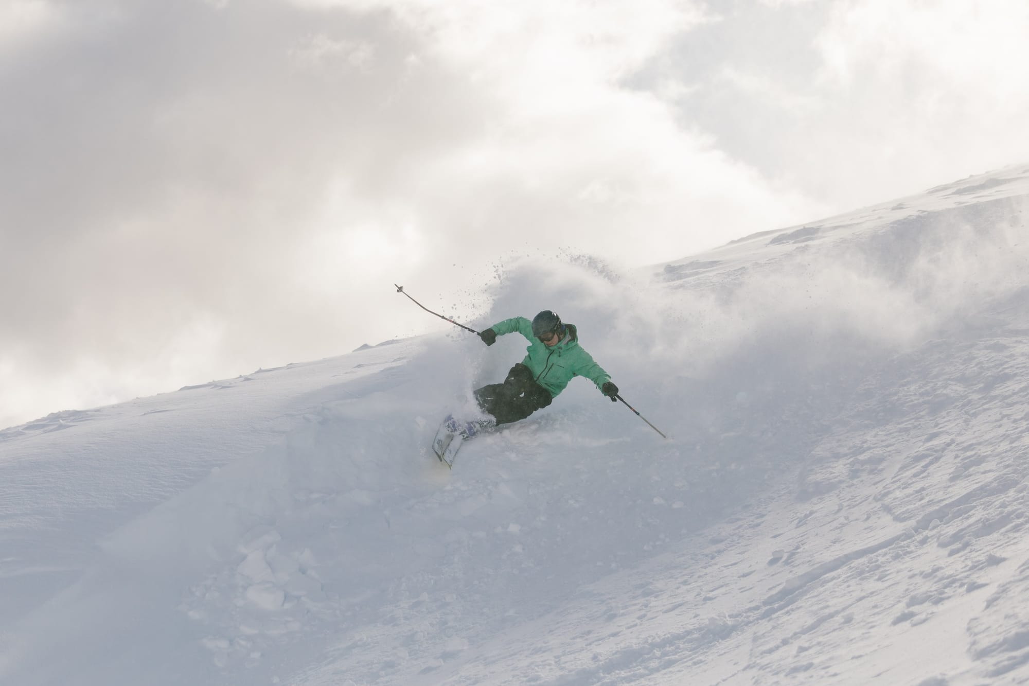
Spring Thaw Arrives — Last Runs and Fresh Top-Ups Across Southern Hemisphere Resorts
Weekly Snow News for Southern Hemisphere, updated 17 September 2025: Late-season snow and top-ups keep Perisher and Chilean resorts deep while many Andes areas begin to close.
- Spring arrives — many Southern resorts preparing to close.
- Australia posts some of the deepest September bases worldwide.
- New Zealand sees significant top-ups and Whakapapa lift reopening.
- Chile and Argentina: mixed late-season snow, pockets of deep cover.
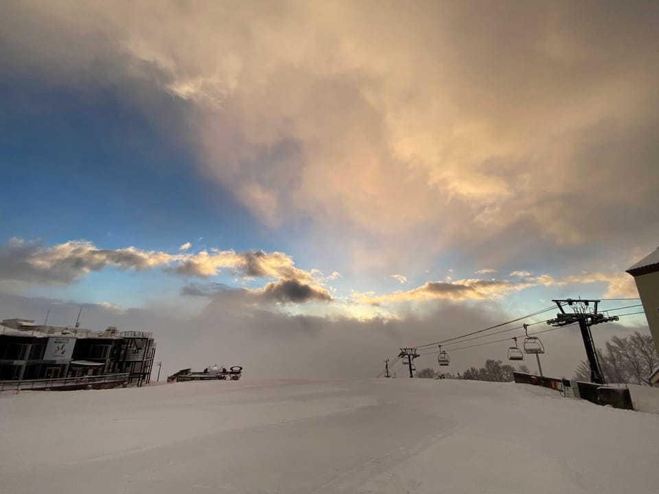
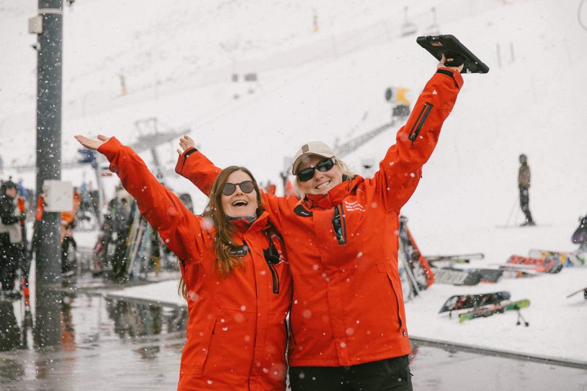
Australia
There was more snowfall on Aussie slopes as we were publishing last week’s report, which eventually added up to another 10–20 cm (4–8") by the time skies cleared on Thursday. But it has continued to warm up—especially at low elevations in springtime—so the result has been the typical spring mix of short-lived fresh powder and sticky snow in the afternoons, with snowpacks starting to reduce overall.
That said, it continues to be one of the best seasons in years, with some of the deepest September bases Australian centres ever see, and some of the deepest in the world still at present. Although its base depth has dropped, Perisher (120/215 cm / 48/86") still offers more terrain than anywhere else currently open on the planet. Thredbo (108/196 cm / 43/79") and Charlotte Pass (170/230 cm / 67/91") are also thriving, thanks to recent 15 cm (6") top-ups. Charlotte Pass’s base depth is currently the deepest in the world.
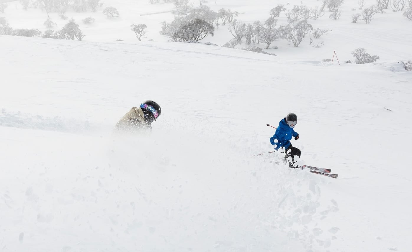
Hotham (60/107 cm / 24/43") and Falls Creek (62/101 cm / 24/40") are reporting excellent coverage, with powder pockets and spring sunshine. Mt Buller (49/98 cm / 20/39") remains popular for weekenders, though lower slopes may soften by midday. Tasmania’s Ben Lomond (40/80 cm / 16/31") and Mount Mawson (30/60 cm / 12/24") are holding up, with light snow forecast.
Overall, it remains a stellar late-season window for Aussie skiers as we enter the final few weeks—especially at higher elevations.
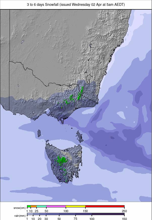
Forecast
Australian ski areas will see light snowfalls and variable conditions, with most resorts expecting 2–12 cm (1–5") of fresh snow. Snow levels will dip to 1100–1500 m, with northwesterly winds strengthening midweek. Expect cloudy skies, icy tracks, and brief clear spells—a classic late-season mix before warmer weather returns.
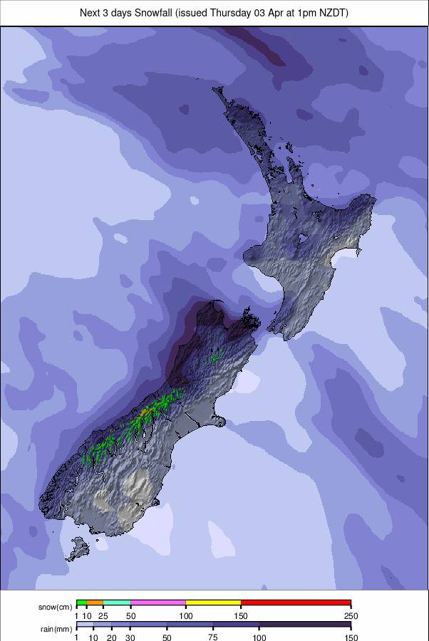
New Zealand
New Zealand’s ski areas have been enjoying a snowy September and some of the best conditions of the season. The upside is particularly noteworthy on the North Island, where Whakapapa (70/100 cm / 28/39") and Tūroa (75/105 cm / 30/41") on Mt Ruapehu are both reporting deeper cover, more lifts operating, and more terrain open after their challenging first month.
As a result, Whakapapa has announced its West Ridge Quad chair is ready to ride for the first time in two years.
“After a massive team push, final checks are done and everything’s in place. Big thanks to the whole crew, including Patrol, Grooming, Maintenance, and Operations, who have worked hard to bring this lift back to life. We’re stoked to say it’s ready to open, weather permitting,” the centre says.
Elsewhere, there’s been plenty of fresh snowfall again this week, with powder days declared. The main issue at times has continued to be gale-force winds leading to slope closures. Mount Hutt (138/166 cm / 54/65") leads in snow depth on the South Island and remains fully open. Porter Heights (130/160 cm / 51/63"), Mount Olympus (90/110 cm / 35/43"), and Craigieburn (80/100 cm / 31/39") are also reporting excellent conditions. Cardrona (65/85 cm / 26/33"), Treble Cone (60/85 cm / 24/33"), and The Remarkables (80/110 cm / 31/43") are benefiting from recent top-ups.
Forecast
New Zealand’s snowfields are in for a wintry blast. Resorts could see 10–39 cm (4–16") of fresh snowfall. Expect cold temperatures, gusty winds, and low visibility at times. Friday looks stormy, but clearer spells may return Saturday.
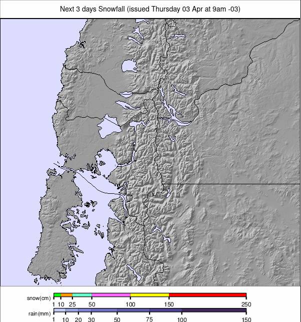
Argentina
We’re into the final weeks of the season in Argentina. Although there have been some mostly light snowfalls, it has been largely dry and sunny, with summit temperatures dipping to –10°C for some areas overnight and climbing to only +3°C in the daytime. At lower elevations, though, afternoons have topped +10°C, creating classic spring freeze–thaw conditions.
Caviahue and Chapelco are reported to have ended their 2025 seasons. The largest lift-served area when fully open, Catedral Alta Patagonia (30/60 cm / 12/24"), has seen a modest refresh, though only a handful of runs are open there, as has been the case all season. Las Leñas (45/115 cm / 18/45") is the standout for snow depth, boasting deep upper cover and powder-packed bowls. Chapelco (35/90 cm / 14/35") continues to deliver consistent coverage, ideal for intermediate terrain. Down south, Cerro Castor (50/90 cm / 20/35") leads in operational terrain, with nearly full lift access and packed powder conditions. Cerro Bayo (25/70 cm / 10/28") is holding up well, though warmer base temps may soften snow by afternoon.
Forecast
Argentina’s ski areas will see light to moderate snowfall, with Catedral Alta Patagonia forecast to receive up to 16 cm (6"), and Las Leñas, La Hoya, and Cerro Castor a more moderate 2–7 cm (1–3"). Conditions will be wintry but variable, with cloud cover, gusty winds, and intermittent visibility.
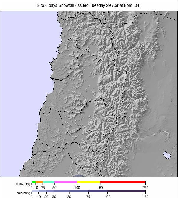
Chile
Chile’s ski areas have enjoyed mostly sunny skies and relatively mild spring temperatures over the past week. The latter is not great news for snow, of course, but we are nearing the season end. Summit highs have reached around +5°C, but nights continue to dip below zero, creating freeze–thaw conditions. With low wind and excellent visibility, conditions are great on the groomed runs, and powder is increasingly hard to find.
Valle Nevado (60/180 cm / 24/71") remains fully open and currently has South America’s deepest reported cover. Nearby La Parva (55/160 cm / 22/63") and El Colorado (30/160 cm / 12/63") are also looking strong for late season, offering packed powder and high lift access. Portillo (65/140 cm / 26/57") remains a favourite for advanced skiers, with 91% of its terrain still open. Further south, Nevados de Chillán (110/150 cm / 43/59") is also 100% open but has announced it will close this coming weekend on the 20th. Chapa Verde (25/60 cm / 10/24") and Antillanca (20/50 cm / 8/20") are holding up, though conditions vary with elevation.
Forecast
Chile’s ski areas are expected to see a notable snow refresh, especially in the south. Pucon leads with up to 59 cm (two feet), while El Colorado near Santiago could see 41 cm (16"), and Termas de Chillán around 18 cm (7"). Expect cold, stormy conditions, low visibility, and strong winds midweek, easing slightly by Saturday.