North America Weekly Snow Roundup #286
Weekly Snow News for North America, updated 29 October 2025: Keystone opened first for 2025/26 amid 60 cm (2 ft) Pacific Northwest snowstorms and strong starts in Colorado and Western Canada.
- Keystone wins 2025/26 North American opening race
- Pacific Northwest is buried under 60 cm (2 ft) of snow
- Canadian Rockies prepare for early November openings
- Colorado and Arapahoe Basin kick off ski season
- First flakes reach the East Coast mountains
North America Ski Season Update and Conditions 2025/26
It has been an exciting week across the continent with more snowfall in many mountain areas, including the first measurable flakes on the East Coast. Temperatures have also fallen into the 20s °F, enabling snowmakers to do their work. All this meant that anticipation levels for the first resort to announce its opening date reached fever pitch among local skiers by the start of the weekend, with Colorado’s Arapahoe Basin and Keystone appearing to be front-runners to be first to open. Ultimately, Keystone managed this by deciding to open at 8.30 am on Sunday.
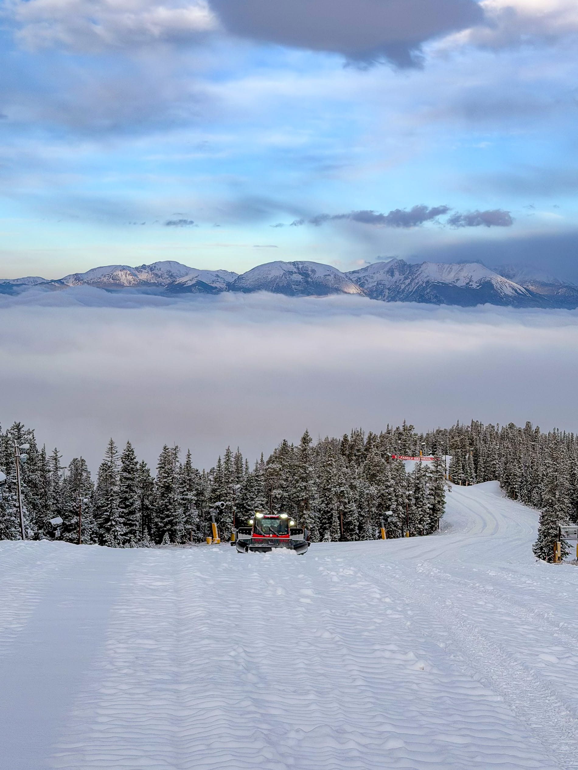
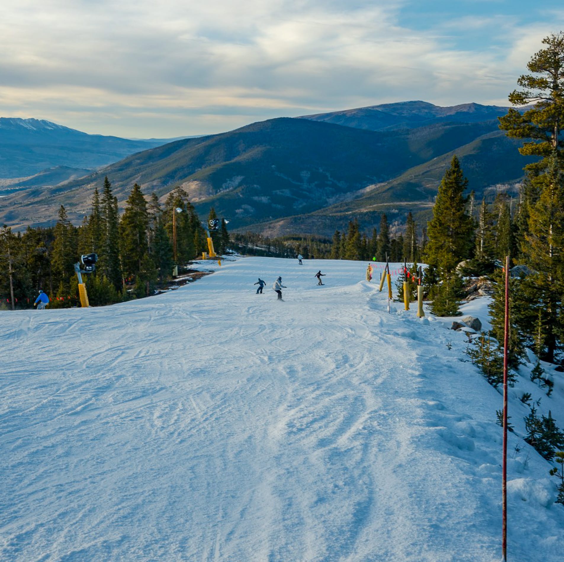
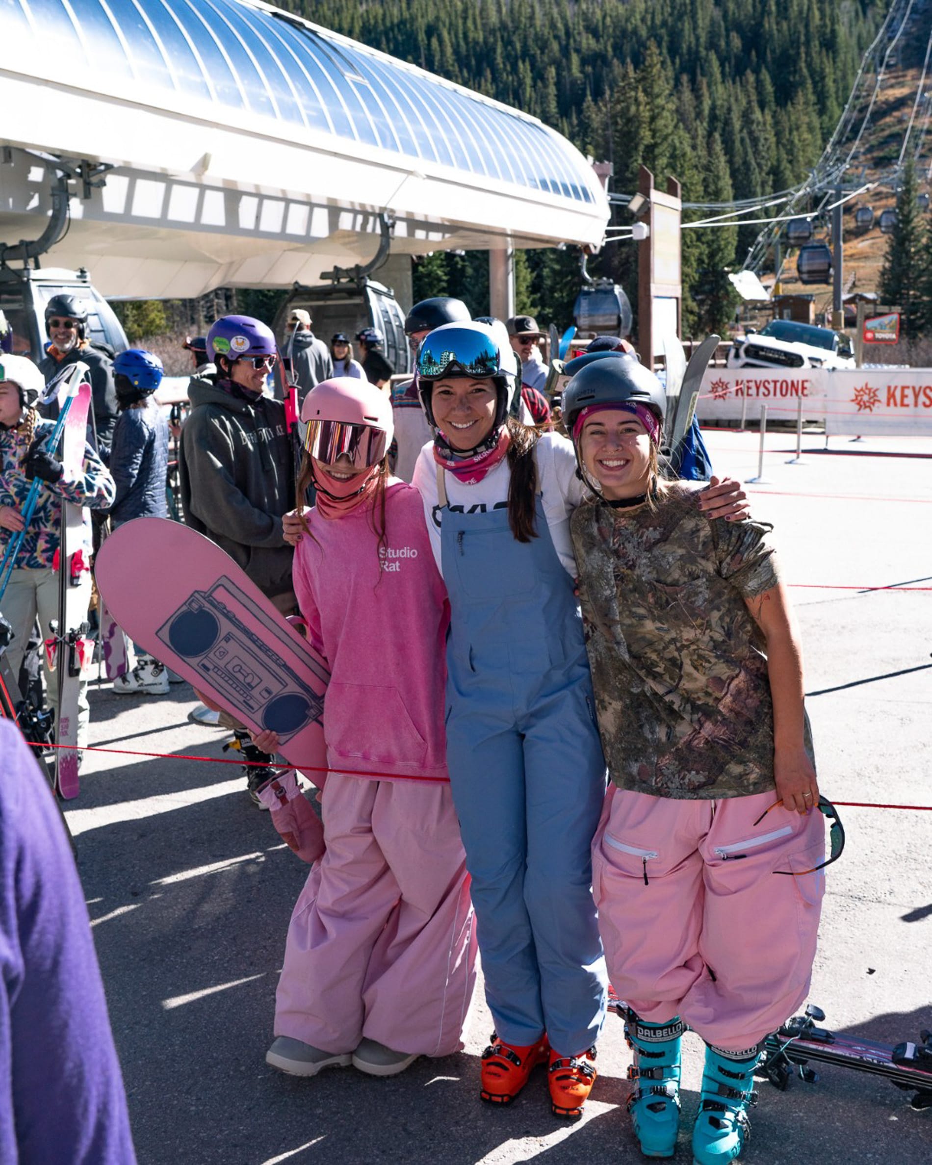
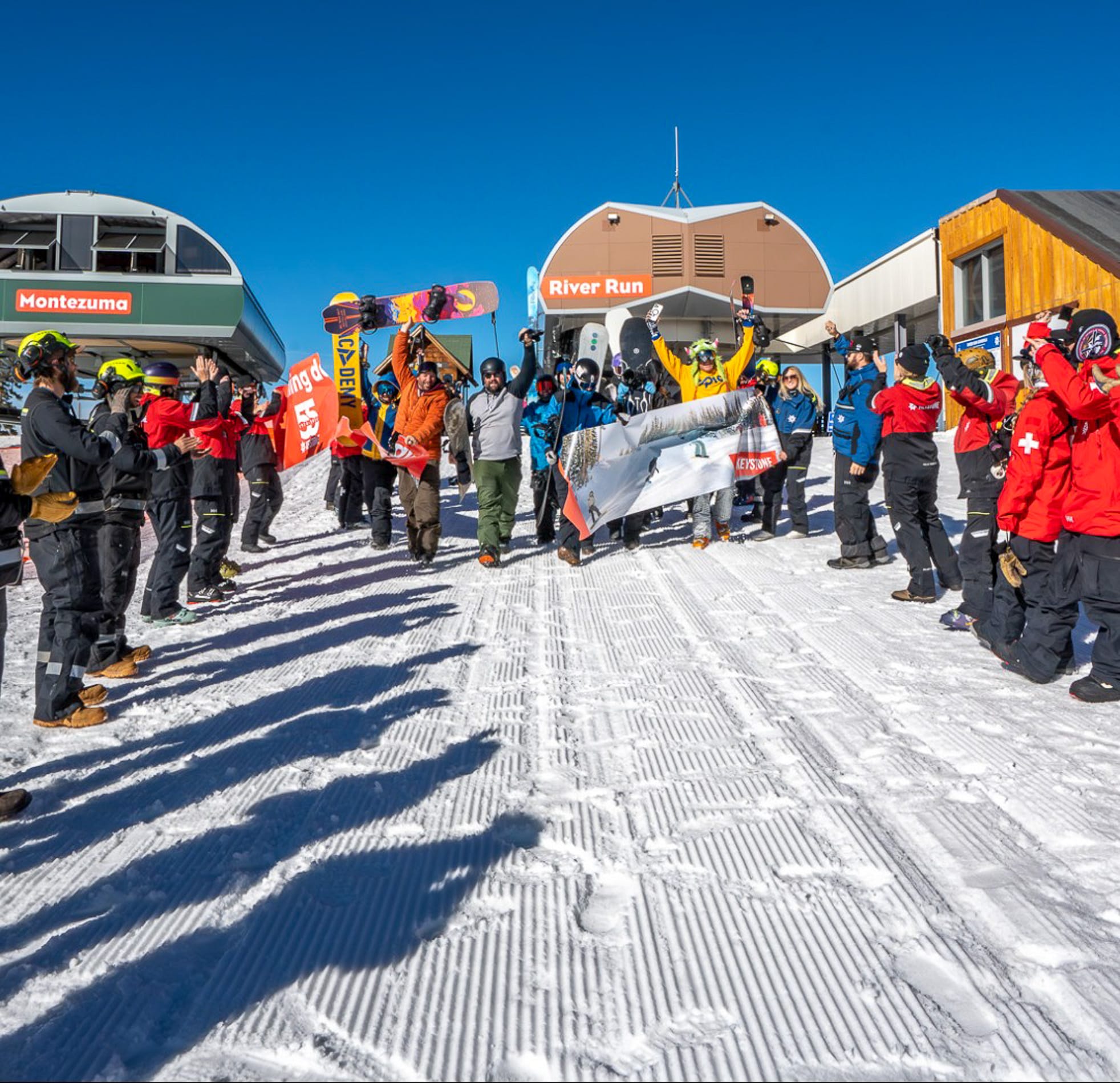
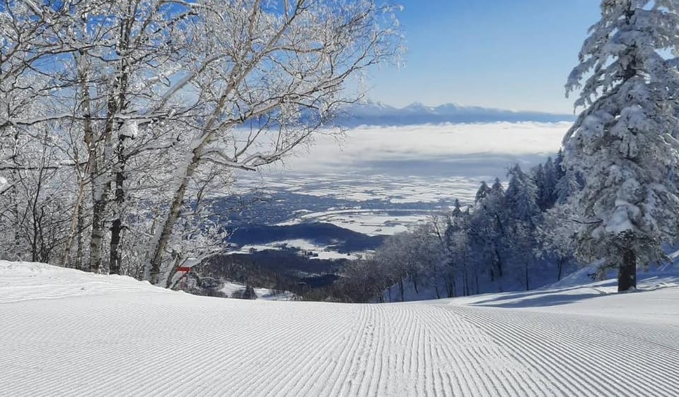
Images from the opening of Keystone
The heaviest snowfall has been in the Pacific Northwest corner of the continent, where a series of snowstorms delivered up to 2 feet (60 cm) through the end of last week and into the start of this week, blanketing higher terrain.
Beyond the season-opening excitement in the US, it has also been cold and snowy in the mountains of Western Canada, with Banff Mount Norquay set to open in just three days and Whistler Blackcomb in 23, while Revelstoke and Mount Washington both plan November 29 openings. The season start here is now just over a week away.
Canada Ski Season Outlook and Snow Conditions 2025/26
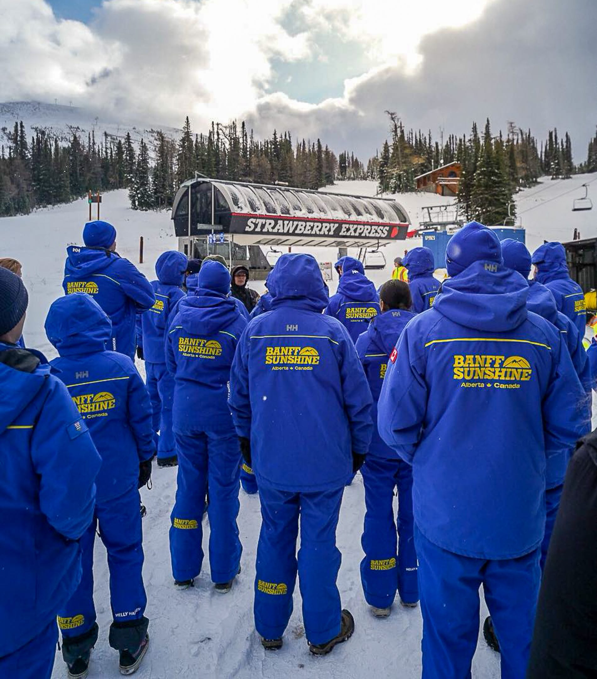
The start of Canada’s ski season is expected to be just over a week away, with the three ski areas around Banff (Sunshine, Mt Norquay, and Lake Louise) likely to be the first to open ahead of the weekend after this. Other probable early openers include Nakiska, closest to Calgary, and Marmot Basin near Jasper, all in Alberta.
Over in the east, Sommet Saint-Sauveur in Quebec tends to open as early as it can. North America’s largest, Whistler-Blackcomb, opens in just over three weeks, aiming for 21 November. Weather conditions have been increasingly promising, with plenty of snowfall in the west and sub-zero temperatures. The past few days have seen mixed conditions, with Alberta mostly dry, highs ranging from -5 °C to 2 °C, and little fresh snow. British Columbia has been cool (-8 °C to +2 °C) with frequent snow and rain showers to start the week.
Canada Snow Forecast
Looking ahead to the weekend, Alberta ski regions will be mainly dry, with highs of 2–7 °C and lows near -5 °C. Winds remain light to moderate, and while no significant snowfall is expected, conditions will be suitable for snowmaking. In British Columbia, colder air brings highs of -2 °C to 2 °C and lows down to -6 °C, with 6–15 cm (3–6 in) of snowfall forecast towards the weekend. Freezing levels drop below 1,600 m, favouring upper terrain coverage.
United States Ski Season Update and Resort Openings 2025/26
Excitement grew throughout last week in the Rockies as very low temperatures created excellent snowmaking conditions, while multiple fronts delivered substantial snowfall. The expectation that at least one high-altitude Colorado ski area would open by Saturday was high, especially with the forecast remaining similar.
It was a surprise then that no one announced a Saturday opening by Friday night, but Keystone (0/12” / 0/30 cm) made its 3 pm move as soon as Arapahoe Basin (2/12” / 5/30 cm) said they were open on Sunday. This unusual start to the season saw Keystone opening the Schoolmarm and Silver Spoon trails for three hours until 6 pm, finishing under the resort’s famous floodlights. Keystone always aims to open with at least two miles of runs, and 2025 was no exception. Its Opening Day also featured a hike-to terrain park under snowcat-lit conditions, a live DJ, and $5.50 beers and hot dogs to celebrate the resort’s 55th season. Terrain is accessed via the River Run Gondola, with laps off the Montezuma Express lift; skiers download back to base at day’s end.
“We’re thrilled to kick off the season here at Keystone with over two miles of skiing and riding,” said Resort Vice President and General Manager Shannon Buhler. “Our team has poured their hearts into creating an incredible early opening celebration. We’re just excited to be back on snow.”
though some light snow in Vermont and surrounding states generated social media Keystone says their snowmaking team will continue working around the clock to expand terrain as weather permits. During early-season operations, uphill access remains closed and later restricted to designated routes outside lift hours. Details are on the resort’s safety page.
Arapahoe Basin has also started its season — usually North America’s second longest after Oregon’s Timberline, opening in three days — lasting around eight to nine months into late spring or early summer. Its Black Mountain Express is now operating 8:30 am to 4:00 pm daily, servicing High Noon.
Beyond Colorado, snow and good snowmaking conditions have spread across many western mountain areas. The Pacific Northwest continues to see the best of it, with most regions recording at least 5 cm (2 in) fresh snow. Resorts such as Mt Hood Meadows (opening in 17 days), Crystal Mountain (24 days), and Mount Baker (23 days) are counting down to their November starts.
Ski areas in Oregon, Washington State, and neighbouring regions received up to 2 feet (60 cm) of snow over the weekend, enticing some early hikers to take their first turns of the season. Unfortunately, one 29-year-old snowboarder was injured on Mt Bachelor’s Cinder Cone, prompting a search and rescue operation by 15 volunteers.
There’s not much to get excited about in the East yet, though some light snow in Vermont and surrounding states generated social media buzz. A few high-elevation resorts like Stowe saw brief white peaks sufficient for photographs but no lasting cover.
United States Weather and Snow Forecast
The coming days are expected to show a mixed pattern across regions. The Pacific Northwest and northern Rockies look most wintery, with Oregon and Washington State expecting moderate to heavy snow from Pacific systems and lower temperatures. The north Rockies around Montana and Wyoming may see up to 20 in (50 cm) on high terrain, building a promising early base. Central Rockies (Colorado and Utah) should see lighter 4–8 in (10–20 cm) falls. The Southwest remains dry and mild, while the Sierra Nevada stays snow-free mainly. Midwest and Northeast mountains could see occasional lake-effect flurries but no sustained cover yet.