North America Weekly Snow Roundup #282
Weekly Snow News for North America, updated 1 October 2025: First Pacific flakes; Midwest ‘Snow Stash’ returns; Rockies dustings 2–3 cm (1 ") aid snowmaking ahead of late-October openings.
- First flakes hit Pacific ranges; webcams light up again
- Midwest unwraps farmed snow for Open Haugen Weekend
- Rockies eye late-October starts with helpful dustings
- Canada’s Rockies trend cooler with light weekend top-ups
USA
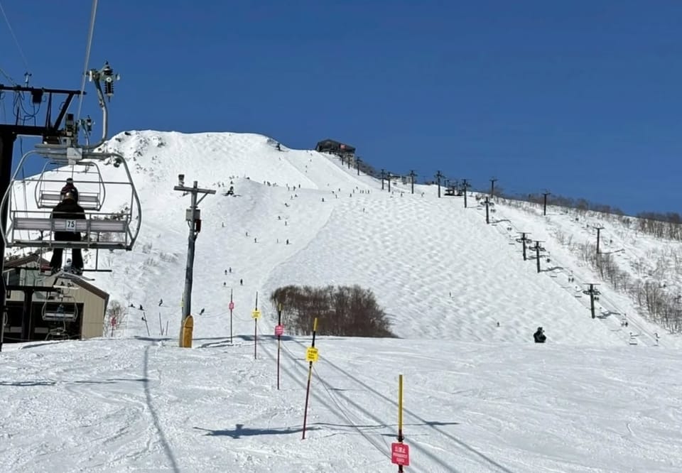
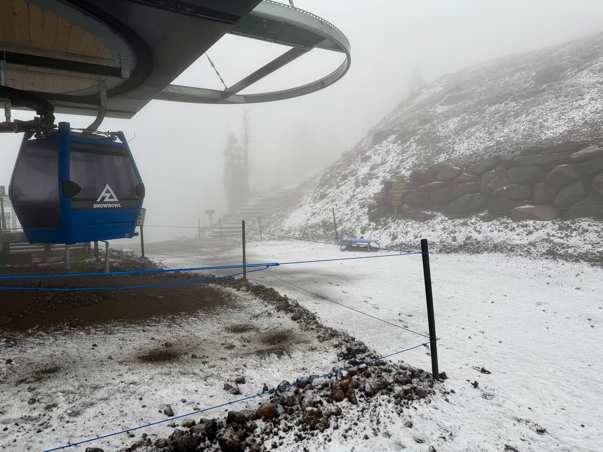
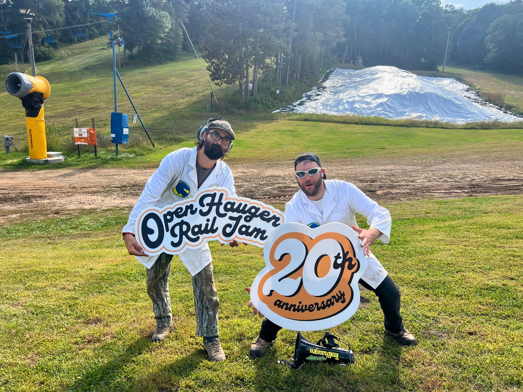
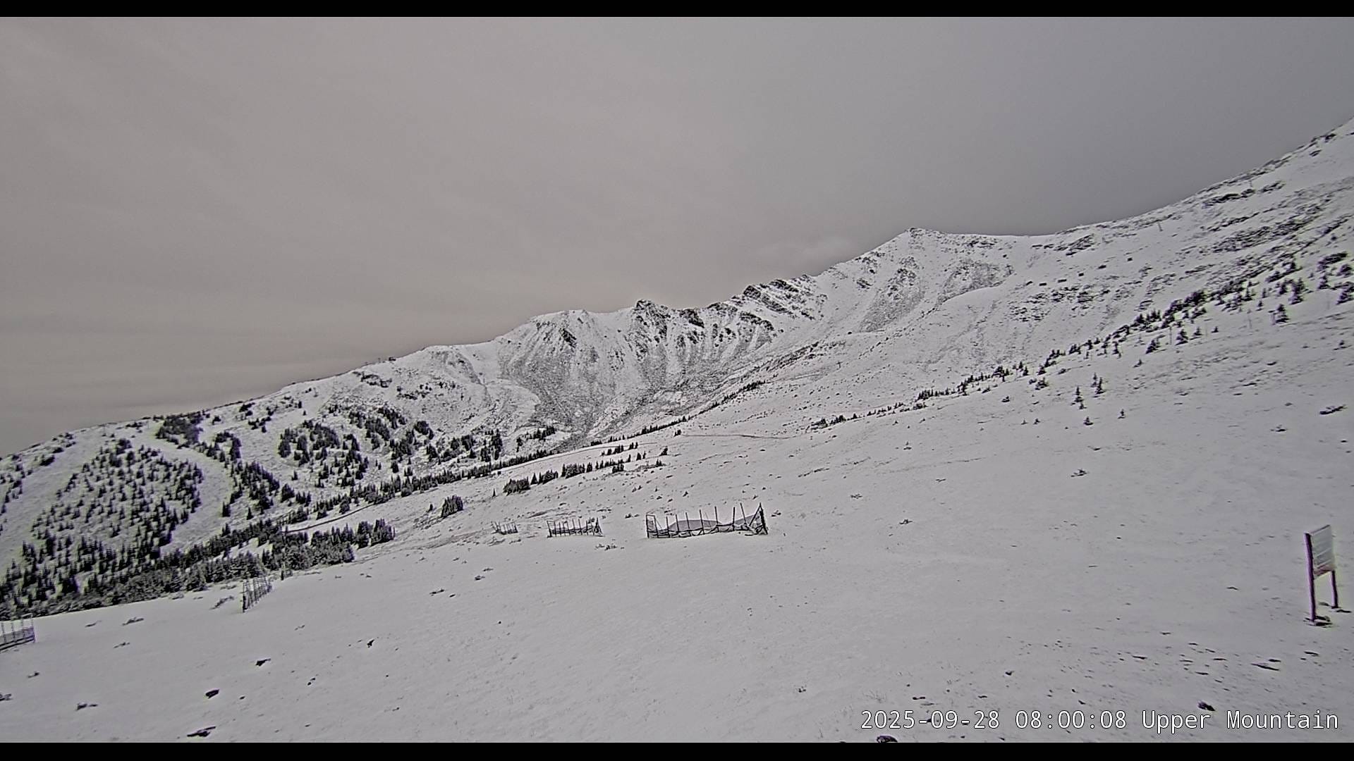
California was the latest US state to report first snowflakes falling this week. It was so light that resorts like Heavenly and Mt. Rose opted for videos of the flakes in their posts, as there was hardly enough accumulation to be visible on the ground, but it still generated huge excitement. The snowfall was reported along the entire Pacific coast, with Whistler Blackcomb also posting video of falling (but not yet accumulating on the ground) snowflakes. Inland Marmot Basin at Jasper and other Alberta ski areas have been posting snowier webcam images, showing snow covering mountainsides, not just in the air, this week too. There will be some on-snow action this weekend, though, and in the Midwest, as Trollhaugen in Wisconsin is due to unwrap its ‘Snow Stash’, which it stockpiled last spring under big white tarps, for its annual Open Haugen Weekend, incorporating its 20th Anniversary Rail Jam this October 3–5. Looking ahead, our forecasts predict a few centimetres of snow at Arapahoe Basin on Saturday, accompanied by overnight freezes — ideal for snowmaking — as they anticipate a late-October opening window around 24 days from now.
Forecast
North America’s mountains are edging ever closer to early-season mode this week. Light snow is forecast for parts of Colorado, New Mexico, and the Canadian Rockies. Taos and Copper Mountain may see 2–3 cm (an inch), while Jackson Hole and Mammoth stay cool with highs around 10 °C. It will also be cool in the East. Stowe in Vermont could receive a dusting of snow at higher elevations midweek. Snowmaking is expected to begin at several resorts as temperatures drop below freezing overnight. While no major storms are expected, high-altitude areas should continue to see early dustings and continue prepping for late-October/early-November openings.
Canada
Early-season signals are building. The first coastal flakes aligned with Pacific systems were noted on webcams, while the Canadian Rockies — including Marmot Basin — showed broader mountain coverage this week.
Forecast
Sunshine Village and Lake Louise are both expected to receive fresh snow this weekend and are tracking for early November starts (around five weeks), while Marmot Basin also looks set for a light top-up on Saturday ahead of a late-November opening.