NASA Photos Show Snow Loss in Californian Mountains
NASA has published images of California’s Sierra Nevada mountains taken 15 years apart to show the amount of snow cover disappearing.
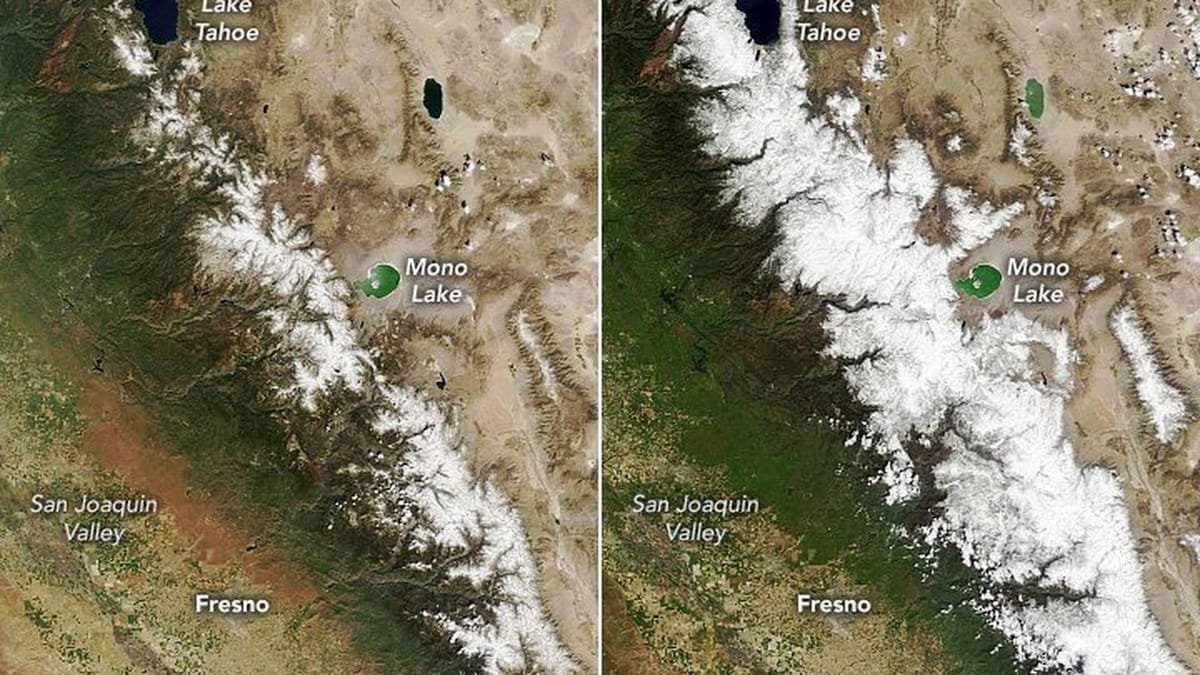
The space agency’s Nasa Earth division released the images taken in 2006 and in 2021 show dramatically less snow this year than 15 years ago. Each image was taken around April 1st when the snowpack is usually at its maximum.
In fact the region is famous for, typically, either getting huge snowfalls, or near drought conditions, depending largely on atmospheric conditions and sea temperatures in the Pacific Ocean.
It was only a few winters ago that Californian ski areas covered in the images were posting record snowfall in January and February and several opened for skiing through to August.
But scientists say this heavy snowfall coming over just a few weeks is part of a pattern of more extreme dry or wet weather in the region, and in many other parts of the world, and that the longer term trend is more drier weather.
NASA say the images show the gradual “drying” of the mountains and that overall they have ultimately seen less snow accumulation in recent years.
Alongside the comparison images, Nasa also posted a timelapse video of springtime in the snow-covered region, spanning a time frame from 2006 to 2021. The difference is stark, showing while there are still wet cycles, the dry cycles of the region are becoming harsher and more frequent.
“Snow in the Sierra Nevada tends to be boom or bust, and much of it tends to come from atmospheric river events,” McKenzie Skiles, a snow scientist at the University of Utah, told Nasa.
“Over the past 10 years, there have been fewer boom years, while the dry years have been getting drier.”


