Europe Weekly Snow Roundup #299
Weekly Snow News for Europe, updated 28 January 2026: colder weather brings regular snowfalls, high avalanche danger in places and mostly full terrain openings.
- Wintry pattern returns across most European ski regions
- Pyrenees post Europe’s deepest bases and heaviest snow
- Cold temperatures preserve snow quality
- Most major resorts operating 85–95% open terrain
Europe Snow Report and Ski Conditions 2025/26
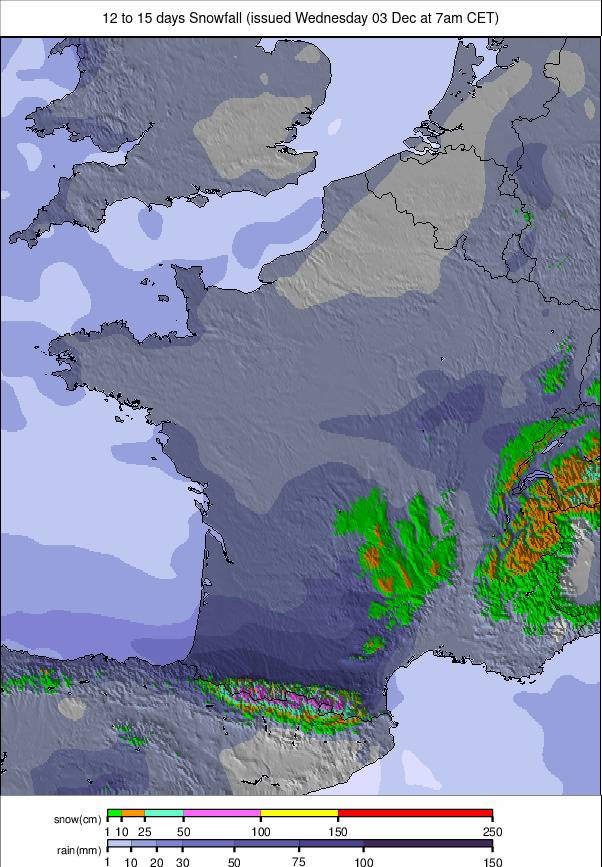
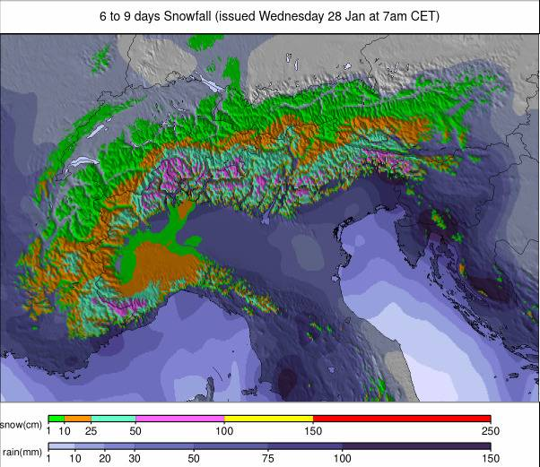
A more wintry pattern has finally settled over Europe this week, bringing a welcome spell of fresh snowfall to most ski regions. Many areas have seen regular topups, albeit generally light ones, ending the latest dry spells that dominated earlier in the season. That said, some areas have posted more. The Pyrenees again topped the snowfall tables with up to 80cm (32”) in 72 hours, leading to high avalanche danger off piste. In the Dolomites, it’s been up to 55cm (22”) and in the southwestern Alps up to 35cm (14”).
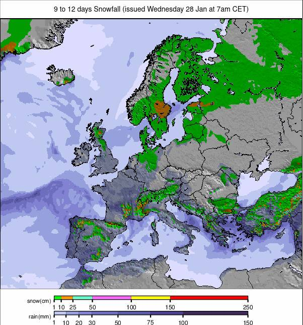
Temperatures have stayed firmly on the cold side too, rarely nudging above freezing in the Alps and frequently dropping to between –8°C and –18°C above 1,800m, with similarly frigid conditions right down to sea level up in northern Scandinavia. Snow bases are still running behind where they would normally be in January in most areas, with the big exception being the Pyrenees, where they’re now running 50% above normal after further snowfalls this past week.
Right across Europe, almost all larger resorts continue to operate with the bulk of their terrain open, often 85–95% or more. The high snowfall in the Pyrenees has pushed avalanche danger up to very high in places, while elsewhere the fresh snow has refreshed pistes and improved ski quality without major disruption.
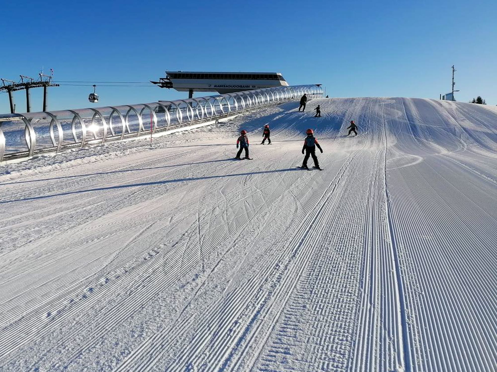
Austrian Alps Snow Report and Ski Conditions
A mixed week in the Austrian Alps with snow showers, sunny spells and also periods of low cloud and poor visibility. The snow showers have been mostly light, in the 5–10cm (2–4”) range, boosting cover a little but more importantly giving slopes a healthy refresh. Temperatures have been generally favourable, with lows down towards –10°C and, in the valleys, highs not much above freezing in the afternoons. Not a lot of change from a week ago with the big picture, though, which is that the Austrian snowpack remains at about 75% of the seasonal average. Most of the country’s larger areas have most of their terrain open, albeit with a lot of machine-made snow forming the bulk of the snowpack, while smaller, lower resorts continue to struggle. The Skiwelt (60/90cm / 24/36”), home to Soll, Ellmau, Westendorf and others, reports about 85% of its slopes open, equating to around 230km (144 miles) of runs. It’s just ahead of potentially larger areas, the Arlberg and Saalbach–Hinterglemm, in terms of what’s actually available to ski.
Austria Weather and Snow Forecast
More snowfall is forecast for much of the Austrian Alps, with frequent light-to-moderate snow showers and consistently cold temperatures helping to refresh pistes through the rest of the week. Widespread light snow is expected midweek, with deeper falls in higher, storm-exposed regions such as the Arlberg, Gasteinertal and Silvretta.
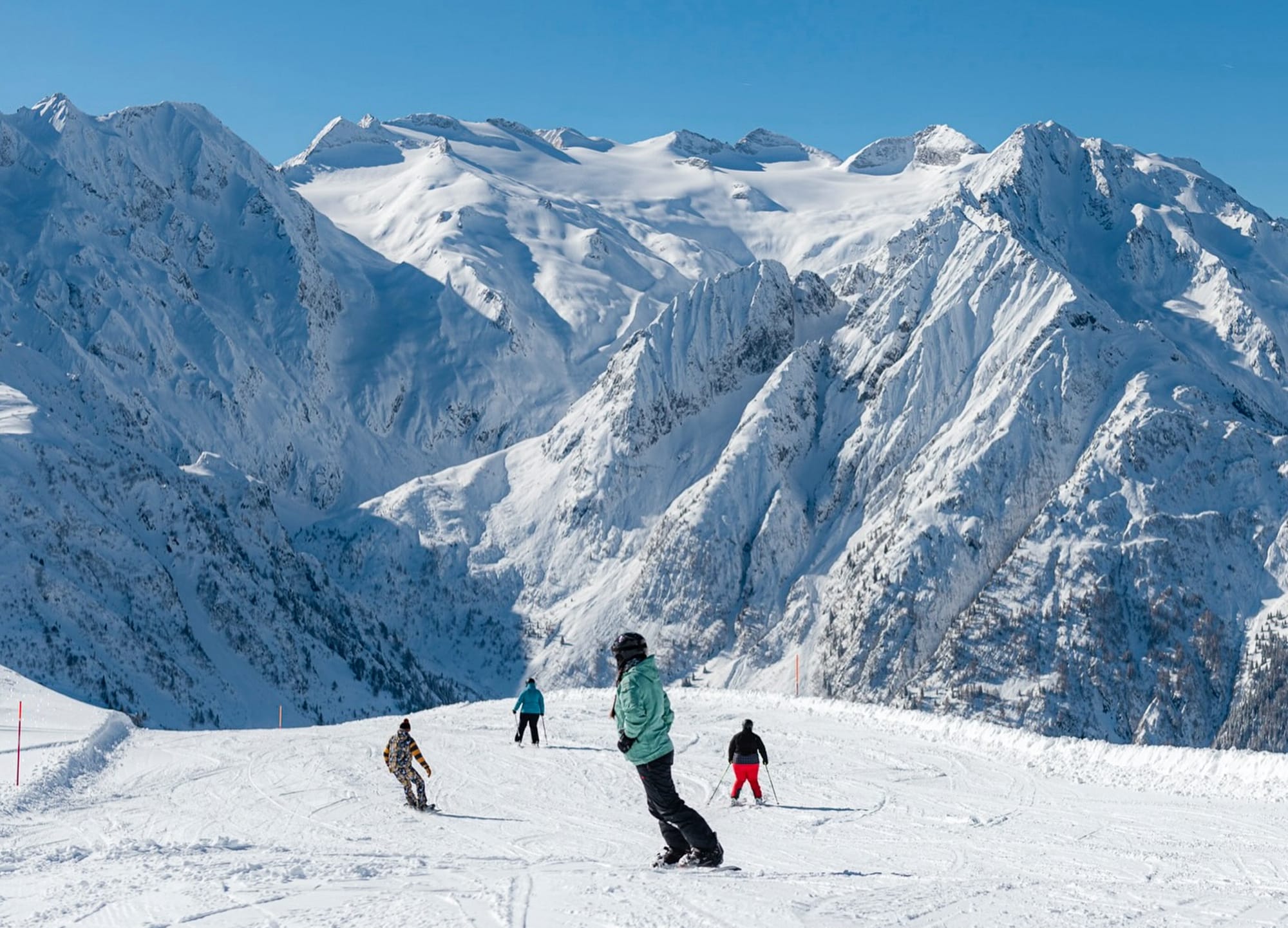
French Alps Snow Report and Ski Conditions
Full-on winter seems to have arrived this week in the French Alps, with most ski areas across the country seeing regular snowfall since the weekend. Temperatures have been low too, rarely getting above freezing, with overnight readings at altitude dropping below –15°C. The snowline has been in the 500–1,400m zone, meaning snowfall reached valley floors in many cases. Couple this slope refresh with the fact that most regions had 90% or more of their terrain open as of last week, and it’s a winning combination. Les 3 Vallées (120/190cm / 48/76”) has about 500km (313 miles) of slopes open, the most in the world. Chamonix (105/200cm / 42/80”) posted the most snowfall in the French Alps over recent days with 35cm (14”). Snow depths are climbing again, with La Clusaz (25/270cm / 10/108”) currently topping the table. Conditions remain wintry across most elevations, with fresh snow improving surface quality across pistes and off-piste terrain alike.
France Weather and Snow Forecast
Further fresh snowfall is expected across the French Alps over the coming week, mostly modest accumulations, combined with sub-zero nights and occasional clearer spells. Higher-altitude resorts such as Chamonix, Tignes, Val Thorens and Avoriaz should see the biggest falls, while lower valleys may see occasional sleet or rain.
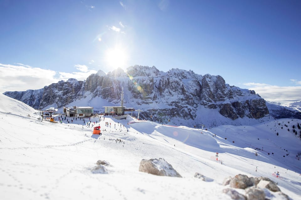
Italian Alps Snow Report and Ski Conditions
Italy has been enjoying some of its most widespread snowfall of the season so far, with most ski areas seeing at least 10cm (4”) since the weekend, and some recording totals of 30–50cm (12–20”). The Carezza region (50/100cm / 20/40”) in the Dolomites posted the biggest recent total with 55cm (22”) since Sunday. For most resorts, snowfall has come as lighter but healthy refreshes rather than major dumps. Temperatures have been very low, down to –20°C on the highest slopes, and rarely above freezing even in valleys. Via Lattea (20/120cm / 8/38”), linking Sestriere, Sauze d’Oulx, San Sicario, Claviere and Montgenèvre, reports around 70% open with 280km (175 miles) of slopes available.
Italy Weather and Snow Forecast
Snowy spells continue across Italy’s mountains, with cold temperatures and brighter intervals. The Dolomites and western resorts including Cervinia, Monterosa and Livigno should see the most regular snowfall, while occasional milder spells may bring sleet to lower valleys.
Swiss Alps Snow Report and Ski Conditions
Snow has fallen at times across much of Switzerland since the weekend, with many areas posting 5–10cm (2–4”) accumulations on most days. Temperatures have remained sub-zero much of the time, only rising a few degrees above freezing in lower valleys, and dropping below –10°C at 2,000m. The fresh snow has been a welcome refresh after dry spells in many regions. The 4 Valleys around Verbier (50/190cm / 20/76”) currently have around 90% of their 410km of slopes open, the most extensive offering in the country.
Switzerland Weather and Snow Forecast
Further snowfall is expected over the next few days, bringing showers, colder air and occasional brighter spells. Engelberg, Laax, Davos–Klosters and the Jungfrau region should see the most regular new snow, while lower slopes may experience mixed precipitation at times.
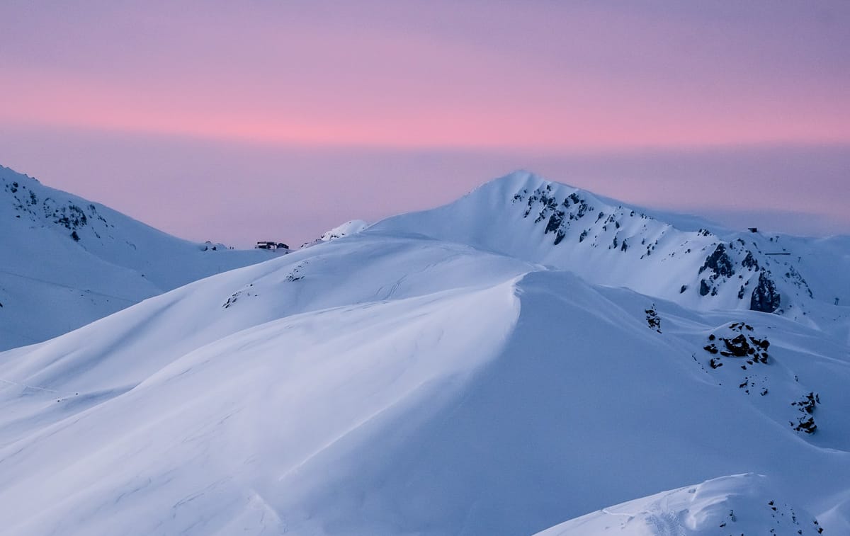
Pyrenees Snow Report and Ski Conditions
The Pyrenees continue to enjoy some of the best conditions in Europe. Another snowy week has added 5–10cm (2–4”) in many areas, with heavier totals over longer periods. Font-Romeu – Pyrénées 2000 (150/180cm / 60/72”) reported 80cm (32”) in 72 hours.
Bases are increasing rapidly and almost all resorts are at or close to 100% open. Baqueira Beret (90/120cm / 36/48”) briefly reached full opening before further heavy snowfall forced partial closures due to exceptionally high avalanche danger. Grandvalira (130/180cm / 52/72”) continues to report the most open terrain in the region.
Pyrenees Weather and Snow Forecast
Snow showers continue across the range over the next four days, with passing snowfall, colder spells and occasional brighter breaks. Lower elevations may see brief rain-snow transitions as milder air brushes the foothills.
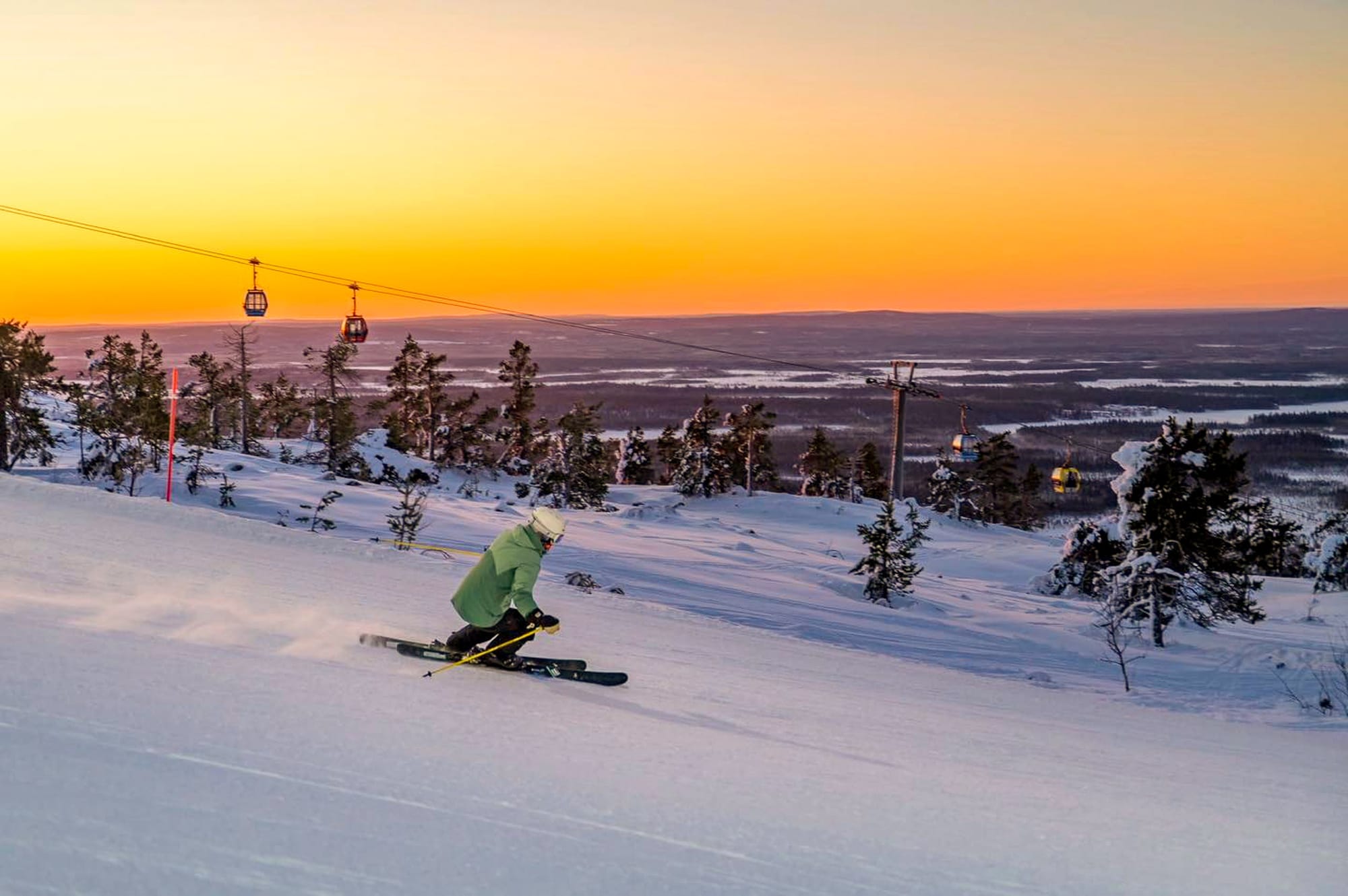
Scandinavia Snow Report and Ski Conditions
A sustained cold spell continues to dominate Scandinavia, with mountain temperatures frequently between –6°C and –15°C, dropping lower in northern resorts. Dry, sunny weather during limited daylight hours has combined with light snowfall to keep surfaces well preserved. Sweden’s Tänndalen (70/135cm / 28/54”) reports the deepest snowpack and is 100% open. Åre (50/70cm / 20/28”) has around 70km (43 miles) of slopes available, with close to 90% open.
Scandinavia Weather and Snow Forecast
Snow showers continue across the region, with western Norway likely to see the most frequent snowfall. Temperatures stay firmly cold, helping preserve cover across all elevations.
Eastern Europe Snow Report and Ski Conditions
Conditions continue to improve across Eastern Europe. Bulgaria saw dry weather end with a decent snowfall early this week. Bansko (10/120cm / 4/48”) reports more than 80% of slopes open following a 35cm (14”) weekend snowfall, pushing avalanche danger to high.
Farther north in Czechia, Poland and Slovakia, dry and sunny weather has dominated, with light snowfall of a few centimetres reported. Jasna (40/90cm / 16/36”) reports around 90% of its terrain open.
Eastern Europe Weather and Snow Forecast
Snowy spells continue across the region with light snowfall, colder phases and clearer breaks. Higher areas will see the most snow, with sleet or rain possible in valleys.
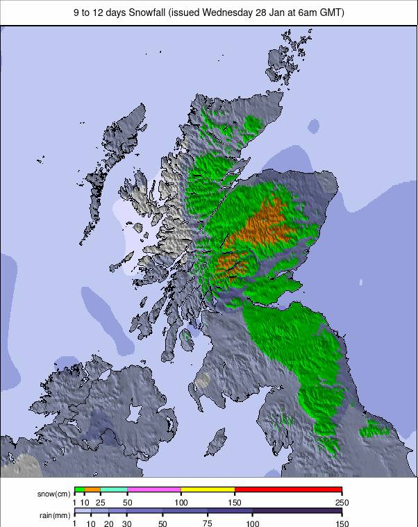
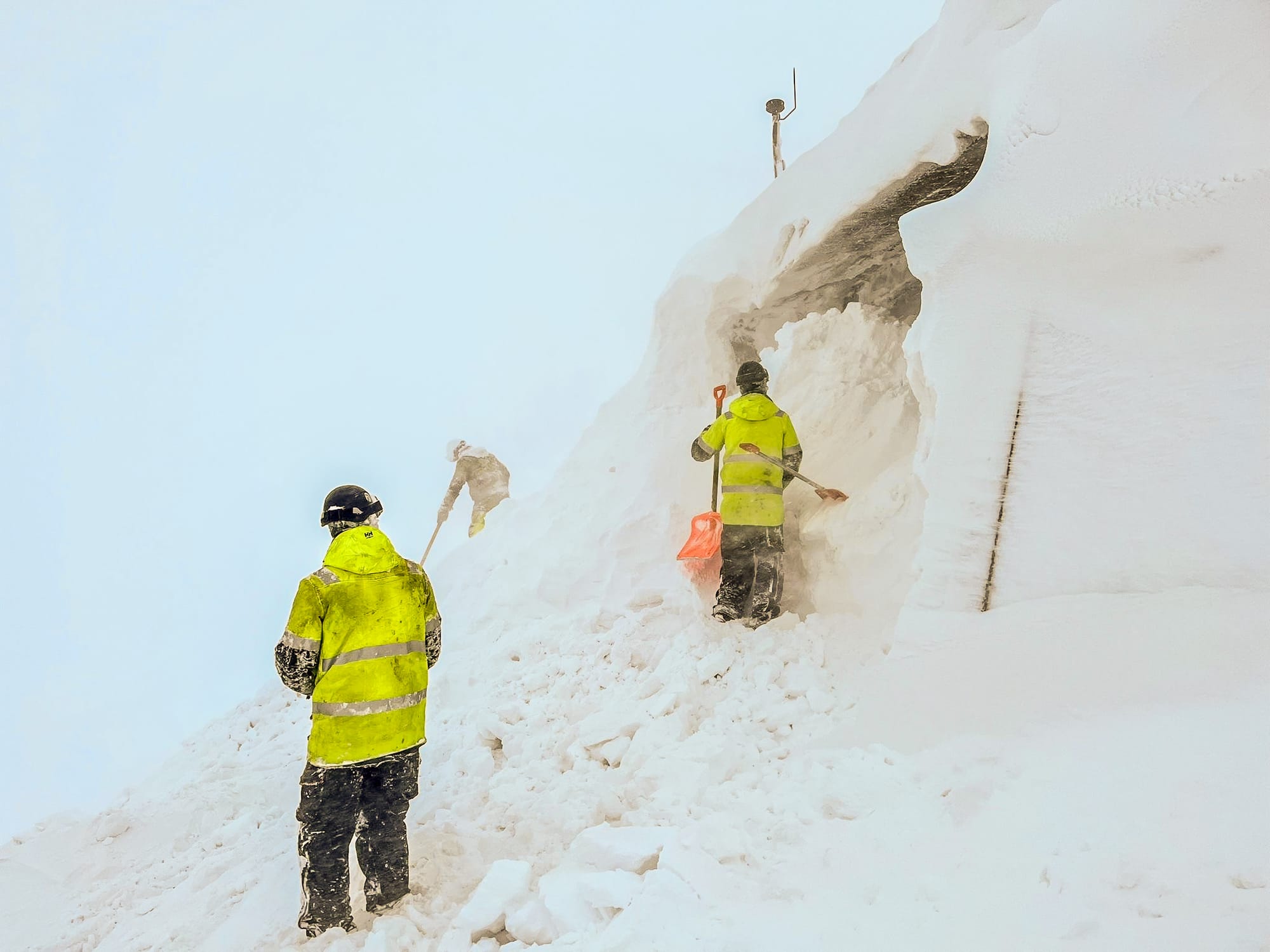
Scotland Snow Report and Ski Conditions
After three weeks of stable, cold weather, Scotland has returned to strong gales, blizzard conditions and fluctuating temperatures. This led to temporary closures across the country’s four centres. Conditions varied sharply over short distances, with rain stripping cover in some areas while snow improved conditions elsewhere.
Cairngorm and Glenshee reported some of the biggest drifting-snow build-ups on high terrain in recent years. Nevis Range and Glencoe have seen rapid changes as weather systems moved through.
Scotland Weather and Snow Forecast
Cold, wintry weather is set to continue into February. Summit temperatures frequently sit between –8°C and –12°C, keeping upper slopes frozen and offering good potential for holding new snow.