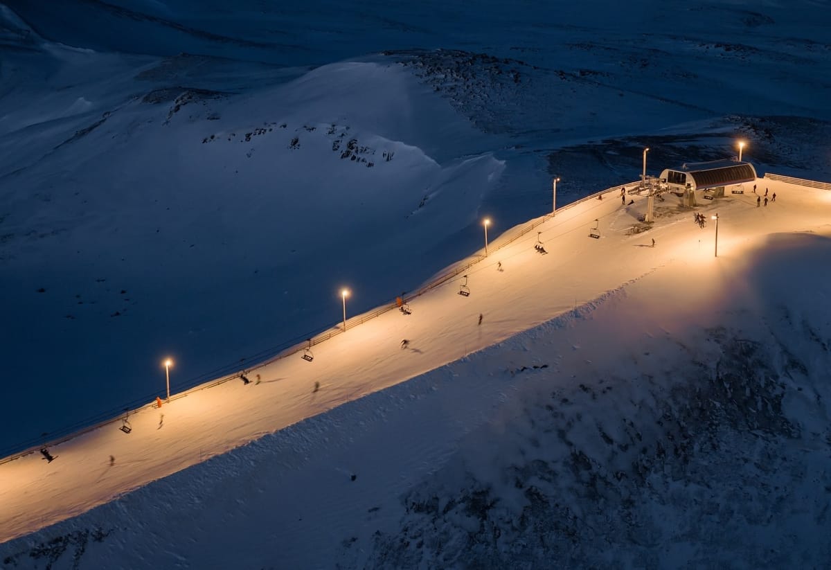
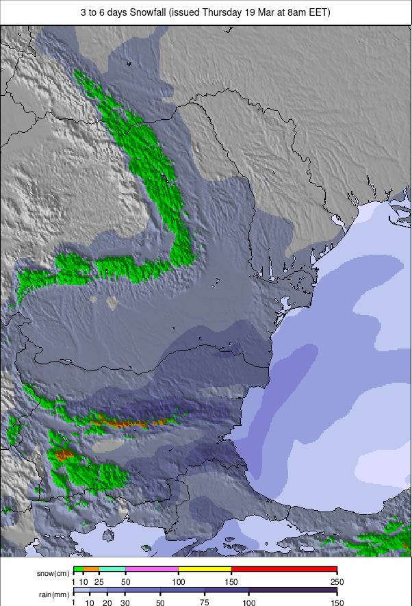
Europe Weekly Snow Roundup #306
Weekly Snow News for Europe, updated 19 March 2026: Alps see widespread snowfall up to 82cm (33"), while Scandinavia stays sub-zero and Scotland battles gales and fresh snow.
- Alps snowfall returns after prolonged dry spell
- Switzerland records Europe-leading 82cm (33") totals
- Scandinavia remains firmly sub-zero with regular snowfall
- Pyrenees continue with deep, above-average snowpack
- Scotland sees gales but fresh snowfall boosts conditions
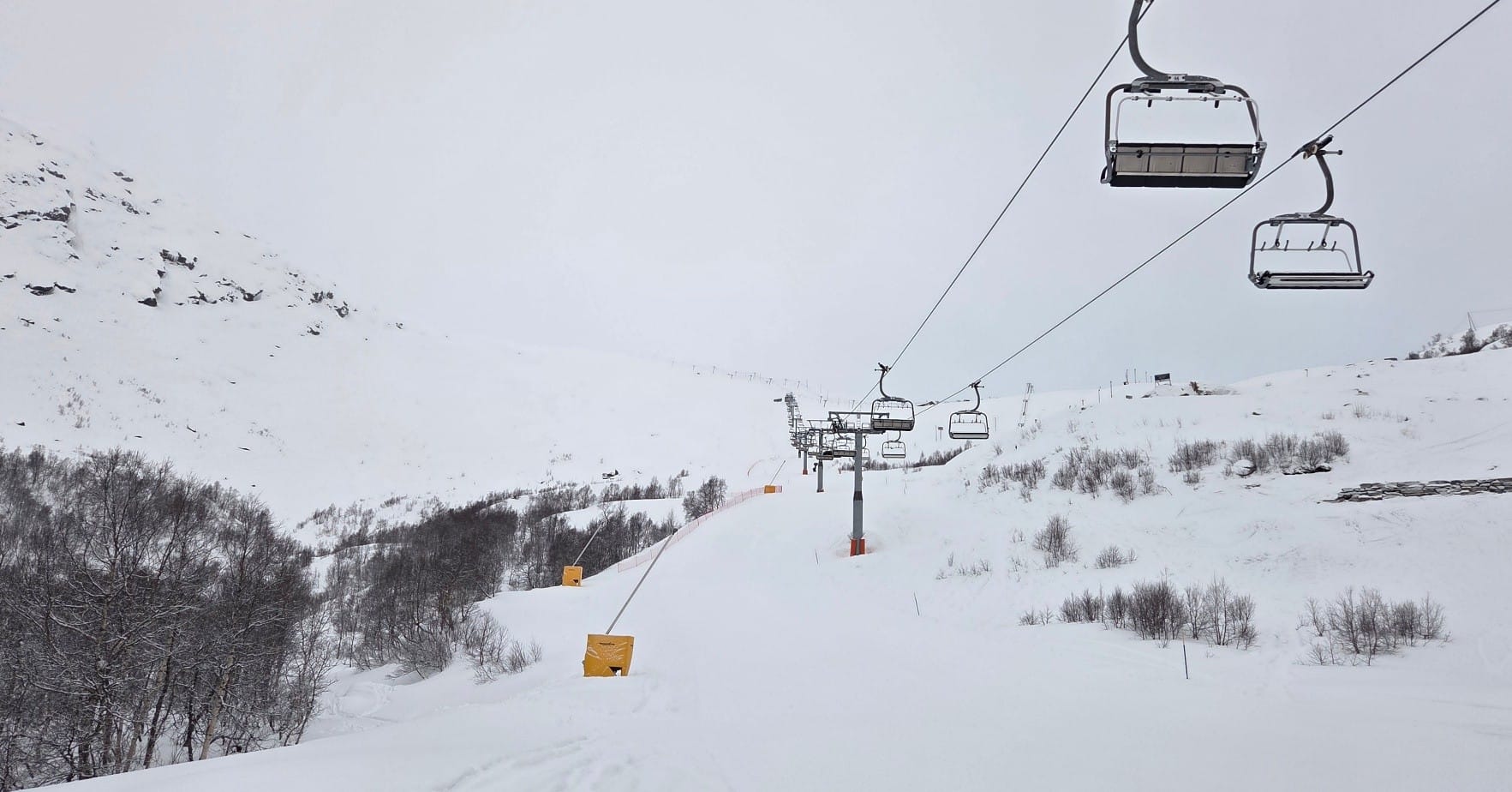
Austria Snow Report
Austria is seeing a mixed mid-March pattern, with mild afternoons in the valleys but colder, more changeable weather returning at altitude. Many regions continue to enjoy sunny, spring-like conditions, with freezing levels rising well above 1,500m.
However, a shift to cooler north-westerlies has brought falling temperatures, firmer snow and occasional light snowfall on higher slopes, especially in the Arlberg, Zillertal and Salzburg regions, with rain and sleet falling to lower valleys before freezing levels drop again. Some of Austria's largest ski areas, including the Arlberg, home to Lech and St Anton, are reporting the most terrain open all season.
Austria Snow Forecast
Brighter, milder weather continues, with rising freezing levels bringing spring warmth to many valleys. High terrain in Tyrol, Vorarlberg and Salzburg remains noticeably colder, preserving snow quality.
Lower and mid-mountain slopes soften each afternoon, particularly in the east and south, where temperatures reach double digits. Sunshine becomes increasingly widespread, with only isolated cloud bands across the central ranges.
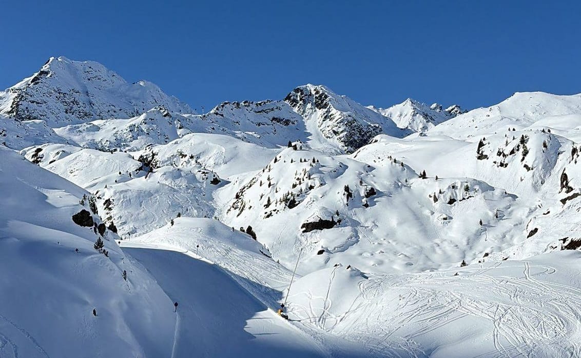
France Snow Report
Forecast snowfall began impacting the southern French Alps late last week and intensified through the weekend. Isola 2000 (160/200 cm / 64/80”) posted 25 cm (10”) in 24 hours midweek, while Alpe d’Huez (205/400 cm / 82/160”) returned above the four-metre base depth mark after a further 26 cm (10.5”). By Friday, totals reached 50 cm (20”) over 48 hours at Saint François Longchamp (70/285 cm / 28/114”), before widespread snowfall on Saturday, falling as rain and sleet at lower elevations.
FIS races planned for Courchevel were reorganised to avoid the worst conditions, but events scheduled for Saturday and Sunday were ultimately cancelled due to the weather, which delivered around 83 cm during the storm cycle.
France Snow Forecast
Conditions remain largely sunny with occasional flurries at altitude, though temperatures are a few degrees lower than last week. Summit temperatures range between –10°C and –16°C above 3,000 m, rising to 0–10°C in the valleys.
Cloudier periods will bring light snow above 1,600–1,900 m and rain lower down. Winds remain moderate to fresh, occasionally stronger on exposed ridges.
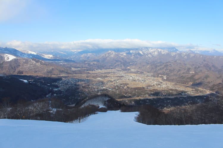
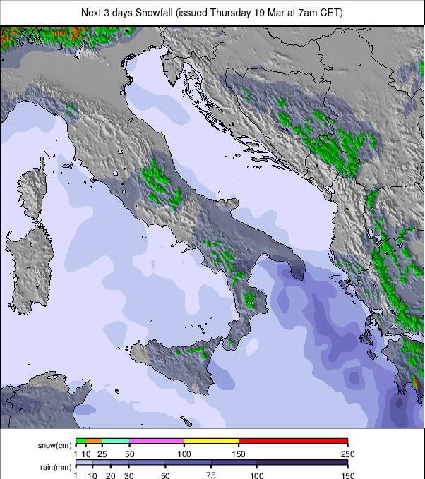
Italy Snow Report
Italy has also seen increasingly unsettled, wintry weather, initially bringing 5–10 cm (2–4”) to Courmayeur and the Aosta Valley before becoming heavier and more widespread through the weekend.
Snowfall disruption affected the final Paralympic events in Cortina, while western areas recorded the biggest totals, with Cervinia posting 55 cm (22”). Like much of Europe, conditions have since returned to milder, more typical spring weather.
Italy Snow Forecast
Freezing levels dip mid-week before rising again, creating crisp mornings and softer afternoons.
Western areas near the Aosta Valley remain the coldest, preserving the best snow, while eastern resorts, including Cortina, are expected to see 20–40 cm of snowfall in longer-range forecasts.
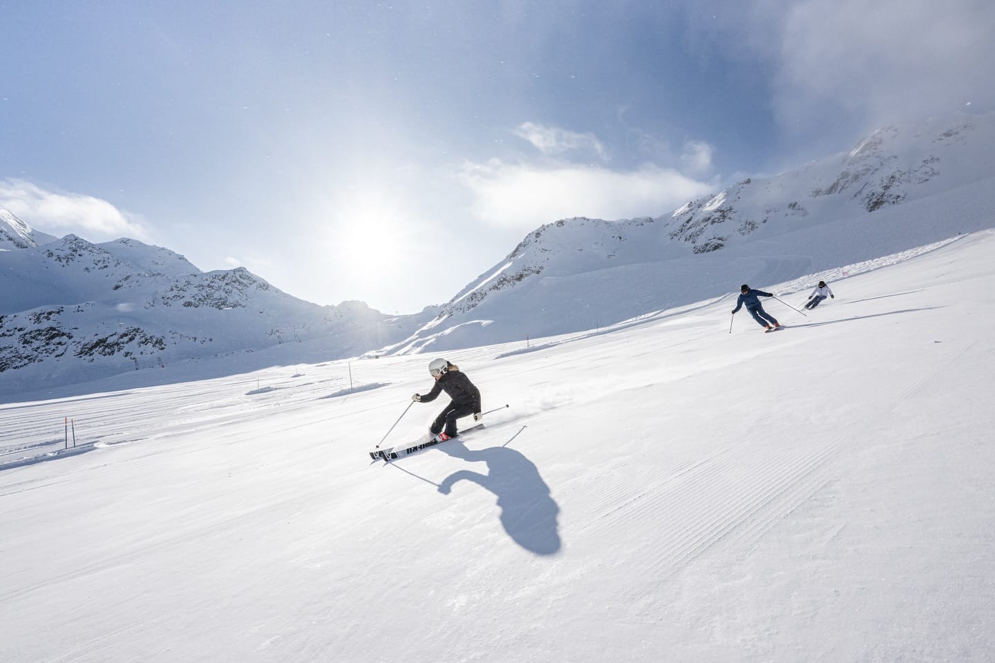
Switzerland Snow Report
After three dry weeks, Swiss conditions shifted sharply over the weekend, with widespread snowfall across the country.
Torgon recorded 50 cm (20”) in 48 hours, but Aletsch Arena (135/210 cm / 46/84”) led Europe with 82 cm (33"). Verbier saw 61 cm (24”), while St Moritz recorded 55 cm (22").
Since then, conditions have stabilised, with milder temperatures and increasing sunshine across most regions.
Switzerland Snow Forecast
Predominantly dry and mild, although high alpine areas such as Zermatt, Saas-Fee and St Moritz retain colder air, keeping upper slopes firm and wintry.
Mid-mountain terrain softens through the afternoons, with western regions trending warmer, while eastern Switzerland stays slightly cooler.
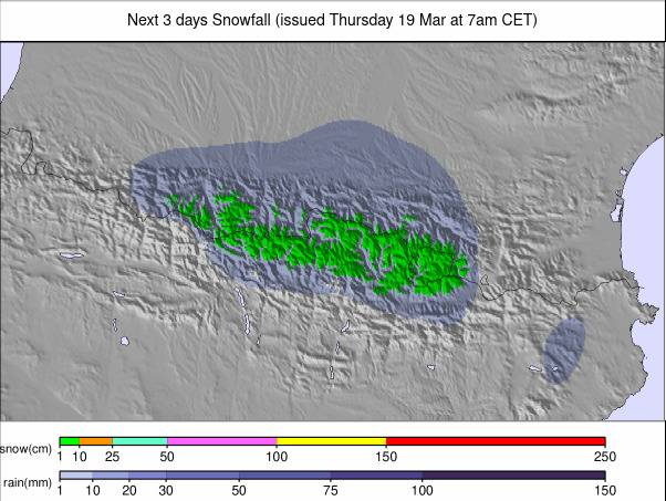
Pyrenees Ski Season Update and Snow Forecast
The Pyrenees have enjoyed plenty of sunshine over the past week, with skiers and riders benefiting from a deep, above-average snowpack.
Grandvalira (230/310 cm / 92/124”) saw fluctuating freezing levels with cloud, light snow and occasional sleet on lower slopes, heaviest at the weekend. Saint-Lary-Soulan (190/200 cm / 76/80”) maintains a strong, near-uniform base, while Baqueira Beret (190/230 cm / 76/92”) continues to perform strongly with deep cover and regular top-ups.
Overall, piste conditions remain excellent, with base depths well above seasonal averages across the region.
Pyrenees Forecast
Mostly sunny, with summit temperatures between –7°C and –12°C, rising to 0–10°C at lower elevations.
Light snowfall is expected at higher elevations later in the week, with rain or sleet possible on lower slopes during warmer periods. Winds remain moderate, occasionally fresh on exposed ridges.
Scandinavia Ski Season Update and Snow Forecast
Scandinavia has turned more wintry over the past week, with colder air and frequent snow showers returning across the mountains. Snowfalls of up to 25 cm (10”) in 24 hours have been reported in western Norway.
Resorts such as Trysil (62/81 cm / 25/32”) and Åre (72/116 cm / 29/46”) remain mostly below freezing, with regular snowfall refreshing upper slopes. Finland remains the coldest, with Levi (60/76 cm / 24/30”) maintaining firm winter conditions.
Scandinavia Forecast
A cold pattern persists, with summit temperatures between –10°C and –18°C and valleys between –4°C and –10°C.
Light snowfall continues in Norway, while Sweden and Finland remain colder and drier before more unsettled weather develops later in the week.
Eastern Europe Snow Report
Eastern Europe has shifted from mild, sunny conditions to a more unsettled pattern. The Carpathians remain mild and often wet, with rain and sleet at lower elevations and only limited snowfall at higher altitudes.
Bulgaria remains colder, although conditions are also becoming more variable, with a mix of snow, sleet and rain.
Eastern Europe Forecast
A mild but changeable pattern continues, with mountain temperatures around –3°C to +3°C and warmer lower slopes.
Expect mixed precipitation, with only brief snowfall at higher elevations as cooler air edges in mid-week.
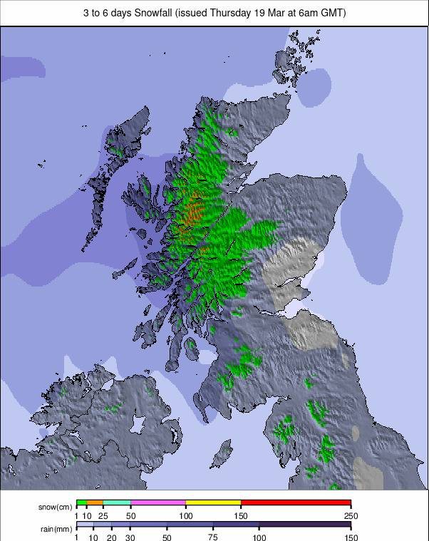
Scotland Ski Season Update and Snow Forecast
Scottish ski areas have experienced another unsettled week, with strong gales forcing closures on multiple days, alongside a return of colder temperatures and fresh snowfall.
Glencoe, Glenshee and Cairngorm are aiming to continue operations into Easter, conditions permitting. The Lecht and Nevis Range remain closed and are unlikely to reopen without a significant return to sustained cold and snowfall.
Scotland Forecast
Cold, unsettled conditions continue, with frequent snow showers, strong winds and reduced visibility on higher terrain.