Europe Weekly Roundup #302
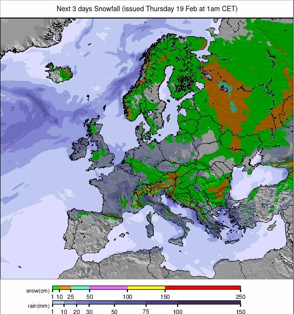
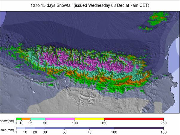
Weekly Snow News for Europe, updated 19 February 2026: Western Alps buried by near-record snowfall, avalanche risk high, while Scandinavia stays cold and dry.
- Up to 3 metres fall on high French slopes
- Avalanche danger reaches rare level 5
- Temporary full resort closures reported Snow spreads into Switzerland and Italy
EUROPE INTRO
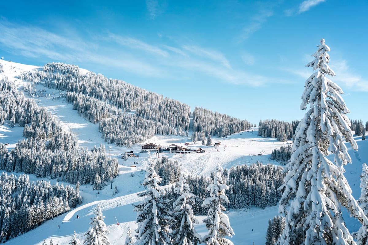
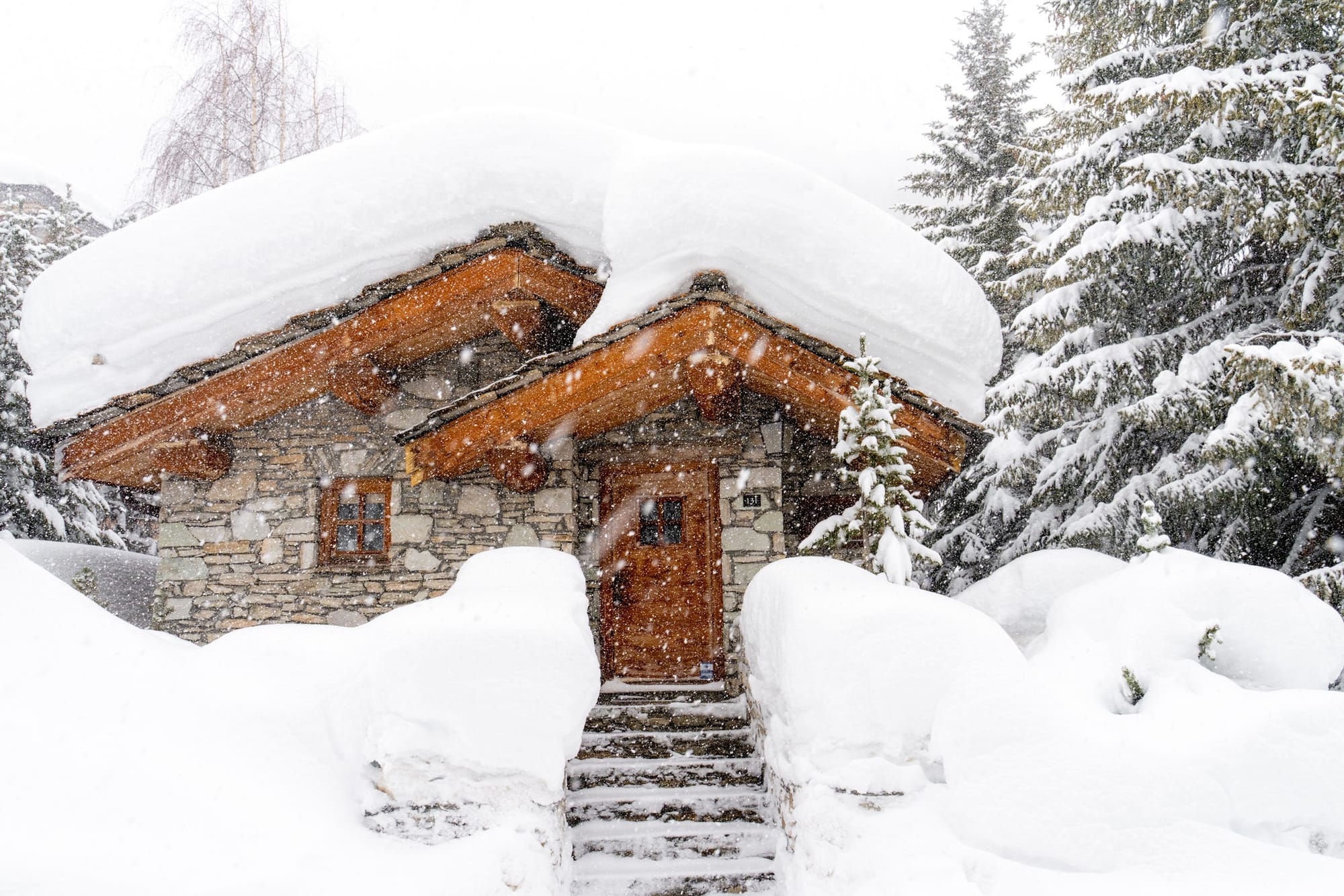
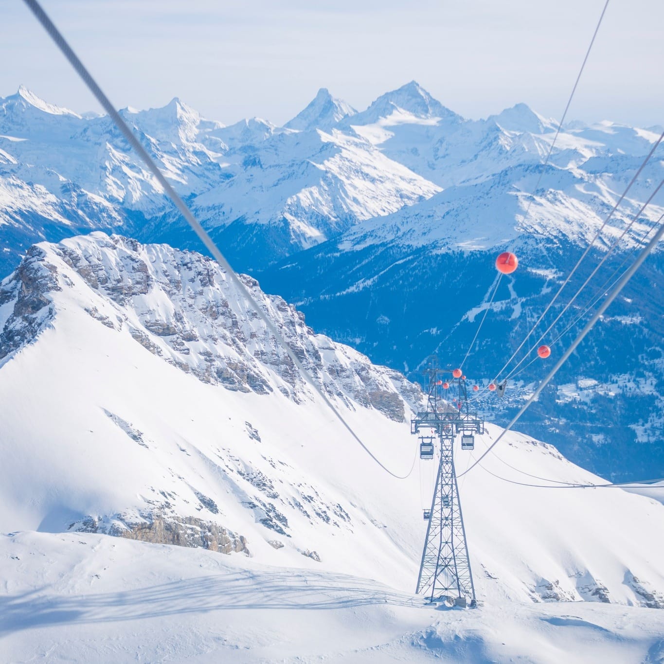
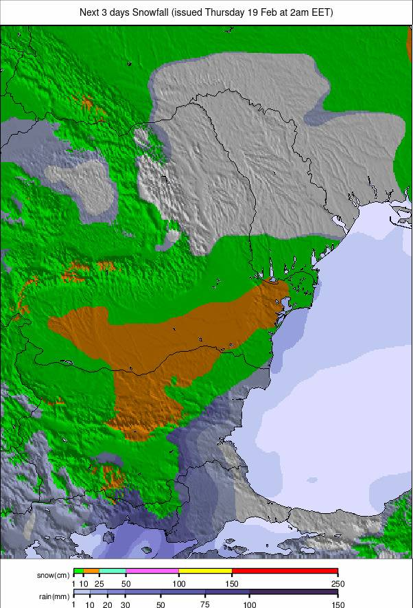
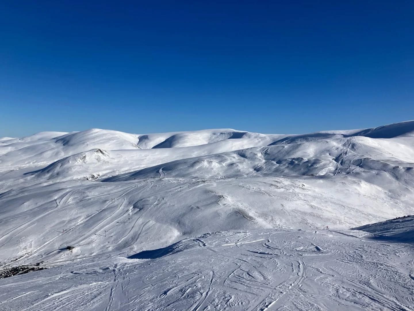
It’s been quite a week in the Western Alps with some huge snowfalls, now approaching 3 metres (10 feet) in total over the last seven days on some higher French slopes. That's led to some dramatic events, including the avalanche danger level reaching a rare maximum 5 out of 5 in the Tarentaise Valley and several resorts, including La Plagne, completely shutting down their slopes last Thursday.
The snowfall continued into western Switzerland and Italy, spreading across much of mainland Europe to a lesser degree, with lighter but still welcome snowfall. However, the Western Alps topped their snowfall total this week (unusually for the 25-26 season). The Pyrenees saw still more heavy snowfalls, and bases there are, in many cases, a little greater than those in the Alps, after their more consistent wintry weather all season. Strong winds were a factor here at the end of last week, leading to temporary resort closures again.
Elsewhere, Scottish centres continue their best season in years, with all five centres open and most of them reporting 60-80% of their terrain skiable. Scandinavia is still bitterly cold and a little short on fresh snow, but mostly good. The same (if not so cold) is true across eastern Europe's ski slopes.
Europe Forecast
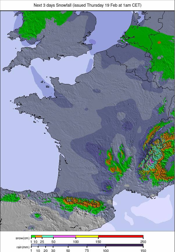
Subzero temperatures remain dominant across the Western Alps with further light to moderate snowfall expected midweek, particularly in western-facing regions. Clearer, colder spells are likely toward the weekend as freezing levels fall again.
AUSTRIA REPORT
After missing out on the big snowfalls further west in the latter half of last week, and indeed not seeing much snowfall at all so far this year, it has turned much more wintery with regular moderate snowfall on Austrian slopes since the weekend, with ski areas reporting 10-20cm (4-8") daily top-ups.
Temperatures have dropped a few degrees, too, with base-level highs around +3C and lows around -10. With lots of cloud, visibility has dropped, but slope conditions have improved with the fresh snow. The Arlberg region (55/150cm / 22/60”) continues to post the most terrain open in the country, about 80% of its slopes.
Austria Forecast
Temperatures in many Alpine valleys will hover around 0°C to –3°C, while higher ski areas trend well below freezing. Light snow is possible midweek, especially in western resorts such as Lech, St. Anton and Ischgl, with brighter, colder periods toward the weekend.
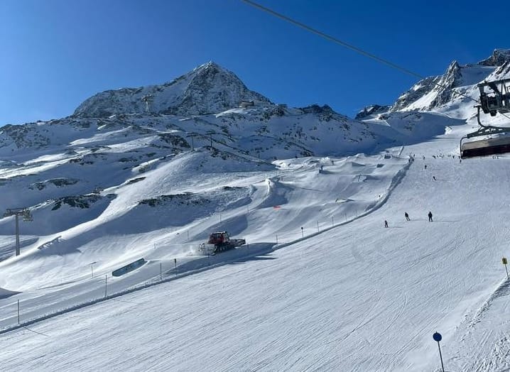
FRANCE REPORT
The huge snowstorm that was getting underway as we published last week's report blew through by Friday afternoon, leaving glorious blue skies. That was not through until reports of 72 hour snowfall totals of up to 2.6m (nearly 9 feet) had come in for the Chamonix Valley (50/300cm / 20/120”) and Paradiski (100/270cm / 40/108”), with plenty of other areas posting 1-2m (40-80") three-day totals.
Last Thursday saw the most intense snowfall along with high winds that saw many resorts close most of their slopes, and in La Plagne’s case, all of them, as the avalanche danger reached a rare maximum 5 out of 5 on the scale in the Tarentaise Valley and wider area.
France Forecast
The cold, snowy pattern continues with further fresh accumulations and summit temperatures between –9°C and –16°C. Heavier snowfall is expected at higher elevations, followed by lighter showers and improving visibility.
ITALY REPORT
Western Italian ski areas have seen the heaviest snowfall of the season, catching the front that moved through the western Alps at the end of last week and then seeing fresh heavy snowfalls at the start of this. Further east, things have been a little drier, and there have been prolonged sunny spells for some, but there has been some fresh snowfall for most areas across the country.
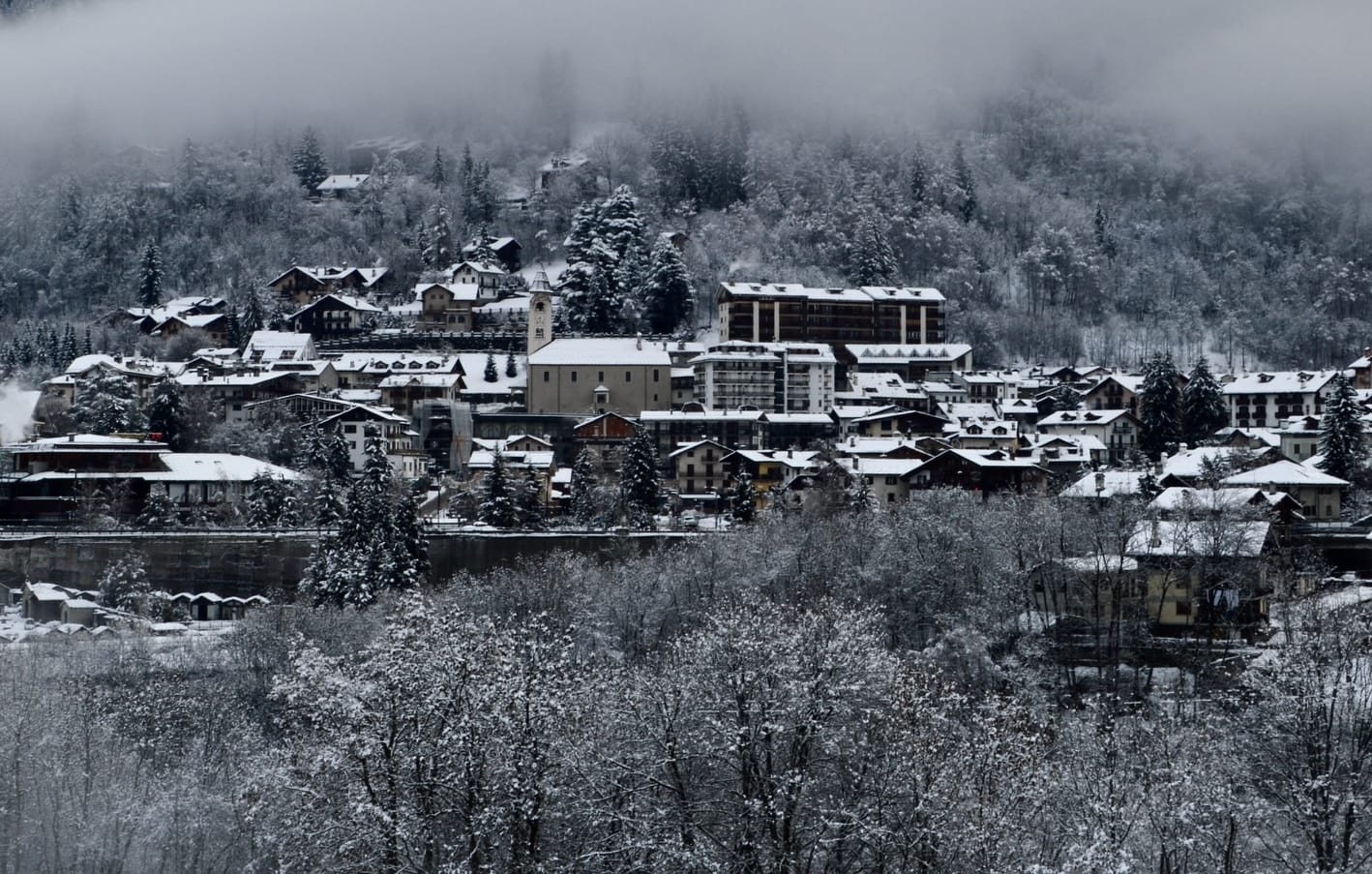
With the snow in the west, base depths are reaching a very healthy 3m (10 feet), enough to see out the season. Artesina - Mondolè Ski (200/300 cm / 80/120cm) is posting the deepest cover at the time of writing.
Italy Forecast
The Italian Alps should stay cold with summit temperatures generally ranging from –8°C to –15°C. Further light to moderate snowfall is expected, especially in the Dolomites and western Alpine regions.
SWITZERLAND REPORT
It has been the snowiest week of the season to date in Switzerland. There was snowfall across the country, but the west in particular saw some huge accumulations, led by Montana/6day/mid">Crans Montana (65/130cm / 16/52"), which posted a 1.2m (4 feet) snowfall tally over 72 hours. Champéry (130/180cm / 52/72”), on the Swiss side of the Portes du Soleil, posted 95cm (38”) in the same period.
Many parts of the country were dry and sunny through the weekend, although the avalanche danger remained high. Since Monday, it's been much more changeable with snowfall totals varying from 2-25cm (2-10") a day.
Switzerland Forecast
Subzero temperatures continue with summit levels generally ranging from –8°C to –16°C. Light to moderate snowfall is expected midweek, particularly in the Valais and Graubünden.
PYRENEES REPORT
It is unclear if the Pyrenees are wishing the snowfall would stop now. It keeps snowing, moderately to heavily, with many areas seeing another metre (40") or more over the last week. More ski areas now have bases of more than 3 metres (10 feet).
The constant snowfall is keeping avalanche danger levels high and leading to slope closures. Last week's storm saw several resorts, including Spain's largest Baqueira Beret (190/200cm / 76/80"), completely close on Thursday due to 100kph winds. That said, there have been some great sunshine days between the storms.
Pyrenees Forecast
Remaining mixed with cold temperatures, regular snow showers and occasional brighter spells. Summit temperatures between –10°C and –3°C, with 5–15cm (2-6”) top ups likely on higher terrain.
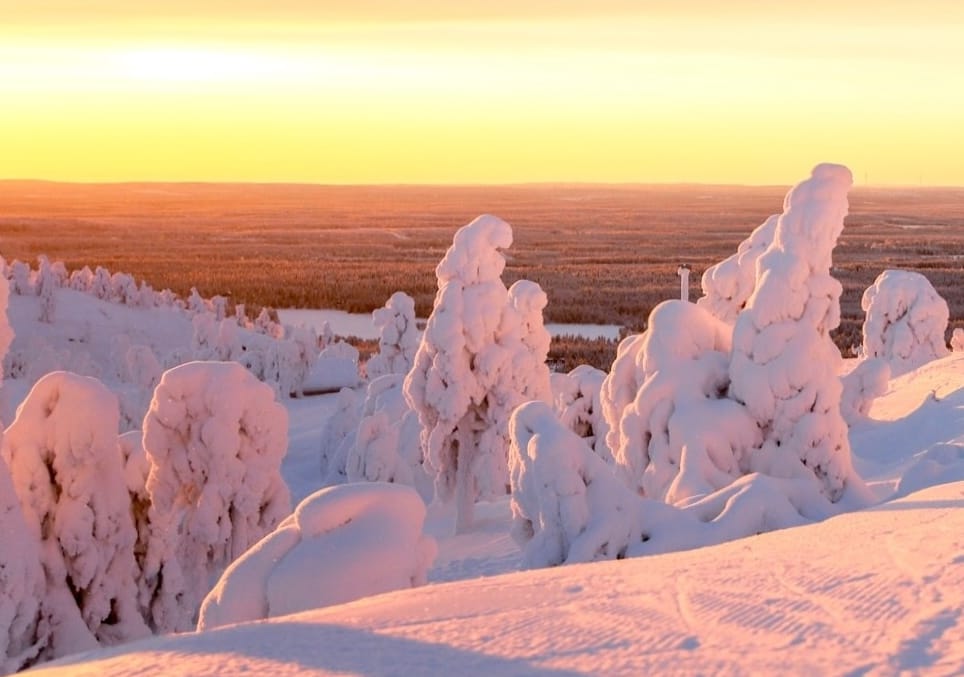
SCANDINAVIA REPORT
It's remained very cold, dry and sunny across Scandinavian ski areas for the past week. Temperatures have mostly been in the -10 to -20C range, but further north the mercury continues to dip well into the minus 20s.
Most ski areas are close to full operations, albeit with hard-packed piste now and little or no powder to be found. There's been little change in base depths since last year, with Sweden's Tänndalen (70/135cm / 28/54”) posting the region’s deepest.
Scandinavia Forecast
Very cold, classically wintry weather continues with nighttime lows between –20°C and –30°C in northern areas. Light to moderate snow showers are expected at intervals.
EASTERN EUROPEAN REPORT
Following last week's snowfalls, it's been a mostly dry week across eastern Europe. Temperatures have stayed largely below freezing in the northern mountains, in the -2 to -15C range, but have warmed up in the Balkans, in the -8 to +7°C range.
Bansko (20/1590cm / 8/60”) has the deepest reported base in the region and the most terrain open – 100% of its slopes.
Eastern Europe Forecast
Predominantly cold with a mix of light snowfall and brighter spells. Light snow showers forecast intermittently, especially in Bulgaria and Slovakia.
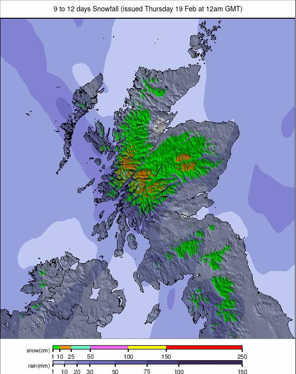
SCOTLAND REPORT
There have been some fabulous blue sky, still days on Scottish mountains over the past seven days, following weeks of gales and overcast skies as snow showers moved through.
All five Highland ski centres remain open, although Nevis Range appears to be operating on a more flexible schedule, opening on some days but not others. The other four areas are typically reporting between 60-80% of their slopes open and lift operating.
Scotland Forecast
Cold, changeable week with summit temperatures from –8°C to –2°C. Light snow showers expected on several days with brighter spells between fronts.