Europe Weekly Snow Roundup #300
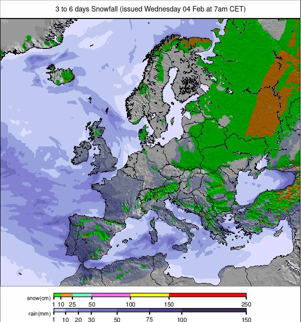
Weekly Snow News for Europe, updated 4th February 2026: Heavy snowfall boosts Pyrenees and southern Alps, while Scotland and Bulgaria enjoy improving midwinter conditions.
- Big snow continues for Pyrenees and southern Alps
- Scotland reports best conditions in several winters
- Light refreshes keep Alps ticking over
- Cold holds firm across Scandinavia
- Bulgarian resorts more than 90% open
Europe Snow Report and Ski Conditions
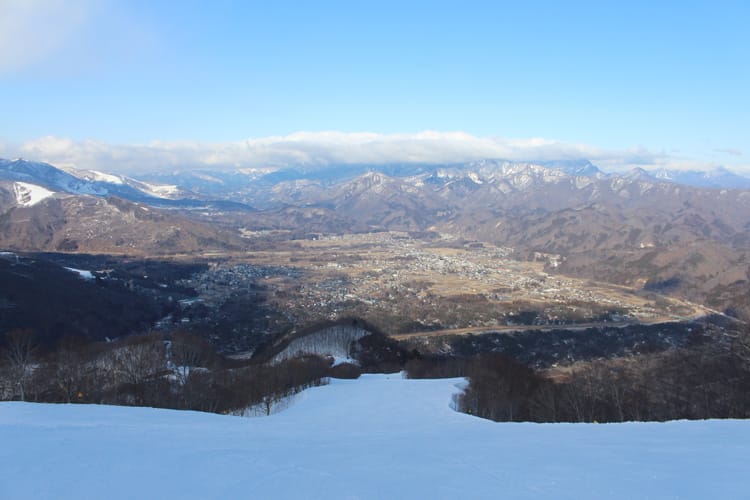
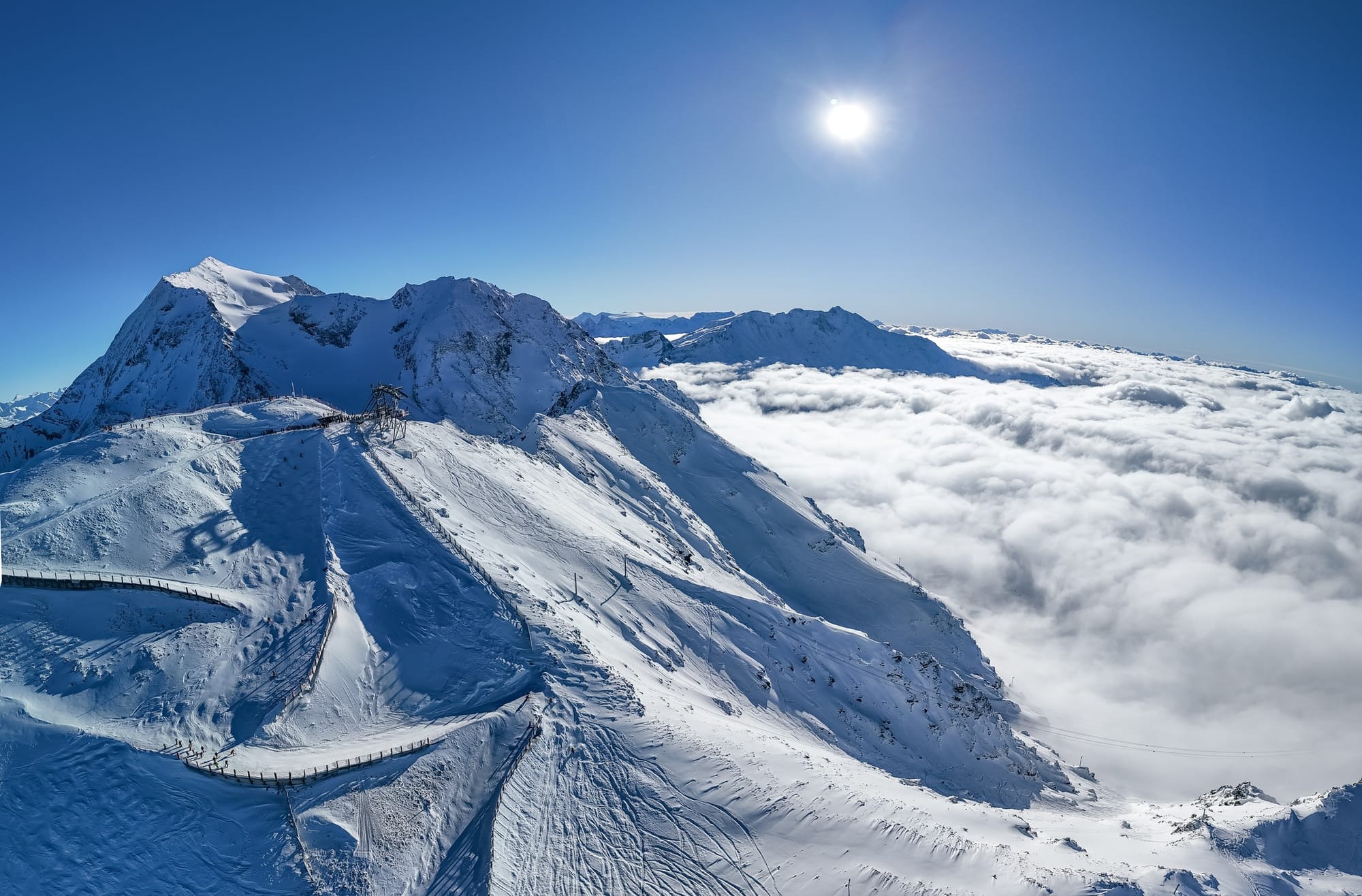
Unsettled conditions have been the norm across most of Europe’s ski regions for a second week. The weather has been following a familiar pattern for this season to date, favouring the Pyrenees and wider Southwestern corner of Europe, including the southern Alps, with the best of the fresh snowfall again, although the falls have been widespread, just generally lighter elsewhere.
It’s kept cold up in Scandinavia with some fresh snowfall too, but Scotland has seen the biggest falls of the past week, with most of the country’s centres now able to open the most terrain they’ve been able to all winter. On the other side of Europe, Bulgaria has seen another spell of cold, snowy weather, further improving conditions here too.
Austria Snow Report and Ski Conditions
The unsettled weather has continued into February in the Austrian Alps. It has been drier in most parts of the country than last week, with temperatures staying low (a few degrees above freezing down to -10 to -15°C) and plenty of prolonged, sunny spells. There have continued to be mostly light snowfalls, adding 5-10cm (1-2") slope refreshes now and then. So overall, staying fresh but no significant accumulations. The glaciers have the deepest snowpack, but it is still below seasonal averages. Kaunertal (105/165cm / 42/66") reports the deepest. The Arlberg region (55/150cm / 22/60") has the most terrain open, around 80%/240km/150 miles of its runs.
Austria Weather and Snow Forecast
A similar week ahead with Austria’s ski areas looking set for a cold, mostly settled week, with upper mountain terrain consistently subzero temperatures on the mountains preserving the snowpack. High alpine resorts stay firmly wintry, while valley bases experience regular freeze–thaw cycles and the mildest afternoons. The forecast shows very little new snowfall across the country, so conditions remain predominantly dry with occasional cloud and the odd flurry at best. Expect firm, grippy pistes up high, hard early morning snow lower down, and softer sections developing later in the day.
France Snow Report and Ski Conditions
It’s been a great week for fresh snowfall in the French Alps (and Pyrenees). The snowfall last week in the southern Alps continued with fresh fronts bringing still more through the weekend and the start of this week. Three-day accumulation totals included 70cm (28”) in Val d’Allos (145/205cm / 58/82”) and 60cm (24”) at Superdévoluy / La Joue du Loup (30/150cm / 12/60").The snowfall then started getting heavier further north, with La Clusaz (60/210cm / 24/84") posting 60cm (24") to start the new week.
France Weather and Snow Forecast
Continuing unsettled with more areas set to see more moderate snowfall as fronts move through, with temperatures remaining very cold. The next few days will be largely dry, with temperatures down to -15°C, but snowfall is expected on Thursday/Friday, followed by potentially heavier accumulations at the weekend. High alpine slopes stay reliably wintry, while low valleys see freeze–thaw cycles before temperatures fall again.
Italy Snow Report and Ski Conditions
After the snow started falling in Italy last week, it has not let up much since, with many areas posting 25-50cm (10-20") seven-day accumulations. It’s particularly good news for Olympic venues, which had been facing reports of having to rely on 100% machine-made snow until recently. That’s still largely the case, but there’s fresh natural stuff on top now. Cortina d’Ampezzo’s (60/100cm / 24/40") base has more than doubled over the past week from the thin cover it had through December and early January. Most Italian areas are now 90-100% open, with Val Gardena (60/90cm / 24/96") posting the most open of a single area – 180km/113 miles of slopes.
Italy Weather and Snow Forecast
Italy’s mountains are set for a cold, mostly settled week as we head into the Olympics, with widespread subzero temperatures on the peaks and only light, occasional snowfall in the forecast. The Dolomites and high Alpine resorts hold firm to wintry conditions, with temperatures dropping below -10°C at night and a consistently frozen snowpack helping preserve snow quality. Lowerlying bases see the usual freeze–thaw pattern, with colder mornings and milder afternoons, but overall the freezing level stays low enough to maintain good coverage across most elevations. Limited new snowfall is expected, mostly 2-5cm (1-2 inches), with occasional falls.
Switzerland Snow Report and Ski Conditions
Swiss resorts have also been enjoying a second snowy week, with resorts posting up to 75cm (30") in 72 hours over the weekend, heaviest in the west of the country. That’s good news, with base depths still only at 65% the average for this point in the season.
Glacier 3000 (175/480cm / 70/188") has upped its base (the deepest in the country, and Europe and indeed anywhere outside Japan) by more than a metre (40") over the past 10 days, including a 25cm (10”) weekend fall. As elsewhere in the Alps, the snowfall has raised avalanche danger warning levels to 3 or 4 in many areas. The 4 Valleys (40/150cm / 16/60") have the most terrain open wholly in Switzerland, over 320km (200 miles) of piste.
Switzerland Weather and Snow Forecast
The wintry pattern is set to continue, with cold air locked over the Swiss Alps and only light, occasional snowfall drifting through. Most regions are holding onto well preserved snowpack thanks to consistently subzero temperatures at altitude. At the same time, valley floors see the familiar freeze–thaw rhythm of frosty mornings and slightly milder afternoons. The major resorts in Valais and Graubünden should see a mix of sunny and snowy spells, but mostly limited to 2–10cm (1-4”) top ups. Higher slopes remain properly cold, dipping below –10°C at night.
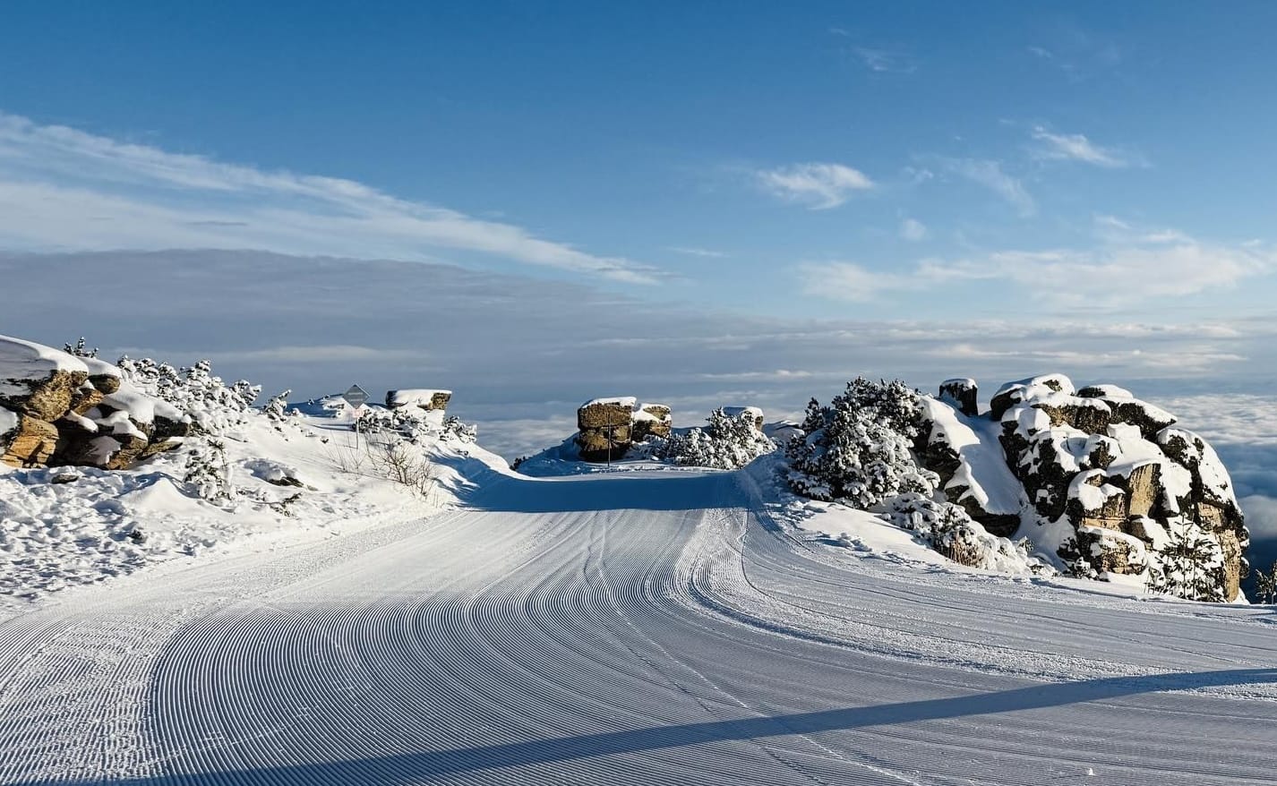
Pyrenees Snow Report and Ski Conditions
It has been yet another week of big snowfalls in the Pyrenees as further fronts move through the southerly European range in rapid succession. Most ski areas report powder conditions with a growing number posting 2m bases or deeper.
All the snowfall is causing some issues making slopes safe and as a result the amount of terrain open at some bigger resorts like Andorra’s Grandvalira (190/240cm / 76/96”) – home to Soldeu El Tarter, Pas de la Casa and others - and Spain’s Baqueira Beret (150/170cm / 60/68”) is actually down on a week or two back. Avalanche danger is also widely rated as moderate to high. Against that, base depths are the best they’ve been for several years, and there’s now enough snow lying for most ski areas in the Pyrenees to see out the season.
Pyrenees Weather and Snow Forecast
The Pyrenees continue in a cold, changeable spell this week, with temperatures hovering around or below freezing on the mid mountain slopes and frequent light snow showers drifting through. Midweek sees a mix of mostly cloudy spells and passing snow showers, with some areas picking up a few centimetres of fresh snow, though further heavy accumulations aren’t expected this week. Toward the weekend, brighter intervals return between further scattered light snowfalls, keeping the surface refreshed.
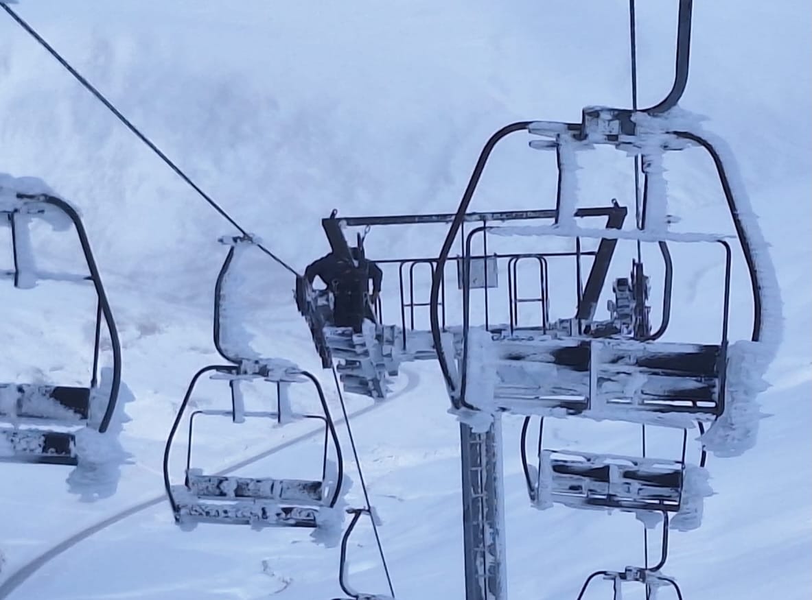
Scandinavia Snow Report and Ski Conditions
Temperatures have remained very cold in Scandinavia, with many resorts seeing -15 to -25C over the past week. There was some snowfall, most of it at the weekend and generally just light – 5-10cm (12-4”) accumulations rather than anything major. Sweden’s Tänndalen (70/135cm / 28/54") reports the most snow cover build-up. Åre (40/55cm / 16/22"), as usual, has the most terrain open in the region, around 80% of its 80km (50 miles) of slopes.
Scandinavia Weather and Snow Forecast
Full winter conditions continue across Scandinavia, with severe cold and widespread subzero temperatures. Many areas continue to plunge into the –20s, especially overnight, keeping the snowpack dry and firm. Daytime temperatures remain well below freezing across most elevations, with light snow showers moving through at times, but a more active spell is expected toward the weekend, bringing heavier snowfall to parts of Norway and Sweden.
Eastern Europe Snow Report and Ski Conditions
Bulgarian ski areas have been celebrating further snowfalls and continuing low temperatures following a change in weather conditions from the warm, dry weather that dominated the country in the first half of January. Borovets (95/95cm / 38/38"), which delayed its opening due to a lack of snowfall five weeks ago, is now more than 90% open. In the north, it has been drier with plenty of sunshine, but remained below freezing, typically -8 to -1C at ski areas in Czechia, Slovakia and Poland.
Eastern Europe Weather and Snow Forecast
Eastern European mountains also remain broadly wintry for the rest of this week, with the Carpathians and Balkan ranges holding onto cold air and maintaining their mostly frozen snowpack. Bulgaria, Romania and Slovakia stay firmly below freezing on the upper slopes, with nights dipping well into the –10°C range. Light snow showers move across the region at times, bringing a few centimetres of fresh cover to higher terrain but without major falls expected. Czechia and Poland see a mix of cloud, brighter spells, and occasional snow flurries.
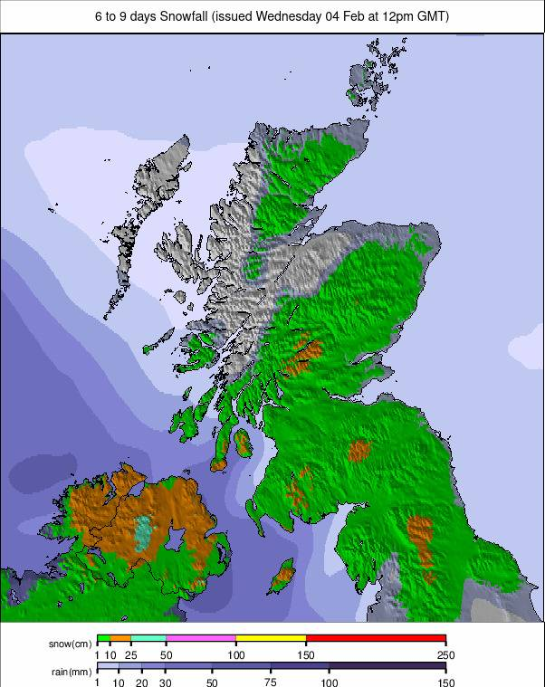
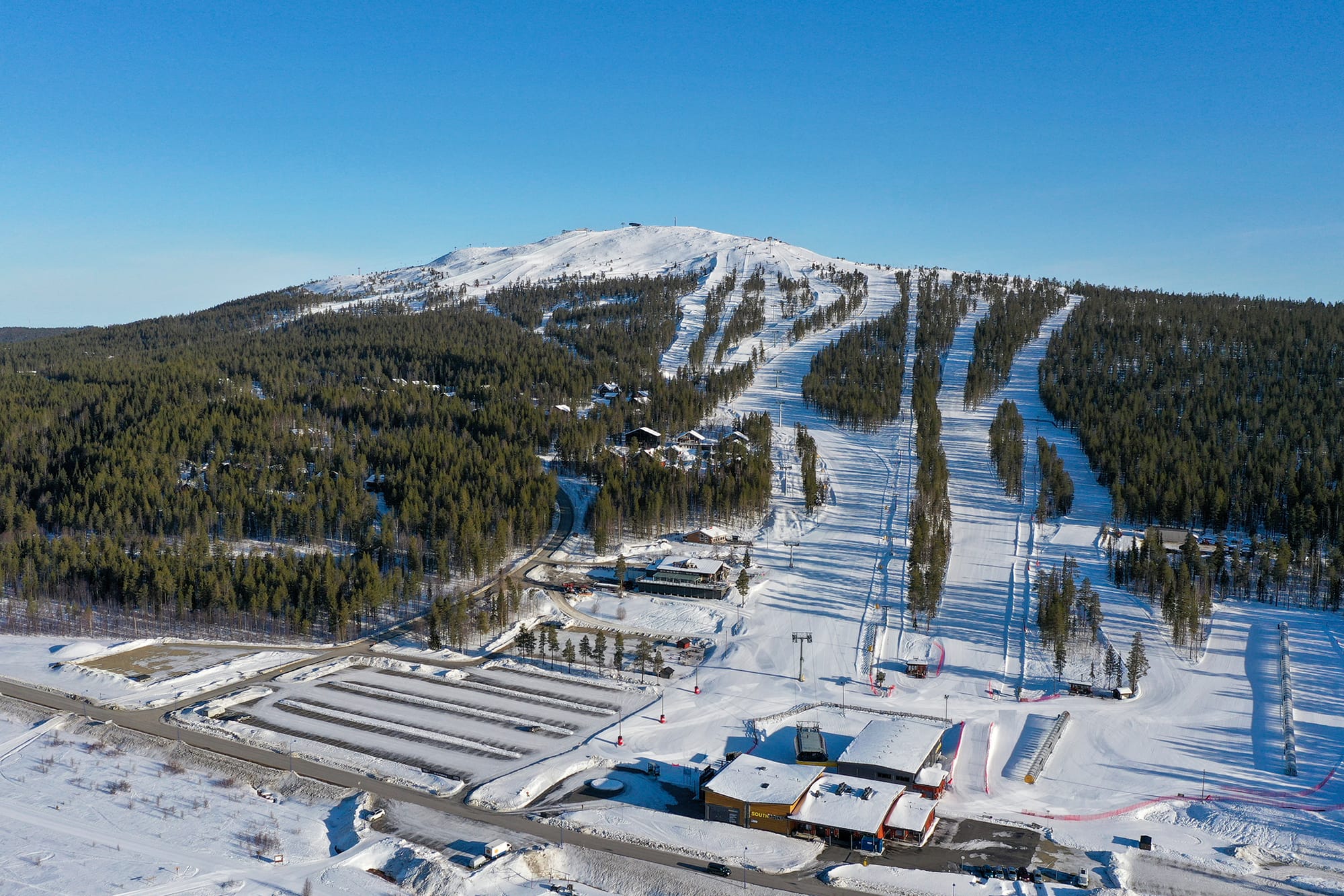
Scotland Snow Report and Ski Conditions
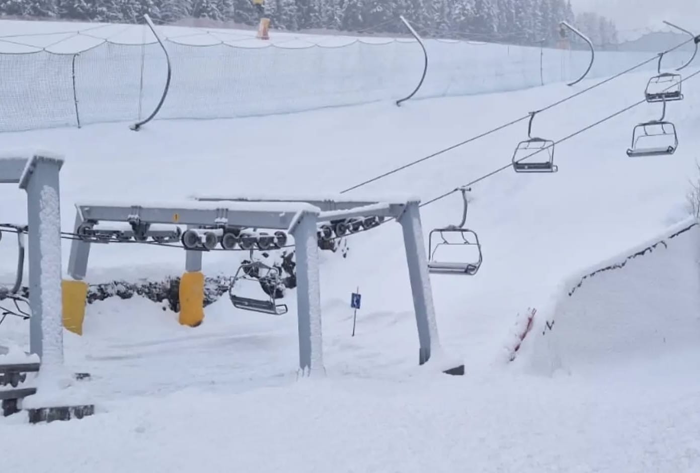
Scottish ski areas have seen ever-improving conditions for another week. There have been more huge snow drifts blocking roads and burying chairlifts at Cairngorm and Glenshee, while ever-improving conditions have been reported at the Lecht and Glencoe on the West Coast. In a sign of just how good things are, Nevis Range near Fort William, which hasn’t opened for snowsports for several years, says it hopes to open for the season from this Friday, if slope preparations go smoothly.
Operations at the four open areas have faced their usual challenges; heavy snowfall blocked access roads and required lifts and other infrastructure to be dug out, and gale-force winds also led to centre closures at times. When open, though, conditions are the best they’ve been in several years, with the most terrain open as well.
Scotland Weather and Snow Forecast
The Scottish Highlands remain locked in a cold, unsettled pattern throughout this week, with frequent wintry showers sweeping in on brisk westerlies. Freezing levels remain low, keeping the upper slopes consistently below 0°C, while nights dip well into the negatives across most elevations. Snowfall is generally light and showery, but pulses of heavier precipitation are possible at times, especially toward the weekend as Atlantic fronts move through. Lower bases continue to see a mix of sleet, wet snow and brief thawing, but higher terrain holds firm, with regular topups helping maintain the snowpack.