

Global Weekly Snow Roundup #320
Weekly Snow News for the world, updated 25 June 2026: Chile and New Zealand's seasons proper set to begin, Tignes and Sunshine reopen for summer skiing. weekend as Riksgransen ends its 2026 season.

Next 3 days weather summary:Heavy rain (total 32.0mm), heaviest during Sun afternoon. Warm (max 21°C on Sat afternoon, min 13°C on Sun night). Wind will be generally light. | Days 4-6 weather summary:Heavy rain (total 57.0mm), heaviest during Wed night. Very mild (max 18°C on Tue afternoon, min 7°C on Wed night). Wind will be generally light. | |||||||||||||||||
Saturday 27 | Sunday 28 | Monday 29 | Tuesday 30 | Wednesday 1 | Thursday 2 | |||||||||||||
AM | PM | night | AM | PM | night | AM | PM | night | AM | PM | night | AM | PM | night | AM | PM | night | |
clear | t-storm risk | rain shwrs | t-storm risk | mod. rain | rain shwrs | t-storm risk | t-storm risk | rain shwrs | t-storm risk | mod. rain | rain shwrs | some clouds | mod. rain | heavy rain | rain shwrs | clear | clear | |
km/h | ||||||||||||||||||
Snow map |  |  |  |  |  |  | ||||||||||||
— | — | — | — | — | — | — | — | — | — | — | — | — | — | — | — | — | — | |
mm | — | 4 | 7 | 1 | 10 | 1 | 1 | 2 | 6 | 2 | 6 | 4 | — | 10 | 34 | 1 | — | — |
max °C | 19 | 21 | 17 | 19 | 20 | 14 | 19 | 20 | 16 | 17 | 18 | 15 | 18 | 17 | 7 | 11 | 15 | 13 |
min °C | 16 | 18 | 15 | 16 | 16 | 13 | 16 | 19 | 13 | 15 | 14 | 13 | 15 | 13 | 7 | 8 | 14 | 9 |
chill °C | 16 | 18 | 15 | 16 | 16 | 13 | 16 | 19 | 13 | 15 | 14 | 13 | 15 | 13 | 4 | 6 | 14 | 9 |
Humid % | 58 | 71 | 75 | 56 | 78 | 68 | 55 | 55 | 75 | 56 | 79 | 70 | 50 | 91 | 88 | 53 | 46 | 67 |
Freeze m | 4500 | 4600 | 4600 | 4550 | 4550 | 4500 | 4350 | 4500 | 4300 | 4200 | 4250 | 4300 | 4250 | 4100 | 3300 | 3550 | 3950 | 3700 |
5:22 | — | — | 5:22 | — | — | 5:22 | — | — | 5:22 | — | — | 5:24 | — | — | 5:24 | — | — | |
— | — | 9:08 | — | — | 9:08 | — | — | 9:08 | — | — | 9:08 | — | — | 9:08 | — | — | 9:08 | |
Go pro and carve into:
Avalanche information: European Avalanche Warning Services (EAWS)
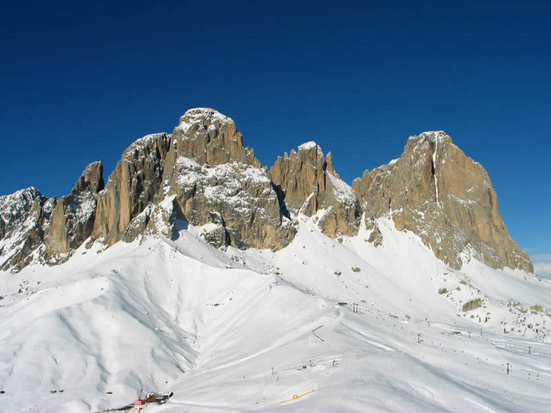
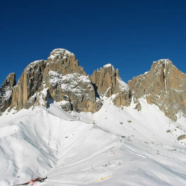
Latest snow reports near Vigo di Fassa:
| Top snow depth: | 0 cm |
|---|---|
| Bottom snow depth: | 0 cm |
| Fresh snowfall depth: | — |
| Last snowfall: | 16 May 2026 |
| Snow Alerts | Create Alert |
0.0 | Bluebird Powder days Fresh snow, mostly sunny, light wind. |
|---|---|
0.0 | Powder days Fresh snow, limited sun, any wind. |
0.0 | Bluebird days Average snow, mostly sunny, light wind. |


The above table gives the weather forecast for Vigo di Fassa at the specific elevation of 2000 m. Our sophisticated weather models allow us to provide snow forecasts for the top, middle and bottom ski stations of Vigo di Fassa. To access the weather forecasts for the other elevations, use the tab navigation above the table. For a wider view of the weather, check out the Weather Map of Italy.
Click here to read further information on freezing levels and how we forecast our temperatures.
Overall 3.4 Based on 11 votes and 1 review
Vigo di Fassa is a small picturable village. There are a few shops and cafes but for your apres-ski hours it is better to drive to Moena (only a few minutes away). The ski area is good enough and it is a very good place for kids as in front of the cable car Ciampedie is playground 'Kinderpark' with lots of games, activities and ski lessons for our little ones. Dont forget to try 'Thoni' and 'Tomba'.
GIORGOS from Greece writes:
Vigo di Fassa is a small picturable village. There are a few shops and cafes but for your apres-ski hours it is better to drive to Moena (only a few minutes away). The ski area is good enough and it is a very good place for kids as in front of the cable car Ciampedie is playground 'Kinderpark' with lots of games, activities and ski lessons for our little ones. Dont forget to try 'Thoni' and 'Tomba'.


 Nearest