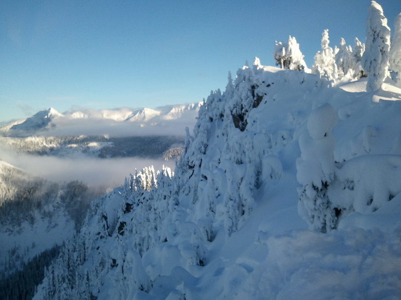


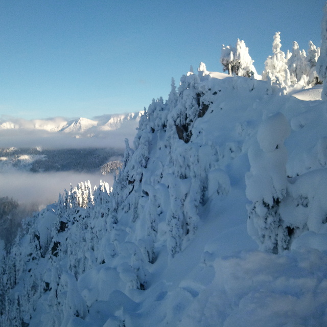
Portillo Storm Snowfall Total Passes 5m / 17 Feet
A snow storm that has now continued for nine days has taken Chilean ski resort Portillo to a snowfall total of 5.2 metres (17 feet) so far, with more snow forecast.

Next 3 days weather summary:Mostly dry. Warm (max 21°C on Fri afternoon, min 7°C on Wed morning). Wind will be generally light. | Days 4-6 weather summary:Light rain (total 8.0mm), mostly falling on Sat afternoon. Very mild (max 15°C on Mon afternoon, min 4°C on Sun morning). Wind will be generally light. | |||||||||||||||||
Wednesday 29 | Thursday 30 | Friday 31 | Saturday 1 | Sunday 2 | Monday 3 | |||||||||||||
AM | PM | night | AM | PM | night | AM | PM | night | AM | PM | night | AM | PM | night | AM | PM | night | |
some clouds | clear | clear | clear | clear | clear | clear | clear | clear | rain shwrs | rain shwrs | rain shwrs | some clouds | clear | clear | clear | clear | clear | |
km/h | ||||||||||||||||||
Snow map |  |  |  |  |  |  | ||||||||||||
— | — | — | — | — | — | — | — | — | — | — | — | — | — | — | — | — | — | |
mm | — | — | — | — | — | — | — | — | — | 1 | 4 | 3 | — | — | — | — | — | — |
max °C | 11 | 16 | 12 | 12 | 16 | 14 | 16 | 21 | 17 | 10 | 9 | 8 | 6 | 11 | 9 | 10 | 15 | 15 |
min °C | 7 | 15 | 9 | 9 | 15 | 12 | 13 | 20 | 12 | 9 | 8 | 5 | 4 | 10 | 5 | 5 | 14 | 14 |
chill °C | 6 | 15 | 8 | 8 | 15 | 11 | 13 | 20 | 11 | 8 | 5 | 3 | 2 | 8 | 3 | 4 | 14 | 14 |
Humid % | 60 | 40 | 62 | 51 | 30 | 44 | 41 | 34 | 58 | 95 | 88 | 90 | 85 | 51 | 71 | 53 | 39 | 43 |
Freeze m | 3900 | 4000 | 4050 | 4050 | 4200 | 4450 | 4450 | 4600 | 4450 | 3450 | 2800 | 3400 | 3350 | 3200 | 2800 | 3250 | 3450 | 3500 |
5:37 | — | — | 5:39 | — | — | 5:39 | — | — | 5:41 | — | — | 5:43 | — | — | 5:43 | — | — | |
— | — | 8:44 | — | — | 8:42 | — | — | 8:40 | — | — | 8:39 | — | — | 8:37 | — | — | 8:37 | |
Go pro and carve into:
Avalanche information: National Avalanche Center
Latest snow reports near Stevens Pass:
| Top snow depth: | — |
|---|---|
| Bottom snow depth: | — |
| Fresh snowfall depth: | — |
| Last snowfall: | 10 Jun 2026 |
| Snow Alerts | Create Alert |
0.0 | Bluebird Powder days Fresh snow, mostly sunny, light wind. |
|---|---|
0.0 | Powder days Fresh snow, limited sun, any wind. |
0.0 | Bluebird days Average snow, mostly sunny, light wind. |
The above table gives the weather forecast for Stevens Pass at the specific elevation of 1506 m. Our sophisticated weather models allow us to provide snow forecasts for the top, middle and bottom ski stations of Stevens Pass. To access the weather forecasts for the other elevations, use the tab navigation above the table. For a wider view of the weather, check out the Weather Map of United States.
Click here to read further information on freezing levels and how we forecast our temperatures.
Overall 3.0 Based on 53 votes and 41 reviews
I've been skiing at Stevens as a passholder since the 2013-2014 season. That was a legendary low snow year, but Stevens stayed open, groomed heroically, and kept almost the entire resort open. This year we have epic quantities of snow, but even during the peak holiday season, almost nothing is open: the backside is closed, Big Chief Mountain is closed, popular frontside trails were ungroomed, and only two intermediate lifts are open for night skiing (vs. five in all past seasons). It's a total disaster -- Stevens is so understaffed this season that ski patrollers and park crews are running the few lifts that are open at all. Someone needs to fire the corporate management and start over.
Miles Erickson from United States writes:
I've been skiing at Stevens as a passholder since the 2013-2014 season. That was a legendary low snow year, but Stevens stayed open, groomed heroically, and kept almost the entire resort open.
This year we have epic quantities of snow, but even during the peak holiday season, almost nothing is open: the backside is closed, Big Chief Mountain is closed, popular frontside trails were ungroomed, and only two intermediate lifts are open for night skiing (vs. five in all past seasons).
It's a total disaster -- Stevens is so understaffed this season that ski patrollers and park crews are running the few lifts that are open at all. Someone needs to fire the corporate management and start over.


 Nearest