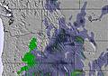
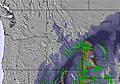
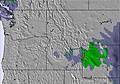
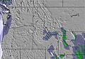
The above table gives the weather forecast for Sleeping Giant at the specific elevation of 2194 m. Our sophisticated weather models allow us to provide snow forecasts for the top, middle and bottom ski stations of Sleeping Giant. To access the weather forecasts for the other elevations, use the tab navigation above the table. For a wider view of the weather, check out the Weather Map of United States.
Click here to read further information on freezing levels and how we forecast our temperatures.
This is a small non-profit ski area with two chairs and a magic carpet. It is great value. Views are fabulous. You are right at the entrance to Yellowstone National Park. Terrain is varied ranging from beginner to true expert treed steeps. Here is the best thing about SG, it is only open Friday through Sunday (except during school holidays). The snow builds all week and Fridays are almost always powder days. There are no lift lines and powder takes several days to get skied off. There is a large quantity of groomed nordic, with stunning views along the river, and great back-country skiing. This is truly a locals mountain with the nearest accommodations an hour away in Cody. A great family/learn to ski mountain where you can turn your kids loose and they will always easily find their way back to the lodge. Love this place.
This is a small non-profit ski area with two chairs and a magic carpet. It is great value. Views are fabulous. You are right at the entrance to Yellowstone National Park. Terrain is varied ranging from beginner to true expert treed steeps. Here is the best thing about SG, it is only open Friday through Sunday (except during school holidays). The snow builds all week and Fridays are almost always powder days. There are no lift lines and powder takes several days to get skied off. There is a large quantity of groomed nordic, with stunning views along the river, and great back-country skiing. This is truly a locals mountain with the nearest accommodations an hour away in Cody. A great family/learn to ski mountain where you can turn your kids loose and they will always easily find their way back to the lodge. Love this place.
Free Snow-Forecast.com weather widget for your website
Embed the Sleeping Giant weather widget on your site for free. It provides a weekly snapshot of snow and rain conditions across all elevations. Follow the two quick steps to grab your custom code and paste it into your site. Choose between metric or imperial units. Click here to get the code.


 Nearest