

Global Weekly Snow Roundup #320
Weekly Snow News for the world, updated 25 June 2026: Chile and New Zealand's seasons proper set to begin, Tignes and Sunshine reopen for summer skiing. weekend as Riksgransen ends its 2026 season.

Next 3 days weather summary:Mostly dry. Very mild (max 15°C on Mon afternoon, min 3°C on Sat night). Winds decreasing (strong winds from the SW on Sat morning, calm by Sat night). | Days 4-6 weather summary:Mostly dry. Very mild (max 15°C on Tue afternoon, min 5°C on Thu night). Winds increasing (light winds from the SSW on Tue morning, fresh winds from the SW by Thu afternoon). | |||||||||||||||||
Saturday 27 | Sunday 28 | Monday 29 | Tuesday 30 | Wednesday 1 | Thursday 2 | |||||||||||||
AM | PM | night | AM | PM | night | AM | PM | night | AM | PM | night | AM | PM | night | AM | PM | night | |
clear | clear | clear | clear | clear | clear | some clouds | some clouds | some clouds | some clouds | some clouds | clear | clear | clear | some clouds | cloudy | some clouds | clear | |
km/h | ||||||||||||||||||
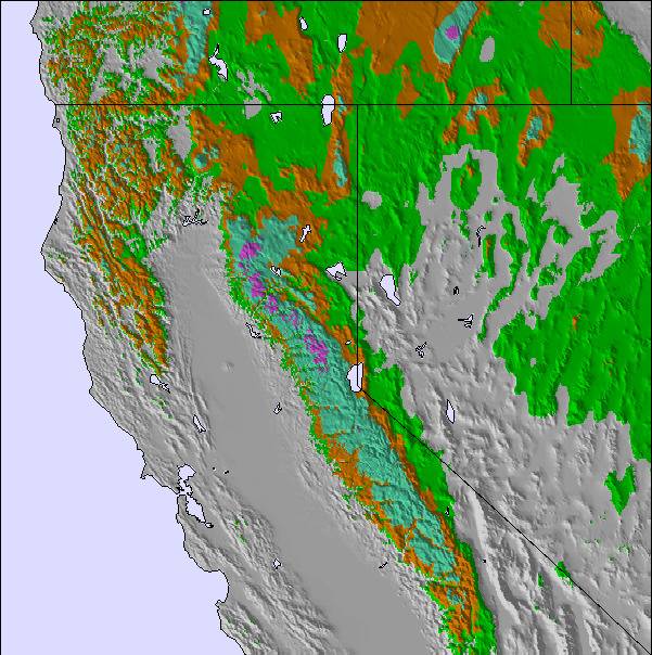
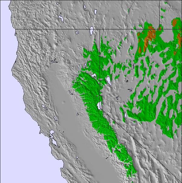
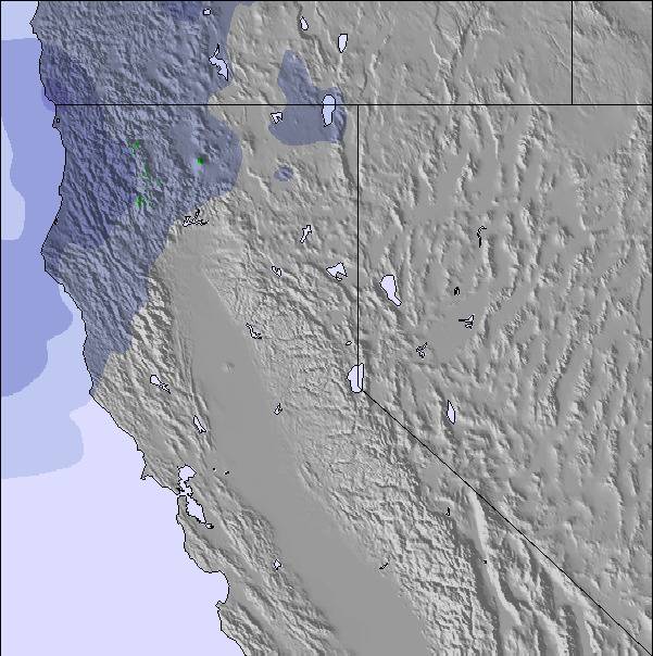
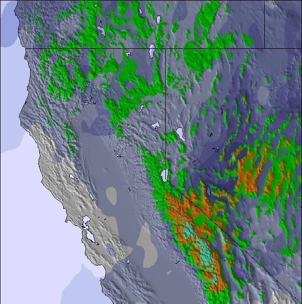
Snow map |  |  |  | 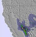 | 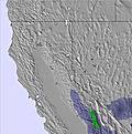 | 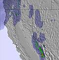 | ||||||||||||
— | — | — | — | — | — | — | — | — | — | — | — | — | — | — | — | — | — | |
mm | — | — | — | — | — | — | — | — | — | — | — | — | — | — | — | — | — | — |
max °C | 7 | 8 | 6 | 8 | 11 | 9 | 12 | 15 | 12 | 14 | 15 | 11 | 14 | 15 | 11 | 12 | 11 | 8 |
min °C | 6 | 8 | 3 | 4 | 10 | 7 | 9 | 14 | 10 | 12 | 14 | 9 | 11 | 14 | 9 | 10 | 11 | 5 |
chill °C | 1 | 4 | 3 | 4 | 8 | 4 | 9 | 13 | 10 | 11 | 12 | 7 | 10 | 12 | 6 | 7 | 8 | 0 |
Humid % | 45 | 49 | 58 | 42 | 36 | 37 | 25 | 31 | 34 | 23 | 27 | 33 | 25 | 27 | 33 | 35 | 44 | 63 |
Freeze m | 3300 | 3400 | 3050 | 3300 | 3650 | 3600 | 3850 | 4100 | 4150 | 4150 | 4150 | 3950 | 4200 | 4200 | 4000 | 3900 | 3750 | 3450 |
5:37 | — | — | 5:37 | — | — | 5:37 | — | — | 5:37 | — | — | 5:39 | — | — | 5:39 | — | — | |
— | — | 8:29 | — | — | 8:29 | — | — | 8:29 | — | — | 8:29 | — | — | 8:29 | — | — | 8:29 | |
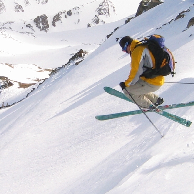
Go pro and carve into:
Avalanche information: National Avalanche Center
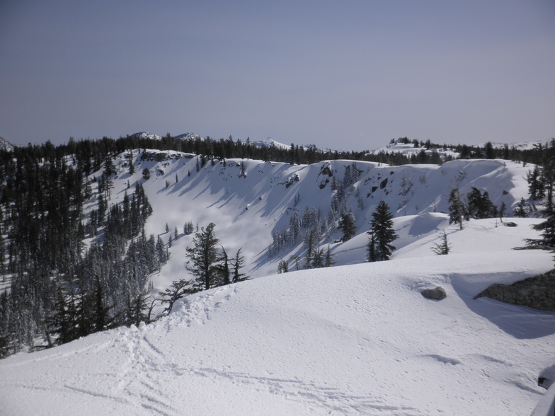
Latest snow reports near Sierra at Tahoe:
| Top snow depth: | 0 cm |
|---|---|
| Bottom snow depth: | 0 cm |
| Fresh snowfall depth: | — |
| Last snowfall: | 28 May 2026 |
| Snow Alerts | Create Alert |
0.0 | Bluebird Powder days Fresh snow, mostly sunny, light wind. |
|---|---|
0.0 | Powder days Fresh snow, limited sun, any wind. |
0.0 | Bluebird days Average snow, mostly sunny, light wind. |

The above table gives the weather forecast for Sierra at Tahoe at the specific elevation of 2360 m. Our sophisticated weather models allow us to provide snow forecasts for the top, middle and bottom ski stations of Sierra at Tahoe. To access the weather forecasts for the other elevations, use the tab navigation above the table. For a wider view of the weather, check out the Weather Map of United States.
Click here to read further information on freezing levels and how we forecast our temperatures.
Overall 4.0 Based on 11 votes and 1 review
Another underated tahoe resort. Sierra is one of the closest resort to the bay area, and it is a very nice resort, while it's not as huge as squaw for example it is still repectable. The main things here are very good snow, and the corwds aren't too bad.
thibaut colar from United States writes:
Another underated tahoe resort.
Sierra is one of the closest resort to the bay area, and it is a very nice resort, while it's not as huge as squaw for example it is still repectable. The main things here are very good snow, and the corwds aren't too bad.

 Nearest