

Portillo Re-Opens To Guests Arriving By Helicopter
Chile’s famous Portillo ski resort is reported to have re-opened to guests arriving by helicopter after being cut off by road for more than two weeks by over 6m/20 feet of snowfall.

Next 3 days weather summary:Moderate rain (total 14.0mm), heaviest on Tue night. Warm (max 27°C on Wed afternoon, min 14°C on Tue night). Wind will be generally light. | Days 4-6 weather summary:Moderate rain (total 10.0mm), heaviest on Thu night. Warm (max 27°C on Fri afternoon, min 14°C on Thu night). Wind will be generally light. | |||||||||||||||||
Monday 3 | Tuesday 4 | Wednesday 5 | Thursday 6 | Friday 7 | Saturday 8 | |||||||||||||
AM | PM | night | AM | PM | night | AM | PM | night | AM | PM | night | AM | PM | night | AM | PM | night | |
rain shwrs | t-storm risk | rain shwrs | some clouds | light rain | rain shwrs | clear | cloudy | clear | some clouds | rain shwrs | rain shwrs | clear | t-storm risk | rain shwrs | clear | t-storm risk | rain shwrs | |
km/h | ||||||||||||||||||
Snow map |  |  |  |  |  |  | ||||||||||||
— | — | — | — | — | — | — | — | — | — | — | — | — | — | — | — | — | — | |
mm | 1 | 2 | 2 | — | 2 | 7 | — | — | — | — | 1 | 3 | — | 1 | 3 | — | 1 | 1 |
max °C | 26 | 26 | 20 | 25 | 26 | 16 | 25 | 27 | 22 | 26 | 26 | 21 | 23 | 27 | 20 | 24 | 27 | 22 |
min °C | 19 | 24 | 16 | 18 | 21 | 14 | 18 | 24 | 17 | 20 | 23 | 14 | 16 | 25 | 15 | 18 | 26 | 17 |
chill °C | 19 | 24 | 16 | 18 | 21 | 14 | 18 | 24 | 17 | 20 | 23 | 13 | 16 | 25 | 15 | 18 | 26 | 17 |
Humid % | 43 | 52 | 72 | 41 | 66 | 74 | 46 | 51 | 71 | 40 | 57 | 92 | 48 | 51 | 83 | 52 | 41 | 50 |
Freeze m | 4500 | 4650 | 4500 | 4450 | 4400 | 4500 | 4450 | 4600 | 4500 | 4450 | 4550 | 4400 | 4350 | 4500 | 4400 | 4300 | 4600 | 4450 |
6:20 | — | — | 6:20 | — | — | 6:22 | — | — | 6:24 | — | — | 6:24 | — | — | 6:26 | — | — | |
— | — | 8:58 | — | — | 8:57 | — | — | 8:54 | — | — | 8:53 | — | — | 8:52 | — | — | 8:51 | |
Go pro and carve into:
Avalanche information: European Avalanche Warning Services (EAWS)
Latest snow reports near Serre Chevalier:
| Top snow depth: | 0 cm |
|---|---|
| Bottom snow depth: | 0 cm |
| Fresh snowfall depth: | — |
| Last snowfall: | 15 May 2026 |
| Snow Alerts | Create Alert |
0.0 | Bluebird Powder days Fresh snow, mostly sunny, light wind. |
|---|---|
0.0 | Powder days Fresh snow, limited sun, any wind. |
0.0 | Bluebird days Average snow, mostly sunny, light wind. |
The above table gives the weather forecast for Serre Chevalier at the specific elevation of 1200 m. Our sophisticated weather models allow us to provide snow forecasts for the top, middle and bottom ski stations of Serre Chevalier. To access the weather forecasts for the other elevations, use the tab navigation above the table. For a wider view of the weather, check out the Weather Map of France.
Click here to read further information on freezing levels and how we forecast our temperatures.
Overall 4.3 Based on 58 votes and 57 reviews
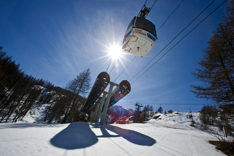
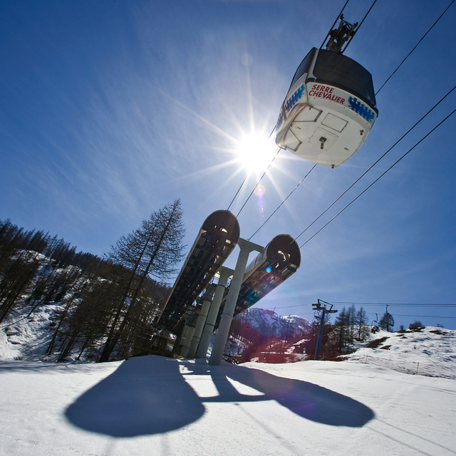
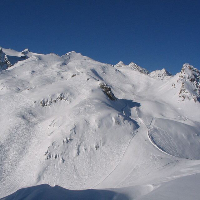
Serre Chevalier is a gem kept secret from the rest of the Alps. Having never heard of the area before my arrival I was dubious and unsure what it would have to offer. However, my qualms were short lived. Although the village I stayed in (Villeneuve) was small and quiet, it was quaint and had everything that I would want throughout my stay, even an old town full of character that transports you to 17th century French living. There are 4 main towns that make up Serre Chevalier all with something to offer. Villeneuve (where I stayed), Monetier Les Bain, with a wonderful outdoor thermal spa perfect for a change of pace, Chantemerle with more of an evening atmosphere and Briancon, the highest town in Europe which boasts another wonderful old town, which towers over the modern town in the hills of Serre Chevalier. All 4 places connect by a free (with a lift pass) and frequent bus service. You can also catch a bus to Montgeneve, a better known ski resort which is also worth a visit! The skiing in Serre Che is perfect for intermediate skiers who like to challenge themselves but also have the option to take easier scenic routes down. It is through the trees and is a beautiful setting to enjoy and be in.
Jessica Wright from France writes:
Serre Chevalier is a gem kept secret from the rest of the Alps. Having never heard of the area before my arrival I was dubious and unsure what it would have to offer. However, my qualms were short lived. Although the village I stayed in (Villeneuve) was small and quiet, it was quaint and had everything that I would want throughout my stay, even an old town full of character that transports you to 17th century French living. There are 4 main towns that make up Serre Chevalier all with something to offer. Villeneuve (where I stayed), Monetier Les Bain, with a wonderful outdoor thermal spa perfect for a change of pace, Chantemerle with more of an evening atmosphere and Briancon, the highest town in Europe which boasts another wonderful old town, which towers over the modern town in the hills of Serre Chevalier. All 4 places connect by a free (with a lift pass) and frequent bus service. You can also catch a bus to Montgeneve, a better known ski resort which is also worth a visit! The skiing in Serre Che is perfect for intermediate skiers who like to challenge themselves but also have the option to take easier scenic routes down. It is through the trees and is a beautiful setting to enjoy and be in.


 Nearest