Issued by Snow-Forecast.com at:11 pm (local time) / 24 Jun 2026
Last 6 daysScroll left for last 6 daysNow
Next 4 days weather summary:
Moderate rain (total 11.0mm), heaviest on Thu afternoon. Very mild (max 19°C on Sat afternoon, min 12°C on Thu afternoon). Winds increasing (light winds from the WSW on Wed night, strong winds from the WNW by Thu night).
Days 5-7 weather summary:
Mostly dry. Very mild (max 18°C on Sun afternoon, min 11°C on Sun night). Winds decreasing (near gales from the WSW on Sat night, light winds from the W by Mon night).
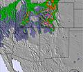
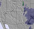
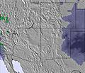
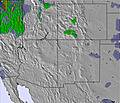
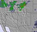
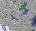
The above table gives the weather forecast for Sandia Peak at the specific elevation of 3163 m. Our sophisticated weather models allow us to provide snow forecasts for the top, middle and bottom ski stations of Sandia Peak. To access the weather forecasts for the other elevations, use the tab navigation above the table. For a wider view of the weather, check out the Weather Map of United States.
Click here to read further information on freezing levels and how we forecast our temperatures.
Sandia Peak is a great area for the Albuquerque, NM visitor who wants to get in a quick day or half-day of skiing. You can drive around to the other side of the mountain to the base or save some time by riding the Tram on the Albq. side and start from the top. Note that there are no ski rentals available if you do the Tram.
The resort is on the eastern slope of the Sandia Mountains that is pitched to average of 15 degrees leading to a family resort of intermediate skiing. However, there is glade skiing and some advanced pitches to keep the day interesting. Sandia does have snow problems in some years but can also have overwelming amounts of snow in wet years. Also look into Ski Santa Fe for a more advanced skiing experience.
Free Snow-Forecast.com weather widget for your website
Embed the Sandia Peak weather widget on your site for free. It provides a weekly snapshot of snow and rain conditions across all elevations. Follow the two quick steps to grab your custom code and paste it into your site. Choose between metric or imperial units. Click here to get the code.


 Nearest