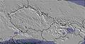
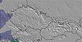
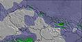
The above table gives the weather forecast for Rußbach at the specific elevation of 1440 m. Our sophisticated weather models allow us to provide snow forecasts for the top, middle and bottom ski stations of Rußbach. To access the weather forecasts for the other elevations, use the tab navigation above the table. For a wider view of the weather, check out the Weather Map of Austria.
Click here to read further information on freezing levels and how we forecast our temperatures.
Rußbach is a great ski area for families and intermediates but not so good for beginners as there are long, fairly steep runs to get back to car park (unless you get the lift). The lifts are modern with no queues. Restaurants are good value and the scenery is absolutely stunning. If you like Schladming you will love the Dachstein West area. It has the same sort of skiing but much quieter and with plenty of good red runs with a couple of steep black runs to test your turning skills. Took us 3 days to ski the whole area and recommend also visiting the smaller resort of Loser near Bad Auseee and Feurkogel in Ebensee. For those expert skiers who love going off-piste, the Krippenstein at Obertauren is a fantastic ski area with the longest red run possibly in Europe.
Rußbach is a great ski area for families and intermediates but not so good for beginners as there are long, fairly steep runs to get back to car park (unless you get the lift). The lifts are modern with no queues. Restaurants are good value and the scenery is absolutely stunning. If you like Schladming you will love the Dachstein West area. It has the same sort of skiing but much quieter and with plenty of good red runs with a couple of steep black runs to test your turning skills. Took us 3 days to ski the whole area and recommend also visiting the smaller resort of Loser near Bad Auseee and Feurkogel in Ebensee. For those expert skiers who love going off-piste, the Krippenstein at Obertauren is a fantastic ski area with the longest red run possibly in Europe.
Free Snow-Forecast.com weather widget for your website
Embed the Rußbach weather widget on your site for free. It provides a weekly snapshot of snow and rain conditions across all elevations. Follow the two quick steps to grab your custom code and paste it into your site. Choose between metric or imperial units. Click here to get the code.


 Nearest