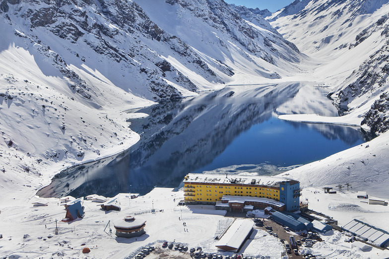


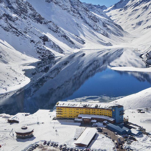
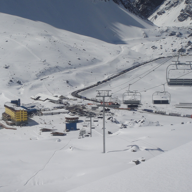
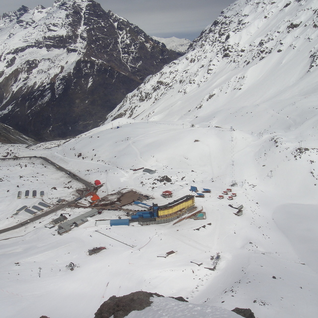
Portillo Storm Snowfall Total Passes 5m / 17 Feet
A snow storm that has now continued for nine days has taken Chilean ski resort Portillo to a snowfall total of 5.2 metres (17 feet) so far, with more snow forecast.

Next 3 days weather summary:A heavy fall of snow, heaviest during Sun morning. Freeze-thaw conditions (max 3°C on Tue morning, min -4°C on Sun morning). Wind will be generally light. | Days 4-6 weather summary:A moderate fall of snow, heaviest on Thu night. Freeze-thaw conditions (max 1°C on Wed morning, min -14°C on Fri night). Winds increasing (light winds from the NW on Wed morning, fresh winds from the W by Thu afternoon). | |||||||||||||||||
Sunday 2 | Monday 3 | Tuesday 4 | Wednesday 5 | Thursday 6 | Friday 7 | |||||||||||||
AM | PM | night | AM | PM | night | AM | PM | night | AM | PM | night | AM | PM | night | AM | PM | night | |
heavy snow | light snow | mod. snow | light snow | snow shwrs | cloudy | light snow | cloudy | some clouds | clear | some clouds | some clouds | some clouds | light snow | mod. snow | light snow | snow shwrs | light snow | |
km/h | ||||||||||||||||||
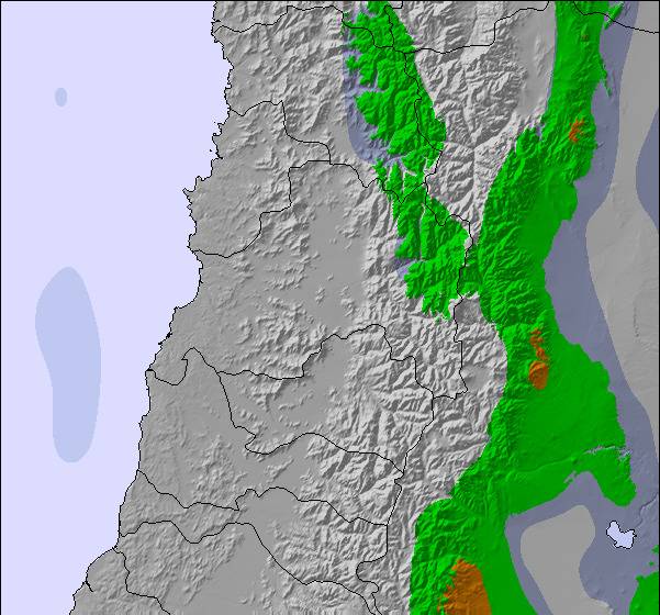
Snow map |  |  |  |  | 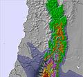 | 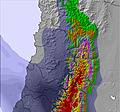 | ||||||||||||
11 | 4 | 9 | 2 | — | — | — | — | — | — | — | — | — | 5 | 9 | 1 | 1 | 2 | |
mm | — | — | — | — | — | — | — | — | — | — | — | — | — | — | — | — | — | — |
max °C | -2 | -1 | -1 | 0 | 1 | 1 | 3 | 3 | -1 | 1 | 1 | -3 | -4 | -4 | -6 | -7 | -8 | -11 |
min °C | -4 | -1 | -2 | -2 | 0 | 0 | 2 | 2 | -1 | -2 | -1 | -4 | -5 | -6 | -10 | -8 | -9 | -14 |
chill °C | -10 | -5 | -6 | -6 | -3 | -2 | 0 | 0 | -1 | -4 | -5 | -9 | -12 | -14 | -17 | -16 | -17 | -23 |
Humid % | 95 | 90 | 90 | 78 | 65 | 43 | 49 | 49 | 29 | 38 | 54 | 44 | 70 | 91 | 77 | 82 | 88 | 85 |
Freeze m | 2950 | 3200 | 3050 | 3350 | 3400 | 3300 | 3700 | 3500 | 3150 | 3500 | 3200 | 2700 | 2750 | 2400 | 1700 | 2150 | 1950 | 1050 |
7:30 | — | — | 7:28 | — | — | 7:28 | — | — | 7:26 | — | — | 7:26 | — | — | 7:26 | — | — | |
— | 6:02 | — | — | 6:04 | — | — | 6:04 | — | — | 6:05 | — | — | 6:06 | — | — | 6:06 | — | |
Go pro and carve into:
Latest snow reports near Portillo:
| Top snow depth: | 275 cm |
|---|---|
| Bottom snow depth: | 230 cm |
| Fresh snowfall depth: | 36 cm |
| Last snowfall: | 1 Aug 2026 |
| Snow Alerts | Create Alert |
0.7 | Bluebird Powder days Fresh snow, mostly sunny, light wind. |
|---|---|
0.8 | Powder days Fresh snow, limited sun, any wind. |
1.9 | Bluebird days Average snow, mostly sunny, light wind. |
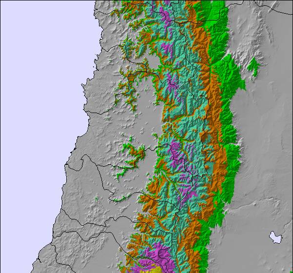
The above table gives the weather forecast for Portillo at the specific elevation of 3310 m. Our sophisticated weather models allow us to provide snow forecasts for the top, middle and bottom ski stations of Portillo. To access the weather forecasts for the other elevations, use the tab navigation above the table. For a wider view of the weather, check out the Weather Map of Chile.
Click here to read further information on freezing levels and how we forecast our temperatures.
Overall 3.8 Based on 38 votes and 22 reviews
I really wanted to like Portillo, but frankly it's mediocre in most aspects. The vertical is not great with all lifts accessing less than 1,000'. It's very difficult to expand that number because the resort is divided in half by the Inca Lake. The best skiing is the "bowls" - really just long chutes that you reach via 4/5 person poma lifts that whisk you up. There are 3 of these, and from them you can traverse or climb to some others. In most other ambitious ski resorts these would all have chairlifts and better planning of layout throughout. The care-taking of the mountain is seriously lacking, with minimal grooming, little signage of any kind, and complacent staff attitudes. The "trails" number less than a handful and get boring quickly, especially after skiing/boarding them for a day or two. If snow is iffy there is hardly any snowmaking backup - a serious problem. Most folks stay at the Hotel Portillo (except for the budget minded - there's a bunk bed building) which is basic; very modest rooms including 4 meals daily which are surprisingly bad and sometimes near rancid. I don't know how it's partnered up with Rockresorts, other than a stunning location (it has nothing in common with those five star resorts). As someone who has skied most everywhere I'm glad I visited for my own education, but I'd find it hard to recommend this place except for the most inquisitive, it simply doesn't live up to expectations. From what I understand, Valle Nevado is a better choice, and when I return to S.A. it will be my next.
Davey B. from United States writes:
I really wanted to like Portillo, but frankly it's mediocre in most aspects. The vertical is not great with all lifts accessing less than 1,000'. It's very difficult to expand that number because the resort is divided in half by the Inca Lake. The best skiing is the "bowls" - really just long chutes that you reach via 4/5 person poma lifts that whisk you up. There are 3 of these, and from them you can traverse or climb to some others. In most other ambitious ski resorts these would all have chairlifts and better planning of layout throughout. The care-taking of the mountain is seriously lacking, with minimal grooming, little signage of any kind, and complacent staff attitudes. The "trails" number less than a handful and get boring quickly, especially after skiing/boarding them for a day or two. If snow is iffy there is hardly any snowmaking backup - a serious problem. Most folks stay at the Hotel Portillo (except for the budget minded - there's a bunk bed building) which is basic; very modest rooms including 4 meals daily which are surprisingly bad and sometimes near rancid. I don't know how it's partnered up with Rockresorts, other than a stunning location (it has nothing in common with those five star resorts). As someone who has skied most everywhere I'm glad I visited for my own education, but I'd find it hard to recommend this place except for the most inquisitive, it simply doesn't live up to expectations. From what I understand, Valle Nevado is a better choice, and when I return to S.A. it will be my next.

 Nearest