

Global Weekly Snow Roundup #320
Weekly Snow News for the world, updated 25 June 2026: Chile and New Zealand's seasons proper set to begin, Tignes and Sunshine reopen for summer skiing. weekend as Riksgransen ends its 2026 season.

Next 4 days weather summary:Heavy rain (total 36.0mm), heaviest during Sat night. Warm (max 29°C on Sat afternoon, min 14°C on Sun night). Wind will be generally light. | Days 5-7 weather summary:Heavy rain (total 70.0mm), heaviest during Wed morning. Warm (max 21°C on Tue afternoon, min 6°C on Wed night). Wind will be generally light. | |||||||||||||||
Saturday 27 | Sunday 28 | Monday 29 | Tuesday 30 | Wednesday 1 | ||||||||||||
night | AM | PM | night | AM | PM | night | AM | PM | night | AM | PM | night | AM | PM | night | |
clear | clear | t-storm risk | rain shwrs | t-storm risk | t-storm risk | heavy rain | some clouds | t-storm risk | rain shwrs | t-storm risk | t-storm risk | rain shwrs | heavy rain | heavy rain | rain shwrs | |
km/h | ||||||||||||||||
Snow map |  |  |  |  |  |  | ||||||||||
— | — | — | — | — | — | — | — | — | — | — | — | — | — | — | — | |
mm | — | — | 1 | 15 | 1 | 3 | 12 | — | 4 | 6 | 3 | 8 | 12 | 23 | 14 | 4 |
max °C | 23 | 26 | 29 | 17 | 26 | 27 | 16 | 24 | 26 | 18 | 19 | 21 | 15 | 13 | 13 | 12 |
min °C | 16 | 20 | 26 | 16 | 20 | 19 | 14 | 18 | 18 | 13 | 16 | 18 | 13 | 11 | 11 | 6 |
chill °C | 16 | 20 | 26 | 16 | 20 | 19 | 14 | 18 | 18 | 13 | 16 | 18 | 13 | 10 | 10 | 6 |
Humid % | 69 | 47 | 44 | 72 | 46 | 70 | 63 | 47 | 72 | 79 | 73 | 77 | 87 | 98 | 76 | 89 |
Freeze m | 4600 | 4550 | 4700 | 4650 | 4550 | 4600 | 4550 | 4450 | 4600 | 4300 | 4200 | 4250 | 4000 | 3250 | 3050 | 2800 |
— | 5:18 | — | — | 5:20 | — | — | 5:20 | — | — | 5:20 | — | — | 5:20 | — | — | |
— | — | — | 9:14 | — | — | 9:14 | — | — | 9:14 | — | — | 9:13 | — | — | 9:13 | |
Go pro and carve into:
Avalanche information: European Avalanche Warning Services (EAWS)
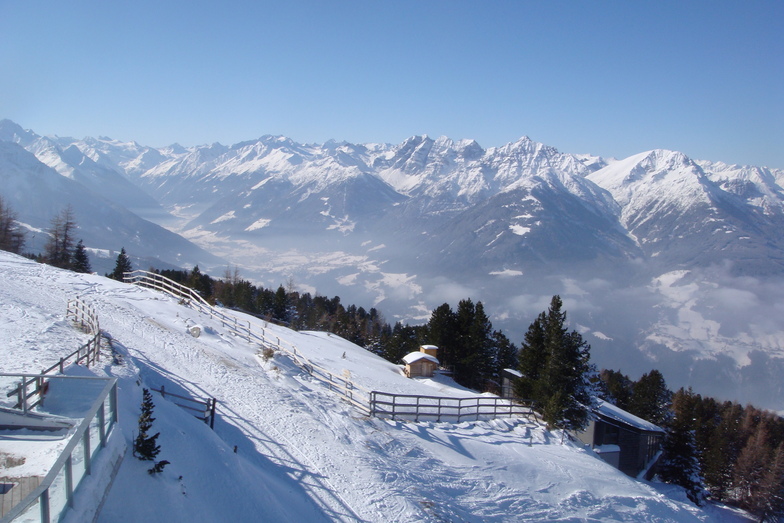
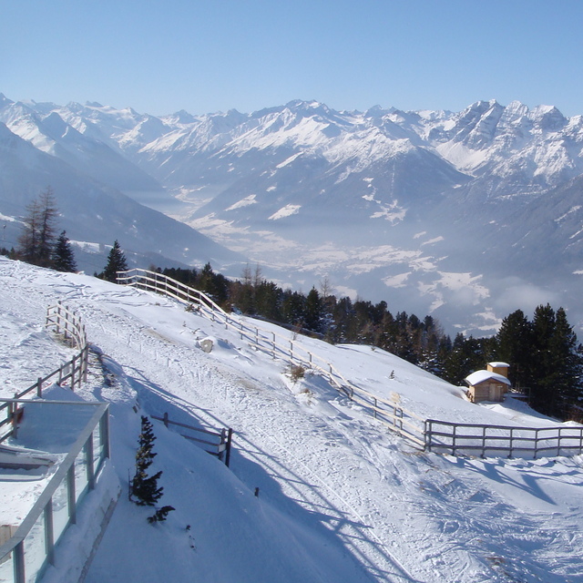
Latest snow reports near Patscherkofel:
| Top snow depth: | 0 cm |
|---|---|
| Bottom snow depth: | 0 cm |
| Fresh snowfall depth: | — |
| Last snowfall: | 10 Jun 2026 |
| Snow Alerts | Create Alert |
0.0 | Bluebird Powder days Fresh snow, mostly sunny, light wind. |
|---|---|
0.0 | Powder days Fresh snow, limited sun, any wind. |
0.0 | Bluebird days Average snow, mostly sunny, light wind. |
The above table gives the weather forecast for Patscherkofel at the specific elevation of 1294 m. Our sophisticated weather models allow us to provide snow forecasts for the top, middle and bottom ski stations of Patscherkofel. To access the weather forecasts for the other elevations, use the tab navigation above the table. For a wider view of the weather, check out the Weather Map of Austria.
Click here to read further information on freezing levels and how we forecast our temperatures.
Overall 3.8 Based on 15 votes and 4 reviews
This is the best resort for learning and practising for whole family. We love this region and all mountains but especially Patscherkofel. You can find there lots of different ways for skiing. Our family is going to PK in January again and I am absolutely sure there will be lots of fun. Our kids love this mountain because they can go and ski when parents want to stop and drink Glühwein. In Olex restaurant you can take some rest and still control what your kids are doing and how they are skiing. But if you are an advanced skier it could be a little boring for longer than a week. If you plan to ski all day long up-and-down, the mountain is quite small. I think also that the marking OlimpiaAbfahrt as red could be little deceptive because, in my opinion, there are parts that should be marked as black.
Hubert from Poland writes:
This is the best resort for learning and practising for whole family. We love this region and all mountains but especially Patscherkofel. You can find there lots of different ways for skiing. Our family is going to PK in January again and I am absolutely sure there will be lots of fun. Our kids love this mountain because they can go and ski when parents want to stop and drink Glühwein. In Olex restaurant you can take some rest and still control what your kids are doing and how they are skiing.
But if you are an advanced skier it could be a little boring for longer than a week. If you plan to ski all day long up-and-down, the mountain is quite small.
I think also that the marking OlimpiaAbfahrt as red could be little deceptive because, in my opinion, there are parts that should be marked as black.


 Nearest