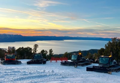
North America Weekly Snow Roundup #308
Weekly Snow News for North America, updated 2 April 2026: US resorts close early amid +20°C warmth, while Canada sees up to 64cm (26") snowfall and strong coverage.
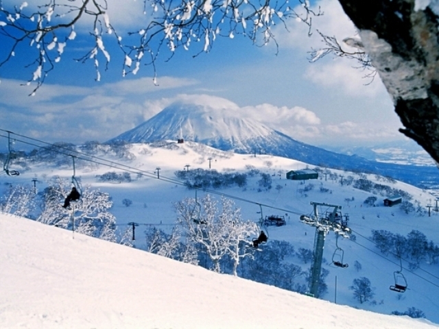

Niseko Annupuri Weather (Next 3 days): The snow forecast for Niseko Annupuri is: Moderate rain (total 13.0mm), heaviest on Sat night. Mild temperatures (max 7°C on Sat morning, min 2°C on Fri morning). Mainly fresh winds.
Niseko Annupuri Weather (Days 4-6): Heavy rain (total 21.0mm), heaviest during Tue afternoon. Later becoming colder with a dusting of snow on Tue afternoon. Freeze-thaw conditions (max 6°C on Mon morning, min -2°C on Tue night). Mainly near gales.
| Resort | Snow Depth | Temp. (°C) | Wind (km/h) | Weather | ||
|---|---|---|---|---|---|---|
| Top Lift: | 0 | |||||
| Middle Lift: | 2 | |||||
| Bottom Lift: | 5 |

Friday 3 | Saturday 4 | Sunday 5 | Monday 6 | Tuesday 7 | Wednesday 8 | |||||||||||||
AM | PM | night | AM | PM | night | AM | PM | night | AM | PM | night | AM | PM | night | AM | PM | night | |
clear | clear | some clouds | cloudy | cloudy | heavy rain | rain shwrs | some clouds | cloudy | clear | cloudy | mod. rain | light rain | light snow | light snow | snow shwrs | snow shwrs | some clouds | |
km/h | ||||||||||||||||||
Snow map |  |  |  |  |  | 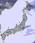 | ||||||||||||
— | — | — | — | — | — | — | — | — | — | — | — | — | 2 | 3 | — | — | — | |
— | — | — | — | — | 12 | 1 | — | — | — | — | 6 | 4 | 11 | — | — | — | — | |
max °C | 4 | 4 | 4 | 7 | 7 | 6 | 6 | 4 | 3 | 6 | 6 | 4 | 6 | 3 | -1 | 0 | 0 | 3 |
min °C | 2 | 4 | 3 | 6 | 5 | 4 | 5 | 4 | 3 | 5 | 5 | 4 | 6 | 1 | -2 | -1 | 0 | 1 |
-3 | 0 | 0 | 2 | 1 | -1 | 0 | -1 | 1 | 1 | 0 | -1 | 2 | -4 | -10 | -9 | -7 | -5 | |
45 | 35 | 50 | 56 | 58 | 96 | 97 | 66 | 57 | 73 | 79 | 97 | 97 | 99 | 91 | 85 | 81 | 61 | |
1100 | 1300 | 1850 | 2050 | 1950 | 1800 | 2100 | 2150 | 2150 | 1950 | 1950 | 1750 | 2000 | 1300 | 550 | 700 | 750 | 1000 | |
5:16 | — | — | 5:15 | — | — | 5:13 | — | — | 5:11 | — | — | 5:09 | — | — | 5:07 | — | — | |
— | 6:04 | — | — | 6:06 | — | — | 6:07 | — | — | 6:07 | — | — | 6:08 | — | — | 6:09 | — | |
Moderate rain (total 13.0mm), heaviest on Sat night. Mild temperatures (max 7°C on Sat morning, min 2°C on Fri morning). Mainly fresh winds.
Heavy rain (total 21.0mm), heaviest during Tue afternoon. Later becoming colder with a dusting of snow on Tue afternoon. Freeze-thaw conditions (max 6°C on Mon morning, min -2°C on Tue night). Mainly near gales.
Latest snow reports near Niseko Annupuri:
| Top snow depth: | — |
|---|---|
| Bottom snow depth: | — |
| Fresh snowfall depth: | — |
| Last snowfall: | 28 Mar 2026 |
| Snow Alerts | Create Alert |
0.5 | Bluebird Powder days Fresh snow, mostly sunny, light wind. |
|---|---|
0.6 | Powder days Fresh snow, limited sun, any wind. |
0.7 | Bluebird days Average snow, mostly sunny, light wind. |
The above table gives the weather forecast for Niseko Annupuri at the specific elevation of 778 m. Our sophisticated weather models allow us to provide snow forecasts for the top, middle and bottom ski stations of Niseko Annupuri. To access the weather forecasts for the other elevations, use the tab navigation above the table. For a wider view of the weather, check out the Weather Map of Japan.
Click here to read further information on freezing levels and how we forecast our temperatures.


 Nearest