


Global Weekly Snow Roundup #320
Weekly Snow News for the world, updated 25 June 2026: Chile and New Zealand's seasons proper set to begin, Tignes and Sunshine reopen for summer skiing. weekend as Riksgransen ends its 2026 season.

Next 3 days weather summary:Light rain (total 3.0mm), mostly falling on Sat afternoon. Warm (max 20°C on Tue morning, min 16°C on Sat night). Wind will be generally light. | Days 4-6 weather summary:Moderate rain (total 14.0mm), heaviest on Tue afternoon. Very mild (max 19°C on Tue afternoon, min 16°C on Thu night). Wind will be generally light. | ||||||||||||||||
Sat 27 | Sunday 28 | Monday 29 | Tuesday 30 | Wednesday 1 | Thursday 2 | ||||||||||||
PM | night | AM | PM | night | AM | PM | night | AM | PM | night | AM | PM | night | AM | PM | night | |
light rain | cloudy | some clouds | rain shwrs | some clouds | clear | clear | some clouds | t-storm risk | t-storm risk | rain shwrs | light rain | t-storm risk | rain shwrs | rain shwrs | rain shwrs | some clouds | |
km/h | |||||||||||||||||
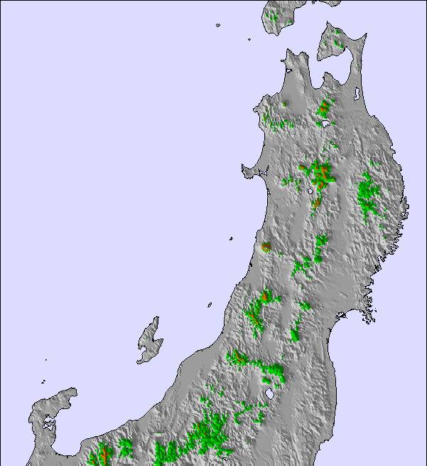
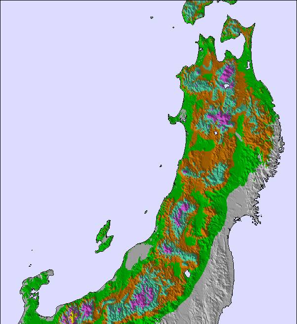
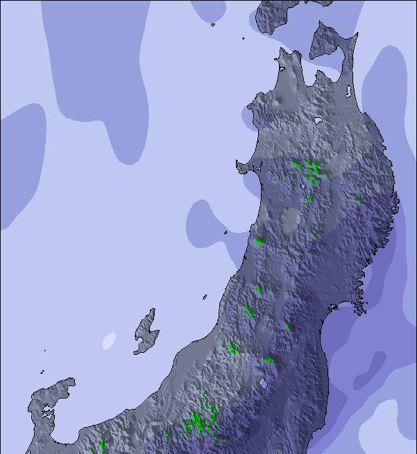
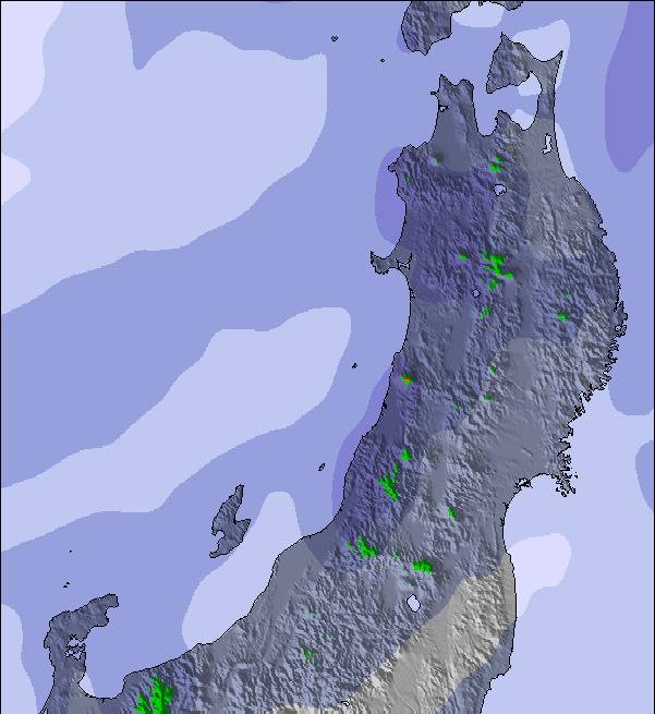
Snow map | 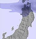 | 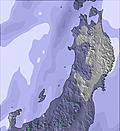 | 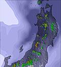 | 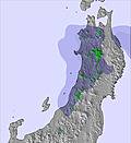 | 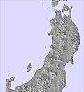 | 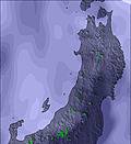 | |||||||||||
— | — | — | — | — | — | — | — | — | — | — | — | — | — | — | — | — | |
mm | 1 | — | — | 1 | — | — | — | — | 1 | 4 | 1 | 1 | 4 | 1 | 1 | 2 | — |
max °C | 17 | 16 | 18 | 18 | 16 | 19 | 19 | 17 | 20 | 19 | 18 | 19 | 18 | 18 | 19 | 19 | 17 |
min °C | 17 | 16 | 17 | 17 | 16 | 17 | 18 | 16 | 18 | 19 | 17 | 18 | 18 | 17 | 18 | 18 | 16 |
chill °C | 17 | 16 | 17 | 17 | 16 | 17 | 18 | 16 | 18 | 19 | 17 | 18 | 18 | 17 | 18 | 18 | 16 |
Humid % | 93 | 85 | 68 | 72 | 76 | 56 | 64 | 79 | 78 | 77 | 81 | 80 | 85 | 89 | 84 | 71 | 72 |
Freeze m | 4700 | 4750 | 4350 | 4300 | 4100 | 4050 | 4150 | 4000 | 4250 | 4250 | 4300 | 4350 | 4400 | 4450 | 4300 | 4300 | 4250 |
— | — | 4:30 | — | — | 4:30 | — | — | 4:31 | — | — | 4:31 | — | — | 4:31 | — | — | |
7:09 | — | — | 7:09 | — | — | 7:09 | — | — | 7:09 | — | — | 7:09 | — | — | 7:09 | — | |
Go pro and carve into:
Avalanche information: Japan Avalanche Network
Latest snow reports near Ikenotaira Onsen Alpenblick:
| Top snow depth: | — |
|---|---|
| Bottom snow depth: | — |
| Fresh snowfall depth: | — |
| Last snowfall: | 7 Apr 2026 |
| Snow Alerts | Create Alert |
0.0 | Bluebird Powder days Fresh snow, mostly sunny, light wind. |
|---|---|
0.0 | Powder days Fresh snow, limited sun, any wind. |
0.0 | Bluebird days Average snow, mostly sunny, light wind. |
The above table gives the weather forecast for Ikenotaira Onsen Alpenblick at the specific elevation of 1150 m. Our sophisticated weather models allow us to provide snow forecasts for the top, middle and bottom ski stations of Ikenotaira Onsen Alpenblick. To access the weather forecasts for the other elevations, use the tab navigation above the table. For a wider view of the weather, check out the Weather Map of Japan.
Click here to read further information on freezing levels and how we forecast our temperatures.
Resort name is also written as Myoko Ikenotaira Onsen.
One of the four major resorts at Myoko, Ikenotaira Onsen is terrific for beginners through advanced intermediate skiers and boarders and benefits from the lack of crowds due to being the least well known of the majors. The pistes are wide and not too challenging, and there is abundant side and back country throughout the forests in the resort. Ikenotaira gets tremendous amounts of powder and the lack of crowds means that that fresh powder skiing is often available all day long.
Kevin from Japan writes:
One of the four major resorts at Myoko, Ikenotaira Onsen is terrific for beginners through advanced intermediate skiers and boarders and benefits from the lack of crowds due to being the least well known of the majors. The pistes are wide and not too challenging, and there is abundant side and back country throughout the forests in the resort. Ikenotaira gets tremendous amounts of powder and the lack of crowds means that that fresh powder skiing is often available all day long.
Read 1 more reviews of Ikenotaira Onsen Alpenblick or submit your own

 Nearest