


Portillo Storm Snowfall Total Passes 5m / 17 Feet
A snow storm that has now continued for nine days has taken Chilean ski resort Portillo to a snowfall total of 5.2 metres (17 feet) so far, with more snow forecast.

Next 3 days weather summary:Mostly dry. Freeze-thaw conditions (max 6°C on Sat morning, min 0°C on Thu morning). Winds increasing (calm on Fri afternoon, strong winds from the NNW by Sat night). | Days 4-6 weather summary:A light fall of snow, heaviest on Mon night. Turning milder with light rain (total 2.0mm) on Tue morning. Freeze-thaw conditions (max 6°C on Sun morning, min 0°C on Sun night). Winds decreasing (strong winds from the NNW on Sun night, moderate winds from the WSW by Tue night). | |||||||||||||||||
Thursday 30 | Friday 31 | Saturday 1 | Sunday 2 | Monday 3 | Tuesday 4 | |||||||||||||
AM | PM | night | AM | PM | night | AM | PM | night | AM | PM | night | AM | PM | night | AM | PM | night | |
light snow | light snow | cloudy | some clouds | cloudy | clear | clear | clear | clear | clear | clear | snow shwrs | light snow | light snow | mod. snow | light snow | light snow | light snow | |
km/h | ||||||||||||||||||
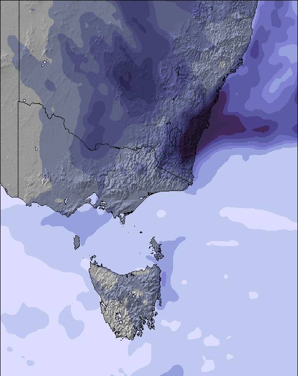
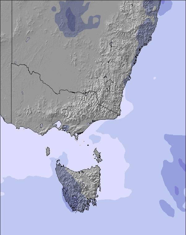
Snow map | 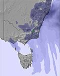 | 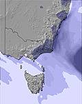 | 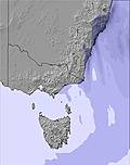 | 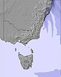 |  |  | ||||||||||||
— | — | — | — | — | — | — | — | — | — | — | — | 1 | 3 | 9 | 1 | — | — | |
mm | — | — | — | — | — | — | — | — | — | — | — | — | — | — | — | 1 | 1 | — |
max °C | 1 | 1 | 1 | 4 | 4 | 1 | 6 | 5 | 2 | 6 | 5 | 3 | 1 | 0 | 1 | 2 | 2 | 1 |
min °C | 0 | 1 | 0 | 2 | 2 | 1 | 4 | 2 | 2 | 5 | 3 | 0 | 0 | 0 | 0 | 1 | 2 | 1 |
chill °C | -5 | -3 | -3 | 0 | 2 | 1 | 0 | -3 | -3 | -1 | -4 | -7 | -8 | -8 | -7 | -6 | -4 | -5 |
Humid % | 96 | 94 | 97 | 82 | 76 | 74 | 60 | 68 | 68 | 78 | 73 | 62 | 96 | 97 | 97 | 99 | 96 | 95 |
Freeze m | 1250 | 1350 | 1450 | 1450 | 1750 | 1800 | 1850 | 2000 | 2100 | 1950 | 2000 | 1800 | 1250 | 1300 | 1250 | 1500 | 1550 | 1350 |
7:16 | — | — | 7:16 | — | — | 7:15 | — | — | 7:13 | — | — | 7:13 | — | — | 7:11 | — | — | |
— | 5:24 | — | — | 5:24 | — | — | 5:25 | — | — | 5:27 | — | — | 5:28 | — | — | 5:29 | — | |
Go pro and carve into:
Avalanche information: Mountain Safety Collective
Latest snow reports near Mount St Gwinear:
Snowing at a moderate rate in Mount Baw Baw. from Mount Baw Baw
| Top snow depth: | — |
|---|---|
| Bottom snow depth: | — |
| Fresh snowfall depth: | 9 cm |
| Last snowfall: | 29 Jul 2026 |
| Snow Alerts | Create Alert |
0.0 | Bluebird Powder days Fresh snow, mostly sunny, light wind. |
|---|---|
0.0 | Powder days Fresh snow, limited sun, any wind. |
0.0 | Bluebird days Average snow, mostly sunny, light wind. |
The above table gives the weather forecast for Mount St Gwinear at the specific elevation of 1204 m. Our sophisticated weather models allow us to provide snow forecasts for the top, middle and bottom ski stations of Mount St Gwinear. To access the weather forecasts for the other elevations, use the tab navigation above the table. For a wider view of the weather, check out the Weather Map of Australia.
Click here to read further information on freezing levels and how we forecast our temperatures.
Overall 3.1 Based on 1 vote and 2 reviews
Could tell the truth but....... would rather it stayed a secret. Gwinear is not suitable for Melbournians as it never has enough snow for you guys, better you stick to Lake Mountain or go to Buller or Thredbo!
gwinnearfan from Australia writes:
Could tell the truth but....... would rather it stayed a secret.
Gwinear is not suitable for Melbournians as it never has enough snow for you guys, better you stick to Lake Mountain or go to Buller or Thredbo!


 Nearest