

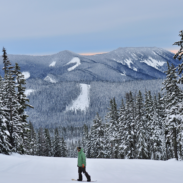
Global Weekly Snow Roundup #320
Weekly Snow News for the world, updated 25 June 2026: Chile and New Zealand's seasons proper set to begin, Tignes and Sunshine reopen for summer skiing. weekend as Riksgransen ends its 2026 season.

Next 3 days weather summary:Moderate rain (total 12.0mm), heaviest on Sat morning. Very mild (max 11°C on Mon afternoon, min 3°C on Sat morning). Mainly fresh winds. | Days 4-6 weather summary:Mostly dry. Very mild (max 13°C on Thu afternoon, min 3°C on Tue night). Mainly fresh winds. | |||||||||||||||||
Saturday 27 | Sunday 28 | Monday 29 | Tuesday 30 | Wednesday 1 | Thursday 2 | |||||||||||||
AM | PM | night | AM | PM | night | AM | PM | night | AM | PM | night | AM | PM | night | AM | PM | night | |
light rain | light rain | light rain | light rain | light rain | cloudy | cloudy | some clouds | some clouds | some clouds | clear | cloudy | cloudy | some clouds | some clouds | clear | some clouds | clear | |
km/h | ||||||||||||||||||
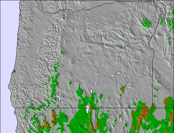
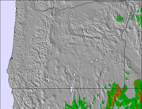
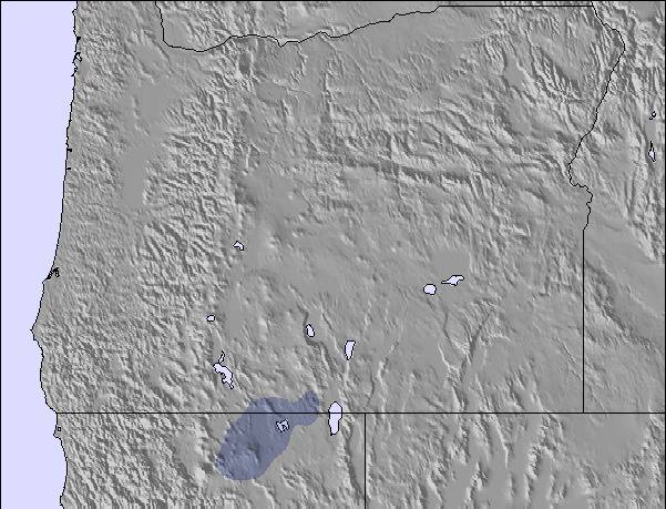
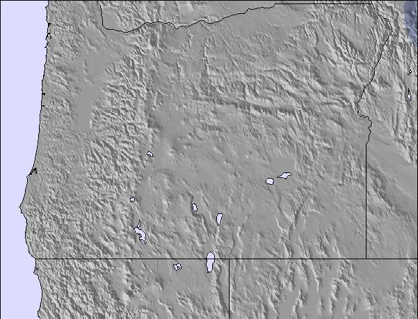
Snow map |  |  |  |  | 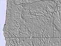 | 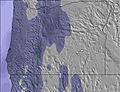 | ||||||||||||
— | — | — | — | — | — | — | — | — | — | — | — | — | — | — | — | — | — | |
mm | 2 | 2 | 4 | 2 | 2 | — | — | — | — | — | — | — | — | — | — | — | — | — |
max °C | 4 | 5 | 5 | 6 | 8 | 7 | 6 | 11 | 8 | 7 | 11 | 9 | 6 | 10 | 7 | 11 | 13 | 10 |
min °C | 3 | 5 | 4 | 4 | 8 | 4 | 4 | 9 | 3 | 4 | 11 | 3 | 4 | 10 | 3 | 6 | 13 | 3 |
chill °C | -2 | 0 | -1 | -1 | 4 | -1 | -1 | 7 | -2 | 0 | 9 | -2 | 0 | 7 | -1 | 4 | 12 | -1 |
Humid % | 92 | 94 | 97 | 93 | 89 | 95 | 90 | 72 | 86 | 75 | 58 | 89 | 86 | 63 | 77 | 52 | 47 | 67 |
Freeze m | 1900 | 2150 | 2350 | 3050 | 3400 | 3950 | 3750 | 3800 | 3700 | 3350 | 3450 | 3450 | 2750 | 2900 | 2900 | 2800 | 2850 | 2900 |
5:20 | — | — | 5:20 | — | — | 5:20 | — | — | 5:20 | — | — | 5:22 | — | — | 5:22 | — | — | |
— | — | 8:58 | — | — | 8:58 | — | — | 8:58 | — | — | 8:58 | — | — | 8:58 | — | — | 8:58 | |
Go pro and carve into:
Avalanche information: National Avalanche Center
Latest snow reports near Mt Hood Meadows:
| Top snow depth: | 0 cm |
|---|---|
| Bottom snow depth: | 0 cm |
| Fresh snowfall depth: | — |
| Last snowfall: | 9 Jun 2026 |
| Snow Alerts | Create Alert |
0.0 | Bluebird Powder days Fresh snow, mostly sunny, light wind. |
|---|---|
0.0 | Powder days Fresh snow, limited sun, any wind. |
0.0 | Bluebird days Average snow, mostly sunny, light wind. |
The above table gives the weather forecast for Mt Hood Meadows at the specific elevation of 1379 m. Our sophisticated weather models allow us to provide snow forecasts for the top, middle and bottom ski stations of Mt Hood Meadows. To access the weather forecasts for the other elevations, use the tab navigation above the table. For a wider view of the weather, check out the Weather Map of United States.
Click here to read further information on freezing levels and how we forecast our temperatures.
Overall 3.1 Based on 162 votes and 177 reviews
I echo many of the previous comments. Mt Hood Meadows enjoys a monopoly on the mountain and seems more concerned with net profit than creating and maintaining a classy operation. When the lines at Mt Hood Express are 300 deep for night skiing and Stadium is open and beautiful still bathed in the fading light they never keep it open even though it is the best lit run on the mountain. It's maddening. When I ask the hands about it they eventually say they can't find staff for it. Then offer higher pay! And Sahale lodge? What a joke. Who designed that thing. Everything about it is wrong. I hate going in there. They run the place like it's a money maker and don't care about aesthetics or to create a top notch ski area to be proud of. But the mountain is pretty great when it's on. Too bad the owners just don't get it.
Jay Rundle from United States writes:
I echo many of the previous comments. Mt Hood Meadows enjoys a monopoly on the mountain and seems more concerned with net profit than creating and maintaining a classy operation. When the lines at Mt Hood Express are 300 deep for night skiing and Stadium is open and beautiful still bathed in the fading light they never keep it open even though it is the best lit run on the mountain. It's maddening. When I ask the hands about it they eventually say they can't find staff for it. Then offer higher pay! And Sahale lodge? What a joke. Who designed that thing. Everything about it is wrong. I hate going in there. They run the place like it's a money maker and don't care about aesthetics or to create a top notch ski area to be proud of. But the mountain is pretty great when it's on. Too bad the owners just don't get it.

 Nearest