

Arizona Ski Area Staying Open Into June
Arizona Snowbowl has announced it will operate into June and celebrate a historic milestone: the longest ski season in the resort’s 87-year history.
Please sign in with your Snow-Forecast account details below.
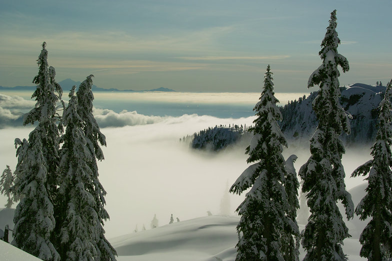


Mt Seymour Weather (Next 3 days): The snow forecast for Mt Seymour is: A dusting of snow. Milder later with heavy rain (total 28.0mm) on Sat afternoon. Temperatures will be slightly above freezing (max 4°C on Sun afternoon, min 1°C on Thu night). Wind will be generally light.
Mt Seymour Weather (Days 4-6): A light covering of new snow, mostly falling on Mon morning. Becoming milder with moderate rain (total 10.0mm) heaviest on Mon night. Freeze-thaw conditions (max 4°C on Sun night, min 0°C on Wed afternoon). Wind will be generally light.
| Resort | Snow Depth | Temp. (°C) | Wind (km/h) | Weather | ||
|---|---|---|---|---|---|---|
| Top Lift: | 0.0 m | 1 | ||||
| Bottom Lift: | 0.0 m | 3 |
Latest snow reports near Mt Seymour:
Light rain reported from North Vancouver at 234 metres elevation one km N of Grouse Mountain but it is forecast cold enough for snow at the ski area from Grouse Mountain

Friday 16 | Saturday 17 | Sunday 18 | Monday 19 | Tuesday 20 | Wednesday 21 | ||||||||||||||
night | AM | PM | night | AM | PM | night | AM | PM | night | AM | PM | night | AM | PM | night | AM | PM | night | |
light snow | light snow | light rain | light rain | light rain | mod. rain | mod. rain | light rain | rain shwrs | light rain | light snow | light snow | light snow | clear | rain shwrs | rain shwrs | light snow | light snow | light snow | |
km/h | |||||||||||||||||||
Snow map | 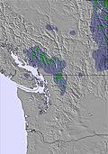 | 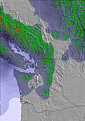 | 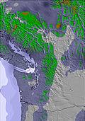 | 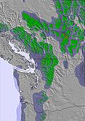 | 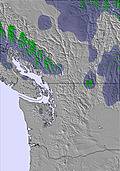 | 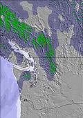 | 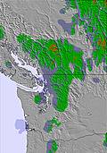 | ||||||||||||
2.0 | 1.0 | — | — | — | — | — | — | — | — | 4 | — | — | — | — | — | 1.0 | 3 | — | |
— | 2.0 | 2.0 | 4 | 2.0 | 6 | 8 | 2.0 | 2.0 | 1.0 | — | 1.0 | 4 | — | 3 | 1.0 | — | — | — | |
max°C | 2 | 2 | 3 | 3 | 3 | 3 | 3 | 3 | 4 | 4 | 2 | 2 | 2 | 2 | 4 | 4 | 2 | 1 | 1 |
min°C | 1 | 2 | 2 | 3 | 3 | 3 | 2 | 3 | 4 | 2 | 1 | 1 | 2 | 2 | 3 | 2 | 1 | 0 | 0 |
-2 | 0 | 0 | 0 | 2 | 1 | 2 | 3 | 2 | -3 | -4 | -3 | 0 | 0 | 0 | 0 | -2 | -3 | -2 | |
99 | 98 | 98 | 98 | 96 | 99 | 97 | 95 | 88 | 93 | 96 | 96 | 96 | 89 | 85 | 76 | 98 | 97 | 96 | |
1400 | 1400 | 1550 | 1700 | 1650 | 1600 | 1500 | 1650 | 1800 | 1650 | 1200 | 1450 | 1450 | 1400 | 1600 | 1650 | 1250 | 1200 | 1150 | |
— | 5:26 | — | — | 5:26 | — | — | 5:24 | — | — | 5:22 | — | — | 5:22 | — | — | 5:20 | — | — | |
— | — | — | 8:49 | — | — | 8:51 | — | — | 8:52 | — | — | 8:52 | — | — | 8:54 | — | — | 8:55 | |
A dusting of snow. Milder later with heavy rain (total 28.0mm) on Sat afternoon. Temperatures will be slightly above freezing (max 4°C on Sun afternoon, min 1°C on Thu night). Wind will be generally light.
A light covering of new snow, mostly falling on Mon morning. Becoming milder with moderate rain (total 10.0mm) heaviest on Mon night. Freeze-thaw conditions (max 4°C on Sun night, min 0°C on Wed afternoon). Wind will be generally light.
Latest snow reports near Mt Seymour:
Light rain reported from North Vancouver at 234 metres elevation one km N of Grouse Mountain but it is forecast cold enough for snow at the ski area from Grouse Mountain
| Top snow depth: | 0 cm |
|---|---|
| Bottom snow depth: | 0 cm |
| Fresh snowfall depth: | — |
| Last snowfall: | 20 Apr 2025 |
| Snow Alerts | Create Alert |
0.0 | Bluebird Powder days Fresh snow, mostly sunny, light wind. |
|---|---|
0.1 | Powder days Fresh snow, limited sun, any wind. |
0.0 | Bluebird days Average snow, mostly sunny, light wind. |
The above table gives the weather forecast for Mt Seymour at the specific elevation of 1100 m. Our sophisticated weather models allow us to provide snow forecasts for the top, middle and bottom ski stations of Mt Seymour. To access the weather forecasts for the other elevations, use the tab navigation above the table. For a wider view of the weather, check out the Weather Map of Canada.
Click here to read further information on freezing levels and how we forecast our temperatures.
Overall 3.7 Based on 68 votes and 43 reviews
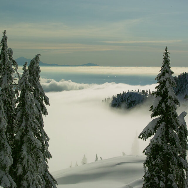
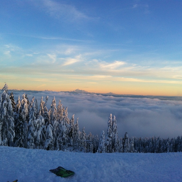
Best of the three mountains. What it lacks in vertical, it makes up for in vibes. Rains a lot, foggy a lot, but then those magical snowy nights make up for all the bad days.
Mike from Canada writes:
Best of the three mountains. What it lacks in vertical, it makes up for in vibes. Rains a lot, foggy a lot, but then those magical snowy nights make up for all the bad days.
The Mt Seymour skiing weather widget is available to embed on external websites free of charge. It provides a daily summary of our Mt Seymour snow forecast and current weather conditions. Simply go to the feed configuration page and follow the 3 simple steps to grab the custom html code snippet and paste it into your own site. You can choose the snow forecast elevation (summit, mid-mountain or bottom lift) and metric/imperial units for the snow forecast feed to suit your own website…. Click here to get the code.
View detailed snow forecast for Mt Seymour at:
snow-forecast.com


 Nearest