Weather Forecast for Moonlight Basin at2133m altitude
Issued: 5 am 25 Jun 2026 (local time)
Forecast update in hr min
View forecast
Moonlight Basinat 2133 m altitude
Issued by Snow-Forecast.com at:5 am (local time) / 25 Jun 2026
Last 6 daysScroll left for last 6 daysNow
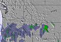
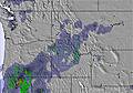
Next 3 days weather summary:
Heavy rain (total 21.0mm), heaviest during Thu afternoon. Warm (max 20°C on Fri morning, min 4°C on Sat night). Winds increasing (calm on Thu afternoon, fresh winds from the SW by Fri afternoon).
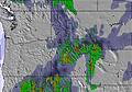
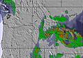
Days 4-6 weather summary:
Moderate rain (total 10.0mm), heaviest on Sun night. Very mild (max 16°C on Tue afternoon, min 2°C on Sun night). Mainly fresh winds.
The above table gives the weather forecast for Moonlight Basin at the specific elevation of 2133 m. Our sophisticated weather models allow us to provide snow forecasts for the top, middle and bottom ski stations of Moonlight Basin. To access the weather forecasts for the other elevations, use the tab navigation above the table. For a wider view of the weather, check out the Weather Map of United States.
Click here to read further information on freezing levels and how we forecast our temperatures.
Moonlight Basin has some of the best in-bounds terrain in the United States. The Headwaters Traverse - aka the Lord of the Rings Traverse - accesses a plethora of steep, interesting terrain. The traverse alone gets the adrenalin juices flowing. The Spring Run-Off Challenge is one of the few big mountain free ride competitions in SW Montana. With a Lone Peak Pass skiers and snowboarders can ride both Big Sky and Moonlight, which means access to the North Summit Snowfield, one of the longest runs in North America, over 4000 vertical feet. Moonlight's patrol does an amazing job in getting their terrain open and really encourages folks to get after it.
Moonlight is also an ideal place for families and beginners. With little to no crowds ever, Moonlight has lots of space to cruise. The only downside are some flat sections on the lower mountain.
If you are looking to bang out laps the Headwaters chair and the Lone Tree Lift allow one to rack up vertical quickly.
Moonlight has a cool local scene and offers a cheaper alternative to neighboring Big Sky. For apres the Moonlight Lodge is a classy place where you can still get a PBR and plate of Nachos on a dirtbag budget.
Free Snow-Forecast.com weather widget for your website
Embed the Moonlight Basin weather widget on your site for free. It provides a weekly snapshot of snow and rain conditions across all elevations. Follow the two quick steps to grab your custom code and paste it into your site. Choose between metric or imperial units. Click here to get the code.


 Nearest