North America Weekly Snow Roundup #308
Weekly Snow News for North America, updated 2 April 2026: US resorts close early amid +20°C warmth, while Canada sees up to 64cm (26") snowfall and strong coverage.


Monts-Jura (Lélex/Crozet) Weather (Next 3 days): The snow forecast for Monts-Jura (Lélex/Crozet) is: Mostly dry. Freeze-thaw conditions (max 10°C on Sun morning, min 0°C on Thu night). Winds decreasing (fresh winds from the NNE on Thu afternoon, calm by Sat afternoon).
Monts-Jura (Lélex/Crozet) Weather (Days 4-6): Light rain (total 4.0mm), mostly falling on Sun night. Very mild (max 12°C on Sun afternoon, min 6°C on Tue night). Winds increasing (calm on Mon morning, fresh winds from the SW by Tue night).
| Resort | Snow Depth | Temp. (°C) | Wind (km/h) | Weather | ||
|---|---|---|---|---|---|---|
| Top Lift: | 0.0 m | 0 | ||||
| Middle Lift: | 3 | |||||
| Bottom Lift: | 0.0 m | 6 |

Thu 2 | Friday 3 | Saturday 4 | Sunday 5 | Monday 6 | Tuesday 7 | ||||||||||||
PM | night | AM | PM | night | AM | PM | night | AM | PM | night | AM | PM | night | AM | PM | night | |
some clouds | snow shwrs | clear | some clouds | clear | some clouds | some clouds | some clouds | cloudy | some clouds | light rain | clear | some clouds | rain shwrs | clear | some clouds | clear | |
km/h | |||||||||||||||||
Snow map | 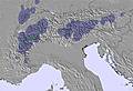 | 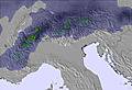 | 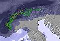 | 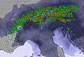 | 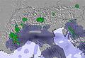 | 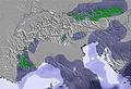 | |||||||||||
— | — | — | — | — | — | — | — | — | — | — | — | — | — | — | — | — | |
— | — | — | — | — | — | — | — | — | — | 3 | — | — | 1 | — | — | — | |
max °C | 3 | 2 | 1 | 5 | 3 | 5 | 8 | 9 | 10 | 12 | 10 | 9 | 12 | 11 | 11 | 12 | 11 |
min °C | 2 | 0 | 0 | 4 | 3 | 4 | 7 | 8 | 9 | 11 | 8 | 8 | 11 | 10 | 10 | 12 | 6 |
-4 | -5 | -5 | 1 | 1 | 2 | 6 | 8 | 6 | 10 | 7 | 8 | 11 | 8 | 8 | 10 | 3 | |
76 | 78 | 80 | 64 | 71 | 81 | 79 | 59 | 62 | 64 | 86 | 79 | 67 | 64 | 62 | 60 | 44 | |
1650 | 1500 | 1450 | 2100 | 2050 | 2600 | 3050 | 2950 | 2800 | 2800 | 2650 | 2700 | 2900 | 2950 | 2850 | 2900 | 2650 | |
— | — | 7:13 | — | — | 7:11 | — | — | 7:09 | — | — | 7:07 | — | — | 7:05 | — | — | |
— | 8:05 | — | — | 8:06 | — | — | 8:07 | — | — | 8:08 | — | — | 8:09 | — | — | 8:12 | |
Mostly dry. Freeze-thaw conditions (max 10°C on Sun morning, min 0°C on Thu night). Winds decreasing (fresh winds from the NNE on Thu afternoon, calm by Sat afternoon).
Light rain (total 4.0mm), mostly falling on Sun night. Very mild (max 12°C on Sun afternoon, min 6°C on Tue night). Winds increasing (calm on Mon morning, fresh winds from the SW by Tue night).
Latest snow reports near Monts-Jura (Lélex/Crozet):
| Top snow depth: | 0 cm |
|---|---|
| Bottom snow depth: | 0 cm |
| Fresh snowfall depth: | — |
| Last snowfall: | 30 Mar 2026 |
| Snow Alerts | Create Alert |
0.2 | Bluebird Powder days Fresh snow, mostly sunny, light wind. |
|---|---|
0.4 | Powder days Fresh snow, limited sun, any wind. |
0.2 | Bluebird days Average snow, mostly sunny, light wind. |
The above table gives the weather forecast for Monts-Jura (Lélex/Crozet) at the specific elevation of 1280 m. Our sophisticated weather models allow us to provide snow forecasts for the top, middle and bottom ski stations of Monts-Jura (Lélex/Crozet). To access the weather forecasts for the other elevations, use the tab navigation above the table. For a wider view of the weather, check out the Weather Map of France.
Click here to read further information on freezing levels and how we forecast our temperatures.
Resort name is also written as Monts-Jura.
Overall 3.4 Based on 17 votes and 4 reviews
Monts-Jura is advertised as one ski area; the 3 alpine areas are far apart with no links. The skibus service that used to exist between the areas has been stopped. Monts-Jura is therefore three completely separate small areas, even though you have no choice but to buy a skipass that covers all 3. We stayed almost all the time at Mijoux. It's ideal for beginners and lower-intermediates. We stayed mostly at Mijoux. All the reds at Mijoux are easy. The solitary very short black is tricky as is the off-piste descent back to Mijoux if you go straight down rather than following the long winding blue. Snow conditions when we were there were better than we expected from the snow report and the views to Geneva and the Alps are stunning. It's a very pretty place to ski.
Hi from England from United Kingdom writes:
Monts-Jura is advertised as one ski area; the 3 alpine areas are far apart with no links. The skibus service that used to exist between the areas has been stopped. Monts-Jura is therefore three completely separate small areas, even though you have no choice but to buy a skipass that covers all 3. We stayed almost all the time at Mijoux. It's ideal for beginners and lower-intermediates. We stayed mostly at Mijoux. All the reds at Mijoux are easy. The solitary very short black is tricky as is the off-piste descent back to Mijoux if you go straight down rather than following the long winding blue. Snow conditions when we were there were better than we expected from the snow report and the views to Geneva and the Alps are stunning. It's a very pretty place to ski.
Read 3 more reviews of Monts-Jura (Lélex/Crozet) or submit your own

 Nearest