


Global Weekly Snow Roundup #320
Weekly Snow News for the world, updated 25 June 2026: Chile and New Zealand's seasons proper set to begin, Tignes and Sunshine reopen for summer skiing. weekend as Riksgransen ends its 2026 season.

Next 4 days weather summary:Light rain (total 3.0mm), mostly falling on Thu night. Warm (max 32°C on Sun afternoon, min 18°C on Thu night). Wind will be generally light. | Days 5-7 weather summary:Heavy rain (total 43.0mm), heaviest during Mon night. Warm (max 27°C on Sun night, min 14°C on Tue night). Wind will be generally light. | |||||||||||||||
Friday 26 | Saturday 27 | Sunday 28 | Monday 29 | Tuesday 30 | ||||||||||||
night | AM | PM | night | AM | PM | night | AM | PM | night | AM | PM | night | AM | PM | night | |
light rain | some clouds | some clouds | clear | clear | clear | some clouds | clear | clear | some clouds | clear | t-storm risk | heavy rain | t-storm risk | t-storm risk | light rain | |
km/h | ||||||||||||||||
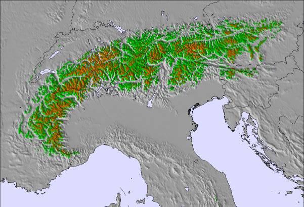
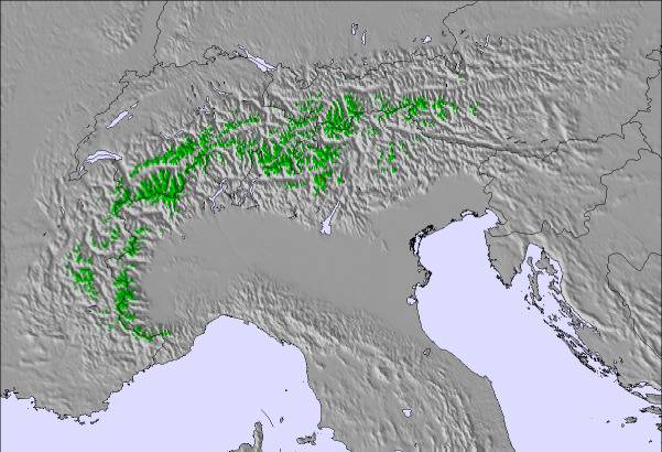
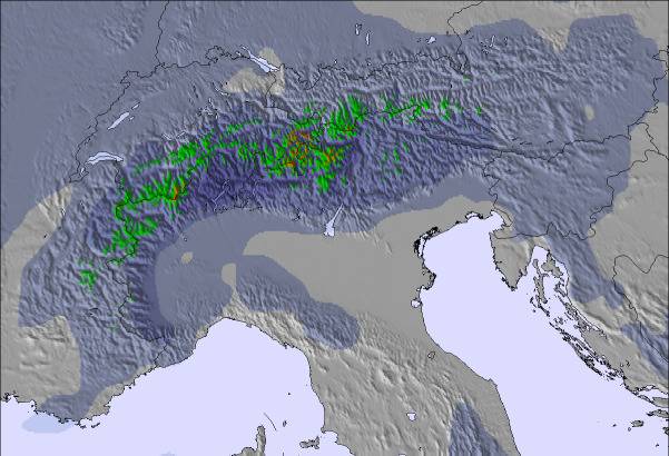
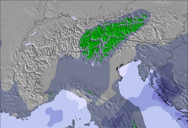
Snow map | 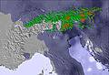 | 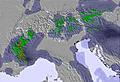 | 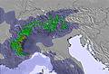 | 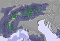 |  |  | ||||||||||
— | — | — | — | — | — | — | — | — | — | — | — | — | — | — | — | |
mm | 3 | — | — | — | — | — | — | — | — | — | — | 1 | 27 | 4 | 5 | 3 |
max °C | 23 | 26 | 29 | 26 | 28 | 31 | 27 | 28 | 32 | 27 | 24 | 27 | 22 | 18 | 19 | 18 |
min °C | 18 | 20 | 29 | 20 | 22 | 31 | 20 | 23 | 31 | 18 | 19 | 26 | 16 | 16 | 19 | 14 |
chill °C | 18 | 20 | 29 | 20 | 22 | 31 | 20 | 23 | 31 | 18 | 19 | 26 | 16 | 16 | 19 | 13 |
Humid % | 59 | 45 | 37 | 46 | 38 | 31 | 39 | 33 | 30 | 73 | 62 | 62 | 86 | 90 | 81 | 93 |
Freeze m | 4500 | 4500 | 4500 | 4600 | 4550 | 4600 | 4650 | 4500 | 4550 | 4550 | 4400 | 4400 | 4100 | 3900 | 3900 | 3800 |
— | 5:45 | — | — | 5:45 | — | — | 5:46 | — | — | 5:46 | — | — | 5:47 | — | — | |
— | — | — | 9:31 | — | — | 9:31 | — | — | 9:31 | — | — | 9:31 | — | — | 9:31 | |
Go pro and carve into:
Avalanche information: European Avalanche Warning Services (EAWS)
Latest snow reports near Monts-Jura (Lélex/Crozet):
| Top snow depth: | 0 cm |
|---|---|
| Bottom snow depth: | 0 cm |
| Fresh snowfall depth: | — |
| Last snowfall: | 16 May 2026 |
| Snow Alerts | Create Alert |
0.0 | Bluebird Powder days Fresh snow, mostly sunny, light wind. |
|---|---|
0.0 | Powder days Fresh snow, limited sun, any wind. |
0.0 | Bluebird days Average snow, mostly sunny, light wind. |
The above table gives the weather forecast for Monts-Jura (Lélex/Crozet) at the specific elevation of 880 m. Our sophisticated weather models allow us to provide snow forecasts for the top, middle and bottom ski stations of Monts-Jura (Lélex/Crozet). To access the weather forecasts for the other elevations, use the tab navigation above the table. For a wider view of the weather, check out the Weather Map of France.
Click here to read further information on freezing levels and how we forecast our temperatures.
Resort name is also written as Monts-Jura.
Overall 3.4 Based on 17 votes and 4 reviews
A very little known area very close to Geneva; you can see the main lift from the airport. There are two main areas Crozet/Lelex and Col de la Faucille, Crozet/lelex is only about 25/30 mins drive from Geneva as the cable car takes you up to the piste. La Faucille is a longer drive as you have to drive up the Jura via Gex about 35/45 mins. For me the Crozet area is better as it has some nice long runs with a couple of restaurants, is also good for most standards. La Faucille is very pretty and is not so exposed if the Bies is blowing as it's mostly in the trees. If you're in Geneva on business or just fancy a quick ski weekend it's worth checking out.
B Sears from France writes:
A very little known area very close to Geneva; you can see the main lift from the airport. There are two main areas Crozet/Lelex and Col de la Faucille, Crozet/lelex is only about 25/30 mins drive from Geneva as the cable car takes you up to the piste. La Faucille is a longer drive as you have to drive up the Jura via Gex about 35/45 mins. For me the Crozet area is better as it has some nice long runs with a couple of restaurants, is also good for most standards. La Faucille is very pretty and is not so exposed if the Bies is blowing as it's mostly in the trees.
If you're in Geneva on business or just fancy a quick ski weekend it's worth checking out.
Read 3 more reviews of Monts-Jura (Lélex/Crozet) or submit your own


 Nearest