

Portillo Re-Opens To Guests Arriving By Helicopter
Chile’s famous Portillo ski resort is reported to have re-opened to guests arriving by helicopter after being cut off by road for more than two weeks by over 6m/20 feet of snowfall.

Next 3 days weather summary:Light rain (total 2.0mm), mostly falling on Wed night. Warm (max 27°C on Wed afternoon, min 20°C on Tue night). Wind will be generally light. | Days 4-6 weather summary:Heavy rain (total 26.0mm), heaviest during Sat night. Warm (max 26°C on Thu afternoon, min 17°C on Fri night). Wind will be generally light. | ||||||||||||||||
Mon 3 | Tuesday 4 | Wednesday 5 | Thursday 6 | Friday 7 | Saturday 8 | ||||||||||||
PM | night | AM | PM | night | AM | PM | night | AM | PM | night | AM | PM | night | AM | PM | night | |
some clouds | some clouds | clear | some clouds | clear | clear | some clouds | rain shwrs | clear | t-storm risk | rain shwrs | t-storm risk | t-storm risk | rain shwrs | rain shwrs | t-storm risk | rain shwrs | |
km/h | |||||||||||||||||
Snow map |  |  |  |  |  |  | |||||||||||
— | — | — | — | — | — | — | — | — | — | — | — | — | — | — | — | — | |
mm | — | — | — | — | — | — | — | 2 | — | 1 | 5 | 2 | 4 | 4 | 1 | 3 | 6 |
max °C | 26 | 25 | 23 | 26 | 25 | 23 | 27 | 24 | 23 | 26 | 22 | 20 | 23 | 20 | 20 | 23 | 21 |
min °C | 25 | 21 | 21 | 26 | 20 | 21 | 26 | 20 | 20 | 24 | 18 | 18 | 23 | 17 | 17 | 23 | 17 |
chill °C | 25 | 21 | 21 | 26 | 20 | 21 | 26 | 20 | 20 | 24 | 18 | 18 | 23 | 17 | 17 | 23 | 17 |
Humid % | 39 | 48 | 51 | 42 | 58 | 53 | 38 | 63 | 52 | 49 | 68 | 66 | 55 | 72 | 62 | 58 | 73 |
Freeze m | 4450 | 4400 | 4400 | 4500 | 4450 | 4500 | 4600 | 4500 | 4400 | 4500 | 4450 | 4200 | 4200 | 4300 | 4200 | 4250 | 4300 |
— | — | 6:00 | — | — | 6:01 | — | — | 6:03 | — | — | 6:03 | — | — | 6:05 | — | — | |
— | 8:44 | — | — | 8:42 | — | — | 8:40 | — | — | 8:39 | — | — | 8:37 | — | — | 8:37 | |
Go pro and carve into:
Avalanche information: European Avalanche Warning Services (EAWS)
Latest snow reports near Molveno:
| Top snow depth: | — |
|---|---|
| Bottom snow depth: | — |
| Fresh snowfall depth: | — |
| Last snowfall: | 14 May 2026 |
| Snow Alerts | Create Alert |
0.0 | Bluebird Powder days Fresh snow, mostly sunny, light wind. |
|---|---|
0.0 | Powder days Fresh snow, limited sun, any wind. |
0.0 | Bluebird days Average snow, mostly sunny, light wind. |
The above table gives the weather forecast for Molveno at the specific elevation of 1196 m. Our sophisticated weather models allow us to provide snow forecasts for the top, middle and bottom ski stations of Molveno. To access the weather forecasts for the other elevations, use the tab navigation above the table. For a wider view of the weather, check out the Weather Map of Italy.
Click here to read further information on freezing levels and how we forecast our temperatures.
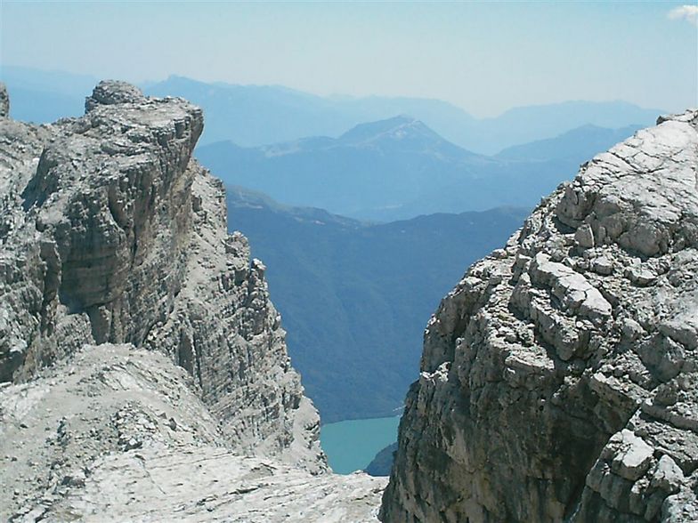
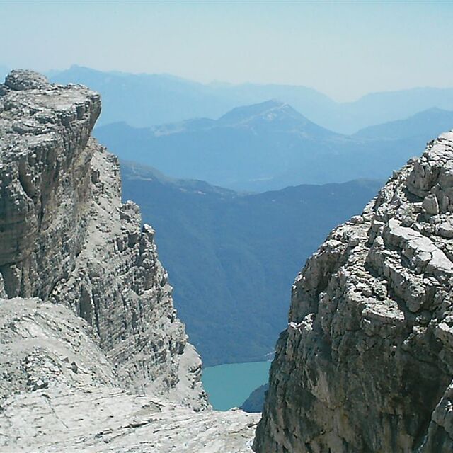
I have been living in the UK for 2 years now but am coming originally from Uganda where there is obviously no ability to ski, so coming to Molveno in March 2007 was a new experience for me. It was a small resort with only 1 piste but was perfect for me to learn to ski. The village of Molveno was very nice and quiet by a stunning blue lake and high mountains rising up behind. It is stated on this page that the bottom station is 864m but that is actually the village height, you have to get cable car from the village up a cliff to the bottom of the run at 1196m - what is called 'mid station' here. As Mr Brian Betonde found the cable car was not running from the village so we had to drive up too. This involves going up a dirt road through forest to reach a hotel car park which contains the lift station. There was not snow on the whole slope and no snow cannons to make artificial so some few parts we had to take off skis and walk down a small section of the slope to the next section of snow. This was not a problem for me as a beginner but I see an expert could find it limiting. Chairlift pass was around UG$86,000 which was about €90 at the time for 6 days, which I thought good value for the 1km run and having the slope to ourselves most time! I would reccommend Molveno to beginner and intermediate as long as you have friends to teach you, as there is no ski school.
George Agdgdgwngo from United Kingdom writes:
I have been living in the UK for 2 years now but am coming originally from Uganda where there is obviously no ability to ski, so coming to Molveno in March 2007 was a new experience for me. It was a small resort with only 1 piste but was perfect for me to learn to ski. The village of Molveno was very nice and quiet by a stunning blue lake and high mountains rising up behind. It is stated on this page that the bottom station is 864m but that is actually the village height, you have to get cable car from the village up a cliff to the bottom of the run at 1196m - what is called 'mid station' here. As Mr Brian Betonde found the cable car was not running from the village so we had to drive up too. This involves going up a dirt road through forest to reach a hotel car park which contains the lift station. There was not snow on the whole slope and no snow cannons to make artificial so some few parts we had to take off skis and walk down a small section of the slope to the next section of snow. This was not a problem for me as a beginner but I see an expert could find it limiting. Chairlift pass was around UG$86,000 which was about €90 at the time for 6 days, which I thought good value for the 1km run and having the slope to ourselves most time! I would reccommend Molveno to beginner and intermediate as long as you have friends to teach you, as there is no ski school.


 Nearest