

Global Weekly Snow Roundup #320
Weekly Snow News for the world, updated 25 June 2026: Chile and New Zealand's seasons proper set to begin, Tignes and Sunshine reopen for summer skiing. weekend as Riksgransen ends its 2026 season.

Next 3 days weather summary:Light rain (total 2.0mm), mostly falling on Sun night. Warm (max 29°C on Sun afternoon, min 21°C on Fri morning). Wind will be generally light. | Days 4-6 weather summary:Heavy rain (total 37.0mm), heaviest during Mon afternoon. Warm (max 27°C on Tue afternoon, min 12°C on Wed night). Wind will be generally light. | |||||||||||||||||
Friday 26 | Saturday 27 | Sunday 28 | Monday 29 | Tuesday 30 | Wednesday 1 | |||||||||||||
AM | PM | night | AM | PM | night | AM | PM | night | AM | PM | night | AM | PM | night | AM | PM | night | |
clear | clear | clear | clear | clear | clear | clear | clear | t-storm risk | t-storm risk | rain shwrs | rain shwrs | clear | some clouds | t-storm risk | rain shwrs | some clouds | rain shwrs | |
km/h | ||||||||||||||||||
Snow map |  |  |  |  | 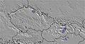 |  | ||||||||||||
— | — | — | — | — | — | — | — | — | — | — | — | — | — | — | — | — | — | |
mm | — | — | — | — | — | — | — | — | 2 | 2 | 23 | 1 | — | — | 7 | 1 | — | 3 |
max °C | 23 | 26 | 24 | 25 | 28 | 26 | 26 | 29 | 27 | 23 | 21 | 22 | 24 | 27 | 25 | 17 | 17 | 15 |
min °C | 21 | 25 | 21 | 23 | 27 | 23 | 25 | 28 | 22 | 22 | 21 | 20 | 22 | 27 | 15 | 15 | 17 | 12 |
chill °C | 21 | 25 | 21 | 23 | 27 | 23 | 25 | 28 | 22 | 22 | 21 | 20 | 22 | 27 | 14 | 14 | 16 | 10 |
Humid % | 46 | 40 | 50 | 39 | 33 | 44 | 40 | 37 | 59 | 65 | 59 | 61 | 51 | 39 | 93 | 82 | 74 | 96 |
Freeze m | 4400 | 4250 | 4400 | 4500 | 4500 | 4600 | 4600 | 4600 | 4400 | 4400 | 4600 | 4450 | 4300 | 4350 | 4150 | 3950 | 4000 | 4000 |
5:01 | — | — | 5:01 | — | — | 5:01 | — | — | 5:01 | — | — | 5:03 | — | — | 5:03 | — | — | |
— | — | 9:00 | — | — | 9:00 | — | — | 9:00 | — | — | 9:00 | — | — | 9:00 | — | — | 9:00 | |
Go pro and carve into:
Avalanche information: European Avalanche Warning Services (EAWS)
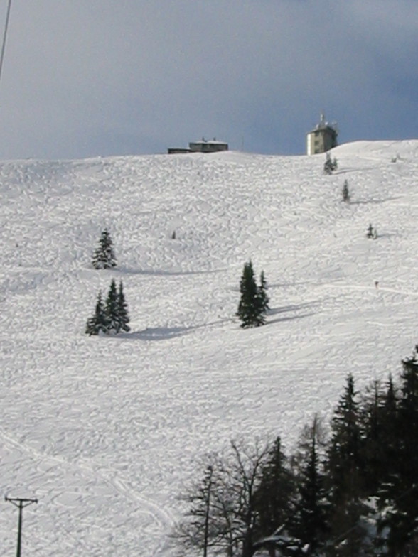
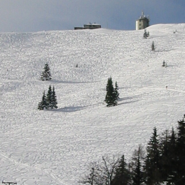
Latest snow reports near Mariazeller Land:
| Top snow depth: | 0 cm |
|---|---|
| Bottom snow depth: | 0 cm |
| Fresh snowfall depth: | — |
| Last snowfall: | 16 May 2026 |
| Snow Alerts | Create Alert |
0.0 | Bluebird Powder days Fresh snow, mostly sunny, light wind. |
|---|---|
0.0 | Powder days Fresh snow, limited sun, any wind. |
0.0 | Bluebird days Average snow, mostly sunny, light wind. |
The above table gives the weather forecast for Mariazeller Land at the specific elevation of 1065 m. Our sophisticated weather models allow us to provide snow forecasts for the top, middle and bottom ski stations of Mariazeller Land. To access the weather forecasts for the other elevations, use the tab navigation above the table. For a wider view of the weather, check out the Weather Map of Austria.
Click here to read further information on freezing levels and how we forecast our temperatures.
Overall 2.2 Based on 10 votes and 1 review
We visited Lower Austria for a long weekend (27th to 29th January 2017) choosing a ski resort that was close to Vienna. Mariazeller is a pretty small resort with 15km of pistes all set amongst tree lined runs. The resort is relatively low altitude but when we went there we enjoyed fabulous snow conditions (1.5m depth) with "bluebird" skies throughout. The resort was quiet at the weekend when we visited; we hardly waited longer than a minute at the bottom of the two chairlifts. The great thing about the resort is that it takes around 2 hours to get to the slopes in a hire car from Vienna. The roads are very easy to navigate with motorway and A roads right up to the slopes. However, the one downside is that Mariazeller is small with 9 pistes, but it does benefit from being close to two other similar sized resorts: Gemeiendealpe and Annabergerland, a mere 15 minutes drive away. We skiied as a family at all 3 ski centres, each for a half day. Gemeindealpe has more challenging mostly red and a couple of black runs (the top black is set at 70 degrees gradient!) Gemeiendealpe is more of a young persons resort with noisy bars on the slopes whereas Annabergerland is more child friendly with gentle learner slopes. We stayed in the local village of Annaberg, in Gasthof Meyer, in an ideal 7 person apartment. All very reasonably priced at €95 per night for the apartment. The ski pass cost €64 per person for 2 full days skiing. The pass allowed us to ski at all 3 resorts. At all 3 resorts, everyone except us were Austrian locals and so the food and drink costs were reasonable (3.20 Euros for a large beer can't be bad!) All in all, we had a wonderful long weekend away that was very invigorating and a complete break from life in London. I wholeheartedly recommend you try out the Lower Austria ski area. Provided the snow has fallen you will love it.
Guy Pocock from United Kingdom writes:
We visited Lower Austria for a long weekend (27th to 29th January 2017) choosing a ski resort that was close to Vienna. Mariazeller is a pretty small resort with 15km of pistes all set amongst tree lined runs. The resort is relatively low altitude but when we went there we enjoyed fabulous snow conditions (1.5m depth) with "bluebird" skies throughout. The resort was quiet at the weekend when we visited; we hardly waited longer than a minute at the bottom of the two chairlifts. The great thing about the resort is that it takes around 2 hours to get to the slopes in a hire car from Vienna. The roads are very easy to navigate with motorway and A roads right up to the slopes.
However, the one downside is that Mariazeller is small with 9 pistes, but it does benefit from being close to two other similar sized resorts: Gemeiendealpe and Annabergerland, a mere 15 minutes drive away. We skiied as a family at all 3 ski centres, each for a half day. Gemeindealpe has more challenging mostly red and a couple of black runs (the top black is set at 70 degrees gradient!) Gemeiendealpe is more of a young persons resort with noisy bars on the slopes whereas Annabergerland is more child friendly with gentle learner slopes.
We stayed in the local village of Annaberg, in Gasthof Meyer, in an ideal 7 person apartment. All very reasonably priced at €95 per night for the apartment. The ski pass cost €64 per person for 2 full days skiing. The pass allowed us to ski at all 3 resorts.
At all 3 resorts, everyone except us were Austrian locals and so the food and drink costs were reasonable (3.20 Euros for a large beer can't be bad!)
All in all, we had a wonderful long weekend away that was very invigorating and a complete break from life in London. I wholeheartedly recommend you try out the Lower Austria ski area. Provided the snow has fallen you will love it.


 Nearest