The above table gives the weather forecast for Manigod at the specific elevation of 1810 m. Our sophisticated weather models allow us to provide snow forecasts for the top, middle and bottom ski stations of Manigod. To access the weather forecasts for the other elevations, use the tab navigation above the table. For a wider view of the weather, check out the Weather Map of France.
Click here to read further information on freezing levels and how we forecast our temperatures.
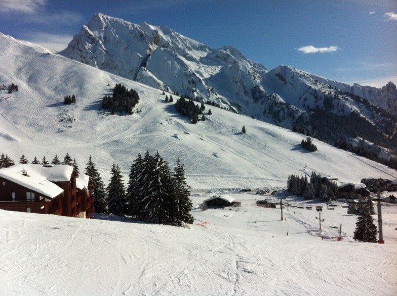
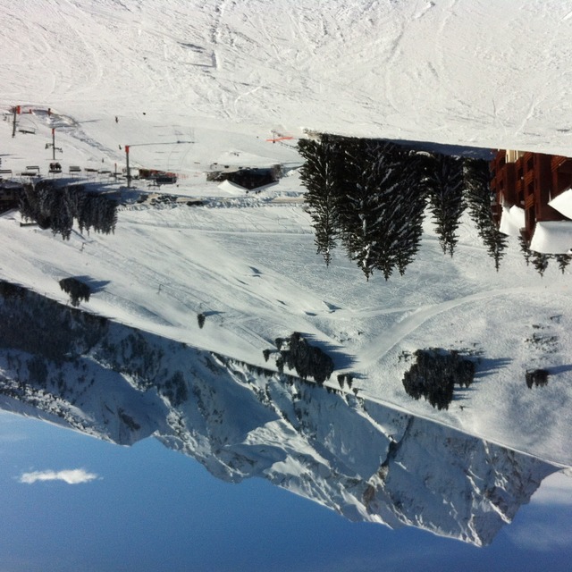
I skied in Manigod on Friday 17 Feb. 2017. Actually Manigod belongs to the allied ski centers of La Clusaz. This means that with one ticket you can ski more interconnected ski centers. Distance from Geneva bus station 1h and 15 min. I took Beauregard gondola and started from Beauregard mountain. Then you can continue to Manigod ski center, where I actually spent almost all my day. There was about 130 cm of snow. However, the ski center has a low altitude. As a result the snow suffered from high temperatures. The resort managers warned about hard snow. However, in Manigod there was nowhere hard snow. In the contrary: till 1 pm snow was ok, after was soft. The ski center is really easy. It is a good place to learn how to ski. There are some red pistes, but nothing difficult. I have particularly enjoyed the red Myrtilles and Grand Chamois and Sorbiers. Bois Manigod is a nice piste as well among pine trees, however, the snow there was awful. What I have most enjoyed there was the atmosphere. The ski center was full mainly with French families. It was like a holiday and this made me happy. At the end of the day it started raining. La Clusaz is a pretty but small village. I would suggest La Clusaz for a short ski trip. Next time I would like to visit Aiguille and Etale mountains.
I skied in Manigod on Friday 17 Feb. 2017. Actually Manigod belongs to the allied ski centers of La Clusaz. This means that with one ticket you can ski more interconnected ski centers. Distance from Geneva bus station 1h and 15 min. I took Beauregard gondola and started from Beauregard mountain. Then you can continue to Manigod ski center, where I actually spent almost all my day. There was about 130 cm of snow. However, the ski center has a low altitude. As a result the snow suffered from high temperatures. The resort managers warned about hard snow. However, in Manigod there was nowhere hard snow. In the contrary: till 1 pm snow was ok, after was soft. The ski center is really easy. It is a good place to learn how to ski. There are some red pistes, but nothing difficult. I have particularly enjoyed the red Myrtilles and Grand Chamois and Sorbiers. Bois Manigod is a nice piste as well among pine trees, however, the snow there was awful. What I have most enjoyed there was the atmosphere. The ski center was full mainly with French families. It was like a holiday and this made me happy. At the end of the day it started raining. La Clusaz is a pretty but small village. I would suggest La Clusaz for a short ski trip. Next time I would like to visit Aiguille and Etale mountains.
Free Snow-Forecast.com weather widget for your website
Embed the Manigod weather widget on your site for free. It provides a weekly snapshot of snow and rain conditions across all elevations. Follow the two quick steps to grab your custom code and paste it into your site. Choose between metric or imperial units. Click here to get the code.


 Nearest