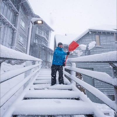
"March Madness" As Snowfall Hits Australia In Early Autumn
Winter made an early-season entrance in Australia overnight, with a polar blast from the Antarctic dumping up to 15cm of fresh snow on the slopes as temperatures tumbled to around -2.C.
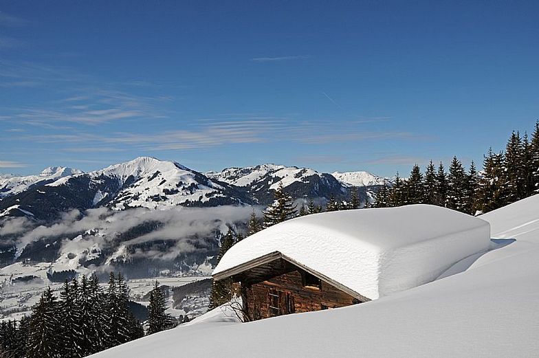


Kitzbühel Weather (Next 3 days): The snow forecast for Kitzbühel is: A light covering of new snow, mostly falling on Wed morning. Freeze-thaw conditions (max 2°C on Fri afternoon, min -6°C on Wed morning). Wind will be generally light.
Kitzbühel Weather (Days 4-6): Mostly dry. Very mild (max 12°C on Mon afternoon, min 1°C on Sat morning). Wind will be generally light.
| Resort | Snow Depth | Temp. (°C) | Wind (km/h) | Weather | ||
|---|---|---|---|---|---|---|
| Top Lift: | -10 | |||||
| Middle Lift: | -6 | |||||
| Bottom Lift: | -3 |

Wednesday 1 | Thursday 2 | Friday 3 | Saturday 4 | Sunday 5 | Monday 6 | |||||||||||||
AM | PM | night | AM | PM | night | AM | PM | night | AM | PM | night | AM | PM | night | AM | PM | night | |
light snow | light snow | light snow | light snow | light snow | light snow | snow shwrs | snow shwrs | clear | some clouds | some clouds | some clouds | clear | clear | cloudy | some clouds | clear | some clouds | |
km/h | ||||||||||||||||||
Snow map |  |  |  |  |  |  | ||||||||||||
1 | 1 | — | — | 1 | 2 | — | — | — | — | — | — | — | — | — | — | — | — | |
— | — | — | — | — | — | — | — | — | — | — | — | — | — | — | — | — | — | |
max °C | -4 | -3 | -3 | -3 | -1 | -2 | -1 | 2 | 1 | 3 | 6 | 5 | 9 | 11 | 9 | 9 | 12 | 10 |
min °C | -6 | -3 | -5 | -5 | -2 | -2 | -2 | 1 | 0 | 1 | 5 | 4 | 6 | 10 | 7 | 7 | 12 | 9 |
-6 | -6 | -5 | -5 | -5 | -4 | -2 | 1 | -2 | 1 | 5 | 3 | 5 | 10 | 7 | 7 | 12 | 9 | |
95 | 96 | 95 | 97 | 97 | 99 | 96 | 78 | 78 | 74 | 84 | 73 | 54 | 59 | 65 | 60 | 48 | 57 | |
800 | 1000 | 700 | 950 | 1200 | 1000 | 1250 | 1700 | 1250 | 1950 | 2300 | 2550 | 2750 | 2900 | 2750 | 2700 | 2900 | 3000 | |
6:50 | — | — | 6:48 | — | — | 6:46 | — | — | 6:43 | — | — | 6:41 | — | — | 6:39 | — | — | |
— | 7:38 | — | — | 7:39 | — | — | 7:42 | — | — | 7:43 | — | — | 7:44 | — | — | 7:45 | — | |
A light covering of new snow, mostly falling on Wed morning. Freeze-thaw conditions (max 2°C on Fri afternoon, min -6°C on Wed morning). Wind will be generally light.
Mostly dry. Very mild (max 12°C on Mon afternoon, min 1°C on Sat morning). Wind will be generally light.
Latest snow reports near Kitzbühel:
Today, alongside fresh snowfall, exciting events await you once again: from 11:00 AM, a free “witch’s potion” will be served at the ice rink of the enchanted winter wonderland in Söll (Hexenwasser gondola station), while the ski cinema in the old farmhouse “Hexerei” on the Keata slope will be open from 11:00 AM to 3:00 PM. From 11:30 AM, “T.B.G. by Da Vinci Family” invites you to a party-style coffee gathering featuring hits from the 80s, 90s, and 2000s. All events can be found at [link] . Promotions include 15% off 1- and 2-day tickets with the SkiWelt Club (online only for... from Westendorf
| Top snow depth: | — |
|---|---|
| Bottom snow depth: | — |
| Fresh snowfall depth: | 25 cm |
| Last snowfall: | 31 Mar 2026 |
| Snow Alerts | Create Alert |
0.4 | Bluebird Powder days Fresh snow, mostly sunny, light wind. |
|---|---|
0.6 | Powder days Fresh snow, limited sun, any wind. |
0.4 | Bluebird days Average snow, mostly sunny, light wind. |
The above table gives the weather forecast for Kitzbühel at the specific elevation of 1400 m. Our sophisticated weather models allow us to provide snow forecasts for the top, middle and bottom ski stations of Kitzbühel. To access the weather forecasts for the other elevations, use the tab navigation above the table. For a wider view of the weather, check out the Weather Map of Austria.
Click here to read further information on freezing levels and how we forecast our temperatures.
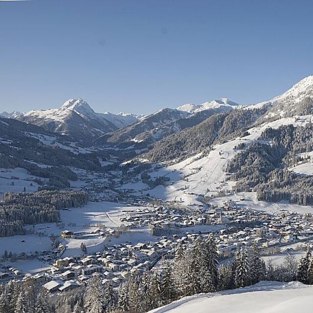
Resort name is also written as Kitzbuhel.
Overall 4.3 Based on 21 votes and 26 reviews
I came to skiing quite late in life and although have really enjoyed some challenging red runs in other resorts I usually need a good half a day of cruisey blues on good snow to get my ski legs on and more importantly confidence up. And here just hasn’t offered that opportunity. It’s a great resort, but I’d say due to multi-hill terrain it’s a bit stop-start; short run here, lift, short run there, switchback here, and so on. It’s clear the world famous downhill has an impact, with people flying down busy (today slushy) pistes like demons trying to emulate the pros. And the run classifications... it’s like someone has decided each hill needs at least one blue, a red and a black run to show some variety. But in truth there’s sometimes v little between some blues and blacks. Off the mountain I have had a lovely time. Friendly people about the place, good restaurants and social side. In summary: if you fancy a challenge, then you’ll love the slushy runs, aside precipitous mountain drops, while weaving in between others of a similar mindset. If you’re looking for somewhere to build your confidence and put some cruisey miles in: avoid.
Mark T from Austria writes:
I came to skiing quite late in life and although have really enjoyed some challenging red runs in other resorts I usually need a good half a day of cruisey blues on good snow to get my ski legs on and more importantly confidence up. And here just hasn’t offered that opportunity. It’s a great resort, but I’d say due to multi-hill terrain it’s a bit stop-start; short run here, lift, short run there, switchback here, and so on. It’s clear the world famous downhill has an impact, with people flying down busy (today slushy) pistes like demons trying to emulate the pros. And the run classifications... it’s like someone has decided each hill needs at least one blue, a red and a black run to show some variety. But in truth there’s sometimes v little between some blues and blacks. Off the mountain I have had a lovely time. Friendly people about the place, good restaurants and social side. In summary: if you fancy a challenge, then you’ll love the slushy runs, aside precipitous mountain drops, while weaving in between others of a similar mindset. If you’re looking for somewhere to build your confidence and put some cruisey miles in: avoid.


 Nearest