

Portillo Storm Snowfall Total Passes 5m / 17 Feet
A snow storm that has now continued for nine days has taken Chilean ski resort Portillo to a snowfall total of 5.2 metres (17 feet) so far, with more snow forecast.

Next 3 days weather summary:Heavy rain (total 32.0mm), heaviest during Fri afternoon. Very mild (max 16°C on Sat afternoon, min 8°C on Fri night). Wind will be generally light. | Days 4-6 weather summary:Heavy rain (total 42.0mm), heaviest during Tue morning. Very mild (max 14°C on Sun afternoon, min 7°C on Mon night). Wind will be generally light. | ||||||||||||||||
Thu 30 | Friday 31 | Saturday 1 | Sunday 2 | Monday 3 | Tuesday 4 | ||||||||||||
PM | night | AM | PM | night | AM | PM | night | AM | PM | night | AM | PM | night | AM | PM | night | |
mod. rain | cloudy | light rain | mod. rain | rain shwrs | clear | some clouds | mod. rain | cloudy | light rain | heavy rain | light rain | light rain | mod. rain | mod. rain | light rain | light rain | |
km/h | |||||||||||||||||
Snow map | 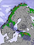 | 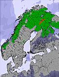 | 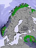 | 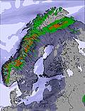 | 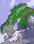 | 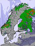 | |||||||||||
— | — | — | — | — | — | — | — | — | — | — | — | — | — | — | — | — | |
mm | 8 | — | 2 | 9 | 4 | — | — | 9 | — | 2 | 13 | 4 | 2 | 6 | 9 | 3 | 2 |
max °C | 14 | 13 | 13 | 14 | 14 | 13 | 16 | 13 | 12 | 14 | 12 | 8 | 9 | 9 | 8 | 9 | 9 |
min °C | 12 | 11 | 13 | 14 | 8 | 11 | 15 | 8 | 10 | 13 | 8 | 8 | 9 | 7 | 7 | 9 | 7 |
chill °C | 11 | 11 | 12 | 13 | 7 | 10 | 15 | 7 | 8 | 12 | 6 | 6 | 8 | 5 | 4 | 7 | 6 |
Humid % | 88 | 85 | 98 | 94 | 77 | 63 | 51 | 90 | 81 | 73 | 97 | 95 | 90 | 91 | 89 | 86 | 80 |
Freeze m | 3000 | 3050 | 3050 | 2950 | 2600 | 2200 | 2300 | 2100 | 2050 | 2200 | 2100 | 1900 | 1900 | 1950 | 1850 | 1900 | 1700 |
— | — | 2:48 | — | — | 2:54 | — | — | 2:59 | — | — | 3:03 | — | — | 3:08 | — | — | |
— | 10:43 | — | — | 10:37 | — | — | 10:31 | — | — | 10:27 | — | — | 10:22 | — | — | 10:17 | |
Go pro and carve into:
Avalanche information: European Avalanche Warning Services (EAWS)
Latest snow reports near Kiruna:
| Top snow depth: | — |
|---|---|
| Bottom snow depth: | — |
| Fresh snowfall depth: | — |
| Last snowfall: | 11 May 2026 |
| Snow Alerts | Create Alert |
0.0 | Bluebird Powder days Fresh snow, mostly sunny, light wind. |
|---|---|
0.0 | Powder days Fresh snow, limited sun, any wind. |
0.0 | Bluebird days Average snow, mostly sunny, light wind. |

The above table gives the weather forecast for Kiruna at the specific elevation of 442 m. Our sophisticated weather models allow us to provide snow forecasts for the top, middle and bottom ski stations of Kiruna. To access the weather forecasts for the other elevations, use the tab navigation above the table. For a wider view of the weather, check out the Weather Map of Sweden.
Click here to read further information on freezing levels and how we forecast our temperatures.
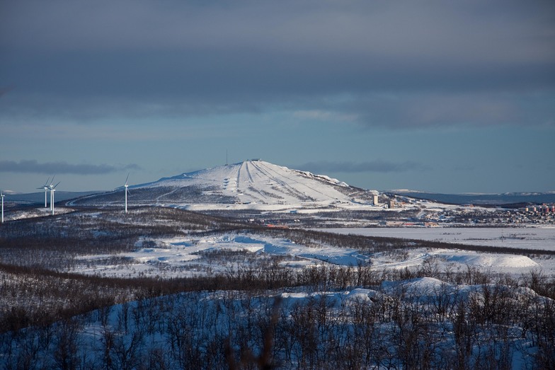
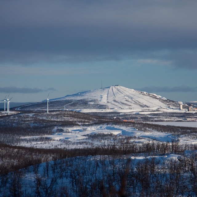
Kiruna is mainly a destination for the famous ice hotel, husky sled rides, snowscooter rides and visits to the mines. But they also have a small skiing area which should just be called a bluff with some lifts. The snow is good all winter long because the city is in the north pole circle, however this 'mountain' is the only bluff in the vicinity so it catches all the wind. Renting equipment is outdated, slopes are not challenging and there is only one house at the bottom where you can drink or eat the local 'specialty': mashed potatoes with a hotdog sticking out of it. However, in town there was something going on for apres ski: the Scandia Hotel has a bar/discotheque open to everyone which was very good. If you go to Kiruna, go for the other attractions that skiing. Yet if you have an hour spare when waiting for your plane or train back south, you could go there just like I did for the novelty of skiing in the north pole circle.
Wiebe Koorevaar from The Netherlands writes:
Kiruna is mainly a destination for the famous ice hotel, husky sled rides, snowscooter rides and visits to the mines. But they also have a small skiing area which should just be called a bluff with some lifts. The snow is good all winter long because the city is in the north pole circle, however this 'mountain' is the only bluff in the vicinity so it catches all the wind. Renting equipment is outdated, slopes are not challenging and there is only one house at the bottom where you can drink or eat the local 'specialty': mashed potatoes with a hotdog sticking out of it.
However, in town there was something going on for apres ski: the Scandia Hotel has a bar/discotheque open to everyone which was very good. If you go to Kiruna, go for the other attractions that skiing. Yet if you have an hour spare when waiting for your plane or train back south, you could go there just like I did for the novelty of skiing in the north pole circle.


 Nearest