

Global Weekly Snow Roundup #324
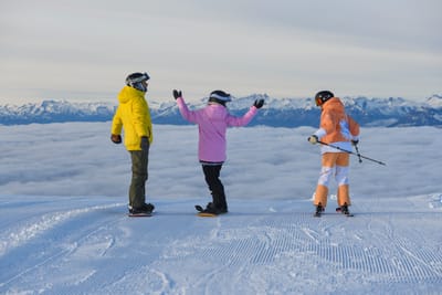
Weekly Snow News for World, updated 23 July 2026: South America’s 2026 season roars back with over 4m (13ft) of snowfall, while Saas-Fee opens and North America’s last lift-served skiing ends.

Next 3 days weather summary:Moderate rain (total 10.0mm), heaviest on Thu afternoon. Warm (max 21°C on Sat afternoon, min 7°C on Fri morning). Wind will be generally light. | Days 4-6 weather summary:Heavy rain (total 30.0mm), heaviest during Mon morning. Warm (max 20°C on Wed morning, min 10°C on Mon morning). Wind will be generally light. | ||||||||||||||||
Thu 23 | Friday 24 | Saturday 25 | Sunday 26 | Monday 27 | Tuesday 28 | ||||||||||||
PM | night | AM | PM | night | AM | PM | night | AM | PM | night | AM | PM | night | AM | PM | night | |
t-storm risk | rain shwrs | clear | clear | clear | some clouds | clear | some clouds | light rain | mod. rain | mod. rain | rain shwrs | t-storm risk | rain shwrs | clear | clear | clear | |
km/h | |||||||||||||||||
Snow map |  |  |  |  |  |  | |||||||||||
— | — | — | — | — | — | — | — | — | — | — | — | — | — | — | — | — | |
mm | 4 | 5 | — | — | — | — | — | — | 1 | 6 | 6 | 11 | 3 | 4 | — | — | — |
max °C | 11 | 9 | 11 | 14 | 14 | 17 | 21 | 19 | 16 | 13 | 12 | 10 | 13 | 12 | 14 | 18 | 16 |
min °C | 11 | 8 | 7 | 13 | 12 | 13 | 20 | 17 | 14 | 11 | 11 | 10 | 13 | 11 | 12 | 17 | 15 |
chill °C | 9 | 6 | 6 | 12 | 12 | 13 | 20 | 17 | 14 | 10 | 10 | 9 | 12 | 11 | 12 | 17 | 15 |
Humid % | 71 | 74 | 58 | 43 | 54 | 37 | 30 | 55 | 65 | 93 | 77 | 92 | 81 | 80 | 66 | 50 | 65 |
Freeze m | 2900 | 2600 | 2900 | 3400 | 3800 | 3950 | 4100 | 4200 | 3650 | 3350 | 3250 | 3200 | 3450 | 3300 | 3950 | 4250 | 4350 |
— | — | 5:31 | — | — | 5:33 | — | — | 5:35 | — | — | 5:35 | — | — | 5:37 | — | — | |
— | 8:52 | — | — | 8:51 | — | — | 8:50 | — | — | 8:47 | — | — | 8:46 | — | — | 8:45 | |
Go pro and carve into:
Avalanche information: European Avalanche Warning Services (EAWS)
Latest snow reports near Gosau-Zwieselalm:
| Top snow depth: | — |
|---|---|
| Bottom snow depth: | — |
| Fresh snowfall depth: | — |
| Last snowfall: | 16 May 2026 |
| Snow Alerts | Create Alert |
0.0 | Bluebird Powder days Fresh snow, mostly sunny, light wind. |
|---|---|
0.0 | Powder days Fresh snow, limited sun, any wind. |
0.0 | Bluebird days Average snow, mostly sunny, light wind. |
The above table gives the weather forecast for Gosau-Zwieselalm at the specific elevation of 1436 m. Our sophisticated weather models allow us to provide snow forecasts for the top, middle and bottom ski stations of Gosau-Zwieselalm. To access the weather forecasts for the other elevations, use the tab navigation above the table. For a wider view of the weather, check out the Weather Map of Austria.
Click here to read further information on freezing levels and how we forecast our temperatures.
My daughter and I stayed at the quite large, vital sport hotel for a week,in January. Lovely staff and good facilities, a short bus ride from the lift stations. We were the only snowboarders (and English) at hotel all week but no bad thing as we could practice our German. The pistes were in excellent condition thanks to new snow, good mix of skiers and boarders on the mountain, enjoying superb views from the top of the Hornspitz across the valley and from the Zwissalm towards the Dachstein glacier once the skies cleared. Tho you must check what time the last bus goes from the panorama jet gondola-we missed it at 4.50 and had to hike back (in the dark) for over an hour on roads with no footpath!!
martin r from United Kingdom writes:
My daughter and I stayed at the quite large, vital sport hotel for a week,in January. Lovely staff and good facilities, a short bus ride from the lift stations. We were the only snowboarders (and English) at hotel all week but no bad thing as we could practice our German. The pistes were in excellent condition thanks to new snow, good mix of skiers and boarders on the mountain, enjoying superb views from the top of the Hornspitz across the valley and from the Zwissalm towards the Dachstein glacier once the skies cleared. Tho you must check what time the last bus goes from the panorama jet gondola-we missed it at 4.50 and had to hike back (in the dark) for over an hour on roads with no footpath!!


 Nearest