


Global Weekly Snow Roundup #320
Weekly Snow News for the world, updated 25 June 2026: Chile and New Zealand's seasons proper set to begin, Tignes and Sunshine reopen for summer skiing. weekend as Riksgransen ends its 2026 season.

Next 4 days weather summary:Mostly dry. Temperatures will be slightly above freezing (max 4°C on Fri morning, min 2°C on Thu night). Wind will be generally light. | Days 5-7 weather summary:Heavy rain (total 64.0mm), heaviest during Wed afternoon. Mild temperatures (max 5°C on Wed morning, min 2°C on Sun night). Winds increasing (light winds from the N on Mon afternoon, near gales from the NNW by Wed morning). | |||||||||||||||
Friday 26 | Saturday 27 | Sunday 28 | Monday 29 | Tuesday 30 | ||||||||||||
night | AM | PM | night | AM | PM | night | AM | PM | night | AM | PM | night | AM | PM | night | |
clear | clear | some clouds | clear | clear | clear | clear | some clouds | some clouds | light snow | light rain | rain shwrs | some clouds | light rain | mod. rain | light rain | |
km/h | ||||||||||||||||
Snow map | 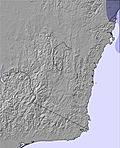 | 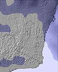 | 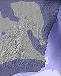 | 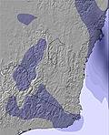 | 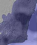 | 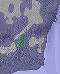 | ||||||||||
— | — | — | — | — | — | — | — | — | — | — | — | — | — | — | — | |
mm | — | — | — | — | — | — | — | — | — | 1 | 1 | 1 | — | 3 | 6 | 5 |
max °C | 3 | 4 | 3 | 2 | 3 | 3 | 2 | 3 | 3 | 3 | 3 | 3 | 3 | 3 | 3 | 3 |
min °C | 2 | 2 | 2 | 2 | 2 | 2 | 2 | 2 | 3 | 2 | 2 | 3 | 3 | 3 | 3 | 3 |
chill °C | 0 | 2 | 0 | 0 | 2 | 0 | 2 | 0 | 0 | -2 | -2 | 0 | -2 | -2 | -3 | -3 |
Humid % | 66 | 69 | 70 | 63 | 60 | 59 | 59 | 58 | 71 | 97 | 92 | 89 | 88 | 89 | 97 | 98 |
Freeze m | 2200 | 2050 | 2150 | 2000 | 2000 | 2150 | 2050 | 2050 | 2150 | 2050 | 2050 | 2200 | 2300 | 2200 | 2250 | 2200 |
— | 7:24 | — | — | 7:24 | — | — | 7:24 | — | — | 7:24 | — | — | 7:24 | — | — | |
— | — | 5:01 | — | — | 5:02 | — | — | 5:02 | — | — | 5:02 | — | — | 5:04 | — | |
Go pro and carve into:
Avalanche information: Avalanche Australia
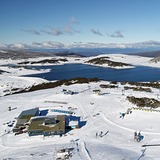
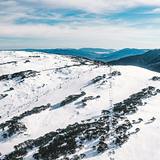
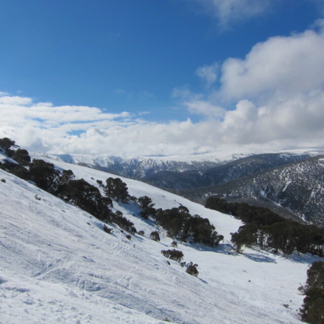
Latest snow reports near Falls Creek:
| Top snow depth: | 5 cm |
|---|---|
| Bottom snow depth: | — |
| Fresh snowfall depth: | — |
| Last snowfall: | 20 Jun 2026 |
| Snow Alerts | Create Alert |
0.2 | Bluebird Powder days Fresh snow, mostly sunny, light wind. |
|---|---|
0.6 | Powder days Fresh snow, limited sun, any wind. |
0.3 | Bluebird days Average snow, mostly sunny, light wind. |

The above table gives the weather forecast for Falls Creek at the specific elevation of 1690 m. Our sophisticated weather models allow us to provide snow forecasts for the top, middle and bottom ski stations of Falls Creek. To access the weather forecasts for the other elevations, use the tab navigation above the table. For a wider view of the weather, check out the Weather Map of Australia.
Click here to read further information on freezing levels and how we forecast our temperatures.
Overall 3.9 Based on 22 votes and 16 reviews
Falls is an amazing place to visit. However, there is a sharp angle exit from most of the lifts where visitors on snowboards may suffer greatly by falling during exits. Me and my friends feel all of our bones and muscles cracking every time we get off the lifts. I am not sure why they are not fixing the chairlift exits for beginners and intermediate snowboarders.
Snowboard begginer from Australia writes:
Falls is an amazing place to visit. However, there is a sharp angle exit from most of the lifts where visitors on snowboards may suffer greatly by falling during exits. Me and my friends feel all of our bones and muscles cracking every time we get off the lifts. I am not sure why they are not fixing the chairlift exits for beginners and intermediate snowboarders.


 Nearest