

Portillo Re-Opens To Guests Arriving By Helicopter
Chile’s famous Portillo ski resort is reported to have re-opened to guests arriving by helicopter after being cut off by road for more than two weeks by over 6m/20 feet of snowfall.

Next 3 days weather summary:Moderate rain (total 16.0mm), heaviest on Mon night. Warm (max 20°C on Wed afternoon, min 11°C on Mon night). Wind will be generally light. | Days 4-6 weather summary:Heavy rain (total 43.0mm), heaviest during Sat night. Warm (max 20°C on Sat afternoon, min 12°C on Thu night). Wind will be generally light. | ||||||||||||||||
Mon 3 | Tuesday 4 | Wednesday 5 | Thursday 6 | Friday 7 | Saturday 8 | ||||||||||||
PM | night | AM | PM | night | AM | PM | night | AM | PM | night | AM | PM | night | AM | PM | night | |
some clouds | rain shwrs | some clouds | light rain | rain shwrs | clear | t-storm risk | t-storm risk | t-storm risk | t-storm risk | rain shwrs | t-storm risk | mod. rain | rain shwrs | clear | t-storm risk | rain shwrs | |
km/h | |||||||||||||||||
Snow map |  |  |  |  |  |  | |||||||||||
— | — | — | — | — | — | — | — | — | — | — | — | — | — | — | — | — | |
mm | — | 4 | — | 1 | 1 | — | 2 | 4 | 4 | 11 | 9 | 1 | 7 | 1 | — | 1 | 13 |
max °C | 19 | 18 | 16 | 18 | 15 | 17 | 20 | 16 | 16 | 16 | 14 | 15 | 16 | 14 | 18 | 20 | 16 |
min °C | 19 | 11 | 13 | 16 | 13 | 14 | 17 | 14 | 14 | 15 | 12 | 13 | 15 | 13 | 14 | 17 | 13 |
chill °C | 19 | 11 | 13 | 16 | 13 | 14 | 17 | 14 | 13 | 15 | 12 | 12 | 15 | 13 | 13 | 17 | 13 |
Humid % | 48 | 78 | 48 | 64 | 77 | 53 | 69 | 79 | 67 | 79 | 80 | 68 | 81 | 72 | 44 | 62 | 54 |
Freeze m | 4600 | 4200 | 4200 | 4450 | 4450 | 4500 | 4550 | 4550 | 4400 | 4400 | 4550 | 4450 | 4400 | 4550 | 4600 | 4700 | 4700 |
— | — | 6:46 | — | — | 6:47 | — | — | 6:48 | — | — | 6:48 | — | — | 6:50 | — | — | |
— | 9:08 | — | — | 9:07 | — | — | 9:07 | — | — | 9:06 | — | — | 9:04 | — | — | 9:02 | |
Go pro and carve into:
Avalanche information: European Avalanche Warning Services (EAWS)
Latest snow reports near Espace Cambre d'Aze (Eyne 2600):
| Top snow depth: | — |
|---|---|
| Bottom snow depth: | — |
| Fresh snowfall depth: | — |
| Last snowfall: | 17 May 2026 |
| Snow Alerts | Create Alert |
0.0 | Bluebird Powder days Fresh snow, mostly sunny, light wind. |
|---|---|
0.0 | Powder days Fresh snow, limited sun, any wind. |
0.0 | Bluebird days Average snow, mostly sunny, light wind. |
The above table gives the weather forecast for Espace Cambre d'Aze (Eyne 2600) at the specific elevation of 2146 m. Our sophisticated weather models allow us to provide snow forecasts for the top, middle and bottom ski stations of Espace Cambre d'Aze (Eyne 2600). To access the weather forecasts for the other elevations, use the tab navigation above the table. For a wider view of the weather, check out the Weather Map of France.
Click here to read further information on freezing levels and how we forecast our temperatures.
Overall 4.5 Based on 1 vote and 1 review
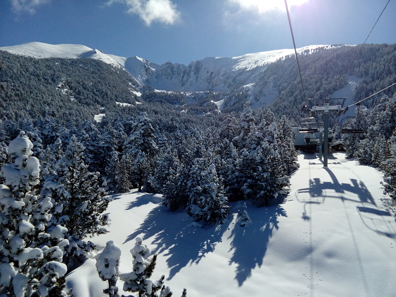
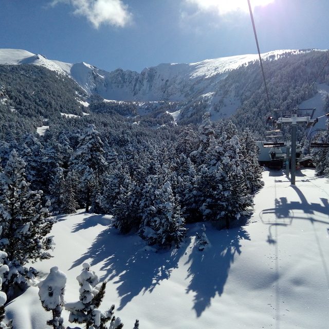
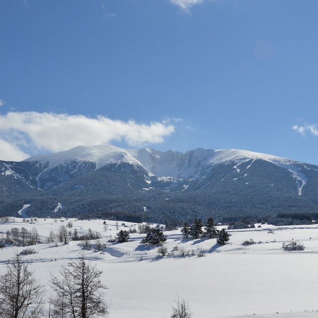
Don't underestimate the quality of the skiing in this beautiful little ski station. North facing slopes guard the snow well and give beautiful tree lined skiing. There is skiing for all abilities and although there is no snow park as such there is some great fun to be had all over the mountain. Given a decent dump of snow then the mountain comes to life and the Font Frede coulee give one of the longest off-piste runs in the Pyrenees.
Ian Pendry from France writes:
Don't underestimate the quality of the skiing in this beautiful little ski station. North facing slopes guard the snow well and give beautiful tree lined skiing. There is skiing for all abilities and although there is no snow park as such there is some great fun to be had all over the mountain. Given a decent dump of snow then the mountain comes to life and the Font Frede coulee give one of the longest off-piste runs in the Pyrenees.
Click here to submit your own review of Espace Cambre d'Aze (Eyne 2600)


 Nearest