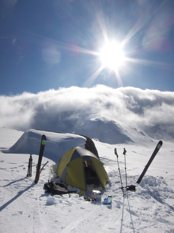
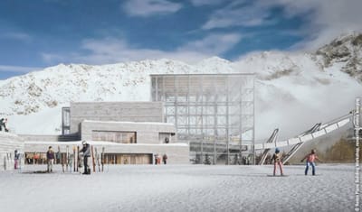
Charlotte Pass snow
Ski Australia - New South Wales

Charlotte Pass Snow Forecast

Weather Forecast for Charlotte Pass at 1760 m
Issued: 3 am  19 Sep 2025 (local time)

New snow in Charlotte Pass

1.3cm0.5in
Fri 19th (NGT)
The snow forecast for Charlotte Pass is: Moderate rain (total 12.0mm) heaviest on Fri afternoon, then becoming colder with a dusting of snow on Fri night. Freeze-thaw conditions (max 6°C on Fri morning, min -3°C on Sat night). Winds decreasing (strong winds from the NW on Fri afternoon, light winds from the W by Sat night).

Charlotte Pass Weather (Next 3 days): The snow forecast for Charlotte Pass is: Moderate rain (total 12.0mm) heaviest on Fri afternoon, then becoming colder with a dusting of snow on Fri night. Freeze-thaw conditions (max 6°C on Fri morning, min -3°C on Sat night). Winds decreasing (strong winds from the NW on Fri afternoon, light winds from the W by Sat night).

Charlotte Pass Weather (Days 4-6): A moderate fall of snow, heaviest on Mon night. Freeze-thaw conditions (max 5°C on Wed morning, min -6°C on Mon night). Wind will be generally light.


Charlotte Pass Live Weather

ResortSnow DepthTemp. (°C)Wind (km/h)Weather
Top Lift: 
2
20
clear
Bottom Lift: 
0
15
clear
Powered by Snow-Forecast.comSnow-Forecast.com
6 Day Forecast
Issued: 3 am 19 Sep 2025 / Updates in ::
Change Forecast Height
Choose Forecast
Last 6 daysScroll left for last 6 daysNow
Friday
19
Saturday
20
Sunday
21
Monday
22
Tuesday
23
Wednesday
24
Thursday
25
AM
PM
night
AM
PM
night
AM
PM
night
AM
PM
night
AM
PM
night
AM
PM
night
AM
PM
night
light rain
light rain
light snow
snow showers
part cloud
part cloud
cloud
cloud
light snow
light snow
light snow
mod snow
light snow
snow showers
clear
part cloud
part cloud
clear
part cloud
cloud
light snow
light rain
light rain
light snow
snow shwrs
some clouds
some clouds
cloudy
cloudy
light snow
light snow
light snow
mod. snow
light snow
snow shwrs
clear
some clouds
some clouds
clear
some clouds
cloudy
light snow
 km/h
30
WNW
40
NW
45
WNW
35
W
20
W
15
W
20
W
20
W
20
WNW
20
WNW
20
WNW
20
SSW
20
S
20
SSW
20
SW
20
SW
10
SSW
10
W
25
W
35
WNW
45
W
Snow map
 cm 
1
1
3
6
2
 mm 
2
4
6
max°C
6
5
4
1
2
-2
2
1
0
1
-1
-3
-1
0
0
5
4
0
4
4
2
min°C
4
3
-2
-1
-1
-3
1
0
0
0
-2
-6
-3
-3
-4
3
0
-1
4
2
0
chill°C 
-2
-4
-9
-8
-6
-8
-4
-5
-5
-5
-7
-13
-9
-9
-10
-2
-2
-3
-1
-5
-6
Humid% 
55
86
94
69
55
80
79
84
84
82
96
85
85
67
56
57
57
53
59
63
92
Freezing level (m
2650
2600
2200
1500
1950
1200
2000
2050
2050
1850
1600
1000
1250
1700
1800
2350
2400
2250
2450
2500
2100
topliftbotliftSea lvl1000m2000m3000m4000m5000m
440-1-1-2000-1-3-5-3-1032123154101-32101-2-5-2-2-242-1431
Sunrise
6:01
6:00
5:58
5:56
5:56
5:54
5:52
Sunset
5:59
6:00
6:00
6:01
6:02
6:02
6:04

Snow Radar

Latest snow reports near Charlotte Pass:

No recent snow reports

No recent snow reports

Charlotte Pass Snow Conditions

Top snow depth:
Bottom snow depth:
Fresh snowfall depth:
Last snowfall:16 Sep 2025
Snow AlertsCreate Alert
Other resorts in Australia - New South Wales are reporting: powder (0) / good piste (0)

Snow-Forecast Partner Offers

Snow History

Week 3 of September has on average:
0.0
Bluebird Powder days
Fresh snow, mostly sunny, light wind.
0.4
Powder days
Fresh snow, limited sun, any wind.
0.1
Bluebird days
Average snow, mostly sunny, light wind.


Snow-Forecast Partner Offers