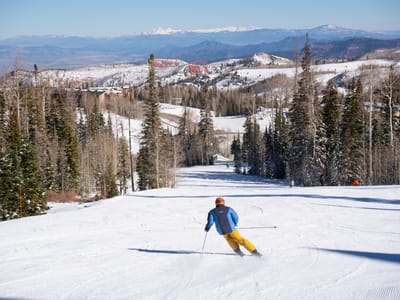
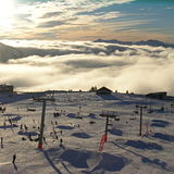
Avoriaz snow
Ski France

Avoriaz Snow Forecast

Weather Forecast for Avoriaz at 1699 m
Issued: 7 pm  18 Apr 2024 (local time)

New snow in Avoriaz

5.1cm2.0in
Fri 19th (NGT)
The snow forecast for Avoriaz is: A moderate fall of snow, heaviest on Fri night. Freeze-thaw conditions (max 1°C on Fri afternoon, min -7°C on Sat night). Wind will be generally light.

Avoriaz Weather (Next 3 days): The snow forecast for Avoriaz is: A moderate fall of snow, heaviest on Fri night. Freeze-thaw conditions (max 1°C on Fri afternoon, min -7°C on Sat night). Wind will be generally light.

Avoriaz Weather (Days 4-6): A dusting of new snow. Temperatures will be below freezing (max 0°C on Wed afternoon, min -6°C on Sun night). Wind will be generally light.


Avoriaz Live Weather

ResortSnow DepthTemp. (°C)Wind (km/h)Weather
Top Lift: 1.8m
-8
20
part cloud
Middle Lift: 
-5
10
snow showers
Bottom Lift: 
-5
5
snow showers
Powered by Snow-Forecast.comSnow-Forecast.com
6 Day Forecast
Issued: 7 pm 18 Apr 2024 / Updates in ::
Change Forecast Height
Choose Forecast
Last 6 daysScroll left for last 6 daysNow
Friday
19
Saturday
20
Sunday
21
Monday
22
Tuesday
23
Wednesday
24
night
AM
PM
night
AM
PM
night
AM
PM
night
AM
PM
night
AM
PM
night
AM
PM
night
snow showers
cloud
cloud
heavy snow
light snow
light snow
light snow
light snow
light snow
light snow
light snow
light snow
light snow
part cloud
light snow
snow showers
part cloud
light snow
light snow
snow shwrs
cloudy
cloudy
heavy snow
light snow
light snow
light snow
light snow
light snow
light snow
light snow
light snow
light snow
some clouds
light snow
snow shwrs
some clouds
light snow
light snow
 km/h
5
E
5
W
10
W
10
NW
10
N
10
N
5
NE
5
NNE
10
NNE
5
E
5
NE
5
N
5
ESE
5
NNE
5
N
10
ENE
5
N
5
NW
10
SW
Snow map
 cm 
11
2.0
1.0
3
2.0
2.0
1.0
 mm 
max°C
-5
-2
1
-1
-5
-3
-4
-5
-3
-4
-4
-3
-3
-2
-1
-1
-2
0
-1
min°C
-5
-4
0
-4
-5
-3
-7
-6
-4
-6
-5
-3
-5
-4
-1
-5
-4
-1
-3
chill°C 
-10
-4
-3
-8
-9
-7
-10
-9
-8
-9
-5
-6
-8
-6
-3
-8
-6
-3
-7
Humid% 
74
69
76
98
87
87
94
83
77
77
88
91
83
73
76
74
65
71
87
Freezing level (m
450
1400
1800
1300
1000
1250
650
1000
1250
700
1150
1300
750
1450
1600
850
1400
1650
1300
topliftbotliftSea lvl1000m2000m3000m4000m5000m
-8-7-4-6-9-8-9-10-8-9-9-7-7-6-5-6-7-5-6-4041-11-3-21-3-11-203-1141
Sunrise
6:37
6:35
6:35
6:33
6:31
6:30
Sunset
8:25
8:27
8:28
8:30
8:30
8:31

Snow Radar

Submit a report Eyeball Reporter

Latest snow reports near Avoriaz:

  • 40 km away from Avoriaz

    14 hours ago
    Eyeball reporter

    Resort closed for the season. See you this summer! from La Giettaz en Aravis

  • 24 km away from Avoriaz

    14 hours ago
    weather station observation

    Continuous moderate rain reported from Aigle at 479 metres elevation 7 kms WSW of Leysin but it is forecast cold enough for snow at the ski area from Leysin

  • 43 km away from Avoriaz

    16 hours ago
    weather station observation

    Light rain reported from Sion at 339 metres elevation only 2 kms NW of Veysonnaz-Printse but it is forecast cold enough for snow at the ski area from Veysonnaz-Printse

  • 28 km away from Avoriaz

    16 hours ago
    Is it snowing?

    Snowing at a moderate rate at Villars. from Villars

Avoriaz Snow Conditions

Top snow depth:180cm
Bottom snow depth:
Fresh snowfall depth:30cm
Last snowfall:17 Apr 2024
Snow AlertsCreate Alert
Other resorts in France are reporting: powder (3) / good piste (2)

Snow History

Week 3 of April has on average:
0.1
Bluebird Powder days
Fresh snow, mostly sunny, light wind.
0.3
Powder days
Fresh snow, limited sun, any wind.
0.2
Bluebird days
Average snow, mostly sunny, light wind.

Avoriaz Resort Webcam

Live Snow webcam for Avoriaz
Most recent Avoriaz webcam image
Webcam courtesy of Avoriaz Tourist Office
  • 2pm yesterdayAvoriaz webcam at 2pm yesterday
  • 2 days agoAvoriaz webcam 1 days ago
  • 3 days agoAvoriaz webcam 2 days ago
  • 4 days agoAvoriaz webcam 3 days ago
  • 5 days agoAvoriaz webcam 4 days ago